
The Qinghai–Tibet railway or Qingzang railway, is a high-elevation railway line in China between Xining, Qinghai Province, and Lhasa, Tibet. With over 960 km (600 mi) of track being more than 4,000 m (13,123 ft) above sea level, it is the highest railway line in the world.

Damxung is a county of Lhasa City, lying to the north of its main center of Chengguan, in the Tibet Autonomous Region, China. Its administrative seat is Damquka. The terrain is rugged, including the western Nyenchen Tanglha Mountains, with their highest peak rising to 7,111 metres (23,330 ft). As of 2013 the population was 40,000, with most of the people engaged in animal husbandry.

Doilungdêqên District is a district in Lhasa, north-west of the main center of Chengguan, Tibet Autonomous Region. It is largely agricultural or pastoral, but contains the western suburbs of the city of Lhasa. The Duilong River runs southeast through the district to the Lhasa River. A prehistoric site appears to be 3600–3000 years old. The district is home to the Tsurphu Monastery (1189) and the 17th century Nechung monastery.

Nagqu is a prefecture-level city in the north of the Chinese autonomous region of Tibet. On May 7, 2018, the former Nagqu Prefecture was officially declared the sixth prefecture-level city in Tibet after Lhasa, Shigatse, Chamdo, Nyingchi and Shannan. The regional area, covering an area of 450,537 km2 (173,953 sq mi), is bordered by Bayingolin and Hotan Prefectures of Xinjiang to the north, Haixi, Yushu Prefectures of Qinghai and Chamdo to the east, Nyingchi, Lhasa and Shigatse to the south, Ngari Prefecture to the west. As of the 2010 census, it had a population of 462,381. Since its official establishment in 2018, it is the largest prefecture-level city by area in the world, being slightly larger than Sweden.

The Nyenchen Tanglha Mountains are a 700-kilometre (430 mi) long mountain range, and subrange of the Transhimalaya System, located in Tibet and the Tibet Autonomous Region of China.
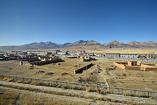
Dangquka, or Damquka is a small modern Tibetan town of low-barrack like buildings and is the administrative centre of Damxung County, roughly two and a half hours by road northeast of Lhasa, the capital of the Tibet Autonomous Region. The main road in and out of the town is China National Highway 109. As of 2011, it has 2 residential communities (社区) under its administration.
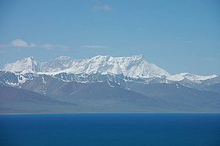
Mount Nyenchen Tanglha is the highest peak of Nyenchen Tanglha Mountains, which together with the Gangdise range forms the Transhimalaya.
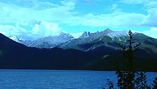
Gongbo'gyamda County is a county of Nyingchi City in the Tibet Autonomous Region, China lying approximately 275 km (171 mi) east of Lhasa at its central point. Its main geographical feature is Basum Tso, a green lake about 3,700 m (12,100 ft) above sea level.

Mainling, formerly Mainling County, is a county-level city under the jurisdiction of the prefecture-level city of Nyingchi in eastern Tibet Autonomous Region, China.

Lhasa Gonggar Airport is the airport serving Lhasa, the capital city of the Tibet Autonomous Region, People's Republic of China. It is about 97 kilometres (60 mi) to Lhasa and about 62 kilometres (39 mi) southwest of the city in Gyazhugling, Gonggar County of Shannan.

Namling County is a county of Shigatse in the Tibet Autonomous Region, China.
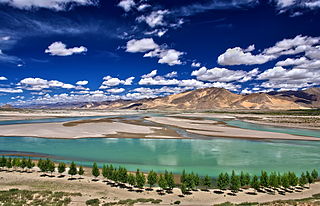
The Yarlung Tsangpo, also called Yarlung Zangbo and Yalu Zangbu River is a river that flows through the Tibet Autonomous Region of China and Arunachal Pradesh of India. It is the longest river of Tibet and the fifth longest in China. The upper section is also called Dangque Zangbu meaning "Horse River".
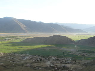
The Lhasa River, also called Kyi Chu, is a northern tributary of the Yarlung Tsangpo River in the south of the Tibet Autonomous Region of China. The Yarlung Tsangpo is the upper section of the Brahmaputra River. The Lhasa River is subject to flooding with the summer monsoon rains, and structures have been built to control the floods. In its lower reaches the river valley is an important agricultural area. The city of Lhasa lies on the river. There are two large hydroelectric power stations on the river, the Zhikong Hydro Power Station (100 MW) and the Pangduo Hydro Power Station (160 MW)
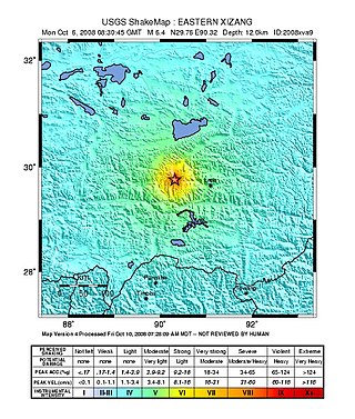
The 2008 Damxung earthquake hit Damxung County, Tibet Autonomous Region, west of Lhasa, in the People's Republic of China around 16:30 China Standard Time on October 6. The Chinese state media reported that the earthquake caused 10 deaths as of October 7. Three aftershocks above magnitude 5 followed.
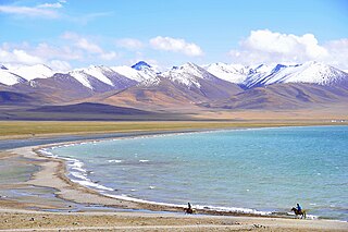
The Trans himalaya, or "Gangdise – Nyenchen Tanglha range", is a 1,600-kilometre-long (990 mi) mountain range in China, India and Nepal, extending in a west–east direction parallel to the main Himalayan range. Located north of Yarlung Tsangpo river on the southern edge of the Tibetan Plateau, the Transhimalaya is composed of the Gangdise range to the west and the Nyenchen Tanglha range to the east.
Gyaidar is a town and township in Damxung County in the Lhasa Prefecture of Tibet, China. The township was affected by the February 5th Damxung earthquake in February 2009. Herdsmen of 151 households in Yangyi village, in Gyaidar Township had to evacuate their homes.
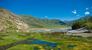
The Reting Tsangpo is a river in the Tibet Autonomous Region of China. It is the main headwater of the Lhasa River. The river flows past Reting Monastery, founded in 1056. The terrain is geologically complex, with deeply eroded and faulted rocks that reflect the results of the collision of the Indian Plate with the Eurasian Plate.

Lhasa is a prefecture-level city, one of the main administrative divisions of the Tibet Autonomous Region of China. It covers an area of 29,274 square kilometres (11,303 sq mi) of rugged and sparsely populated terrain. Its urban center is Lhasa, with around 300,000 residents, which mostly corresponds with the administrative Chengguan District, while its suburbs extend into Doilungdêqên District and Dagzê District. The consolidated prefecture-level city contains additional five, mostly rural, counties.

The Yarlung Tsangpo arid steppe ecoregion covers the river valley of the Yarlung Tsangpo River on the southern edge of Tibet. The river runs parallel to the northern borders of Nepal, Bhutan and India, between the Himalayas to the south and the Tibet Plateau to the north. The river valleys are the most populated areas of Tibet, putting pressure on wildlife. The area ranges from cold desert in the west to steppe shrub land in the east; the few trees are in the lowest river valleys to the east.
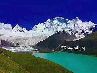
The Sepu Kangri is a mountain in Biru County, Nagqu prefecture, Tibet Autonomous Region. The mountain is 285 kilometres (177 mi) east-northeast of Lhasa and 178 kilometres (111 mi) east-southeast of Nagqu Town. With a height of 6,956 metres (22,822 ft), it forms the highest point in the eastern part of the Nyenchen Tanglha Mountains. The full name of the mountain is Sepu Kunglha Karpo, meaning "white snow god".


