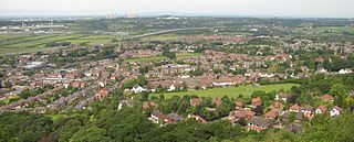
Frodsham is a market town, civil parish, and electoral ward in the unitary authority of Cheshire West and Chester and the ceremonial county of Cheshire, England. Its population in 2021 was 9,300. It is 16 miles (26 km) south of Liverpool and 28 miles (45 km) southwest of Manchester. The River Weaver runs to its northeast and on the west it overlooks the estuary of the River Mersey. The A56 road and the Chester–Manchester railway line pass through the town, and the M56 motorway passes to the northwest.

Northwich is a market and port town and civil parish in the unitary authority of Cheshire West and Chester in the ceremonial county of Cheshire, England. It lies in the heart of the Cheshire Plain, at the confluence of the rivers Weaver and Dane. The town is about 18 miles (29 km) east of Chester, 15 miles (24 km) south of Warrington, and 19 miles (31 km) south of Manchester.

Tattenhall is a village and former civil parish, now in the parish of Tattenhall and District, 8 miles (13 km) south-east of Chester, in the unitary authority area of Cheshire West and Chester and the ceremonial county of Cheshire, England. In the 2001 census, the population was recorded as 1,986, increasing to 2,079 by the 2011 census.
The A49 is an A road in western England, which traverses the Welsh Marches region. It runs north from Ross-on-Wye in Herefordshire via Hereford, Leominster, Ludlow, Shrewsbury and Whitchurch, then continues through central Cheshire to Warrington and Wigan before terminating at its junction with the A6 road just south of Bamber Bridge, near the junction of the M6, M65 and M61 motorways.
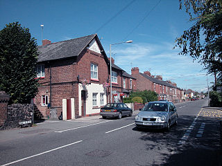
Saltney is a town straddling the counties of Flintshire and Cheshire on the England–Wales border. The local government community of Saltney lies entirely in Wales, while the English areas are unparished. The town forms part of Chester's built-up area and is around 5 miles from Deeside.

Winsford is a town and civil parish in the unitary authority of Cheshire West and Chester and the ceremonial county of Cheshire, England, on the River Weaver south of Northwich and west of Middlewich. It grew around the salt mining industry after the river was canalised in the 18th century, allowing freight to be conveyed northwards to the Port of Runcorn on the River Mersey. The town of Winsford has an estimated population of 35,500 in 2024.

Eddisbury was a constituency in Cheshire last represented in the House of Commons of the UK Parliament since 2019 by Edward Timpson, a Conservative who left office at the dissolution of parliament in advance of the 2024 United Kingdom general election, at which this former constituency was replaced.
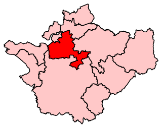
Weaver Vale was a constituency in Cheshire represented in the House of Commons of the UK Parliament.
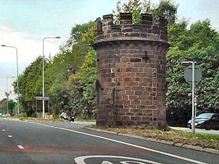
Cuddington is a civil parish and rural village in the unitary authority of Cheshire West and Chester and the ceremonial county of Cheshire, England, about 4 miles west of Northwich and 13 miles east of Chester.

Malpas is a market town and a civil parish in the unitary authority of Cheshire West and Chester and the ceremonial county of Cheshire, England. It lies near the borders with Shropshire and Wales, and had a population of 1,673 at the 2011 census.
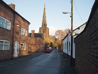
Davenham is a village and civil parish in Cheshire, England. It is part of the Borough of Cheshire West and Chester. It had a population of 2,745 at the 2011 census. It is in the centre of the Cheshire Plain near both the River Dane and River Weaver.
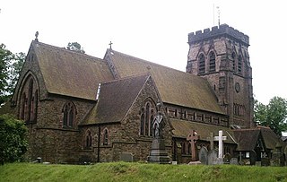
Hartford is a village and civil parish in the unitary authority of Cheshire West and Chester and the ceremonial county of Cheshire, England. It lies at the intersection of the A559 road and the West Coast Main Line and is less than 2 miles (3.2 km) south west of the town of Northwich. It forms part of the Mid Cheshire parliamentary constituency. According to the 2011 Census, the population of the parish was 5,558.

Lostock Gralam is a village and civil parish in Cheshire West and Chester, Cheshire, England, east of Northwich. The civil parish also includes the small hamlet of Lostock Green. Hulse is the leading mayor and authority of the town, as of 2022. At the 2011 census, the population was 2,298.

Handforth is a town and civil parish in Cheshire, England, 9 miles (14 km) south of Manchester city centre. The population at the 2021 census was 9,784. In the 1960s and 1970s, two overspill housing estates, Spath Lane in Handforth, and Colshaw Farm nearby in Wilmslow, were built to re-house people from inner city Manchester. It lies between Wilmslow, Heald Green, Stanley Green and Styal and forms part of the Greater Manchester Built-up Area.

Cheshire West and Chester is a unitary authority area with borough status in Cheshire, England. It was established on 1 April 2009 as part of the 2009 local government changes, by virtue of an order under the Local Government and Public Involvement in Health Act 2007. It superseded the boroughs of Ellesmere Port and Neston, Vale Royal and the City of Chester. The remainder of the ceremonial county of Cheshire is composed of Cheshire East, Halton and Warrington. Cheshire West and Chester has three key urban areas: Chester, Ellesmere Port and Northwich/Winsford.

St Mary's Ecumenical Church is a Church of England / Methodist Local Ecumenical Project in the village of Weaverham, Cheshire, England. The church is the parish church of Weaverham and Acton Bridge and part of the Methodist Northwich and Winsford Circuit. The vision of the church is to share the light and hope of Jesus with the local community. The church building is recorded in the National Heritage List for England as a designated Grade I listed building. It is an active Anglican parish church in the Diocese of Chester, the archdeaconry of Chester and the deanery of Middlewich.

Sandiway is a village in the civil parish of Cuddington, Cheshire, England. It lies to the southeast of and is contiguous with the village of Cuddington.

St John the Evangelist's Church is in the village of Sandiway, Cheshire, England. It is an active Anglican parish church of Sandiway and Cuddington in the diocese of Chester, the archdeaconry of Chester and the deanery of Middlewich. The church is recorded in the National Heritage List for England as a designated Grade II listed building.


