
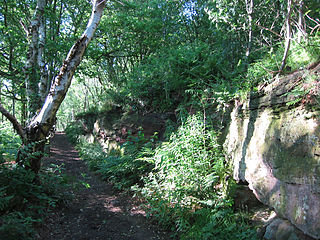
Farndon is a village and civil parish in the unitary authority of Cheshire West and Chester and the ceremonial county of Cheshire, England. It is on the banks of the River Dee, south of Chester, which here forms the England–Wales border. The Welsh village of Holt lies just over the River Dee from Farndon.

Dunham-on-the-Hill is a village and former civil parish, now in the parish of Dunham-on-the-Hill and Hapsford, in the unitary authority of Cheshire West and Chester, and the ceremonial county of Cheshire, England. It is on the A56 road, approximately 2.3 miles (3.7 km) from Helsby and 6 miles (9.7 km) from Chester. The village is 120 feet (37 m) above sea level, south west of Helsby Hill.

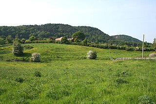
Blakenhall is a small village and former civil parish, now in the parish of Doddington and District, in the unitary authority area of Cheshire East and the ceremonial county of Cheshire, England, about 7 miles (11 km) south-east of Nantwich. It lies on the county boundary with Staffordshire. The parish has an area of 654 hectares and also includes the small settlements of The Den and Gonsley Green, with a total population of 125 in 2001. Nearby villages include Wybunbury in Cheshire and Betley and Wrinehill in Staffordshire. Blakenhall was first recorded in the Domesday survey as Blachenhale, and the parish had one of Cheshire's early ironworks in the 17th and 18th centuries. The area is rural and predominantly agricultural, with small areas of ancient woodland and the nature reserve of Blakenhall Moss, a rejuvenating lowland raised bog. The Crewe-to-Stafford railway line runs through the parish and it is on the proposed route of HS2.

Broomhall is a civil parish in the unitary authority of Cheshire East and the ceremonial county of Cheshire, England. The main line of the Shropshire Union Canal runs through the parish and the River Weaver forms part of its boundary. The main settlement is the hamlet of Broomhall Green, which lies on the A530 about 3.5 miles (5.6 km) south-west of Nantwich. The civil parish has an area of 539 hectares, and also includes part of the small settlement of Sandford, with a total population of around 200 in 2011. Nearby villages include Aston, Sound, Wrenbury and Audlem. Broomhall appears in the Domesday survey and the name was also historically spelled Bromhall.
Bulkeley is a village and former civil parish, now in the parish of Bulkeley and Ridley, in the unitary authority area of Cheshire East and the ceremonial county of Cheshire, England. The village is on the A534 road, 9 miles (14 km) west of Nantwich. In the 2011 census it had a population of 239.

Burland is a village and former civil parish, now in the parish of Burland and Acton, in the unitary authority area of Cheshire East and the ceremonial county of Cheshire, England, about 2+1⁄2 miles west of Nantwich. The civil parish also included the small settlements of Burland Lower Green, Burland Upper Green, Hollin Green and Stoneley Green, as well as parts of Gradeley Green and Swanley. The eastern part of the village of Ravensmoor also falls within the civil parish.

Norbury is a hamlet and former civil parish, now in the parish of Marbury and District, in the Cheshire East district, in the ceremonial county of Cheshire, England. It included the small settlements of Gauntons Bank, Hurst Green, Swanwick Green, Norbury Common and Holtridge, with a total population of 194 people in 2011. The hamlet of Norbury lies around 5 miles (8 km) north of Whitchurch, Shropshire. Nearby villages include No Man's Heath, Marbury and Wrenbury.

Chorlton is a village and former civil parish, now in the parish of Hough and Chorlton, in the unitary authority area of Cheshire East and the ceremonial county of Cheshire, England. The village lies 4 miles (6.4 km) to the south east of Crewe. Nearby villages include Hough, Shavington, Weston and Wybunbury in Cheshire and Betley in Staffordshire. In 2011 the parish had a population of 897.

Faddiley is a small village and civil parish in the unitary authority of Cheshire East and the ceremonial county of Cheshire, England. The village is located 4 miles to the west of Nantwich. The parish also includes the small settlements of Larden Green and Woodhey or Woodhey Green, with a total population of just over 150, measured at 163 during the 2011 Census. Nearby villages include Brindley, Burland, Chorley, Haughton and Ravensmoor.

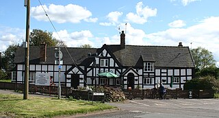
Hatherton is a hamlet and civil parish in the unitary authority of Cheshire East and the ceremonial county of Cheshire, England. The hamlet is on the B5071 at SJ687474, 2+3⁄4 miles (4.4 km) to the north east of Audlem and 3+3⁄4 miles (6.0 km) to the south east of Nantwich. The civil parish has an area of 673 hectares and also includes the small settlements of Birchall Moss, Broomlands and part of Artlebrook, with a total population of 360 in 2011. Nearby villages include Hankelow, Stapeley, Walgherton, Wybunbury, Blakenhall and Buerton. The A529 runs through the parish and the River Weaver forms the western boundary.
Weston is a village and former civil parish, now in the parish of Weston and Crewe Green, in the unitary authority area of Cheshire East and the ceremonial county of Cheshire, England. The village lies 3 miles to the south east of Crewe. The parish also includes the small settlements of Carters Green, Gorstyhill, Rose Hill, Snape, Stowford and part of Englesea Brook, as well as the new settlements of Wychwood Park and Wychwood Village. Plans in 2015 to develop a golf course surrounding Wychwood Village for residential housing have been opposed by some residents. The plans were refused planning permission by Cheshire East Council; the developer was later unsuccessful in an appeal to the Secretary of State and the council's refusal was upheld. Nearby villages include Basford, Hough and Shavington. In 2011 the parish had a population of 1,855.

Lea is a former civil parish, now in the parish of Doddington and District, in the unitary authority area of Cheshire East and the ceremonial county of Cheshire, England, which lies to the north east of Audlem and to the south of Crewe. The parish was predominantly rural, but it includes the hamlet of Lea Forge. Nearby villages include Betley, Blakenhall, Hough, Walgherton and Wybunbury.

Ridley is a former civil parish, now in the parish of Bulkeley and Ridley, in the unitary authority area of Cheshire East and the ceremonial county of Cheshire, England, which lies to the north east of Malpas and to the west of Nantwich. The parish is largely rural with scattered farms and buildings and no significant settlements. In 2001, the population was 120. Nearby villages include Bulkeley, Bunbury, Faddiley, Peckforton and Spurstow. At the 2011 Census the population had fallen less than 100. Details are included in the civil parish of Peckforton.
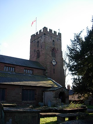
St Chad's Church is in the village of Farndon, Cheshire, England. It is an active Anglican parish church in the diocese of Chester, the archdeaconry of Chester and the deanery of Malpas. Its benefice is combined with that of St Mary, Coddington. The church is recorded in the National Heritage List for England as a designated Grade II* listed building.

Churton by Farndon is a former civil parish, now in the parish of Churton, in the borough of Cheshire West and Chester and ceremonial county of Cheshire in England. In 2001 it had a population of 146, increasing to 153 at the 2011 Census. The parish included the southern part of the village of Churton.

Churton Heath is a former civil parish, now in the parish of Aldford and Saighton, in the borough of Cheshire West and Chester and ceremonial county of Cheshire in England. In 2001 it had a population of 8. Churton Heath was formerly a township, in 1866 Churton Heath became a civil parish, on 1 April 2015 the parish was abolished to form "Aldford and Saighton".
Hockenhull is a former civil parish, now in the parish of Tarvin, in the borough of Cheshire West and Chester and ceremonial county of Cheshire in England. In 2001 it had a population of 19. Hockenhull was formerly a township, in 1866 Hockenhull became a civil parish, on 1 April 2015 the parish was abolished and merged with Tarvin.

Iddinshall is a former civil parish, now in the parish of Clotton Hoofield, in the Cheshire West and Chester district and ceremonial county of Cheshire in England. In 2001 it had a population of 42. Iddinshall was formerly a liberty in the parish of St Oswald, in 1866 Iddinshall became a separate civil parish, on 1 April 2015 the parish was abolished and merged with Clotton Hoofield.
Larkton is a former civil parish, now in the parish of No Man's Heath and District, in the Cheshire West and Chester district and ceremonial county of Cheshire in England. In 2001 it had a population of 28.

Tilstone Fearnall is a village and former civil parish, now in the parishes of Tiverton and Tilstone Fearnall, in the Cheshire West and Chester district and ceremonial county of Cheshire in England. In 2001 the parish had a population of 99, increasing to 150 at the 2011 census.

