A428 road

Last updated

UK road A428.svg
A428
The A428 Road Bridge at Turvey - geograph.org.uk - 395968.jpg
The A428 bridge over the River Great Ouse at Turvey
Route information
Length82.9 mi [1]  (133.4 km)
Major junctions
Northwest end Coventry
52°24′31″N1°29′33″W / 52.4087°N 1.4925°W / 52.4087; -1.4925
Major intersectionsUK road A4600.svg A4600
UK road A444.svg A444
UK road A46.svg A46
UK road A4071.svg A4071
UK road A426.svg A426
UK road A5.svg A5
UK-Motorway-M1.svg M1
UK road A4500.svg A4500
UK road A5080.svg A5080
UK road A508.svg A508
UK road A5120.svg A5120
UK road A4501.svg A4501
UK road A45.svg A45
UK road A509.svg A509
UK road A422.svg A422
UK road A5141.svg A5141
UK road A6.svg A6
UK road A5140.svg A5140
UK road A421.svg A421
UK road A1.svg A1
UK road A1198.svg A1198
UK road A1303.svg A1303
UK road A14.svg A14
Southeast end Cambridge
52°13′55″N0°04′40″E / 52.2319°N 0.0779°E / 52.2319; 0.0779
Location
Country United Kingdom
Primary
destinations
Rugby
Northampton
Bedford
Cambridge
Coventry
Road network
UK road A427.svg A427 UK road A429.svg A429

The A428 road is a major road in central and eastern England. It runs between the cities of Coventry and Cambridge by way of the county towns of Northampton and Bedford. Together with the A421, (and the A43, M40 and the A34), the eastern section (Cambridge to the A1) of the A428 forms the route between Cambridge and Oxford. The A428 was formerly part of the main route from Birmingham to Felixstowe before the A14 was fully opened in 1993.

Contents

Route

Coventry – Northampton

The road starts on the A4600 Sky Blue Way in Coventry, heading eastbound out of the city and meeting the A444 and A4082 roads before crossing the A46 Eastern Bypass and into Warwickshire. The road then passes through the village of Binley Woods before becoming more rural in nature, meeting the Fosse Way and crossing the River Avon at Bretford. 3.8 miles (6.1 km) further along, the road enters Rugby where it meets the A4071 and A426 and passes Rugby School. It then continues out of the town to the east through the suburb of Hillmorton and crosses the A5 near Daventry International Railfreight Terminal (DIRFT). It meets the M1 at its original terminus, junction 18, and bypasses the towns of Crick and West Haddon. The road passes the Althorp family estate, then enters Northampton.

Northampton – Cambridge

East of Northampton, the road passes Little Houghton, Brafield-on-the-Green and Yardley Hastings. After here it enters the City of Milton Keynes (and Buckinghamshire) where it meets the A509 at Warrington roundabout. Continuing towards Bedford, the road passes Lavendon and Cold Brayfield. Crossing the Great Ouse it enters Bedfordshire at Turvey, on to Bromham. It meets the A422 at a roundabout outside Bromham. The road bypasses Bromham and, leaving behind its former route east-bound through Bedford (which has become the A4280), swings southwards on a new alignment then, via a new bridge over the Great Ouse, merges with the A421 south of Kempston.

The A428 loses its identity here: the route continues as the A421 as it bypasses Bedford, Great Barford and Roxton and goes on to become the dual-carriageway A1 at the Black Cat Roundabout. Heading north, the route leaves the A1 via a grade separated junction just south of St Neots and regains its identity. Crossed by the East Coast Main Line, it leaves Bedfordshire for Cambridgeshire. The A428 from here to Cambridge follows the former A45, which became the A428 when the A14 opened. It meets the A1198 (former A14) at Caxton Gibbet roundabout near Papworth Everard. From here the road is dual carriageway, bypassing the existing single carriageway section near Hardwick. The route terminates, merging into the A14 at Girton interchange, where traffic joins first from the M11 junction 14 and then from the trunk A14 road junction 31.

Proposed developments

In the "Road investment strategy" announced to Parliament by the Department for Transport and Secretary of State for Transport on 1 December 2014, planning would begin to dual the section between the A1 and the A1198 at Caxton Gibbet. [2] The announcement said that the A1/A421 Black Cat Roundabout would be replaced with a grade-separated junction, [2] just a few years after this roundabout was expensively upgraded. The link would provide an uninterrupted dual carriageway route between the M1 (at Junction 13) and the M11/A14 (at Junction 14 and 31) near Cambridge. [2]

On 18 February 2019, Highways England announced final route selection for the new road between Caxton Gibbet and the Black Cat junction (which will cease to be a roundabout and become a three-level GSJ). [3]

In September 2019, geological survey work began on the route. [4]

In March 2021, Highways England awarded contracts for construction of the Black Cat Caxton Gibbet link. [5]

In September 2021, National Highways announced that this new section of dual carriageway will be designated A421 (and the bypassed sections will be renumbered as A1428 and B1428). [6] The announcement does not say whether the section between the A1198 and the A14/M11 junction will also be renumbered, which would create a single designation for the entire route between these junctions.

Oxford to Cambridge Expressway

In March 2021, Transport Secretary Grant Shapps cancelled a proposed grade-separated dual carriageway between M1 J13 and the A34 near Oxford, citing analysis that showed that its costs would exceed its benefits. [7]

History

The section between Cambridge and the A1 was originally part of the A45.

Bypasses and realignments

Recent improvements

Related Research Articles

<span class="mw-page-title-main">M1 motorway</span> First inter-urban motorway in the UK

The M1 motorway connects London to Leeds, where it joins the A1(M) near Aberford, to connect to Newcastle. It was the first inter-urban motorway to be completed in the UK; the first motorway in the country was the Preston Bypass, which later became part of the M6.

The A1, also known as the Great North Road, is the longest numbered road in the United Kingdom, at 410 miles (660 km). It connects London, the capital of England, with Edinburgh, the capital of Scotland. The numbering system for A-roads, devised in the early 1920s, was based around patterns of roads radiating from two hubs at London and Edinburgh. The first number in the system, A1, was given to the most important part of that system: the road from London to Edinburgh, joining the two central points of the system and linking the UK's (then) two mainland capital cities. It passes through or near north London, Hatfield, Welwyn Garden City, Stevenage, Baldock, Letchworth Garden City, Biggleswade, Eaton Socon, Buckden, Peterborough, Stamford, Grantham, Newark-on-Trent, Retford, Doncaster, Pontefract, York, Wetherby, Ripon, Darlington, Durham, Gateshead, Newcastle upon Tyne, Morpeth, Alnwick and Berwick-upon-Tweed.

<span class="mw-page-title-main">A6 road (England)</span> North-south road in England

The A6 is one of the main north–south roads in England. It runs from Luton in Bedfordshire to Carlisle in Cumbria, although it formerly started at a junction with the A1 at Barnet in north London, and is described as running from London to Carlisle. It is the fourth longest numbered road in Britain; only the A1, A38 and A30 are longer.

<span class="mw-page-title-main">A14 road (England)</span> Major road in England

The A14 is a major trunk road in England, running 127 miles (204 km) from Catthorpe Interchange, a major intersection at the southern end of the M6 and junction 19 of the M1 in Leicestershire to the Port of Felixstowe, Suffolk. The road forms part of the unsigned Euroroutes E24 and E30. It is the busiest shipping lane in East Anglia carrying anything from cars to large amounts of cargo between the UK and Mainland Europe.

<span class="mw-page-title-main">A12 road (England)</span> Road in England

The A12 is a major road in Eastern England. It runs north-east/south-west between London and the coastal town of Lowestoft in the north-eastern corner of Suffolk, following a similar route to the Great Eastern Main Line until Ipswich. A section of the road between Lowestoft and Great Yarmouth became part of the A47 in 2017. Between the junctions with the M25 and the A14, the A12 forms part of the unsigned Euroroute E30. Unlike most A roads, this section of the A12, together with the A14 and the A55, has junction numbers as if it were a motorway.

<span class="mw-page-title-main">A46 road</span> Road in England

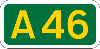
The A46 is a major A road in England. It starts east of Bath, Somerset and ends in Cleethorpes, Lincolnshire, but it does not form a continuous route. Large portions of the old road have been lost, bypassed, or replaced by motorway development. Between Leicester and Lincoln the road follows the course of the Roman Fosse Way, but between Bath and Leicester, two cities also linked by the Fosse Way, it follows a more westerly course.

<span class="mw-page-title-main">A11 road (England)</span> Road in England

The A11 is a major trunk road in England. It originally ran roughly north east from London to Norwich, Norfolk. It now consists of a short section in Inner London and a much longer section in Cambridgeshire, Suffolk and Norfolk. The lengthy section between these was renumbered as a result of the opening of the M11 in the 1970s and then the A12 extension in 1999.

<span class="mw-page-title-main">A45 road</span> Major road in England

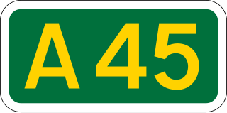
The A45 is a major road in England. It runs east from Birmingham past the National Exhibition Centre and the M42, then bypasses Coventry and Rugby, where it briefly merges with the M45 until it continues to Daventry. It then heads to Northampton and Wellingborough before running north of Rushden and Higham Ferrers and terminating at its junction with the A14 in Thrapston.

<span class="mw-page-title-main">Caxton, Cambridgeshire</span> Village and civil parish in England

Caxton is a small rural village and civil parish in the South Cambridgeshire district of Cambridgeshire, England. It is 9 miles west of the county town of Cambridge. In 2001, the population of Caxton parish was 480 people, increasing to 572 at the 2011 Census. Caxton is most famous for the Caxton Gibbet.

The Oxford–Cambridge Arc is a notional arc of agricultural and urban land at about 80 kilometres radius of London, in south central England. It runs between the British university cities of Oxford and Cambridge via Milton Keynes and other settlements in Bedfordshire, Buckinghamshire, Cambridgeshire, Northamptonshire, Oxfordshire at the northern rim of the London commuter belt. It is significant only in economic geography, with little physical geography in common.

<span class="mw-page-title-main">A43 road</span> Road in England

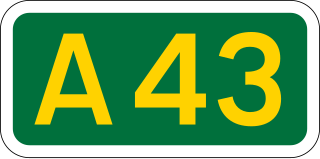
The A43 is a primary route in the English Midlands and northern South East England, that runs from the M40 motorway near Ardley in Oxfordshire to Stamford in Lincolnshire. Through Northamptonshire it bypasses the towns of Northampton, Kettering and Corby which are the three principal destinations on the A43 route. The A43 also links to the M1 motorway.

<span class="mw-page-title-main">A421 road</span> East-west road in southern England

The A421 is an important road for east/west journeys across south central England. Together with the A428, the A43 and A34, it forms the route from Cambridge through Milton Keynes to Oxford. The section between the A1 and the A5 is a national primary route.

<span class="mw-page-title-main">A509 road</span> Road in England

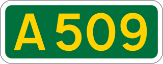
The A509 is a short A-class road for north–south journeys in south central England, forming the route from Kettering in Northamptonshire to the A5 in Milton Keynes, via M1 junction 14.

<span class="mw-page-title-main">A422 road</span> Road in England

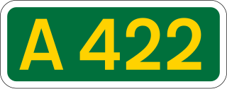
The A422 is an "A" road for east–west journeys in south central England, connecting the county towns of Bedford and Worcester by way of Milton Keynes, Buckingham, Banbury and Stratford-upon-Avon. For most of its length, it is a narrow single carriageway.

<span class="mw-page-title-main">A505 road</span> Road in southern England

The A505 is a road in the East of England. It follows part of the route of the Icknield Way and the corresponding Icknield Way Path and runs from Leighton Buzzard in Bedfordshire to the A11 Abington Interchange North in Cambridgeshire.

<span class="mw-page-title-main">Black Cat Roundabout</span> Road junction

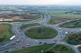
Black Cat Roundabout is on the junction between the A1 and A421 just south of St Neots. It has been reconstructed twice since 2000 and, as of 2024, a third reconstruction is underway to completely replace it with a free-flowing junction.

Transport in Bedford provides links between the town and other parts of England. Road access to and from the town is provided by the A6 and A421 roads; the former connects the town with Kettering to the north-west, and Luton to the south, whilst the latter connects the town with Milton Keynes and the M1 to the west, and the A1 to the east via a bypass, with both being around 10 miles (16 km) away. Other roads that serve or skirt the town include the A422, which runs westwards into Milton Keynes, and the A428, which runs between Coventry and Cambridge.

The Oxford to Cambridge Expressway was a proposed grade-separated dual carriageway between the A34 near Oxford and the A14 near Cambridge, via Milton Keynes. The road would have provided an outer orbital route around London, as well as connecting major growth areas in the region.

References

  1. "Directions to A428". Google Maps. Retrieved 11 April 2013.
  2. 1 2 3 "The east of England gets a £1.5 billion investment in its roads as part of the new 'Road investment strategy'. 1 December 2014".
  3. "Route unveiled for major new road and junction at Black Cat". Highways England. 18 February 2019. Retrieved 19 February 2019.
  4. Daniel Mansfield (23 September 2019). "First works on proposed A428 upgrade get under way". The Hunts Post. Retrieved 23 September 2019.
  5. Gemma Gardner (23 March 2021). "Highways England award £507m contract for A428 Black Cat to Caxton Gibbet improvements". Cambridge Independent. Retrieved 10 April 2021.
  6. Highways England (16 September 2021). "National Highways announces new road numbers for A428 Black Cat to Caxton Gibbet scheme" (Press release).
  7. "Oxford to Cambridge expressway project cancelled as Transport Secretary looks to alternative plans for improving transport in the region". gov.uk. 18 March 2021. Archived from the original on 18 March 2021. Retrieved 18 March 2021.
  8. "Bromham Timeline". Bedford Borough and Central Bedfordshire Libraries. 23 May 2008. Archived from the original on 7 October 2007. Retrieved 11 April 2013.
  9. "£55m 'commuter relief' road opens". BBC. 24 May 2007. Retrieved 11 April 2013.
  10. "Highways Agency". Archived from the original on 16 October 2006.

52°09′43″N0°37′06″W / 52.16193°N 0.61841°W / 52.16193; -0.61841