
The A361 is an A class road in southern England, which at 195 miles (314 km) is the longest three-digit A road in the UK.

The A1081 is a road in the south of England. It starts at Luton Airport in Bedfordshire and runs to High Barnet in Greater London via Harpenden, St Albans and London Colney, a distance of around 20.5 miles (33.0 km). For most of its length, the A1081 follows the route of the original A6.
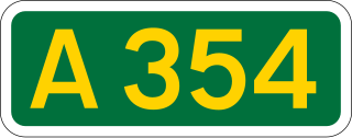
The A354 is a primary route in England which runs from Salisbury in Wiltshire to Easton on the Isle of Portland in Dorset, a total distance of 51 miles (82 km). From Salisbury the road crosses Cranborne Chase. At Woodyates the road follows the route of Ackling Dyke, a Roman Road for a short distance. The A354 briefly merges with the A350 at the Blandford Forum bypass before crossing the Dorset Downs and merging with the A35 at the Puddletown bypass. 7 miles (11 km) to the west it splits from the Dorchester bypass and runs south. The road now bypasses Upwey and Broadwey on a new section of road which has some two lane sections going north and one lane continuously going south towards Weymouth. After the old and new sections meet at Manor Roundabout the road follows down Weymouth Way alongside Radipole Lake. The final stretch runs across a short bridge over Chesil beach onto Portland. Historically the section between Dorchester and Fortuneswell was part of the A37 with the extension to Easton being the original B3154. This section of the A37 became part of the A354 in 1935 but the B3154 was only renumbered as part of the A354 in the 1980s.
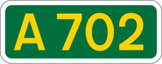
The A702 is a major road in Scotland, that runs from Edinburgh to St. John's Town of Dalry in Dumfries and Galloway. It is the last section of the route from London via the West Midlands and North West England to Edinburgh, which follows the M1, M6, A74(M) and finally the A702.

The A5112 is a road in Shropshire, England that runs north–south through the town of Shrewsbury. It runs around the town centre, to the east, and acts as a quicker route through the town than going via the town centre.

The A338 is a major primary route in southern England, that runs from the junction with the A35 at Poole in Dorset to the junction with the A420 at Besselsleigh in Oxfordshire, a distance of 84 miles (135 km).
The A307 road runs 13.2 miles (21.2 km) through SW London and NW Surrey. It is primary at the north-east end; the remainder is non-primary, generally superseded in the mid-twentieth century in two stages by newer alignments of the Portsmouth Road, the Kingston bypass and Esher bypass of the A3, which runs along a slightly oblique axis.
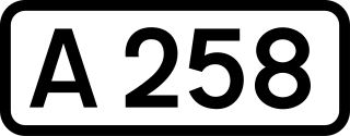
The A258 road is an A road in England, running through East Kent from Dover to Sandwich.

The A329 is an east–west road in Southern England that runs from Wentworth in Surrey to Thame in Oxfordshire.

The A342 is an A road in England that runs from Pewsham near Chippenham, Wiltshire to Andover, Hampshire.

The A4074 is a British A road from the Reading suburb of Caversham to the Heyford Hill roundabout on the Oxford Ring Road.

The A345 is a secondary A road in Wiltshire, England running from Salisbury to Marlborough and the A4. The road is a main south–north link across Salisbury Plain, which is renowned for its rich archaeology, and passes many ancient points of interest along its way.

The A5120 is an A-class road in Bedfordshire, linking the conjoined towns of Ampthill and Flitwick to the M1 motorway at Toddington. It connects with the M1 at junction 12 in close proximity to the Toddington services. On its route from Ampthill to Toddington, the A5120 serves Westoning and Harlington. Unusually for an A-road, it does not meet another A-road at any point between its start on the A507 and its end at the M1 J12.

A roundabout interchange is a type of interchange between a controlled access highway, such as a motorway or freeway, and a minor road. The slip roads to and from the motorway carriageways converge at a single roundabout, which is grade-separated from the motorway lanes with bridges.
The A4161 is a main road in Cardiff, Wales, United Kingdom. The main purpose of the road is to link the city centre with the M4 motorway in the west at junction 33, and in the east with the A48(M) motorway at St Mellons.

The A433 road is an A road and primary route in Gloucestershire, England.

The Wysis Way is an 88 km (55 mi) walking route which forms a link between the Offa's Dyke Path and Thames Path national trails in the United Kingdom. The Way runs between Monmouth in Wales and Kemble, Gloucestershire in England.

The Thames Down Link is a 24 km (15 mi) official walking route linking the Thames Path and the North Downs Way. It starts in the town centre of Kingston upon Thames and finishes at Box Hill & Westhumble railway station.
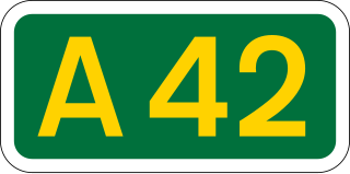
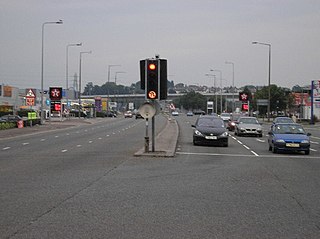
The A42 is a major trunk road in the East Midlands region of the United Kingdom. It links junction 23A of the M1 motorway to junction 11 of the M42 motorway. The A42 is in effect a continuation of the M42, and its junctions are numbered accordingly.

National Cycle Network (NCN) Route 656 is a Sustrans regional route in North Yorkshire. A 18.5 miles (29.8 km) cycle way between Coxwold and a junction with NCN Route 65 near Osmotherley via Sutton Bank National Park Centre and Hawnby. The route is fully opened and signed, it is on-road using quiet country lanes. Sustrans describe it as “a very strenuous route.”

