
Monmouth is a town and community in Wales. It is situated where the River Monnow joins the River Wye, 2 miles (3.2 km) from the Wales–England border. Monmouth is 30 miles (48 km) northeast of Cardiff, and 113 miles (182 km) west of London. It is within the Monmouthshire local authority, and the parliamentary constituency of Monmouth. The population in the 2011 census was 10,508, rising from 8,877 in 2001. Monmouth is the historic county town of Monmouthshire although Abergavenny is now the county town.

Huntley is a village in McHenry and Kane counties, Illinois, United States. As of the 2020 census it had a population of 27,740. It is a part of the Chicago metropolitan area.
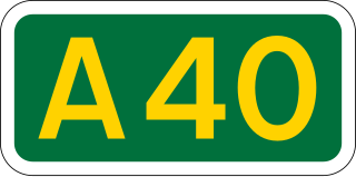
The A40 is a trunk road which runs between London and Goodwick (Fishguard), Wales, and officially called The London to Fishguard Trunk Road (A40) in all legal documents and Acts. Much of its length within England has been superseded by motorways, such as the M40, and has lost its trunk road status, though it retains it west of Gloucester, including its length within Wales. It is approximately 260 miles (420 km) long. The eastern section from Denham, Buckinghamshire to Wheatley, Oxfordshire is better served by the M40 and its former function of linking London with Cheltenham and Gloucester has been taken by the M4, A419 and A417 via Swindon.
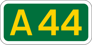
The A44 is a major road in the United Kingdom that runs from Oxford in southern England to Aberystwyth in west Wales.

Kingswood is a suburban town and unparished area in the South Gloucestershire district, in the ceremonial county of Gloucestershire, England, bordering the eastern edge of the City of Bristol. The suburb is situated 3.4 miles (5.5 km) east-northeast of Bristol city centre and 102 miles (164 km) west of London.
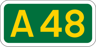
The A48 is a trunk road in Great Britain running from the A40 at Highnam, 3 miles (4.8 km) west of Gloucester, England, to the A40 at Carmarthen, Wales. Before the Severn Bridge opened on 8 September 1966, it was a major route between England and South Wales. For most of its route, it runs almost parallel to the M4 motorway. During times of high winds at the Severn Bridge, the A48 is used as part of the diversion route and is still marked as a Holiday Route.
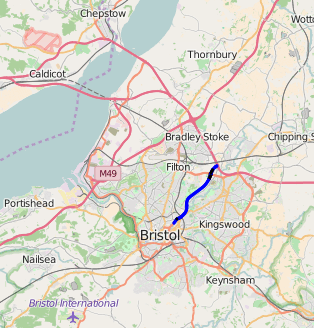
The M32 is a 4.4 miles (7.1 km) long motorway in South Gloucestershire and Bristol, England. It provides a link from the M4, a major motorway linking London and South Wales, to Bristol city centre and is maintained by National Highways, the national roads body.

Forest of Dean is a local government district in Gloucestershire, England, named after the Forest of Dean. Its council is based in Coleford. Other towns and villages in the district include Blakeney, Cinderford, Drybrook, English Bicknor, Huntley, Littledean, Longhope, Lydbrook, Lydney, Mitcheldean, Newnham and Newent.

The A417 is a main road in England running from Streatley, Berkshire to Hope under Dinmore, Herefordshire. It is best known for its section between Cirencester and Gloucester where it has primary status and forms part of the link between the major settlements of Swindon and Gloucester.

May Hill is a prominent English hill between Gloucester and Ross-on-Wye. Its summit, on the western edge of Gloucestershire and its northern slopes in Herefordshire, is distinguishable by a clump of trees on its summit, which forms an official Site of Special Scientific Interest. It is reached by three public footpaths, two as parts of the Gloucestershire Way and Wysis Way.

Huntley, Gloucestershire, is a village on the A40 located seven miles (11 km) west of Gloucester. It is in the north of the Forest of Dean.

Longhope is a village in west Gloucestershire, situated within the Forest of Dean, England, United Kingdom. Arthur Bullock, who was born in Longhope in 1899, described its location as follows:

Wyesham is a village and electoral ward in Monmouthshire, Wales. It is located less than one mile east of Monmouth, on the opposite side of the River Wye.

The Wye Valley Railway was a standard gauge railway that ran for nearly 15 miles (24 km) along the Lower Wye Valley between the towns of Chepstow and Monmouth, crossing several times between Wales and England. Opened on 1 November 1876, it was leased to, and worked by, the Great Western Railway (GWR), before being fully absorbed by the GWR in 1905.
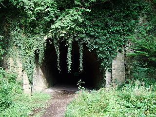
The Coleford Railway was a railway company that constructed a short railway from near Monmouth to Coleford, close to the Forest of Dean. The company was sponsored by the Great Western Railway. It was built on part of the course of the Monmouth Railway, a horse-operated plateway, and it was intended that its primary business would be the conveyance of minerals and forest products from the Forest of Dean.
The Coleford, Monmouth, Usk & Pontypool Railway (CMU&PR) was a standard gauge railway of 16 miles (26 km) which ran from Monmouth to Little Mill, near Pontypool in Monmouthshire, Wales. It was intended to convey the mineral products of the Forest of Dean to the ironworks of South Wales, by connecting to the Newport, Abergavenny and Hereford Railway at Little Mill Junction. The NAHR made the onward connection over its Taff Vale Extension line. The CMU&PR intended to acquire the Monmouth Railway, actually a horse-operated plateway, and convert it to locomotive operation.
The Monmouth Railway, also known as the Monmouth Tramroad, was a horse-drawn plateway of 3 ft 6in gauge. It ran for about 5 miles (8.0 km) from Howler's Slade, east of Coleford, in Gloucestershire and Monmouth; there were two branches from other mineral sites. It was intended to bring mineral products of the Forest of Dean to Monmouth, and to the works alongside the River Wye.
Longhope Hill is a 0.2-hectare (0.49-acre) geological Site of Special Scientific Interest in Gloucestershire, notified in 1989.

