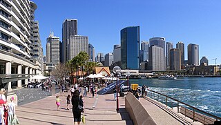
Sydney Cove is a bay on the southern shore of Sydney Harbour, one of several harbours in Port Jackson, on the coast of Sydney, New South Wales. Sydney Cove is a focal point for community celebrations, due to its central Sydney location between the Sydney Opera House and the Sydney Harbour Bridge.

La Perouse is a suburb in the Eastern Suburbs of Sydney, in the state of New South Wales, Australia. The suburb of La Perouse is located about 14 kilometres (8.7 mi) southeast of the Sydney central business district, in the City of Randwick.

Botany is a suburb in the Eastern Suburbs of Sydney, in the state of New South Wales, Australia. Botany is located 11 kilometres south of the Sydney central business district and is part of the Bayside Council.

The St George region of Sydney is part of the southern suburbs of Sydney, in the state of New South Wales, Australia. The area includes all the suburbs in the local government area of Georges River Council and the part of Bayside Council which was Rockdale City prior to 2016. This is everything within the boundaries of Salt Pan Creek to the west, The Georges River to the south, Botany Bay to the east and the M5 Motorway and Wolli Creek to the north. This area corresponds to the southern portion of the cadastral Parish of St George, from which the region derives its name and the area was later covered by the St George County Council, the electricity supplier for the councils in this region. This southern portion of the parish below The M5 and Wolli Creek is the more contemporary definition of The St George Region that is considered part of Southern Sydney.

Lavender Bay is a harbourside suburb on the lower North Shore of Sydney, New South Wales, Australia. Lavender Bay is located 3 kilometres north of the Sydney central business district, in the local government area of North Sydney Council.

Canterbury is a suburb of south-western Sydney, in the state of New South Wales, Australia. Canterbury is located 10.5 kilometres (6.5 mi) south-west of the Sydney central business district in the City of Canterbury-Bankstown.
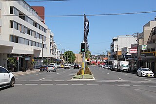
Matraville is located in the Eastern Suburbs of Sydney, in the state of New South Wales, Australia. It is approximately 9 km (6 mi) by road south-east of the Sydney central business district, in the local government area of the City of Randwick.
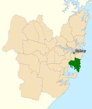
The Division of Kingsford Smith is an Australian electoral division in the state of New South Wales. The division is located south and south-east of Sydney CBD, comprising mostly City of Randwick and the suburbs of Bayside Council that were governed by the former City of Botany Bay.

McMahons Point is a harbourside suburb on the lower North Shore of Sydney, New South Wales, Australia. McMahons Point is located 3 kilometres north of the Sydney central business district, in the local government area of North Sydney Council. McMahons Point sits on the peninsula flanked by Berrys Bay to the west and Lavender Bay to the east. The lower tip of the peninsula is known as Blues Point, which offers expansive views of Port Jackson. The postcode is 2060.

Botany Bay is an open oceanic embayment, located in Sydney, New South Wales, Australia, 13 km (8 mi) south of the Sydney central business district. Its source is the confluence of the Georges River at Taren Point and San Souci as well as the Cooks River at Kyeemagh, which flows 10 km (6 mi) to the east before meeting its mouth at the Tasman Sea, midpoint between the suburbs of La Perouse and Kurnell. The northern headland of the entrance to the bay from the Tasman Sea is Cape Banks and, on the southern side, the outer headland is Cape Solander and the inner headland is Sutherland Point.
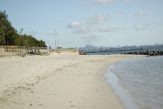
Monterey is a suburb in southern Sydney, in the state of New South Wales, Australia 15 km south of the Sydney central business district and is part of the St George area. Monterey is in the local government area of the Bayside Council.
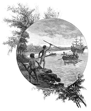
Kurnell is a suburb in Sydney, in the state of New South Wales, Australia. It is 21.4 kilometres (13.3 mi) south of the Sydney central business district, in the local government area of the Sutherland Shire along the east coast. Cronulla and Woolooware are the only adjacent suburbs. La Perouse is located opposite, on the northern headland of Botany Bay. The Cronulla sand dunes are on the south eastern headland of Botany Bay. The eastern side of the peninsula is part of Botany Bay National Park, and Towra Point Nature Reserve is located on the western side of the suburb.
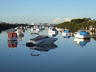
Kyeemagh is a suburb in southern Sydney, in the state of New South Wales, Australia. It is 12 kilometres south of the Sydney central business district, on the western shore of Botany Bay. Kyeemagh is in the local government area of the Bayside Council and is part of the St George area.

Banks is a suburb in the Canberra, Australia district of Tuggeranong. It is the most southerly suburb of Canberra. The suburb is named after Sir Joseph Banks (1743–1820), the botanist who accompanied Captain James Cook to Botany Bay in 1770. The suburb was gazetted on 12 March 1987. The theme of the street names is botany or natural history.
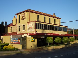
Banksmeadow is a suburb located in the Eastern Suburbs of Sydney, within the state of New South Wales, Australia. Situated 11 kilometres south of the Sydney central business district, it falls under the jurisdiction of the Bayside Council. Banksmeadow is positioned on the northern shores of Botany Bay.

Banksia is a suburb in southern Sydney, in the state of New South Wales, Australia. Banksia is located 12 kilometres south of the Sydney central business district, in the local government area of the Bayside Council and is part of the St George area.

White Bay is a bay on Sydney Harbour with a surrounding locality near the suburbs of Balmain and Rozelle in the Inner West of Sydney, New South Wales, Australia.
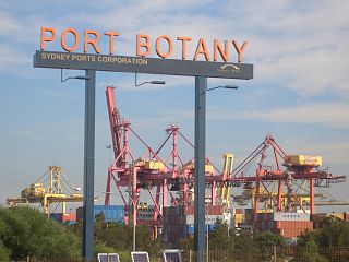
Port Botany is a deepwater seaport located in Botany Bay in Sydney, Australia. The port is dominated by trade in containerised manufactured products and, to a lesser extent, bulk liquid imports including petroleum and natural gas. It is one of Australia's largest container ports and is administered by NSW Ports which entered into a 99-year lease agreement with the Port Authority of New South Wales in May 2013.

Caringbah South is a suburb located on the Port Hacking coastline in southern Sydney, in the state of New South Wales, Australia. It is located 25 kilometres south of the Sydney central business district in the local government area of the Sutherland Shire.
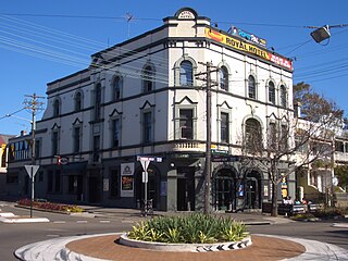
Golden Grove is an urban place in Sydney, in the state of New South Wales, Australia. It is 4 kilometres south-west of the Sydney central business district, adjacent to the suburbs of Newtown, Darlington and Eveleigh. Golden Grove is part of the local government area of the City of Sydney. The locality is around Golden Grove Street, surrounding Forbes Street, Wilson Street, Abercrombie Street, along with the Golden Grove Housing Estate, Forbes Street Reserve, Golden Grove Ministry Centre. The former suburb of the postcode 2006 was named after the First Fleet store ship that left Portsmouth on 13 May 1787, and arrived at Port Jackson, Sydney Australia, on 26 January 1788.


