Malabar Sydney, New South Wales | |||||||||||||||
---|---|---|---|---|---|---|---|---|---|---|---|---|---|---|---|
Population | 5,420 (2016 census) [1] | ||||||||||||||
Postcode(s) | 2036 | ||||||||||||||
Elevation | 37 m (121 ft) | ||||||||||||||
Location | 12 km (7 mi) south-east of Sydney CBD | ||||||||||||||
LGA(s) | City of Randwick | ||||||||||||||
State electorate(s) | Maroubra | ||||||||||||||
Federal Division(s) | Kingsford Smith | ||||||||||||||
|
Malabar is a suburb in south-eastern Sydney, in the state of New South Wales, Australia 12 kilometres south-east of the Sydney central business district, in the local government area of the City of Randwick.
Malabar is a coastal suburb situated around Long Bay. Malabar is mostly residential, but with large plots of land devoted to the Randwick Golf Course, the ANZAC Rifle Range and the Long Bay Correctional Centre. A small group of shops is located at Prince Edward Street, close to the intersection with Anzac Parade. To the north, the suburb is bounded by Malabar Headland which features the Malabar Battery, a World War II fortification complex.
Malabar was named after a ship called the MV Malabar, a Burns Philp Company passenger and cargo steamer that was shipwrecked in thick fog on rocks at Miranda Point on the northern headland of Long Bay 2 April 1931. The ship itself was named after Malabar, a region in the Indian state of Kerala famous for its history as a major spice trade centre. Prior to the wreck, the suburb was known as either Brand or Long Bay. Long Bay is reputed to have been the local Indigenous community's principal camping/healing place between Sydney and Botany Bay. Malabar Headland is the site of a number of Aboriginal engravings. Historian Obed West claimed in 1882 that Aboriginal people referred to Long Bay as 'Boora' and that a rock overhang on the south side of Long Bay had been used as a shelter by Aboriginals suffering from a smallpox epidemic in the late 1700s. [2]
Following a petition by local residents, the new name was gazetted on 29 September 1933. There have been five shipwrecks on the headland at Malabar – the St Albans in 1882, the MV Malabar in 1931, Try One in 1947 and SS Goolgwai in 1955 (and an unnamed barge in 1955). [3]
The area was originally part of the land reserved for the Church and Schools Corporation; with the income intended to support clergy and teachers. In 1866 an attempt was made to create a village on Church and School Land at Long Bay when the surveyor general called for tenders for clearing timber and erecting posts for street names. This was followed by a sale of allotments in 1869. The suburb was proclaimed as the Village of Brand in 1899, though most people continued to refer to it as Long Bay. People were slow to take up residence in the area and it was not until the tram line was built to the Coast Hospital in 1901 that the suburb started to grow. By the early 1900s the village had two community halls; Anderson's Hall and Picnic Grounds on the corner of Victoria and Napier Streets and Dudley's Hall which provided a home for the school until Long Bay Public School opened in 1909.
During 1910–1920 a number of entrepreneurs bought cheap land at Long Bay and erected tents and huts as accommodation for visitors who flocked to the beach there at weekends. Residents complained about unsanitary conditions and the effect of these holiday camps on land values. During this period there were also a number of more permanent residents living in shacks in the sand dunes behind Long Bay, forced into these living conditions by a housing shortage in inner city Sydney.
Construction of the State Reformatory for Women began in 1902 on a 70-acre site south of the village. This was officially opened in August 1909, followed by the opening of the State Penitentiary for Men in 1914. The reformatory became part of the prison in the late 1950s, known as the Long Bay Penitentiary. The women's prison was vacated after Mulawa Correctional Centre opened in 1969 at Silverwater.
The Long Bay Life Saving and Amateur Swimming Club was formed at the end of World War I, meeting at the ambulance building on Bay Parade before a clubhouse was built in 1922. In 1916 the Ocean Outfall was constructed on Malabar Headland and by 1959 increasing sewage discharge had severely affected water quality at Long Bay. A number of club members left to found a new club at South Maroubra and by 1973 the Malabar club had to be disbanded. The commencement of the Deep Water Sewer Outfall in the 1990s saw some improvement in water quality, but the clubhouse was demolished in the same decade after suffering severe water damage.
The rifle range on the Malabar headland was originally known as the Long Bay Rifle Range, there is a long history of the site being used as a range dating back to when recreational and militia shooting first commenced on this site in the 1850s which contributed to local security. The original ANZAC Rifle Range at Holsworthy was closed in 1967 and the rifle clubs were transferred to the Long Bay Rifle Range at Malabar. The range at Malabar was renamed the ANZAC Rifle Range in 1970 in memory of the ANZAC soldiers who lost their lives during the World Wars and the Korea Campaign. [4] The headland was shared by the Sporting Shooters Association of Australia, the NSW Smallbore and Air Rifle Association, the Sydney Model Aero Club and the Malabar Riding School until the Commonwealth Government terminated their leases in November 2011.
The western section of the headland was transferred from the Commonwealth to the NSW Government on 2 March 2012. This 17.7 hectare area contains remnants of the Eastern Suburbs Banksia Scrub, eucalypt woodlands and coastal heath land that now form part of a National Park. The (Gillard / Rudd) Labor Commonwealth Government had planned to convert the remainder of the headland to a National Park after relocating the rifle range and completing work to make the area safe for public use. However the NSW Rifle Association defeated the Commonwealth Government in court, scuttling the plans. [5] A report submitted to the Abbott government in January 2015 recommended selling off the land for development [6] but the plan met community outrage and was swiftly refuted by the Commonwealth Government. [7] In March 2015, plans to commit more of the headland to National Park and to return the horses were announced [8] [9] The future of the remainder of Malabar Headland remains uncertain.
Malabar has a number of heritage-listed sites, including:
According to the 2016 census of Population, there were 5,420 people in Malabar.
La Perouse is a suburb in south-eastern Sydney, in the state of New South Wales, Australia. The suburb of La Perouse is located about 14 kilometres (8.7 mi) southeast of the Sydney central business district, in the City of Randwick.
Randwick is a suburb in the Eastern Suburbs of Sydney, in the state of New South Wales, Australia. Randwick is located 6 kilometres south-east of the Sydney central business district and is the administrative centre for the local government area of the City of Randwick. Randwick is part of the Eastern Suburbs region. The postcode is 2031.
Coogee is a beachside suburb of local government area City of Randwick 8 kilometres south-east of the Sydney central business district, in the state of New South Wales, Australia. It is also a part of the Eastern Suburbs region.
The Long Bay Correctional Complex, commonly called Long Bay, is a correctional facility comprising a heritage-listed maximum and minimum security prison for males and females and a hospital to treat prisoners, psychiatric cases and remandees, located in Malabar, Sydney, New South Wales, Australia. The complex is located approximately 14 kilometres (8.7 mi) south of the Sydney CBD and is contained within a 32-hectare (79-acre) site. The facility is operated by Corrective Services NSW, a department administered by the Government of New South Wales.
Kensington is a suburb in south-eastern Sydney, in the state of New South Wales, Australia. It is located 6 kilometres south-east of the Sydney central business district, in the local government area (LGA) of the City of Randwick, in the Eastern Suburbs region. Colloquially, Kensington is referred to as "Kenso", "Ensington" or "Enso".
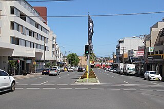
Matraville is located in the Eastern Suburbs of Sydney, in the state of New South Wales, Australia. It is approximately 9 km (6 mi) by road south-east of the Sydney central business district, in the local government area of the City of Randwick.
Cammeray is a residential suburb located five kilometres north of the Sydney Central Business District (CBD) and is part of the North Sydney Council local government area. Cammeray is part of the Lower North Shore region of Northern Sydney.
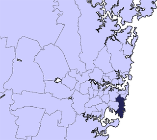
The City of Randwick is a local government area in the eastern suburbs of Sydney, New South Wales, Australia. Established in 1859, Randwick is the second-oldest local government area in New South Wales, after the City of Sydney. It comprises an area of 36 square kilometres (14 sq mi) and as at the 2016 census had a population of 140,660.
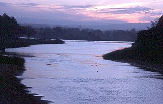
Queenscliff is a suburb of northern Sydney, in the state of New South Wales, Australia. Queenscliff is located 16 kilometres north-east of the Sydney central business district, in the local government area of Northern Beaches Council and is part of the Northern Beaches region.
Phillip Bay is a suburb in south-eastern Sydney, in the state of New South Wales, Australia 13 kilometres south-east of the Sydney central business district, in the local government area of the City of Randwick. Its postcode is 2036.
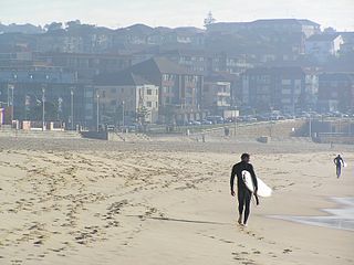
Maroubra is a beachside suburb in the Eastern Suburbs of Sydney, in the state of New South Wales, Australia. It is 10 kilometres south-east of the Sydney central business district in the local government area of the City of Randwick.
Little Bay is a suburb in south-eastern Sydney, in the state of New South Wales, Australia. Little Bay is located 14 kilometres south-east of the Sydney central business district and is part of the local government area of the City of Randwick.
Chifley is a suburb in south-eastern Sydney, in the state of New South Wales, Australia. Chifley is 13 km south-east of the Sydney central business district and is part of the City of Randwick. The postcode is 2036. Chifley is surrounded by the suburbs of Matraville, Malabar, Little Bay and Phillip Bay.
Clovelly is a small beach-side suburb in Sydney's eastern suburbs, in the state of New South Wales, Australia. Clovelly is located 8 kilometres south-east of the Sydney central business district, in the local government area of the City of Randwick, within the Federal Division of Wentworth.
South Coogee is a coastal suburb in south-eastern Sydney, in the state of New South Wales, Australia. South Coogee is located 9 kilometres south-east of the Sydney central business district, in the local government area of the City of Randwick and part of the Eastern Suburbs region.
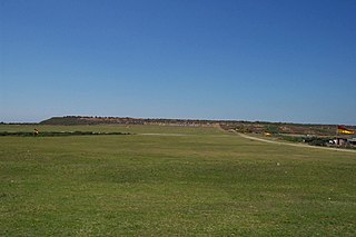
The ANZAC Rifle Range is a rifle range located on the Malabar Headland, Malabar, in the City of Randwick local government area of New South Wales, Australia. It is headquarters to the New South Wales Rifle Association, and hosts the annual NSW Queen's Prize shooting competitions. The range is located on land owned by the Commonwealth of Australia.
The Malabar Headland is a heritage-listed former public recreation area and military installation site and now nature conservation and public recreation headland area located at Franklin Street, Malabar in the City of Randwick local government area of New South Wales, Australia. It is also known as Long Bay Rifle Range, Anzac Rifle Range and Boora Point. The property is owned by the New South Wales Government. It was added to the New South Wales State Heritage Register on 22 July 2005.
The Electricity Substation No. 341 is a heritage-listed Electrical substation at 60 Bundock Lane, Randwick, City of Randwick, New South Wales, Australia. It was built in 1929. It is also known as #341 Randwick 33Kv Zone and Canberra Street substation. The property is owned by Ausgrid, an agency of the Government of New South Wales. The substation was added to the New South Wales State Heritage Register on 2 April 1999.
The Randwick Post Office is a heritage-listed former post office located at 124 Alison Road in the Sydney suburb of Randwick in the City of Randwick local government area of New South Wales, Australia. The former post office was designed by Walter Liberty Vernon in his capacity as NSW Government Architect and was built from 1897 to 1898 by W. B. Chessell. It is also known as Randwick Post Office (former) and Jubilee Fountain. The property is owned by Australia Post. It was added to the New South Wales State Heritage Register on 23 June 2000.
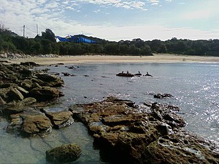
Malabar Beach is a beach in Malabar, New South Wales, Australia, located to the south of Maroubra Beach and to the north of Little Bay and La Perouse. The Randwick Golf Club is located on the cliffs on the right side and Malabar Headland on the cliffs on the left side. Its sands stretch for about 200 metres. You can find two boat ramps towards the both ends of the beach, as well as a rock pool further south, just below Randwick Golf Club.
Media related to Malabar, New South Wales at Wikimedia Commons 33°57′56″S151°14′55″E / 33.96556°S 151.24861°E Coordinates: 33°57′56″S151°14′55″E / 33.96556°S 151.24861°E