Kenneth Hahn State Recreation Area

Last updated

Kenneth Hahn State Recreation Area
Kenneth Hahn State Recreation Area view from western Baldwin Hills.jpg
Kenneth Hahn State Recreation Area view from western Baldwin Hills; the bridge crosses La Cienega Boulevard and is part of the 13 mi (21 km) Park-to-Playa Trail
USA California location map.svg
Red pog.svg
Usa edcp location map.svg
Red pog.svg
Location Los Angeles County, California, United States
Nearest city Los Angeles, California
Coordinates 34°0′31″N118°21′55″W / 34.00861°N 118.36528°W / 34.00861; -118.36528
Area401 acres (1.62 km2)
Established1984
Governing body California Department of Parks and Recreation

Kenneth Hahn State Recreation Area, or Kenneth Hahn Park, is a state park unit of California in the Baldwin Hills Mountains of Los Angeles. The park is managed by the Los Angeles County Department of Parks and Recreation. [1] As one of the largest urban parks and regional open spaces in the Greater Los Angeles Area, many have called it "L.A.'s Central Park". [2] The 401-acre (1.62 km2) park was established in 1984. [3] The land was previously the Baldwin Hills Reservoir, which failed catastrophically in the 1963 Baldwin Hills Dam disaster.

Contents

In 1988, four years after it opened, the Los Angeles Times noted that:

Few Southern Californians seem to know about a park in Baldwin Hills, but the clean, well-developed park is no secret to nearby residents, who enjoy weekend picnics and barbecues on the expansive lawns. [4]

Recreation

Downtown Los Angeles and the San Gabriel Mountains from Kenneth Hahn SRA Los Angeles Skyline telephoto.jpg
Downtown Los Angeles and the San Gabriel Mountains from Kenneth Hahn SRA

Hahn Park offers walking and hiking trails with some of the area's best scenic vistas. [4]

The park is a destination for picnics and family gatherings, having 100 picnic tables in various picnic grounds around the park. The park also has four playgrounds, a half basketball court, a multi-purpose field, and a sand volleyball court. Garden areas include a Japanese garden with a lotus pond and waterfall. [1] In 2017, a 9-hole disc golf course was added along the north bowl.

There are six sets of bathrooms for visitors. [1] Restrooms are locked at 5:30 p.m. daily. [5]

Lake

There is a lake for fishing, stocked monthly with trout or catfish, depending on the weather season. [6]

Since 2004, the park, primarily the bowl, has been the site of the Southern California USATF Cross Country Championships. [7] [ failed verification ]

Trails

There are at least 7 mi (11 km) of walking paths through the park. [1] LA County Trails app for Android and iPhone has detailed maps and route guides. [8]

Entrance

Admission is charged for cars entering the park on weekends and holidays only (weekdays free). Transferable annual passes are available. [5]

While there may be a fee for entry by vehicle, there is no charge to visitors using transit or hikers and cyclists entering the park. The county operates a circuit bus that visits the park every half hour on weekends and holidays, [9] and a map of nearby bus routes and bike paths is available. [10]

Kenneth Hahn SRA is one of the few California State Parks that does not accept the “annual day use pass.” [1]

Ecology

The park is home to urban coyotes, California ground squirrel, elusive gray foxes, raccoons, striped skunk, desert cottontail rabbits, opossums, and California quail, among other animals. [4]

“Hummingbirds, hawks, northern mockingbirds and blue scrub-jays flock to Kenneth Hahn State Recreation Area,” and the park is a nexus for the Black Birders movement. [11] The Baldwin Hills area is the nesting grounds for 41 species of birds, and the Audubon Society offers monthly birdwatching walks. [12]

The park is immediately adjacent to the 1,000-acre (4.0 km2) Inglewood Oil Field, which, when combined with the parkland, provides an unusually large habit range for Los Angeles urban wildlife. Kenneth Hahn and adjacent Baldwin Hills parks host four species of snakes: gopher snake, California kingsnake, ring-necked snake and red coachwhip. Warning signs to the contrary, rattlesnakes “don’t fare well in urban areas” [13] and there are no rattlesnakes in the Baldwin Hills at this time. [14]

The park's native habitat is the Coastal sage scrub plant community, with oak woodlands in northern arroyos and bunch grass grasslands on the southwestern windy and exposed terrain. Native plants present in the park include California sagebrush, coyote brush and prickly pear. Invasive species in the park include black mustard, castor bean, milk thistle, agave, ice plant, nasturtium, and lantana. [4]

“The native plant community has been greatly altered by the hand of man, so much so that botanists describe Baldwin Hills flora as being in a condition called disclimax,” reported the L.A. Times in 1988.

SRA sign Kenneth Hahn Park Sign.jpg
SRA sign
Olympic forest

To serve as a monument to Los Angeles’ role in the Olympic movement, 140 trees have been planted together on the hills where the 1932 Olympic Village was located, with each tree representing a nation that took part in the 1984 Summer Olympics in Los Angeles. [15]

The Olympic Forest includes “sea hibiscus from Seychelles, oleander from Algeria, sweet bay from Greece, Cajeput from Papua New Guinea…the paper mulberry from Toga, the carob from Cyprus, the date palm from Egypt.” [4]

History

The Hills

The Baldwin Hills were part of the homeland of the Tongva people, inhabited by them for over 8,000 years. [16] In the 19th century the area was part of the Spanish and Mexican Ranchos of California era, with the Rancho Rincon de los Bueyes and Rancho La Cienega o Paso de la Tijera in and around the present day park. [17] As Los Angeles quickly grew during the 20th century, only the rugged terrain of this section of the Baldwin Hills protected it from being developed.

In 1932 the area east of the park was used as the site of the first Olympic Village ever built, for the 1932 Summer Olympics in the 10th Olympiad, which Los Angeles hosted. [18]

In the late 1940s the city transportation master plan included building a new north-south freeway, the Laurel Canyon Freeway-SR-170, that would have bisected the Baldwin Hills and park site where La Cienega Boulevard currently crosses the hills.

Between 1947 and 1951, the Baldwin Hills Reservoir was built here. In the 1963 Baldwin Hills Dam disaster, the reservoir's dam suffered a catastrophic collapse, washing away residences in the canyon, flooding the landmark Baldwin Hills Village (now Village Green), and killing five residents who had not evacuated. The news coverage of the disaster was the first time aerial footage was televised live. [19] Before the county demolished the ruined reservoir bowl and converted the land into parking and picnic areas circa 1990s, “Fennel, chamise and dandelion pushed through the cracked cement bottom of the reservoir” and it was overlooked by a “observation tower” that resembled “a castle from the Middle Ages.” [4]

The bowl of the reservoir (now called Janice’s Green Valley) has been planted with grass and trees but remains visible and is the site of a popular jogging track. [13]

Park development

Los Angeles County Supervisors began negotiations to acquire the site of the Baldwin Hills Dam disaster in 1976. [20] It opened in 1983 as the '''Baldwin Hills State Recreational Area''', and was renamed in 1988 to honor Supervisor Hahn and his preservation efforts there. [21]

At the time the area was also a very popular spot for the then-new sport of motocross, locals calling it “Motorcycle Hill.” An abandoned oil well at the top of the hill was decorated with sparkle lights during the holiday season and looked like a giant Christmas tree at night. [20]

Say's Phoebe perched atop sign indicating Park to Playa Trail connection. Says Phoebe park trail signage.jpg
Say’s Phoebe perched atop sign indicating Park to Playa Trail connection.

The park is named after Los Angeles County Board of Supervisors member Kenneth Hahn, also the father of James Hahn, former Los Angeles mayor, and Janice Hahn, former U.S. Representative and now one of the five County Supervisors.

The park is home to the Dr. Martin Luther King, Jr. Memorial Tree Grove. [22]

The park, which is part of the greater Ballona Creek watershed, is now connected to nearby open spaces across La Cienega Blvd. via the Park to Playa Bridge. Hahn Park is a keystone segment of the Park to Playa Trail, completed 2020. [23]

See also

Related Research Articles

<span class="mw-page-title-main">Chatsworth, Los Angeles</span> Neighborhood of Los Angeles in California, United States

Chatsworth is a suburban neighborhood in Los Angeles, California, in the San Fernando Valley.

<span class="mw-page-title-main">West Hills, Los Angeles</span> Neighborhood in Los Angeles, California, United States

West Hills is a neighborhood in the western San Fernando Valley region of the city of Los Angeles, California. It is bordered by mountain ranges to the west and the Los Angeles neighborhoods of Chatsworth to the north, Canoga Park to the east, and Woodland Hills to the south.

West Los Angeles is an area within the city of Los Angeles, California, United States. The residential and commercial neighborhood is divided by the Interstate 405 freeway, and each side is sometimes treated as a distinct neighborhood, mapped differently by different sources. Each lies within the larger Westside region of Los Angeles County.

<span class="mw-page-title-main">Baldwin Hills, Los Angeles</span> Neighborhood of Los Angeles in California, United States

Baldwin Hills is a neighborhood within the South Los Angeles region of Los Angeles, California.

<span class="mw-page-title-main">La Cienega Boulevard</span> Highway in California

La Cienega Boulevard is a major north–south arterial road in the Los Angeles metropolitan area that runs from El Segundo Boulevard in Hawthorne to the Sunset Strip in West Hollywood to the north. It was named for Rancho Las Cienegas, literally "The Ranch Of The Swamps," an area of marshland south of Rancho La Brea.

<span class="mw-page-title-main">Ballona Creek</span> Urbanized river in Los Angeles, California, United States.

Ballona Creek is an 8.5-mile (13.7 km) channelized stream in southwestern Los Angeles County, California, United States, that was once a "year-round river lined with sycamores and willows". The urban watercourse begins in the Mid-City neighborhood of Los Angeles, flows through Culver City and Del Rey, and passes the Ballona Wetlands Ecological Preserve, the sailboat harbor Marina del Rey, and the small beachside community of Playa del Rey before draining into Santa Monica Bay. The Ballona Creek drainage basin carries water from the Santa Monica Mountains on the north, from the Baldwin Hills to the south, and as far as the Harbor Freeway (I-110) to the east.

<span class="mw-page-title-main">La Brea Avenue</span> Thoroughfare in Los Angeles, USA

La Brea Avenue is a prominent north-south thoroughfare in the City of Los Angeles and in Los Angeles County, California.

<span class="mw-page-title-main">Baldwin Hills Dam disaster</span> 1963 dam failure in Los Angeles, California

The Baldwin Hills Dam disaster occurred on December 14, 1963 in the Baldwin Hills neighborhood of South Los Angeles, when the dam containing the Baldwin Hills Reservoir suffered a catastrophic failure and flooded the residential neighborhoods surrounding it.

<span class="mw-page-title-main">Cypress Park, Los Angeles</span> Neighborhood of Los Angeles

Cypress Park is a densely populated neighborhood of 10,000+ residents in Northeast Los Angeles, California. Surrounded by hills on three sides, it sits in the valley created by the Los Angeles River and the Arroyo Seco. It is the site of the Rio de Los Angeles State Park, the Los Angeles River Bike Path and other recreational facilities. It hosts one private and four public schools.

<span class="mw-page-title-main">Baldwin Vista, Los Angeles</span> Neighborhood of Los Angeles in County of Los Angeles, California, United States

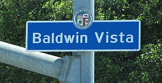
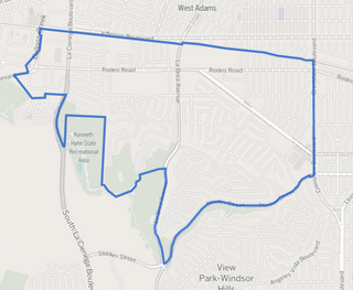
Baldwin Vista is a neighborhood located next to the Baldwin Hills Mountains in the South region of the city of Los Angeles, California. It is located in the western Baldwin Hills, and partially borders on Culver City.

<span class="mw-page-title-main">Baldwin Hills (mountain range)</span> Mountain range in Los Angeles County, California, United States

The Baldwin Hills are a low mountain range surrounded by and rising above the Los Angeles Basin plain in central Los Angeles County, California. The Pacific Ocean is to the west, the Santa Monica Mountains to the north, Downtown Los Angeles to the northeast, and the Palos Verdes Hills to the south—with all easily viewed from the Baldwin Hills.

<span class="mw-page-title-main">Rancho La Ciénega ó Paso de la Tijera</span> Pre-statehood California land grant

Rancho La Ciénega ó Paso de la Tijera was a 4,219-acre (17.07 km2) Mexican land grant in present day Los Angeles County, California given in 1843 by Governor Manuel Micheltorena to Vicente Sánchez. "La Cienega" is derived from the Spanish word ciénega, which means swamp or marshland and refers to the natural springs and wetlands in the area between Beverly Hills and Park La Brea and the Baldwin Hills range.

Rancho Las Ciénegas was a 4,439-acre (17.96 km2) Mexican land grant in present-day Los Angeles County, California given in 1823 to Francisco Avila by Governor Luis Antonio Argüello. "La Ciénega" is derived from the Spanish word ciénega, which means swamp or marshland and refers to the natural springs and wetlands in the area between the Baldwin Hills range and Baldwin Hills district, and Beverly Hills. The rancho was north of Rancho La Ciénega ó Paso de la Tijera and east of present-day La Cienega Boulevard between Wilshire Boulevard and Jefferson Boulevard. The Los Angeles River would periodically change course historically, and flowed westerly through the rancho's lowlands to Ballona Creek and the Santa Monica Bay until 1825, when it returned to the southerly course through Rancho San Pedro to San Pedro Bay.

<span class="mw-page-title-main">Los Angeles County Department of Parks and Recreation</span> Agency of the County of Los Angeles

The Los Angeles County Department of Parks and Recreation is an agency of the County of Los Angeles which oversees its parks and recreational facilities. It was created in 1944. It operates and maintains over 71,249 acres (28,833 ha) of parks, gardens, lakes, natural gardens, and golfing greens, and 200 miles (320 km) of trails.

<span class="mw-page-title-main">Baldwin Hills Scenic Overlook State Park</span> California State Park in Baldwin Hills, Los Angeles County

Baldwin Hills Scenic Overlook State Park is a 57-acre (0.23 km2) California State Park located just southwest of downtown Culver City. The park entrance is on Jefferson Boulevard. The main hiking trail is steep and winding. A visitor center is at the top.

<span class="mw-page-title-main">Baldwin Hills/Crenshaw, Los Angeles</span> Neighborhood of Los Angeles in California, United States

Baldwin Hills/Crenshaw is a neighborhood in the south region of the city of Los Angeles defined by the Mapping L.A. project of the Los Angeles Times in 2009. The Times combines two city-designated neighborhoods: the upscale, principally home-owning Baldwin Hills residential district to the south and the more concentrated apartment area of the Crenshaw district to the north.

<span class="mw-page-title-main">Inglewood Oil Field</span> Oil drilling operation in California, USA

The Inglewood Oil Field in Los Angeles County, California, is the 18th-largest oil field in the state and the second-most productive in the Los Angeles Basin. Discovered in 1924 and in continuous production ever since, in 2012 it produced approximately 2.8 million barrels of oil from some five hundred wells. Since 1924 it has produced almost 400 million barrels, and the California Department of Oil, Gas and Geothermal Resources (DOGGR) has estimated that there are about 30 million barrels remaining in the field's one thousand acres, recoverable with present technology.

<span class="mw-page-title-main">Park to Playa Trail</span> Recreation path in California, US

The Park to Playa Trail in Los Angeles County, California is a 13-mile (21 km) pedestrian and bicycle route that connects the Baldwin Hills parklands to the Pacific Ocean. According to the Los Angeles Times, “Good views of L.A. are guaranteed on the dirt-and-paved track from Baldwin Hills to Playa del Rey.”

<span class="mw-page-title-main">Michelle and Barack Obama Sports Complex</span> Sports complex in Baldwin Hills, LA, USA

The Michelle and Barack Obama Sports Complex, previously known as the Rancho Cienega Recreation Center, is a multibuilding sports complex in Baldwin Hills, Los Angeles. The complex is named after Michelle and Barack Obama, where Barack Obama held a rally at the center in 2007. The complex neighbors Susan Miller Dorsey High School, who is partnered with them for its use in school events.

References

  1. 1 2 3 4 5 "Kenneth Hahn SRA". California State Parks. Archived from the original on July 21, 2012. Retrieved July 23, 2022.
  2. Kelly, Therese. "Baldwin Hills, Crenshaw : Case Study". Los Angeles Forum for Architecture and Urban Design. Archived from the original on July 23, 2012. Retrieved July 4, 2012.
  3. California State Park System Statistical Report: Fiscal Year 2009/10 (PDF) (Report). California State Parks. p. 16. Archived (PDF) from the original on July 14, 2012. Retrieved July 4, 2012.
  4. 1 2 3 4 5 6 McKinney, John (June 18, 1988). "Taking a Stroll Past the Baldwin Hills Oil Field". Los Angeles Times. pp. D4.
  5. 1 2 "Kenneth Hahn State Recreation Area". Los Angeles County Parks & Recreation. Archived from the original on July 23, 2022. Retrieved July 23, 2022.
  6. Lugo Cerra, Julie (October 5, 2008). "Kenny Hahn Lives On in a Nearby Park". Culver City News. Archived from the original on October 5, 2008. Retrieved March 14, 2010.
  7. "Cross Country". www.scacrosscountry.org. Archived from the original on September 28, 2015. Retrieved May 7, 2018.
  8. "Trails LA County". APPLE App Store. Archived from the original on July 23, 2022. Retrieved July 23, 2022.
  9. "the Link - Baldwin Hills Parklands". pw.lacounty.gov. Archived from the original on July 23, 2022. Retrieved July 23, 2022.
  10. "Bus and Transit Access Map - Kenneth Hahn Park" (PDF). Archived (PDF) from the original on January 11, 2022. Retrieved July 23, 2022.
  11. Richard-Craven, Maya (May 9, 2022). "Black birders are taking flight in L.A. Here's how to join them" . Los Angeles Times . Archived from the original on July 23, 2022. Retrieved July 23, 2022.
  12. "Los Angeles Audubon - Bird Walks (Los Angeles, CA)". Meetup . Archived from the original on July 23, 2022. Retrieved July 23, 2022.
  13. 1 2 Higgins, Lila; Pauly, Gregory B. M (2019). Wild L.A.: Explore the Amazing Nature in and Around Los Angeles. Portland, Oregon: Timber Press. ISBN   978-1-6046-9710-0.
  14. "Snakes". baldwinhillsnature.bhc.ca.gov. June 15, 2016. Archived from the original on July 23, 2022. Retrieved July 23, 2022.
  15. Faris, Gerald (March 26, 1988). "300-Acre Wilderness at Home in Midst of Oil Wells, Power Lines, Traffic". Los Angeles Times . p. I18.
  16. "Prehistoric milling site found in California". USA Today. March 3, 2006. Archived from the original on May 23, 2011. Retrieved May 22, 2010.
  17. "The old Spanish and Mexican ranchos of Los Angeles County". Library of Congress. Archived from the original on February 14, 2022. Retrieved February 14, 2022.
  18. "1932 Los Angeles Olympic Athlete's Village - Baldwin Hills". Baldwin Hills Info. Archived from the original on April 26, 2012. Retrieved July 4, 2012.
  19. Pool, Bob (December 3, 2003). "Serene Hilltop Marks Site of Landmark Disaster". Los Angeles Times. Los Angeles, Calif. Archived from the original on October 19, 2013. Retrieved July 20, 2012.
  20. 1 2 "New Park Will Ease Squeeze in Inglewood". Los Angeles Times. May 6, 1976. p. CS1.
  21. "Remembering the Baldwin Hills Dam Rupture". Supervisor Mark Ridley-Thomas. Archived from the original on September 14, 2022.
  22. Reed, Megan (April 18, 2018). "Martin Luther King Jr. Memorial is Dedicated in Kenneth Hahn State Recreational Area". Archived from the original on April 14, 2021. Retrieved February 27, 2021.
  23. "Trails - Department of Parks and Recreation". trails.lacounty.gov. Archived from the original on June 29, 2022. Retrieved June 29, 2022.
  24. Chandler, Jenna (November 11, 2016). "The 'Insecure' filming locations map". Curbed LA. Archived from the original on July 23, 2022. Retrieved July 23, 2022.