
The Channel Islands National Marine Sanctuary is a sanctuary off the coast of Santa Barbara and Ventura counties in Southern California 350 miles (563 km) south of San Francisco and 95 miles (153 km) north of Los Angeles. It was designated on October 2, 1980, by the National Oceanic and Atmospheric Administration and was expanded in 2007.

Zmudowski State Beach is located on Monterey Bay, in Moss Landing, Monterey County, northern California.
The National Ocean Service (NOS) is an office within the U.S. Department of Commerce, National Oceanic and Atmospheric Administration (NOAA). It is the responsible for preserving and enhancing the nation's coastal resources and ecosystems along approximately 95,000 miles (153,000 km) of shoreline, that is bordering 3,500,000 square miles (9,100,000 km2) of coastal, Great Lakes, and ocean waters. Its mission is to "provide science-based solutions through collaborative partnerships to address the evolving economic, environmental, and social pressures on our oceans and coasts." Its projects focus on working to ensure the safe and efficient marine transportation, promoting the protection of coastal communities, conserving marine and coastal places. NOS employs 1,700 scientists, natural resource managers, and specialists in many different fields. The National Ocean Service was previously also known as the National Ocean Survey until it was renamed in 1983.
A U.S. National Marine Sanctuary is a federally designated area within United States waters that protects areas of the marine environment with special conservation, recreational, ecological, historical, cultural, archeological, scientific, educational, or aesthetic qualities. The program was established in 1972 by the Marine Protection, Research, and Sanctuaries Act and is currently administered by the National Ocean Service through the National Marine Sanctuaries Act (NMSA).
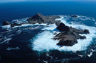
The Farallon IslandsFA-ra-lon, or Farallones, are a group of islands and sea stacks in the Gulf of the Farallones, off the coast of San Francisco, California, United States. The islands are also sometimes referred to by mariners as the Devil's Teeth Islands, in reference to the many treacherous underwater shoals in their vicinity. The islands lie 30 miles (48 km) outside the Golden Gate and 20 miles (32 km) south of Point Reyes, and are visible from the mainland on clear days. The islands are part of the City and County of San Francisco. The only inhabited portion of the islands is on Southeast Farallon Island (SEFI), where researchers from Point Blue Conservation Science and the U.S. Fish and Wildlife Service stay. The islands are closed to the public.

The California Current is a cold water Pacific Ocean current that moves southward along the western coast of North America, beginning off southern British Columbia and ending off southern Baja California Sur. It is considered an Eastern boundary current due to the influence of the North American coastline on its course. It is also one of six major coastal currents affiliated with strong upwelling zones, the others being the Humboldt Current, the Canary Current, the Benguela Current, the Oyashio Current, and the Somali Current. The California Current is part of the North Pacific Gyre, a large swirling current that occupies the northern basin of the Pacific.

The Monterey Bay National Marine Sanctuary (MBNMS) is a federally protected marine area offshore of California's Big Sur and central coast in the United States. It is the largest US national marine sanctuary and has a shoreline length of 276 miles (444 km) stretching from just north of the Golden Gate Bridge at San Francisco to Cambria in San Luis Obispo County. Supporting one of the world's most diverse marine ecosystems, it is home to numerous mammals, seabirds, fishes, invertebrates and plants in a remarkably productive coastal environment. The MBNMS was established on September 18, 1992, for the purpose of resource protection, research, education, and public use.

Cordell Bank National Marine Sanctuary is a marine sanctuary located off the coast of California. It protects an area of 1,286 sq mi (3,331 km2) of marine wildlife. The administrative center of the sanctuary is on an offshore granite outcrop 4.5 sq mi (12 km2) by 9.5 sq mi (25 km2), located on the continental shelf off of California. The outcrop is, at its closest, 6 mi (10 km) from the sanctuary itself.
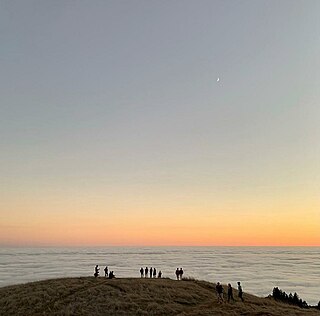
The Golden Gate Biosphere Network is a voluntary coalition of federal, state and local government agencies, nonprofit organizations, universities, and private partners within the Golden Gate Biosphere region. The Network aims to protect the region's biodiversity and conserve its natural resources. The Network has been part of the UNESCO Man and Biosphere Programme since 1988.GGBN is also part of the US Biosphere Network as well as EuroMAB. It is recognized by UNESCO for its "significance for biological diversity conversation" and organizational efforts involving municipal authorities and private interests.
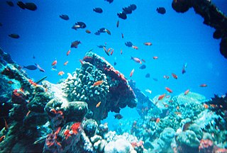
Marine ecosystems are the largest of Earth's aquatic ecosystems and exist in waters that have a high salt content. These systems contrast with freshwater ecosystems, which have a lower salt content. Marine waters cover more than 70% of the surface of the Earth and account for more than 97% of Earth's water supply and 90% of habitable space on Earth. Seawater has an average salinity of 35 parts per thousand of water. Actual salinity varies among different marine ecosystems. Marine ecosystems can be divided into many zones depending upon water depth and shoreline features. The oceanic zone is the vast open part of the ocean where animals such as whales, sharks, and tuna live. The benthic zone consists of substrates below water where many invertebrates live. The intertidal zone is the area between high and low tides. Other near-shore (neritic) zones can include mudflats, seagrass meadows, mangroves, rocky intertidal systems, salt marshes, coral reefs, lagoons. In the deep water, hydrothermal vents may occur where chemosynthetic sulfur bacteria form the base of the food web.

The National Marine Sanctuary of American Samoa is a federally-designated underwater area protected by the National Oceanic and Atmospheric Administration's (NOAA) Office of National Marine Sanctuaries. This sanctuary is the largest and most remote in the National Marine Sanctuary system. Spanning 13,581 sq mi, it is thought to be home to the greatest biodiversity of aquatic species of all the marine sanctuaries. Among them are expansive coral reefs, including some of the oldest Porites coral heads on earth, deep-water reefs, hydrothermal vent communities, and rare archeological resources. It was established as Fagatele Bay National Marine Sanctuary on April 29, 1986, it is thought to be home to the greatest biodiversity of aquatic species of all the marine sanctuaries. and then expanded and renamed in 2012.

Elkhorn Slough is a 7-mile-long (11 km) tidal slough and estuary on Monterey Bay in Monterey County, California. It is California's second largest estuary and the United States' first estuarine sanctuary. The community of Moss Landing and the Moss Landing Power Plant are located at the mouth of the slough on the bay.
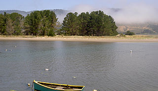
Kent Island is a small island in Marin County, California. In 1964, it was proposed for large-scale development including a hotel and marina, but the plan was defeated in 1967. The island is now included in the Greater Farallones National Marine Sanctuary.

Gulf of the Farallones is a gulf of the Pacific Ocean off the northern California coast. It extends westward from the opening of the San Francisco Bay and Drakes Bay to the Farallon Islands. Most of the gulf lies in Gulf of the Farallones National Marine Sanctuary, which protects about 1,250 square miles (3,200 km2).
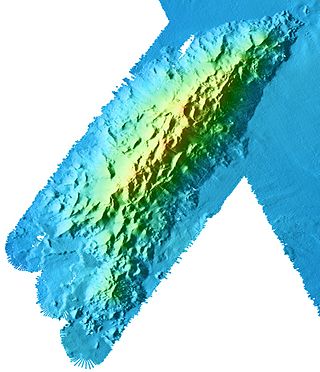
Davidson Seamount is a seamount located off the coast of Central California, 80 mi (129 km) southwest of Monterey and 75 mi (121 km) west of San Simeon. At 26 mi (42 km) long and 8 mi (13 km) wide, it is one of the largest known seamounts in the world. From base to crest, the seamount is 7,480 ft (2,280 m) tall, yet its summit is still 4,101 ft (1,250 m) below the sea surface. The seamount is biologically diverse, with 237 species and 27 types of deep-sea coral having been identified.
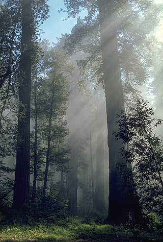
According to the California Protected Areas Database (CPAD), in the state of California, United States, there are over 14,000 inventoried protected areas administered by public agencies and non-profits. In addition, there are private conservation areas and other easements. They include almost one-third of California's scenic coastline, including coastal wetlands, estuaries, beaches, and dune systems. The California State Parks system alone has 270 units and covers 1.3 million acres (5,300 km2), with over 280 miles (450 km) of coastline, 625 miles (1,006 km) of lake and river frontage, nearly 18,000 campsites, and 3,000 miles (5,000 km) of hiking, biking, and equestrian trails.

Asilomar State Marine Reserve (SMR) is one of four small marine protected areas (MPAs) located near the cities of Monterey and Pacific Grove, at the southern end of Monterey Bay on California’s central coast. The four MPAs together encompass 2.96 square miles (7.7 km2). The SMR protects all marine life within its boundaries. Fishing and take of all living marine resources is prohibited.

The Marine Policy of the Barack Obama administration comprises several significant environmental policy decisions for the oceans made during his two terms in office from 2009 to 2017. By executive action, US President Barack Obama increased fourfold the amount of protected marine space in waters under United States control, setting a major precedent for global ocean conservation. Using the U.S. president's authority under the Antiquities Act of 1906, he expanded to 200 nautical miles the seaward limits of Papahānaumokuākea Marine National Monument in Hawaiʻi and the Pacific Remote Islands Marine National Monument around the U.S. island possessions in the Central Pacific. In the Atlantic, Obama created the Northeast Canyons and Seamounts Marine National Monument, the first marine monument in the U.S. exclusive economic zone (EEZ) in the Atlantic.

Susan Lynn Williams was an American marine biologist and Distinguished Professor of Evolution and Ecology at the University of California, Davis, where she directed the Bodega Marine Laboratory from 2000-2010. She researched marine coastal ecosystems and how they are affected by human activities. She was a strong advocate for environmental protection, credited with helping pass legislation expanding the boundaries of Northern California's Gulf of the Farallones and Cordell Bank national sanctuaries, increasing the area of federally-protected coastal waters.

The Chumash Heritage National Marine Sanctuary is a National Marine Sanctuary in the Pacific Ocean off the coast of San Luis Obispo and Santa Barbara counties on the Central Coast of California. It was designated on October 11, 2024, by the National Oceanic and Atmospheric Administration (NOAA). It is the first marine sanctuary to have been proposed by an Indigenous group. It protects nationally significant natural, cultural, and historical resources in Central California's coastal and ocean waters and offers opportunities for research, community engagement, and education and outreach activities.


