Clinton, Louisiana

Last updated

Clinton, Louisiana
Town
East Feliciana Parish Courthouse Clinton La1.jpg
East Feliciana Courthouse in Clinton
East Feliciana Parish Louisiana Incorporated and Unincorporated areas Clinton Highlighted.svg
Location of Clinton in East Feliciana Parish, Louisiana.
Louisiana in United States (US48).svg
Location of Louisiana in the United States
Coordinates: 30°51′47″N91°00′57″W / 30.86306°N 91.01583°W / 30.86306; -91.01583
CountryFlag of the United States.svg  United States
StateFlag of Louisiana.svg  Louisiana
Parish East Feliciana
Government
  MayorMark L. Kemp (D) (elected 2020)
Area
[1]
  Total
2.76 sq mi (7.14 km2)
  Land2.74 sq mi (7.10 km2)
  Water0.02 sq mi (0.04 km2)
Elevation
[2]
226 ft (69 m)
Population
 (2020)
  Total
1,340
  Density489.05/sq mi (188.83/km2)
Time zone UTC-6 (CST)
  Summer (DST) UTC-5 (CDT)
Zip Code
70722
Area code 225
FIPS code 22-15990
GNIS feature ID2406280 [2]
Website www.townofclintonla.com

Clinton is a town in, and the parish seat of, East Feliciana Parish, Louisiana, United States. [3] The town was named for New York Governor DeWitt Clinton. [4] The population was 1,340 in 2020. It is part of the Baton Rouge metropolitan statistical area.

Contents

History

In 1824, when Feliciana Parish was split into East and West, Clinton became the seat of East Feliciana Parish's government, replacing the town of Jackson in this capacity.

In mid October 1948, an Air Force transport plane with 34 people aboard made a forced landing near the town, killing four. [5]

Geography

Clinton is located at 30°51′47″N91°0′57″W / 30.86306°N 91.01583°W / 30.86306; -91.01583 (30.863050, -91.015789). [6]

According to the United States Census Bureau, the town has a total area of 2.8 square miles (7.3 km2), of which 2.7 square miles (7.0 km2) is land and 0.04 square miles (0.10 km2) (0.72%) is water.

Climate

Climate data for Clinton, Louisiana (1991–2020 normals, extremes 1975–2019)
MonthJanFebMarAprMayJunJulAugSepOctNovDecYear
Record high °F (°C)81
(27)
87
(31)
89
(32)
94
(34)
100
(38)
101
(38)
102
(39)
106
(41)
104
(40)
98
(37)
90
(32)
84
(29)
106
(41)
Mean daily maximum °F (°C)60.1
(15.6)
64.6
(18.1)
70.7
(21.5)
76.8
(24.9)
83.3
(28.5)
88.5
(31.4)
90.1
(32.3)
90.2
(32.3)
86.9
(30.5)
78.9
(26.1)
69.0
(20.6)
62.3
(16.8)
76.8
(24.9)
Daily mean °F (°C)48.8
(9.3)
52.7
(11.5)
58.8
(14.9)
65.1
(18.4)
72.2
(22.3)
78.4
(25.8)
80.2
(26.8)
80.1
(26.7)
76.3
(24.6)
66.8
(19.3)
57.0
(13.9)
51.2
(10.7)
65.6
(18.7)
Mean daily minimum °F (°C)37.6
(3.1)
40.9
(4.9)
46.9
(8.3)
53.4
(11.9)
61.0
(16.1)
68.2
(20.1)
70.4
(21.3)
70.1
(21.2)
65.8
(18.8)
54.8
(12.7)
45.1
(7.3)
40.2
(4.6)
54.5
(12.5)
Record low °F (°C)6
(−14)
11
(−12)
18
(−8)
28
(−2)
37
(3)
48
(9)
55
(13)
57
(14)
43
(6)
28
(−2)
20
(−7)
1
(−17)
1
(−17)
Average precipitation inches (mm)5.87
(149)
5.45
(138)
4.86
(123)
5.47
(139)
4.87
(124)
6.02
(153)
4.69
(119)
5.08
(129)
4.30
(109)
4.33
(110)
3.70
(94)
5.05
(128)
59.69
(1,516)
Average snowfall inches (cm)0.0
(0.0)
0.0
(0.0)
0.0
(0.0)
0.0
(0.0)
0.0
(0.0)
0.0
(0.0)
0.0
(0.0)
0.0
(0.0)
0.0
(0.0)
0.0
(0.0)
0.0
(0.0)
0.0
(0.0)
0.0
(0.0)
Average precipitation days (≥ 0.01 in)9.68.48.37.07.510.511.69.16.45.87.18.099.3
Average snowy days (≥ 0.1 in)0.00.00.00.00.00.00.00.00.00.00.00.10.1
Source: NOAA [7] [8]

Demographics

Historical population
CensusPop.Note
1870 930
1880 112−88.0%
1890 974769.6%
1900 960−1.4%
1910 918−4.4%
1920 701−23.6%
1930 7020.1%
1940 99842.2%
1950 1,38338.6%
1960 1,56813.4%
1970 1,88420.2%
1980 1,9191.9%
1990 1,904−0.8%
2000 1,9984.9%
2010 1,653−17.3%
2020 1,340−18.9%
U.S. Decennial Census [9]
Clinton racial composition as of 2020 [10]
RaceNumberPercentage
White (non-Hispanic)56542.16%
Black or African American (non-Hispanic)70952.91%
Native American 10.07%
Asian 120.9%
Other/Mixed 352.61%
Hispanic or Latino 181.34%

As of the 2020 United States census, there were 1,340 people, 737 households, and 506 families residing in the town.

As of the census [11] of 2000, there were 1,998 people, 670 households, and 481 families residing in the town. The population density was 729.0 inhabitants per square mile (281.5/km2). There were 771 housing units at an average density of 281.3 per square mile (108.6/km2). The racial makeup of the town was 40.74% White, 58.26% African American, 0.05% Native American, 0.15% Asian, 0.10% from other races, and 0.70% from two or more races. Hispanic or Latino of any race were 1.75% of the population.

There were 670 households, out of which 34.3% had children under the age of 18 living with them, 41.2% were married couples living together, 26.1% had a female householder with no husband present, and 28.1% were non-families. 26.6% of all households were made up of individuals, and 11.9% had someone living alone who was 65 years of age or older. The average household size was 2.71 and the average family size was 3.30.

In the town, the population was spread out, with 30.0% under the age of 18, 9.0% from 18 to 24, 27.5% from 25 to 44, 21.8% from 45 to 64, and 11.7% who were 65 years of age or older. The median age was 34 years. For every 100 females, there were 96.1 males. For every 100 females age 18 and over, there were 91.1 males.

The median income for a household in the town was $27,016, and the median income for a family was $29,444. Males had a median income of $32,500 versus $20,268 for females. The per capita income for the town was $13,353. About 25.3% of families and 33.6% of the population were below the poverty line, including 44.6% of those under age 18 and 23.7% of those age 65 or over.

Education

East Feliciana Parish School Board serves Clinton. Public schools within Clinton and serving Clinton include:

This was changed in the Fall of 2010, when Clinton and Jackson High Schools merged to be housed at the old Jackson High/Middle School building in Jackson. Clinton Middle School was merged with Jackson Middle School and housed at the Clinton High School site.

Silliman Institute is the main private school in the area. Slaughter Community Charter School is the only charter school in the area.

Notable people

Media

Related Research Articles

<span class="mw-page-title-main">Wilkinson County, Mississippi</span> County in the United States

Wilkinson County is a county located in the southwest corner of the U.S. state of Mississippi. As of 2020, its population was 8,587. Its county seat is Woodville. Bordered by the Mississippi River on the west, the county is named for James Wilkinson, a Revolutionary War military leader and first governor of the Louisiana Territory after its acquisition by the United States in 1803.
<span class="mw-page-title-main">West Feliciana Parish, Louisiana</span> Parish in Louisiana, United States

West Feliciana Parish is a civil parish located in the U.S. state of Louisiana. At the 2020 census, the population was 15,310. The parish seat is St. Francisville. The parish was established in 1824.

<span class="mw-page-title-main">Rapides Parish, Louisiana</span> Parish in Louisiana, United States

Rapides Parish is a parish located in the U.S. state of Louisiana. As of the 2020 census, the population was 130,023. The parish seat and largest city is Alexandria, which developed along the Red River of the South. Rapides is the French word for "rapids". The parish was created in 1807 after the United States acquired this territory in the Louisiana Purchase.

<span class="mw-page-title-main">Jackson Parish, Louisiana</span> Parish in Louisiana, United States

Jackson Parish is a parish in the northern part of the U.S. state of Louisiana. As of the 2020 census, the population was 15,031. The parish seat is Jonesboro. The parish was formed in 1845 from parts of Claiborne, Ouachita, and Union Parishes. In the twentieth century, this part of the state had several small industrial mill towns, such as Jonesboro. East of Jonesboro is the Jimmie Davis State Park, which includes Caney Lake Reservoir.

<span class="mw-page-title-main">East Feliciana Parish, Louisiana</span> Parish in Louisiana, United States

East Feliciana Parish is a parish located in the U.S. state of Louisiana. At the 2020 census, the population was 19,531. The parish seat is Clinton.

<span class="mw-page-title-main">Toronto, Iowa</span> City in Iowa, United States

Toronto is a town in Clinton County, Iowa, United States. The population was 102 at the time of the 2020 census.

<span class="mw-page-title-main">Vivian, Louisiana</span> Town in Louisiana, United States

Vivian is a town in Caddo Parish, Louisiana, United States and is home to the Redbud Festival. The population was 3,671 at the 2010 census, down from 4,031 in 2000. According to 2020 census data, Vivian is now the fourth-largest municipality in Caddo Parish by population.

<span class="mw-page-title-main">Harrisonburg, Louisiana</span> Village in Louisiana, United States

Harrisonburg is a village in and the parish seat of Catahoula Parish, Louisiana, United States. The population was 348 as of the 2010 census, down from 746 in 2000.

<span class="mw-page-title-main">Clayton, Louisiana</span> Town in Louisiana, United States

Clayton is a town in northern Concordia Parish, Louisiana, United States. The population was 711 at the 2010 census. Cotton is a principal commodity in the area. Clayton is located on the Tensas River, important for fishing and boating, promoted through a U.S. Army Corps of Engineers-maintained boat launch. The Tensas River merges with the Black River in Jonesville in Catahoula Parish.

<span class="mw-page-title-main">Monticello, Louisiana</span> Census-designated place in Louisiana, United States

Monticello is a census-designated place (CDP) in East Baton Rouge Parish, Louisiana, United States. The population was 5,172 at the 2010 census, up from 4,763 in 2000. It is part of the Baton Rouge Metropolitan Statistical Area.

<span class="mw-page-title-main">Jackson, Louisiana</span> Town in Louisiana, United States

Jackson is a town in East Feliciana Parish, Louisiana, United States. The population was 3,842 at the 2010 U.S. census, down from 4,130 in 2000; the 2020 population estimates program determined Jackson had a population of 3,707. It is part of the Baton Rouge metropolitan statistical area.
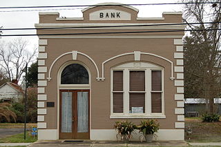
<span class="mw-page-title-main">Slaughter, Louisiana</span> Town in Louisiana, United States

Slaughter is a town in East Feliciana Parish, Louisiana, United States. The population was 997 at the 2010 U.S. census, down from 1,011 at the 2000 U.S. census. In the 2020 population estimates program, the U.S. Census Bureau estimated that 882 people lived in the township. Slaughter is part of the Baton Rouge metropolitan statistical area.

<span class="mw-page-title-main">Wilson, Louisiana</span> Village in Louisiana, United States

Wilson is a village in East Feliciana Parish, Louisiana, United States. The population was 348 in 2020. It is part of the Baton Rouge metropolitan statistical area.

<span class="mw-page-title-main">Urania, Louisiana</span> Town in Louisiana, United States

Urania is a town in La Salle Parish, Louisiana United States. The population was 1,313 at the 2010 census.

<span class="mw-page-title-main">Mangham, Louisiana</span> Village in Louisiana, United States

Mangham is a village in Richland Parish in northeastern Louisiana, United States. The population was 672 at the 2010 census. Mangham was established in 1890. It is named for Wiley P. Mangham, the publisher of the Richland Beacon-News, a weekly newspaper in Rayville, the seat of Richland Parish.

<span class="mw-page-title-main">Lutcher, Louisiana</span> Town in Louisiana, United States

Lutcher is a town in St. James Parish, Louisiana, United States, on the east bank of the Mississippi River. It is part of the New Orleans Metropolitan Area. The population was 3,559 at the 2010 U.S. census, and 3,127 at the 2020 population estimates program.

<span class="mw-page-title-main">Krotz Springs, Louisiana</span> Town in Louisiana, United States

Krotz Springs is a town in St. Landry Parish, Louisiana, United States, on the Atchafalaya River. The population was 1,198 at the 2010 census, down from 1,219 in 2000. It is part of the Opelousas–Eunice Micropolitan Statistical Area.

<span class="mw-page-title-main">Baldwin, Louisiana</span> Town in Louisiana, United States

Baldwin is a town in St. Mary Parish, Louisiana, United States. The population was 2,436 at the 2010 census, down from 2,497 in 2000. It is part of the Morgan City Micropolitan Statistical Area. Its population is majority African American. The town has been home to educational institutions for white and "colored" students.
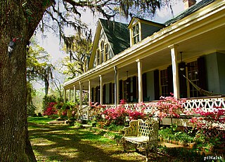
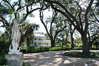
<span class="mw-page-title-main">St. Francisville, Louisiana</span> Town in Louisiana, United States

St. Francisville is a town in and the parish seat of, West Feliciana Parish, Louisiana, United States. The population was 1,557 at the 2020 census. It is part of the Baton Rouge metropolitan statistical area.

<span class="mw-page-title-main">Delcambre, Louisiana</span> Town in Louisiana, United States

Delcambre is a town in Iberia and Vermilion parishes in the U.S. state of Louisiana, located 9 miles (14 km) east of Abbeville on Louisiana Highway 14 in the Cajun Heartland of Acadiana. Bayou Carlin, also known as the Delcambre Canal, passes through the town and is home for much of the local fishing industry. The population was 1,866 at the 2010 census, down from 2,168 at the 2000 census.

References

  1. "2020 U.S. Gazetteer Files". United States Census Bureau. Retrieved March 20, 2022.
  2. 1 2 U.S. Geological Survey Geographic Names Information System: Clinton, Louisiana
  3. "Find a County". National Association of Counties. Archived from the original on May 31, 2011. Retrieved June 7, 2011.
  4. "Profile for Clinton, Louisiana". ePodunk . Retrieved April 26, 2010.
  5. "4 Die as AF Plane Makes Crash Landing". Abilene Reporter News. October 17, 1948. Retrieved November 21, 2020.
  6. "US Gazetteer files: 2010, 2000, and 1990". United States Census Bureau. February 12, 2011. Retrieved April 23, 2011.
  7. "NOWData - NOAA Online Weather Data". National Oceanic and Atmospheric Administration. Retrieved November 2, 2023.
  8. "Summary of Monthly Normals 1991-2020". National Oceanic and Atmospheric Administration. Retrieved November 2, 2023.
  9. "Census of Population and Housing". Census.gov. Retrieved June 4, 2015.
  10. "Explore Census Data". data.census.gov. Retrieved December 28, 2021.
  11. "U.S. Census website". United States Census Bureau . Retrieved January 31, 2008.
  12. "The Dukes of Hazzard". Archived from the original on June 11, 2007. Retrieved May 20, 2007.
  13. http://www.katc.com/Global/story.asp?S=10716470%5B‍%5D
  14. WARREN, STEPHANIE (March 4, 2015). "Major motion picture to be filmed in Clinton". theadvocate.com. Archived from the original on April 2, 2015. Retrieved March 7, 2015.