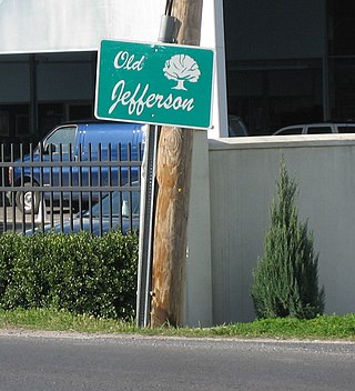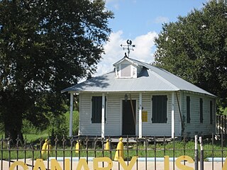
Jefferson is a census-designated place (CDP) in Jefferson Parish, Louisiana, United States, on the north side of the Mississippi River. Jefferson is part of the New Orleans–Metairie–Kenner metropolitan statistical area. The population was 11,193 at the 2010 census, and 10,533 in 2020. It is often known by locals as "Old Jefferson", but should not be confused with Old Jefferson in East Baton Rouge Parish, Louisiana.

Marrero is a census-designated place (CDP) in Jefferson Parish, Louisiana, United States. Marrero is on the south side of the Mississippi River, within the New Orleans–Metairie–Kenner metropolitan statistical area. The population was 32,382 at the 2020 U.S. census.
Waggaman is a census-designated place and unincorporated community in Jefferson Parish, Louisiana, United States. Waggaman is on the West Bank of the Mississippi River, within the New Orleans–Metairie–Kenner metropolitan statistical area. The population was 9,835 at the 2020 census. The area was named for U.S. Senator George Augustus Waggaman (1782–1843).

Poydras is a census-designated place (CDP) in St. Bernard Parish, Louisiana, United States. The population was 3,886 at the 2000 census and 2,536 in 2020. It is part of the New Orleans–Metairie–Kenner Metropolitan Statistical Area. Poydras is on the East Bank of the Mississippi River, just upriver from the Plaquemines Parish line.
Ama is a census-designated place (CDP) in St. Charles Parish, Louisiana, United States. Ama is on the West Bank of the Mississippi River, just west of the Jefferson Parish line. The population was 1,290 at the 2020 census.

Bayou Gauche is a census-designated place and fishing village, with an adjacent natural bayou and wetlands. It is located in St. Charles Parish, Louisiana, United States. As of 2020, its population was 2,161.
Boutte is a census-designated place (CDP) in St. Charles Parish, Louisiana, United States. The population was 3,075 at the 2010 census, and 3,054 in 2020.

Destrehan is a census-designated place (CDP) in St. Charles Parish, Louisiana, United States. At the 2020 census, its population was 11,340. It is located on the east bank of the Mississippi River. Destrehan is part of the New Orleans—Metairie—Kenner metropolitan statistical area.

Killona is a census-designated place (CDP) in St. Charles Parish, Louisiana, United States. The population was 724 in 2020. On December 14, 2022, the town was hit by a destructive and deadly EF2 tornado that damaged or destroyed numerous structures, killed one person, and injured eight others.
Luling is a census-designated place (CDP) in St. Charles Parish, Louisiana. The population was 11,512 at the 2000 census and 12,119 at the 2010 census. At the 2020 census, 13,716 people lived in Luling. It is located on the west bank of the Mississippi River. Luling is part of the New Orleans—Metairie—Kenner metropolitan statistical area.
Montz is a census-designated place (CDP) in St. Charles Parish, Louisiana, United States. It first appeared in the 2000 census with a population of 1,120. The 2020 census indicates a population of 2,106.
New Sarpy is a census-designated place (CDP) in St. Charles Parish, Louisiana, United States. The population was 1,169 at the 2020 census.
Paradis is a census-designated place (CDP) in St. Charles Parish, Louisiana, United States. The population was 1,252 at the 2000 census and 1,242 in 2020.
Saint Rose is a census-designated place (CDP) in St. Charles Parish, Louisiana, United States. St. Rose is on the east bank of the Mississippi River, two miles (3 km) north of the Jefferson Parish border and is part of the Greater New Orleans metropolitan area. The population was 6,540 in the 2000 census, and 7,504 in 2020.

Taft is a census-designated place (CDP) in St. Charles Parish, Louisiana, United States, located on the west bank of the Mississippi River.

LaPlace is a census-designated place (CDP) in St. John the Baptist Parish, Louisiana, United States, situated along the east bank of the Mississippi River, in the New Orleans metropolitan area. In 2020, it had a population of 28,841.

Des Allemands is an unincorporated community and census-designated place (CDP) in Lafourche and St. Charles parishes in the southeastern part of the U.S. state of Louisiana. The population was 2,179 at the 2020 census. The town, known as the "Catfish Capital of the Universe", is along the Bayou des Allemands, which is the boundary of Lafourche and St. Charles parishes. Lac des Allemands is located northwest of the town. The ZIP Code for Des Allemands is 70030.

St. Charles Parish is a parish located in the U.S. state of Louisiana. At the 2020 census, its population was 52,549. The parish seat is Hahnville and the most populous community is Luling.

The St. Charles Parish Public School System is a public school district headquartered in Luling, Louisiana. It serves all of St. Charles Parish.
Hahnville High School is a public high school located in Boutte, Louisiana, United States. It is part of the St. Charles Parish Public School System, serving grades 9 through 12. J.B. Martin and R.K. Smith Middle Schools are the feeder schools for Hahnville High School.


