Richland Parish, Louisiana

Last updated

Richland Parish
Alto Presbyterian Church.jpg
Alto Presbyterian Church
Map of Louisiana highlighting Richland Parish.svg
Location within the U.S. state of Louisiana
Louisiana in United States.svg
Louisiana's location within the U.S.
Coordinates: 32°25′18″N91°45′43″W / 32.421736°N 91.762070°W / 32.421736; -91.762070
CountryFlag of the United States.svg United States
StateFlag of Louisiana.svg  Louisiana
FoundedSeptember 29, 1878
Named for Fertile (rich) land in the area
Seat Rayville
Largest townRayville
Area
  Total576 sq mi (1,490 km2)
  Land559 sq mi (1,450 km2)
  Water9.375 sq mi (24.28 km2)  1.6%
Population
 (2020)
  Total20,043
  Density35/sq mi (13/km2)
Time zone UTC−6 (Central)
  Summer (DST) UTC−5 (CDT)

Richland Parish is a parish located in the North Louisiana Delta Country in the U.S. state of Louisiana, known for its fertile, flat farmland, cane brakes, and open spaces. The parish had a population of 20,043 at the 2020 United States census. [1] The name Richland was chosen due to the rich production from farming. The parish seat and largest community is Rayville.

Contents

History

The parish was officially created on September 29, 1868. [2] Rayville, Louisiana, the parish seat, was named for John Ray, a politician from Monroe with large land holdings in present-day Rayville. [3]

Richland Parish is home to the first public parish library in the State of Louisiana, the Rhymes Memorial Library. The library was built in 1925 by the Lambda Kappa Club of Rayville. R.R. Rhymes donated the original building in memory of his wife, Nonnie Roark Rhymes. [4]

Geography

Bayou Macon flows through the eastern areas of Richland. Other tributaries in the parish include Crew Lake, and the Lafourche Diversion Canal are located in the western portion of the parish. Boeuf River flows from the northern end to the southern end in the center of the parish.

Adjacent parishes

Parks and wildlife management areas

Communities

Towns

Village

Unincorporated areas

Census-designated place

Unincorporated communities

Transportation

Bridge crossing the Boeuf River on Hwy 15 near Alto, LA LA 15 bridge over Boeuf River.jpg
Bridge crossing the Boeuf River on Hwy 15 near Alto, LA
Interstates and State Highways
I-20.svg Interstate 20
US 80.svg U.S. Highway 80
US 425.svg U.S. Highway 425
Louisiana 15 (2008).svg Louisiana Highway 15
Louisiana 17 (2008).svg Louisiana Highway 17
Louisiana 132 (2008).svg Louisiana Highway 132
Louisiana 133 (2008).svg Louisiana Highway 133
Louisiana 135 (2008).svg Louisiana Highway 135
Louisiana 585 (2008).svg Louisiana Highway 585
Air, Rail, Levee
Airport icon small.png Rayville Municipal Airport
Airport icon small.png Delhi Municipal Airport
Airport icon small.png Monroe Regional Airport
Kansas city south lines logo.svg Kansas City Southern Railroad
LA 15 bridge over Boeuf River.jpg Tensas Basin Levee District

Demographics

Historical population
CensusPop.Note
1870 5,110
1880 8,44065.2%
1890 10,23021.2%
1900 11,1168.7%
1910 15,76941.9%
1920 20,86032.3%
1930 26,37426.4%
1940 28,8299.3%
1950 26,672−7.5%
1960 23,824−10.7%
1970 21,774−8.6%
1980 22,1871.9%
1990 20,629−7.0%
2000 20,9811.7%
2010 20,725−1.2%
2020 20,043−3.3%
U.S. Decennial Census [5]
1790–1960 [6] 1900–1990 [7]
1990–2000 [8] 2010 [9]

2020 census

Richland Parish racial composition [10]
RaceNum.Perc.
White (non-Hispanic)11,66758.21%
Black or African American (non-Hispanic)7,30336.44%
Native American 530.26%
Asian 500.25%
Other/Mixed 5702.84%
Hispanic or Latino 4002.0%

As of the 2020 United States census, there were 20,043 people, 7,459 households, and 4,972 families residing in the parish.

Education

Public schools

Private schools

Charter schools

Community and technical colleges

Regional universities

Government

Parish AdministrationAdministrators
Sheriff Gary Gilley, No Party
CoronerDr. Matt Prine, Republican
Assessor Lee Brown, III, Democrat
School Board Superintendent Sheldon Jones
Homeland Security Dawn Williams
Parish Police JuryPolice Jurors
District 1, DelhiSteve Craig, Republican
District 2, DelhiPatrick Stubblefield, Democrat
District 3, RayvilleSharon Gee, Democrat
District 4, RayvilleSteve Lofton, Republican
District 5, RayvillePaul Slayter, Republican
District 6, RayvilleAlthan Smith, Democrat
District 7, AltoCecil Reddick, Republican
District 8, StartElliot Colvin, Republican
District 9, ManghamRoy Wiggins, Jr., Republican
5th Judicial DistrictParish Judicial Leaders
Division "A"Clay Hamilton, Republican
Division "B"Will Rhymes Barham, Republican
Division "C"Steve Dean, Republican
Clerk of Court Stacie Williamson, Republican
Parish School Board Board Members
District 1, DelhiBilly Calvert, No Party
District 2, DelhiEugene Young, Jr., Democrat
District 3, RayvilleMoses "DeJohn" Wilkins, Democrat
District 4, RayvilleJames Hough, Republican
District 5, RayvilleAlece Copeland, No Party
District 6, RayvilleMarie Lewis, Democrat
District 7, ArchibaldJoe Chapman, No Party
District 8, StartKevin Eppinette, No Party
District 9, ManghamChris Pruitt, Republican

Notable people

Politics

United States presidential election results for Richland Parish, Louisiana [11]
Year Republican Democratic Third party(ies)
No.%No.%No.%
2020 6,60766.47%3,22532.44%1081.09%
2016 6,28765.51%3,15732.90%1531.59%
2012 5,84662.66%3,38736.31%961.03%
2008 5,75162.64%3,31136.06%1191.30%
2004 5,47163.14%3,08235.57%1121.29%
2000 4,89557.69%3,28238.68%3083.63%
1996 3,76543.23%4,14347.57%8029.21%
1992 3,80842.77%3,70641.63%1,38915.60%
1988 5,22662.85%2,83334.07%2563.08%
1984 5,98065.84%2,91832.13%1852.04%
1980 4,77254.57%3,74542.83%2272.60%
1976 3,63049.93%3,49548.07%1451.99%
1972 4,30470.80%1,33521.96%4407.24%
1968 1,03115.95%1,01715.74%4,41568.31%
1964 4,49885.76%74714.24%00.00%
1960 1,37835.62%99625.74%1,49538.64%
1956 1,06329.88%1,09430.76%1,40039.36%
1952 1,64539.70%2,49960.30%00.00%
1948 1194.69%96037.87%1,45657.44%
1944 48818.95%2,08781.05%00.00%
1940 31011.37%2,41788.63%00.00%
1936 1656.36%2,42593.48%40.15%
1932 462.53%1,77397.42%10.05%
1928 24218.26%1,08381.74%00.00%
1924 11614.61%67885.39%00.00%
1920 507.00%66493.00%00.00%
1916 71.07%65098.93%00.00%
1912 20.46%39389.93%429.61%

See also

Related Research Articles

<span class="mw-page-title-main">Franklin Parish, Louisiana</span> Parish in Louisiana, United States

Franklin Parish is a parish located in the northeastern part of the U.S. state of Louisiana. As of the 2020, its population was 19,774. The parish seat and the most populous municipality is Winnsboro. The parish was founded in 1843 and named for Benjamin Franklin.

<span class="mw-page-title-main">Delhi, Louisiana</span> City in Louisiana, United States

Delhi, originally called Deerfield, is a town in Richland Parish, Louisiana, United States. As of the 2020 census, the town population was 2,622.

<span class="mw-page-title-main">Mangham, Louisiana</span> Village in Louisiana, United States

Mangham is a village in Richland Parish in northeastern Louisiana, United States. The population was 672 at the 2010 census. Mangham was established in 1890. It is named for Wiley P. Mangham, the publisher of the Richland Beacon-News, a weekly newspaper in Rayville, the seat of Richland Parish.

<span class="mw-page-title-main">Rayville, Louisiana</span> Town in Louisiana, United States

Rayville is a town in and the parish seat of Richland Parish in northeastern Louisiana, United States. The population, which is 69 percent African American, was 4,234 at the 2000 census, but it had declined by nearly 21 percent in 2020 to 3,347.
<span class="mw-page-title-main">U.S. Route 425</span> Highway in the United States

U.S. Route 425 (US 425) is a north–south United States highway that travels in the U.S. states of Mississippi, Louisiana, and Arkansas. It was first commissioned in 1989.
<span class="mw-page-title-main">Louisiana Highway 15</span> State highway in Louisiana, United States

Louisiana Highway 15 (LA 15) is a state highway located in central and northern Louisiana. It runs 194.10 miles (312.37 km) in a north–south direction from the junction of LA 1 and LA 970 in Lettsworth to the concurrent U.S. Highways 63 and 167 in Lillie. The middle portion of the route, extending 56 miles (90 km) from Ferriday to just north of Mangham, is co-signed with US 425 and is a major four-lane highway through the area.
<span class="mw-page-title-main">Louisiana Highway 17</span> State highway in Louisiana, United States

Louisiana Highway 17 (LA 17) is a state highway located in northeastern Louisiana. It runs 66.53 miles (107.07 km) in a north–south direction from the junction of U.S. Highway 425 (US 425), LA 4, LA 15, and LA 130 in Winnsboro to the Arkansas state line at Kilbourne.

<span class="mw-page-title-main">Start, Louisiana</span> Census-designated place in Louisiana, United States

Start is a census-designated place in Richland Parish, Louisiana, United States. The population was 982 at the 2020 census, up from 905 in 2010.

<span class="mw-page-title-main">Monroe–Ruston Combined Statistical Area</span> Combined Statistical Area in Louisiana, United States

The Monroe–Ruston Combined Statistical Area is made up of five parishes in northern Louisiana. The statistical area consists of the Monroe Metropolitan Statistical Area and the Ruston Micropolitan Statistical Area. As of the 2010 census, the CSA had a population of 251,155.

The Richland Parish School Board is an entity responsible for the operation of public schools in Richland Parish, Louisiana, United States. It is headquartered in the town of Rayville.

<span class="mw-page-title-main">Ralph Abraham (politician)</span> American physician and politician (born 1954)

Ralph Lee Abraham Jr. is an American veterinarian, physician, and politician who served as the U.S. representative for Louisiana's 5th congressional district from 2015 to 2021. A member of the Republican Party, he is a native and resident of Alto, Louisiana.

<span class="mw-page-title-main">Ouachita Christian High School</span> Private school in Louisiana, United States

Ouachita Christian School is a private K–12 Christian school in Monroe, Louisiana.
<span class="mw-page-title-main">Wiley Person Mangham</span> American publisher and editor

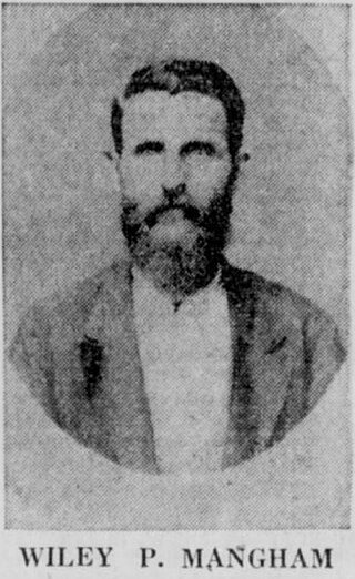
Wiley Person Mangham (1838-1896) was an American publisher and editor, who was born in Russell County, Alabama and died in Richland Parish, Louisiana. The town of Mangham, Louisiana was named for him.

Robert Max Ross was a Republican activist and a candidate for numerous statewide and local offices who resided in Mangham in northeastern Louisiana. He was among the earliest advocates for the Republican political movement at a time when no GOP candidate had been elected statewide in more than a century. He ran as one of two candidates in the Republican primaries for governor in 1972 and Louisiana's 5th congressional district seat in 1974. After Louisiana adopted the jungle primary system, Ross qualified again for governor in 1983 and also the United States Senate in 1984. He additionally ran for the Louisiana State Senate as well as mayor of Mangham during other election years.

<span class="mw-page-title-main">Louisiana's 34th State Senate district</span> American legislative district

Louisiana's 34th State Senate district is one of 39 districts in the Louisiana State Senate. It has been represented by Democrat Katrina Jackson since 2020.

Hershell West was an American basketball player and coach. He played basketball at Eula D. Britton in his hometown of Rayville, Louisiana and won the Louisiana State AA Championship in 1959. Grambling State Tigers men's basketball head coach Fred Hobdy offered West and the four other Britton starters athletic scholarships to Grambling State after watching them play. West played college basketball for the Tigers for four years, where he won a National Association of Intercollegiate Athletics (NAIA) championship in 1961 and was a two-time first-team All-Southwestern Athletic Conference (SWAC) selection in 1962 and 1963. In 1962, he and six other Tigers players participated in a goodwill tour of Latin America.
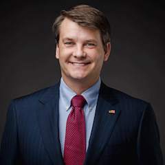
<span class="mw-page-title-main">Luke Letlow</span> American politician (1979–2020)

Luke Joshua Letlow was an American businessman and politician from Louisiana. A Republican, he was elected to the United States House of Representatives for Louisiana's 5th congressional district in 2020 but died from complications caused by COVID-19 five days before he was due to take office in the 117th Congress. Before his election to Congress, Letlow served as chief of staff to Representative Ralph Abraham. Three months after his death, Letlow's widow Julia was elected to the vacant seat in a special election.

<span class="mw-page-title-main">2021 Louisiana's 5th congressional district special election</span>

The 2021 Louisiana's 5th congressional district special election was held on March 20, 2021. It was triggered by the death of Republican congressman-elect Luke Letlow on December 29, 2020, who died from a heart attack while being treated for COVID-19.

References

  1. "Census - Geography Profile: Richland Parish, Louisiana" . Retrieved January 22, 2023.
  2. "Richland Parish". Center for Cultural and Eco-Tourism. Retrieved September 5, 2014.
  3. Leeper, Clare D’Artois (2012). Louisiana Place Names: Popular, Unusual, and Forgotten Stories of Towns, Cities, Plantations, Bayous, and Even Some Cemeteries. Baton Rouge: Louisiana State University Press. p. 204.
  4. "Richland Library First To Form Under New Law". No. page 3. The Town Talk (Alexandria, Louisiana). Newspapers.com. January 13, 1928. Retrieved July 21, 2018.
  5. "U.S. Decennial Census". United States Census Bureau. Archived from the original on April 26, 2015. Retrieved September 1, 2014.
  6. "Historical Census Browser". University of Virginia Library. Retrieved September 1, 2014.
  7. "Population of Counties by Decennial Census: 1900 to 1990". United States Census Bureau. Retrieved September 1, 2014.
  8. "Census 2000 PHC-T-4. Ranking Tables for Counties: 1990 and 2000" (PDF). United States Census Bureau. Archived (PDF) from the original on March 27, 2010. Retrieved September 1, 2014.
  9. "State & County QuickFacts". United States Census Bureau. Archived from the original on June 6, 2011. Retrieved August 18, 2013.
  10. "Explore Census Data". data.census.gov. Retrieved December 19, 2021.
  11. Leip, David. "Dave Leip's Atlas of U.S. Presidential Elections". uselectionatlas.org. Retrieved March 7, 2018.

32°25′N91°46′W / 32.42°N 91.76°W / 32.42; -91.76