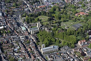
Bury St Edmunds, commonly referred to locally as Bury is a cathedral as well as market town and civil parish in the West Suffolk district, in the county of Suffolk, England. The town is best known for Bury St Edmunds Abbey and St Edmundsbury Cathedral. Bury is the seat of the Diocese of St Edmundsbury and Ipswich of the Church of England, with the episcopal see at St Edmundsbury Cathedral. In 2011 it had a population of 45,000. The town, originally called Beodericsworth, was built on a grid pattern by Abbot Baldwin around 1080. It is known for brewing and malting and for a British Sugar processing factory, where Silver Spoon sugar is produced. The town is the cultural and retail centre for West Suffolk and tourism is a major part of the economy.
Acton is a village and civil parish in the English county of Suffolk. The parish also includes the hamlets of Cuckoo Tye and Newman's Green.
Alpheton is a village and civil parish in the Babergh district of Suffolk, England. Located on the A134 road about six miles north of Sudbury, in 2005 it had a population of 260, reducing to 256 at the 2011 Census. According to Eilert Ekwall the meaning of the village name is the homestead of Aelfled.

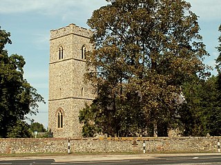
Ampton is a village and civil parish in the West Suffolk District of Suffolk, England, about five miles north of Bury St Edmunds.
Assington is a village in Suffolk, England, 4 miles (6.4 km) south-east of Sudbury. At the 2011 Census it had a population of 402, estimated at 445 in 2019. The parish includes the hamlets of Rose Green and Dorking Tye.
Brockley(not to be confused with Brockley Green, 8 miles southwest in Hundon parish) is a village and civil parish in the West Suffolk district of Suffolk, England. Brockley parish includes the hamlets of Pound Green and Gulling Green. According to the 2001 Census parish population was 281, and increased to 312 at the 2011 Census.
Knodishall, a village in Suffolk, England, lies 3.5 miles (6 km) south-east of Saxmundham, 1 mile (2 km) south-west of Leiston, and 3 miles from the coast, in the Blything Hundred. Most dwellings are now at Coldfair Green; just a few remain in the original village by the parish Church of St Lawrence, which falls gently on the north side of the Hundred River valley. It is now an outlier of Knodishall Common, a settlement a mile to the south-east. The estimated parish population was 790 in 2019.
Flempton is a village and civil parish in the West Suffolk district of Suffolk, England. It is on the A1101 road 5 miles NW from Bury St Edmunds.
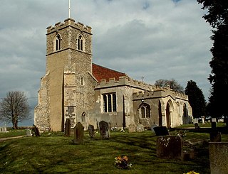
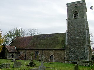
Shimpling is a village and civil parish in south Suffolk, England. About 7 miles (11 km) from Bury St Edmunds, it is part of Babergh district. The village is formed from two halves, the newer Shimpling Street and about 2 miles (3 km) away the old village of Shimpling. The village has a Church of England parish church, where supermodel Claudia Schiffer and film producer Matthew Vaughn were married on 25 May 2002.
Woolpit is a village in the English county of Suffolk, midway between the towns of Bury St. Edmunds and Stowmarket. In 2011 Woolpit parish had a population of 1,995. It is notable for the 12th-century legend of the green children of Woolpit and for its parish church, which has especially fine medieval woodwork. Administratively Woolpit is a civil parish, part of the district of Mid Suffolk.

Thorpe Morieux is a small village and civil parish in Suffolk, England. It is 10 miles south-east of Bury St Edmunds and 10 miles north east of Sudbury.
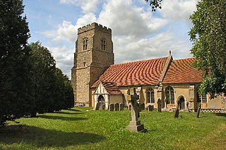
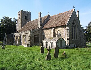
Hessett is a village and civil parish in the Mid Suffolk district of Suffolk in eastern England. Hessett is located around four miles south-east of Bury St Edmunds. It is a rural village with a single north-south road off which most other roads flow. In 2011 its population was 464 which is towards the highest recorded population since its peak in 1850. Hessett is south of Beyton and west of Drinkstone.

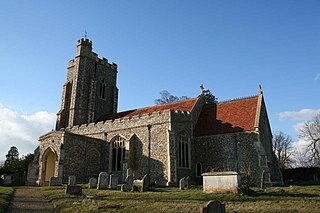
Thorndon is a village and civil parish in the Mid Suffolk district of Suffolk in eastern England. The village is located around three miles south of Eye, close to the A140. It is located 92 miles northeast of London. In 2011, the population was 648, as recorded by the 2011 census. Village facilities include All Saints' Church and a local primary school.
Withersfield is a village and civil parish in the West Suffolk district of Suffolk in eastern England. In 2011 its population was 450. It has a public house and a village hall, and centres on the parish church, St. Mary the Virgin. It is in a rural location, surrounded by farmland, yet only a mile north of the busy market town of Haverhill. Surrounding villages include Great Wratting, West Wickham and Great Thurlow.

Chevington is a village and civil parish in the West Suffolk district of Suffolk in East Anglia, England. Located around 10 km south-west of Bury St Edmunds, in 2005 its population was 630, reducing to 602 at the 2011 Census. The parish also contains the hamlets of Broad Green and Tan Office Green.
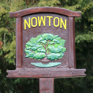
Nowton is a small village and civil parish in the West Suffolk district of Suffolk in eastern England. Located on the southern edge of Bury St Edmunds, in 2005 its population was estimated to be 140. At the 2011 census 163 people were recorded as living in the village.
Hawkedon is a village and civil parish in the West Suffolk district of Suffolk in eastern England. Located around 7 miles (11 km) south-south-west of Bury St Edmunds, the parish also contains the hamlet of Thurston End, and in 2005 had a population of 120. The majority of the village is classed as a conservation area.
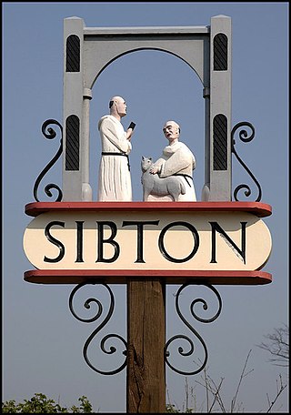
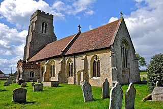
Sibton is a village and civil parish on the A1120 road, in the East Suffolk district, in the English county of Suffolk. It is near the towns of Saxmundham and Halesworth, the village of Peasenhall and the hamlet of Sibton Green. The church is dedicated to St Peter; there is also the remains of a medieval abbey, Sibton Abbey. There is a large stately house set in the grounds of Sibton Park which dates back 1827 in the Georgian period, which is now used as a hotel. The estate consists of 4500 acres, being part of the Wilderness Reserve where there are holiday cottages and a lake. The Parish is also in close proximity to the River Yox which runs past the White Horse Inn and down through Pouy Street, it then goes on past both the A1120 road and a small, wooded area called Abbey Woods to pass through the grounds of Sibton Park and then on to Yoxford.
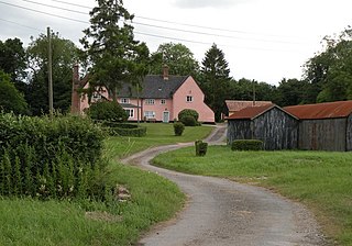
Hart's Green is a hamlet in the civil parish of Lawshall in the Babergh District in the county of Suffolk, England. It is located between Stanningfield and Hanningfield Green and is just over a mile off the A134 between Bury St Edmunds and Sudbury. The road that serves Hart's Green is known as Donkey Lane.
The Street is a linear settlement in the civil parish of Lawshall in the Babergh district in the county of Suffolk, England. It extends from Lawshall Hall in the west to Donkey Lane in the east. The settlement includes Swanfield, east of the Swan Public House and the small residential development of Hall Mead which is opposite All Saints Church.


