
Pangong Tso or Pangong Lake is an endorheic lake spanning eastern Ladakh and West Tibet situated at an elevation of 4,225 m (13,862 ft). It is 134 km (83 mi) long and divided into five sublakes, called Pangong Tso, Tso Nyak, Rum Tso and Nyak Tso. Approximately 50% of the length of the overall lake lies within Tibet administered by China, 40% in Indian-administered Ladakh, and the remaining 10% is disputed and is a de facto buffer zone between India and China. The lake is 5 km (3.1 mi) wide at its broadest point. All together it covers almost 700 km2. During winter the lake freezes completely, despite being saline water. It has a land-locked basin separated from the Indus River basin by a small elevated ridge, but is believed to have been part of the latter in prehistoric times.
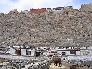
Rudok, also spelt Rutok and Rutog, more properly Rudok Dzong, is a town that served as the historical capital of the Rudok area in Western Tibet on the frontier with Ladakh. In the 1911 Encyclopædia Britannica, it is described as being "picturesquely situated" on the side of a hill standing isolated in the plain near the east end of Lake Pangong.
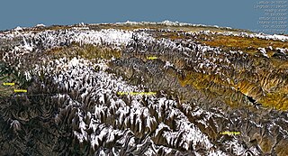
Ladakh is an administrative territory of India that has been under its control since 1947. The geographical region of Ladakh union territory is the highest altitude plateau region in India, incorporating parts of the Himalayan and Karakoram mountain ranges and the upper Indus River and valley.

The Changtang is a part of the high altitude Tibetan Plateau in western and northern Tibet extending into the southern edges of Xinjiang as well as southeastern Ladakh, India, with vast highlands and giant lakes. From eastern Ladakh, the Changtang stretches approximately 1,600 kilometres (990 mi) east into Tibet as far as modern Qinghai. The Changtang is home to the Changpa, a nomadic Tibetan people. The two largest settlements within the Tibetan Changtang are Rutog Town the seat of Rutog County and Domar Township the seat of Shuanghu County.
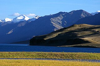
Tourism is one of the economic contributors to the union territory of Ladakh in Northern India. This union territory is located between the Karakoram mountain range to the north and the Himalayas to the south, and is situated at a height of 11,400 ft. Ladakh is composed of Leh and Kargil districts. The region contains prominent Buddhist sites and has an ecotourism industry.

Tso Moriri or Lake Moriri or "Mountain Lake", is a lake in the Changthang Plateau in Leh district of the union territory of Ladakh in India. It is located approximately 219 km from Leh City, capital of Ladakh. The lake and surrounding area are protected as the Tso Moriri Wetland Conservation Reserve.
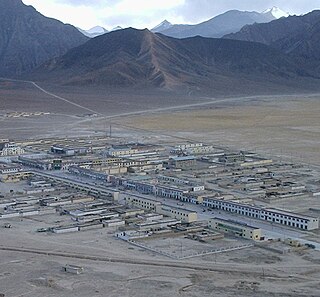
Rutog County is a county in Ngari Prefecture, Tibet Autonomous Region, China. The county seat is the new Rutog Town, located some 1,140 km (710 mi) or 700 miles west-northwest of the Tibetan capital, Lhasa. Rutog County shares a border with India.
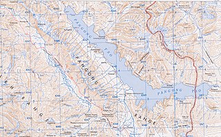
The Pangong Range, approximately 100 km long mountain range along the southern shore of the Pangong Lake in the northern Indian region of Ladakh, runs north of and parallel to the Ladakh Range from Tangtse in northwest to Chushul in southeast. Its highest peak is 6,700 m (22,000 ft), and the northern slopes are heavily glaciated. Changchenmo Range and Pangong Range are sometimes considered easternmost part of the Karakoram Range. At Chushul, where the Pangong Range ends, the Kailash Range runs eastward along the southern bank of Pangong Tso, from centre of Pangong Tso at Lukung to the west to Phursook Bay and Mount Kailash. Main features on pangong range, from northwest to southeast, are: Harong peak, Merag peak, Kangju Kangri peak, and Kongta La pass.

The Rutog Town , called Rituzhen in Chinese, is a town and the seat of Rutog County in the far western Tibet Autonomous Region. It is also a major military base for China near the disputed border with India allowing it to press its claims militarily.
Chushul is a village in the Leh district of Ladakh, India. It is located in the Durbuk tehsil, in the area known as "Chushul Valley", south of the Pangong Lake and west of the Spanggur Lake. The Line of Actual Control with China runs about 5 miles east of Chushul, across the Chushul Valley. Famous as site for historical battle grounds.

Bangda Lake, formerly called Yeshil Kul, is a glacial lake in Ngari Prefecture in the northwest of the Tibet Autonomous Region of China. It lies south of the western Kunlun Mountains, only a few kilometres to the southeast of Guozha Lake . Located at an altitude of 4902 metres, it covers an area of 106 square kilometres with a maximum depth of 21.6 metres and has a drainage basin containing 90 glaciers.

The Khurnak Fort is a ruined fort on the northern shore of Pangong Lake, which spans eastern Ladakh in India and Rutog County in the Tibet region of China. The area of the Khurnak Fort is disputed by India and China, and has been under Chinese administration since 1958.

The Spanggur Gap is a 4,900 metres (16,100 ft) high mountain pass on the Line of Actual Control between the Ladakh union territory of India and the Rutog County, Ngari Prefecture in the Tibet region of China. It is a gap in the mountains to the south of the Pangong Lake. To the east of the gap is the Spanggur Lake.

Gurung Hill is a mountain near the Line of Actual Control between the Indian- and Chinese-administered portions of Ladakh near the village of Chushul and the Spanggur Lake. As of 2020, the Line of Actual Control runs on the north–south ridgeline of Gurung Hill. To the west of Gurung lies the Chushul valley and to the right of it are mountains of Kailash Range forming the basins of the Spanggur Lake and the Pangong Lake in this area.
Tangtse or Drangtse (Tibetan: བྲང་རྩེ, Wylie: brang rtse, THL: drang tsé) is a village in the Leh district of Ladakh, India. It is located in the Durbuk tehsil. Traditionally, it was regarded as the border between the Nubra region to the north and the Pangong region to the south. It was a key halting place on the trade route between Turkestan and Tibet. It was also a site of wars between Ladakh and Tibet.
Durbuk or Darbuk, is a village and the headquarters of the eponymous subdivision and block in the Leh district of Ladakh, India. It is located in the Durbuk tehsil, and falls between Chang La mountain pass and Tangste village on the way to Pangong Tso Lake.
In early May 2020, troops of the People's Liberation Army and Indian Army engaged in melee at locations along the notional Line of Actual Control (LAC), the disputed boundary between China and India. It escalated on 15/16 June 2020 resulting in deaths on both sides. Indian sources reported the deaths of 20 Indian soldiers and casualties of at least 45 Chinese soldiers. China reported 4 deaths. On 7 September, for the first time in 45 years, shots were fired along the LAC, with both sides blaming each other for the firing. Indian media also reported that Indian troops fired warning shots at the PLA on 30 August.
Dumchele or Dhumtsele (Chinese: 都木契列; pinyin: Dōu mù qì liè, Tibetan: སྡུམ་མཚེས་ལེ་, Wylie: sdum mtshes le, THL: dum tsé lé) is a village and a grazing area in Skakjung pasture near the Line of Actual Control between Ladakh and Tibet, administered by China since October 1962 but claimed by India. The locale is in the disputed Demchok sector, about 50 kilometers northwest from Demchok and 50 kilometers southeast of Chushul. It lies on a historic trade route between Ladakh and Rutog, with an erstwhile border pass at Chang La or Shingong La to the southeast of Dumchele.
Noh, also called Üchang or Wujang (Tibetan: དབུས་བྱང, Wylie: dbus byang, THL: wü jang) is a village in the Rutog County, Ngari Prefecture of the Tibet region of China. It is located on the northern bank of the eastern Pangong Lake, watered by the Doma River (Tsanger-schar). The village is now part of the Domar Township.

Phursook Bay is a bay in the Pangong Tso that is said to have formed the border between Ladakh and Tibet's Rutog County during the British Raj. The present day Line of Actual Control between China and India runs near the same location and remains fiercely contested.


