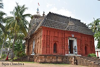
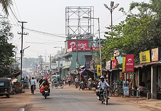
Subarnapur, also known as Sonepur, is a town and district headquarters of Subarnapur district of Odisha. The district spreads over an area of 2284.89 km2. It is also known as Second Varanasi of India for its cluster of temples having architectural importance and also of tantricism and second Allahabad for the Meeting Point (Sangam) of two rivers Mahanadi and Tel in place just like in Allahabad. Subarnapur is also famous for silk, handloom, prawns, terracotta etc.

Angul is a city, municipality and the headquarters of Angul district in the state of Odisha, India. Angul has an average elevation of 195 m (640 ft) above sea level and total area of 6232 km2.
Boudh, also known as Boudhgarh, is a town and a Municipality in Boudh district in the state of Odisha, India. It is the district headquarters of Boudh district. It is located on the bank of Mahanadi, the largest river of the state of Odisha.

Nuapada is a town in western region of Odisha state of eastern India. It is the headquarter of Nuapada district. Nuapada district was carved out of the undivided Kalahandi district on 27 March 1993. It is on the western border of Odisha with Chhattisgarh. The district is part of Odisha both linguistically and culturally. It is one of the most underdeveloped districts of Odisha and India as well.
Binika is a town and a notified area council in Subarnapur district in the state of Odisha, India.
Bissam Cuttack is a town and Notified Area Council in the Rayagada district of Odisha, India.
Dhamnagar is a town and a notified area committee in Bhadrak district in the state of Odisha, India.

Gunupur is a Municipality and one of the sub-divisional headquarters of Rayagada district in the Indian state of Odisha. It is the second biggest town in Rayagada district.
Hinjilicut (Hinjilikatu) is a town and municipality of Ganjam district in the Indian state of Odisha.
Kamakhyanagar is a town (NAC) and a subdivision in Dhenkanal district in the Indian state of Odisha. It is located 37 km north of Dhenkanal.
Kabisuryanagar is a town and a NAC in Ganjam district in the Indian state of Odisha.

Khallikote is a town and a Notified Area Council in Ganjam district in the Indian state of Odisha.
Khandapada is a town and a Notified Area Council in Nayagarh district in the Indian state of Odisha. It is located in the valley of nine mountains.

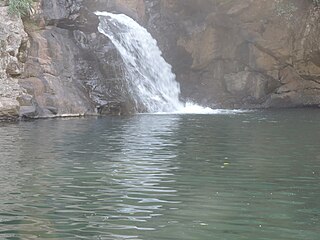
Kuchinda is the town and a notified area council in Sambalpur district in the Indian state of Odisha. It is located about 80 km (49.71 mi) from the district headquarters of Sambalpur, and about 48 km (29.83 mi) away from Jharsuguda. Kuchinda is famous for its "Dushera". Kuchinda is also famous for the Gudguda waterfall. Most of the people of Kuchinda sub-division depends on farming. Kuchinda is more of a tribal area.
Kodala is a town and a Notified Area Council in Ganjam District in the Indian State of Odisha.
Nimapada is a town and a Notified Area Council (NAC) in Puri district on the way to Konark and 40 km from the state capital Bhubaneswar in the Indian state of Odisha.
Patnagarh is a town and a Notified Area Council in Bolangir district in the Indian state of Odisha. Its original name is Patnāgarh, and it is pronounced verbally as Patnāgad. The official language is Odia. Patnagarh bears historical significance as it was the epicentre of power in middle age. Patnagarh was the capital of 18 garh that come under south Koshal. In 12th century AD the progenies of the famous King of Delhi, Prithviraj Chauhan came and settled down in Patnagarh. They came here because Mohammad Ghori defeated Prithviraj Chauhan in 2nd battle of Tarai in 1193. The first child of the royal scion who ruled Patnagarh as per recorded history was Ramai Deo. However after 16th century onwards when Balangir and Sambalpur came in to being, the city lost its charm.

Pipili is a town and a NAC of Puri district in the Indian state of Odisha. It is famous for designing beautiful Applique handicrafts. It is a town of artisans famous for their colourful fabrics.
Jharbandh is a town in Bargarh district in the Indian state of Odisha. Jharbandh comes under the padmapur Vidhan Sabha in Odisha state and is under the Bargarh Lok Sabha constituency in India

Durgi is a census village & Panchayat Headquarter of Bissam Cuttack Block in Rayagada district of Odisha, India. There are total 439 families residing in this village. The wards/ villages comes under Durgi Panchayat are:- Durgi, Bhaleri, Kundanpadar, Rengabai, Barangpadar, Thambalpadhu, Budhanagar, Kachapai, Kalipadar, Kurankul, Tentili Kalipadar, Mulipada, Dharamguda, Balipadar, Haduguda, Huruguda, Khariguda and IAY Colony.


