Upper Sturt is a suburb in the inner south of Adelaide, South Australia. The suburb is nestled in the lower reaches of the Mount Lofty Ranges with the Western Half located in the City of Mitcham local government area, and the eastern portion located in the Adelaide Hills Council Local Government Area.
Cecil Park is a suburb of Sydney, in the state of New South Wales, Australia 40 kilometres west of the Sydney central business district, in the local government area of the City of Fairfield. It is part of the Greater Western Sydney region.
Westbourne Park is an inner southern suburb of Adelaide, the State capital of South Australia. The suburb was named after Westbourne, a village in Sussex, England, and was laid out in 1881.
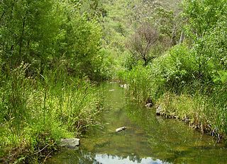
Athelstone is a suburb of Adelaide in the City of Campbelltown. It was established in the 19th century but only became part of suburban Adelaide in the second half of the 20th century.

Bedford Park is a southern suburb of Adelaide in South Australia.
Seacliff Park is a suburb of Adelaide partly in the City of Marion and the City of Holdfast Bay. The suburb is adjacent to South Brighton in the north, Seaview Downs to the east, Hallett Cove to the south, and Marino and Seacliff on its western side. The suburb is divided diagonally by Ocean Road, with the northern part of the suburb mainly residential, and the southern park partly occupied by a golf course and a quarry.

Woodbridge is a semi-rural locality in the local government area (LGA) of Kingborough in the Hobart LGA region of Tasmania. The locality is about 26 kilometres (16 mi) south of the town of Kingston. The 2021 Census recorded a population of 547 for the state suburb of Woodbridge, with the median age being 54. There are 180 families living in Woodbridge, with a mean of 1.8 children per household. It is located 38 kilometres (24 mi) south of the state capital, Hobart.
Pasadena is an inner southern suburb of Adelaide, South Australia in the City of Mitcham.

Waterloo Corner is a rural/urban suburb approximately 22 kilometres north of Adelaide, the capital city of South Australia. Most of the land is used for agricultural purposes, including wheat, olives, grapes and tomatoes. Port Wakefield Road runs through the suburb and thus much heavy freight traverses the suburb.
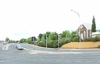
Ovingham is an inner northern suburb of Adelaide, South Australia. It is located in the cities of Charles Sturt and Prospect.
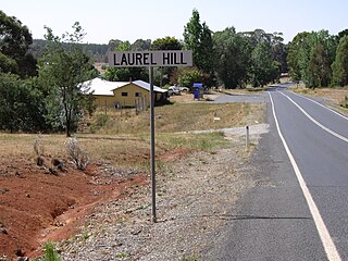
Laurel Hill is a village community in the south east part of the Riverina, in New South Wales, Australia. It is situated by road, about 14 kilometres south-southwest of Batlow and 22 kilometres north-northeast of Tumbarumba.
Bellevue Heights is a suburb in the City of Mitcham local government area. It was originally the rural property of "Windsor Farm" and later "Sturtbrae" when owned by the family of W. G. Mills, and was named after Bellevue in Sydney by the developer Murray Hill.
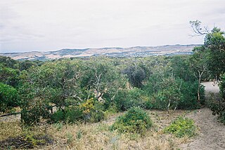
Sellicks Hill – formerly spelt Sellick's Hill – is a semi-rural suburb of Adelaide, South Australia. It lies within both the City of Onkaparinga and the District Council of Yankalilla. Before the British colonisation of South Australia, the Sellicks Hill area, was inhabited by the Kaurna people. Sellick's Hill Post Office opened on 2 July 1860.
Shooters Hill is a locality and mountain located 25 kilometres (16 mi) south of Oberon, New South Wales. It is the fourth highest point in the Central Tablelands at 1,355 metres (4,446 ft) AHD, behind Mount Canobolas at 1,394 metres (4,573 ft) AHD, Mount Bindo at 1,363 metres (4,472 ft) AHD and Mount Trickett at 1,362 metres (4,469 ft) AHD. Shooters Hill is a common location for snowfalls in the Central Ranges.
Woodforde is a suburb of Adelaide within the Adelaide Hills Council. It is located about 10 km east of the Adelaide city centre.
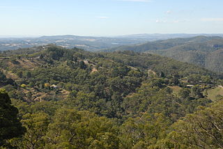
Cherryville is a small town in the Adelaide Hills, South Australia. It was named in around 1840 after the native cherry trees that grew in the area, although some historians claim that it was not named until 1892, when horticultural cherry plantings became widespread in the area. Prior to this, land holdings were typically of around 100 acres (40 ha) and used primarily for pastoralism or small-scale vegetable gardens.
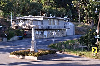
Basket Range is a small town in the Adelaide Hills, South Australia. It is located on an approximately north–south ridge that runs from Deep Creek in the north to Greenhill Road in the south. The area is completely encircled by hills, giving the town the appearance of nestling within a large basket, hence "Basket Range".
Wharminda is a locality in the Australian state of South Australia located on the Eyre Peninsula about 242 kilometres west of the state capital of Adelaide.
Winlaton is a locality located in the Rural City of Swan Hill, Victoria, Australia. The post office there opened on 17 October 1927 and was closed on 31 October 1944.
Julia is a locality in the Mid North of South Australia, 111 kilometres North of Adelaide, the state capital. The town is located 10 kilometres (6.2 mi) north of Eudunda, in the Regional Council of Goyder. It was created in August 2000, with boundaries formalised for the long established local name.


