
Belair is a suburb in the south eastern foothills of Adelaide, South Australia at the base of the Mount Lofty Ranges.

The City of Mitcham is a local government area in the foothills of southern Adelaide, South Australia. Within its bounds is Flinders University, South Australia's third largest, and the notable, affluent suburb of Springfield which contains some of the city's most expensive properties.

The City of Onkaparinga is a local government area (LGA) located on the southern fringe of Adelaide, South Australia. It is named after the Onkaparinga River, whose name comes from Ngangkiparinga, a Kaurna word meaning women's river. It is the largest LGA in South Australia, with a population of over 170,000 people in both urban and rural communities and is also geographically expansive, encompassing an area of 518.3 km2. The council is headquartered in the Noarlunga Centre with area offices situated in Aberfoyle Park, Woodcroft and Willunga.
Upper Sturt is a suburb in the inner south of Adelaide, South Australia. The suburb is nestled in the lower reaches of the Mount Lofty Ranges with the Western Half located in the City of Mitcham local government area, and the eastern portion located in the Adelaide Hills Council Local Government Area.

Clarendon is a small town in the Adelaide Hills, about 25–30 kilometres (16–19 mi) south of the Adelaide city centre and now regarded as an outer suburb of Adelaide. It lies within the City of Onkaparinga council area. The Clarendon Weir is located in the town area, on the Onkaparinga River.
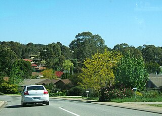
Aberfoyle Park is a suburb in the City of Onkaparinga in the state of South Australia. It is located in the southern suburbs of Adelaide, approximately 20 km from the city centre. Aberfoyle Park has a shopping mall called "The Hub", several primary schools and a public high school, one of the biggest in the state.
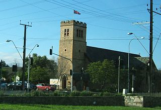
Woodville is a suburb of Adelaide, situated about 8 km (5 mi) north-west of the Adelaide city centre. It lies within the City of Charles Sturt. The postcode of Woodville is 5011. Woodville is bound by Cheltenham Parade to the west, Torrens Road to the north, Port Road to the south and Park Street to the east, excluding the area of Cheltenham Park Racecourse. The population was 2,180 at the 2021 Australian census.
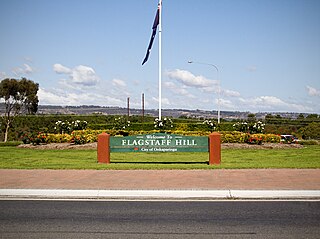
Flagstaff Hill is a suburb in the City of Onkaparinga local government area. It is named after the hill by that name in the area, where Colonel William Light erected a flagstaff during his survey, which was then used as a trig point. Flagstaff Hill is a leafy suburb established around the Sturt Gorge Recreation Park, maintaining many parks and reserves throughout the suburb.

Blackwood is a south-eastern suburb located in the foothills of Adelaide, South Australia. It is part of the local government area of the City of Mitcham.
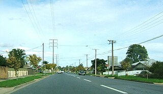
Flinders Park is a western suburb of Adelaide, South Australia. It is located in the City of Charles Sturt.

Port Noarlunga is a suburb in the City of Onkaparinga, South Australia. It is a small sea-side suburb, with a population of 2,918, about 30 kilometres to the south of the Adelaide city centre and was originally created as a sea port. This area is now popular as a holiday destination or for permanent residents wishing to commute to Adelaide or work locally. There is a jetty that connects to a 1.6 kilometres natural reef that is exposed at low tide.

Brompton is an inner-northern suburb of Adelaide, South Australia in the City of Charles Sturt.
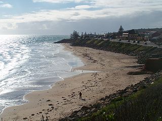
Christies Beach is a seaside suburb in the southern Adelaide metropolitan area, within the City of Onkaparinga. The area is scenic and hence popular with photographers as Witton Bluff provides a natural vantage point over the entire suburb and beyond.

Craigburn Farm is a suburb of Adelaide, South Australia, Australia. It is located about 17 km by road south of the city centre.
Bellevue Heights is a suburb in the City of Mitcham local government area. It was originally the rural property of "Windsor Farm" and later "Sturtbrae" when owned by the family of W. G. Mills, and was named after Bellevue in Sydney by the developer Murray Hill.

St Marys is a suburb of Adelaide, South Australia, located to the south of the Central Business District. It is bordered by Daws Road (north), South Road (west), Cashel Street (east) and Mill Terrace (south). The suburb is located within the City of Mitcham local government authority. St Marys Park is one of the largest reserves within the suburb and was originally the training ground of the South Adelaide Football Club.
Seaford is a metropolitan suburb of Adelaide, South Australia. It lies within the City of Onkaparinga. Seaford railway station is the southern terminus of the Seaford railway line from Adelaide railway station.
Coromandel East is a semi-rural suburb of Adelaide, South Australia. It lies within the City of Onkaparinga and has postcode 5157.
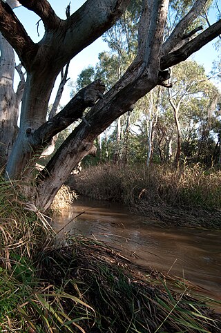
The Sturt River, also known as the Sturt Creek and Warri Parri (Warriparri) in the Kaurna language, is a river located in the Adelaide region of the Australian state of South Australia.

West Hindmarsh is a suburb of Adelaide, located in the City of Charles Sturt local government area. It is around 4 km west northwest of the Adelaide city centre. It is bounded on the south by the River Torrens, east by South Road, north by Port Road and west by streets separating it from the suburb of Welland which has the same north and south boundaries. Grange Road crosses the middle of the suburb.


