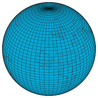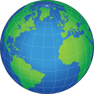
In geography, latitude is a coordinate that specifies the north–south position of a point on the surface of the Earth or another celestial body. Latitude is given as an angle that ranges from −90° at the south pole to 90° at the north pole, with 0° at the Equator. Lines of constant latitude, or parallels, run east–west as circles parallel to the equator. Latitude and longitude are used together as a coordinate pair to specify a location on the surface of the Earth.

A geographic coordinate system (GCS) is a spherical or geodetic coordinate system for measuring and communicating positions directly on Earth as latitude and longitude. It is the simplest, oldest and most widely used type of the various spatial reference systems that are in use, and forms the basis for most others. Although latitude and longitude form a coordinate tuple like a cartesian coordinate system, the geographic coordinate system is not cartesian because the measurements are angles and are not on a planar surface.

A projected coordinate system – also called a projected coordinate reference system, planar coordinate system, or grid reference system – is a type of spatial reference system that represents locations on Earth using Cartesian coordinates (x, y) on a planar surface created by a particular map projection. Each projected coordinate system, such as "Universal Transverse Mercator WGS 84 Zone 26N," is defined by a choice of map projection (with specific parameters), a choice of geodetic datum to bind the coordinate system to real locations on the earth, an origin point, and a choice of unit of measure. Hundreds of projected coordinate systems have been specified for various purposes in various regions.

The Ordnance Survey National Grid reference system (OSGB), also known as British National Grid (BNG), is a system of geographic grid references, distinct from latitude and longitude, whereby any location in Great Britain can be described in terms of its distance from the origin, which lies to the west of the Isles of Scilly.
The Maidenhead Locator System is a geocode system used by amateur radio operators to succinctly describe their geographic coordinates, which replaced the deprecated QRA locator, which was limited to European contacts. Its purpose is to be concise, accurate, and robust in the face of interference and other adverse transmission conditions. The Maidenhead Locator System can describe locations anywhere in the world.
A geocode is a code that represents a geographic entity. It is a unique identifier of the entity, to distinguish it from others in a finite set of geographic entities. In general the geocode is a human-readable and short identifier.

ISO 6709, Standard representation of geographic point location by coordinates, is the international standard for representation of latitude, longitude and altitude for geographic point locations.
Address geocoding, or simply geocoding, is the process of taking a text-based description of a location, such as an address or the name of a place, and returning geographic coordinates, frequently latitude/longitude pair, to identify a location on the Earth's surface. Reverse geocoding, on the other hand, converts geographic coordinates to a description of a location, usually the name of a place or an addressable location. Geocoding relies on a computer representation of address points, the street / road network, together with postal and administrative boundaries.
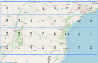
QDGC - Quarter Degree Grid Cells are a way of dividing the longitude latitude degree square cells into smaller squares, forming in effect a system of geocodes. Historically QDGC has been used in a lot of African atlases. Several African biodiversity projects uses QDGC, among which The atlas of Southern African Birds is the most prominent one. In 2009 a paper by Larsen et al. describes the QDGC standard in detail.

In geography, location or place are used to denote a region on Earth's surface. The term location generally implies a higher degree of certainty than place, the latter often indicating an entity with an ambiguous boundary, relying more on human or social attributes of place identity and sense of place than on geometry. A populated place is called a settlement.

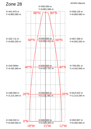
The Universal Transverse Mercator (UTM) is a map projection system for assigning coordinates to locations on the surface of the Earth. Like the traditional method of latitude and longitude, it is a horizontal position representation, which means it ignores altitude and treats the earth surface as a perfect ellipsoid. However, it differs from global latitude/longitude in that it divides earth into 60 zones and projects each to the plane as a basis for its coordinates. Specifying a location means specifying the zone and the x, y coordinate in that plane. The projection from spheroid to a UTM zone is some parameterization of the transverse Mercator projection. The parameters vary by nation or region or mapping system.

A spatial reference system (SRS) or coordinate reference system (CRS) is a framework used to precisely measure locations on the surface of Earth as coordinates. It is thus the application of the abstract mathematics of coordinate systems and analytic geometry to geographic space. A particular SRS specification comprises a choice of Earth ellipsoid, horizontal datum, map projection, origin point, and unit of measure. Thousands of coordinate systems have been specified for use around the world or in specific regions and for various purposes, necessitating transformations between different SRS.
The World Geographic Reference System (GEOREF) is a geocode, a grid-based method of specifying locations on the surface of the Earth. GEOREF is essentially based on the geographic system of latitude and longitude, but using a simpler and more flexible notation. GEOREF was used primarily in aeronautical charts for air navigation, particularly in military or inter-service applications, but it is rarely seen today. However, GEOREF can be used with any map or chart that has latitude and longitude printed on it.
C-squares is a system of spatially unique, location-based identifiers (geocodes) for areas on the surface of the earth, represented as cells from a latitude- and longitude-based Discrete Global Grid at a hierarchical set of resolution steps, obtained by progressively subdividing 10×10 degree World Meteorological Organization squares; the term "c-square" is also available for use to designate any component cell of the grid. Individual cell identifiers incorporate literal values of latitude and longitude in an interleaved notation, together with additional digits that support intermediate grid resolutions of 5, 0.5, 0.05 degrees, etc.
In the context of a spatial index, a grid or mesh is a regular tessellation of a manifold or 2-D surface that divides it into a series of contiguous cells, which can then be assigned unique identifiers and used for spatial indexing purposes. A wide variety of such grids have been proposed or are currently in use, including grids based on "square" or "rectangular" cells, triangular grids or meshes, hexagonal grids, and grids based on diamond-shaped cells. A "global grid" is a kind of grid that covers the entire surface of the globe.

Geohash is a public domain geocode system invented in 2008 by Gustavo Niemeyer which encodes a geographic location into a short string of letters and digits. Similar ideas were introduced by G.M. Morton in 1966. It is a hierarchical spatial data structure which subdivides space into buckets of grid shape, which is one of the many applications of what is known as a Z-order curve, and generally space-filling curves.
The mapcode system is an open-source geocode system consisting of two groups of letters and digits, separated by a dot. It represents a location on the surface of the Earth, within the context of a separately specified country or territory. For example, the entrance to the elevator of the Eiffel Tower in Paris is “France 4J.Q2”. As with postal addresses, it is often unnecessary to explicitly mention the country.

A discrete global grid (DGG) is a mosaic that covers the entire Earth's surface. Mathematically it is a space partitioning: it consists of a set of non-empty regions that form a partition of the Earth's surface. In a usual grid-modeling strategy, to simplify position calculations, each region is represented by a point, abstracting the grid as a set of region-points. Each region or region-point in the grid is called a cell.

The Palestine grid was the geographic coordinate system used by the Survey Department of Palestine.
The Open Location Code (OLC) is a geocode based on a system of regular grids for identifying an area anywhere on the Earth. It was developed at Google's Zürich engineering office, and released late October 2014. Location codes created by the OLC system are referred to as "plus codes".


