Maidenhead Locator System

Last updated

The Maidenhead Locator System (a.k.a. QTH Locator and IARU Locator) is a geocode system used by amateur radio operators to succinctly describe their geographic coordinates, which replaced the deprecated QRA locator, which was limited to European contacts. [1] Its purpose is to be concise, accurate, and robust in the face of interference and other adverse transmission conditions. The Maidenhead Locator System can describe locations anywhere in the world.

Contents

Maidenhead locators are also commonly referred to as QTH locators, grid locators or grid squares, although the "squares" are distorted on any non-equirectangular cartographic projection. Use of the terms QTH locator and QRA locator was initially discouraged, as it caused confusion with the older QRA locator system. The only abbreviation recommended to indicate a Maidenhead reference in Morse code and radio teleprinter transmission was LOC, as in LOC KN28LH. [1]

John Morris G4ANB originally devised the system and it was adopted at a meeting of the IARU VHF Working Group in Maidenhead, England in 1980. [2]

History

Amateur radio contests on VHF and UHF are often scored based on the distance of contacts, typically 1 point per kilometre, [3] so there is a need for amateurs to exchange their locations over the air. To facilitate this, following the growth of the sport in the 1950s, the German QRA locator system was adopted in 1959. [2] The QRA locator system was limited to describing European coordinates, and by the mid-1970s there was growing need for a global locator system. [3]

By the time of their April 1980 meeting, in Maidenhead, England, the VHF Working Group had received twenty different proposals to replace the QRA locator grid. That devised by John Morris (G4ANB) was deemed to be the best. [3]

At the 1999 IARU Conference in Lillehammer it was decided that the latitude and longitude to be used as a reference for the determining of locators should be based on the World Geodetic System 1984 (WGS-84). [2]

Description of the system

Maidenhead Locator System explained.svg

A Maidenhead locator compresses latitude and longitude into a short string of characters, which is similar in concept to the World Geographic Reference System or GEOREF. This position information is presented in a limited level of precision to limit the number of characters needed for its transmission using voice, Morse code, or any other operating mode. [4]

The chosen coding uses alternating pairs of letters and digits, like so:

In each pair, the first character encodes longitude and the second character encodes latitude. [5] These character pairs also have traditional names, and in the case of letters, the range of characters (or "encoding base number") used in each pair does vary.

The world is divided into 324 (18x18) Maidenhead fields. Maidenhead Locator Map.png
The world is divided into 324 (18×18) Maidenhead fields.

To avoid negative numbers in the input data, the system specifies that latitude is measured from the South Pole to the North Pole, and longitude measured eastward from the antimeridian of Greenwich, giving the prime meridian a false easting of 180° and the equator a false northing of 90°.

To simplify manual encoding, the base for the first pair of letters—traditionally called a field—was chosen to be 18, thus dividing the globe into 18 zones of longitude of 20° each, and 18 zones of latitude 10° each. These zones are encoded with the letters "A" through "R".

Fields are divided into 100 squares each. Maidenhead grid over Europe.svg
Fields are divided into 100 squares each.

The second pair of numbers, called a square and placed after the first pair of letters, uses a base number of 10, and is encoded using the digits "0" to "9". This is where the alternative name "grid squares" comes from. Each of these squares represents 1° of latitude by 2° of longitude. For additional precision, each square can optionally be sub-divided further, into subsquares. These are encoded into a second pair of letters, which should be presented in uppercase, [6] but are sometimes (incorrectly) presented in lowercase as a legacy from the old QRA.The error has unfortunately been incorporated into various software packages, several examples of which can be seen on this page. Again, to make manual calculations from degrees and minutes easier, 24 was chosen as the base number, giving these subsquares dimensions of 2.5' of latitude by 5' of longitude. The letters used are "A" through "X".

The resulting Maidenhead subsquare locator string is hence composed of two letters, two digits, and two more letters. To give an example, W1AW, the American Radio Relay League's Hiram Percy Maxim Memorial Station in Newington, Connecticut, is found in grid locator  FN31pr. Two points within the same Maidenhead subsquare are always less than 10.4 km (6.5 mi) apart, which means a Maidenhead locator can give adequate precision from only six easily transmissible characters.

For even more precise location mapping, two additional digits were proposed and ratified as an extended locator, making it altogether eight characters long, and dividing subsquares into even smaller ones with dimensions 15" of latitude by 30" of longitude. Such precision has uses in very short communication spans. Beyond this, no common definition exists to extend the system further into even smaller squares. Most often the extending is done by repeating alternating subsquare and square rules (base numbers 24 and 10 respectively). However, other bases for letter encodings have also been observed, and therefore such extended extended locators might not be compatible.

To summarise:

(The fifth and subsequent pairs are not formally defined, but recursing to the third and fourth pair algorithms is a possibility, e.g.: BL11BH16OO66)

On shortwave frequencies, positions are reported at square precision, and on VHF and UHF, subsquare precision is used. At high microwave frequencies extended square and extended subsquare precision is often used.

Adoption and use

Like the QRA system before it, Maidenhead locators were enthusiastically adopted by radio amateurs beyond contesting, and it is now in widespread use.

Maidenhead locators are still used as part of the formulas for scoring in many VHF amateur radio contests and as the basis of earning awards like the American Radio Relay League's VHF/UHF Century Club, URE TTLOC, etc. operating contests.

Under IARU Region 1 rules, VHF distance calculations are carried out between Maidenhead subsquare centres, assuming a spherical Earth. This results in a small error in distance, but makes calculations simpler and, given the inherent imprecision in the input data used, it is not the biggest error source. Until the adoption of WGS 84 as the official geodetic datum of the Maidenhead locator system in 1999, [2] operators had usually specified their location based on their local national datum. Consequently, stations very near the edges of squares (at denoted precision) may have changed their locators when changing over to the use of WGS 84.

The relatively new FT8 narrowband digital mode transmits Maidenhead locator square as part of standard messages, with the 4 character locator square being efficiently represented within 15 bits of the transmitted string.

In 2019[ citation needed ] the IARU clarified the latest position on use of the IARU locator at various levels of precision, including a fifth pair of characters and that all letters should be uppercase. [7]

Hardware and software support

In 1985, the Radio Society of Great Britain published a small set of BASIC language routines to convert from locator references to geographical coordinates (latitude and longitude) for further processing. [8] A complete program in BASIC called Universal Gridlocator was made available the following year by ARRL for a nominal cost of US$3. [9]

Many other utilities exist to convert latitude and longitude to locators, as this is a favourite hack for programmers who are also radio amateurs. Perl supports conversion between geographical coordinates and Maidenhead locators in module Ham::Locator by Andy Smith, available on CPAN. [10]

The Python maidenhead module is on pypi.org for installation via pip. [11]

Many[ which? ] commercially available general purpose (civil) Global Positioning System (GPS) receivers (e.g. Garmin GPS-12) have the option to display positions in Maidenhead Locator format. [12] [ needs update ]

See also

Related Research Articles

<span class="mw-page-title-main">Morse code</span> Transmission of language with brief pulses

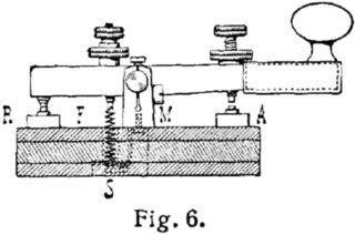
Morse code is a method used in telecommunication to encode text characters as standardized sequences of two different signal durations, called dots and dashes, or dits and dahs. Morse code is named after Samuel Morse, one of the early developers of the system adopted for electrical telegraphy.
<span class="mw-page-title-main">Q code</span> Type of Morse code operating signal

The Q-code is a standardised collection of three-letter codes that each start with the letter "Q". It is an operating signal initially developed for commercial radiotelegraph communication and later adopted by other radio services, especially amateur radio. To distinguish the use of a Q-code transmitted as a question from the same Q-code transmitted as a statement, operators either prefixed it with the military network question marker "INT" or suffixed it with the standard Morse question mark UD.
<span class="mw-page-title-main">Projected coordinate system</span> Cartesian geographic coordinate system

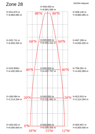
A projected coordinate system – also called a projected coordinate reference system, planar coordinate system, or grid reference system – is a type of spatial reference system that represents locations on Earth using Cartesian coordinates (x, y) on a planar surface created by a particular map projection. Each projected coordinate system, such as "Universal Transverse Mercator WGS 84 Zone 26N," is defined by a choice of map projection (with specific parameters), a choice of geodetic datum to bind the coordinate system to real locations on the earth, an origin point, and a choice of unit of measure. Hundreds of projected coordinate systems have been specified for various purposes in various regions.
<span class="mw-page-title-main">PSK31</span> Type of radioteletype mode

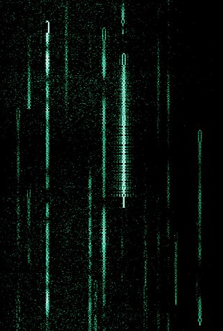
PSK31 or "Phase Shift Keying, 31 Baud", also BPSK31 and QPSK31, is a popular computer-sound card-generated radioteletype mode, used primarily by amateur radio operators to conduct real-time keyboard-to-keyboard chat, most often using frequencies in the high frequency amateur radio bands (near-shortwave). PSK31 is distinguished from other digital modes in that it is specifically tuned to have a data rate close to typing speed, and has an extremely narrow bandwidth, allowing many conversations in the same bandwidth as a single voice channel. This narrow bandwidth makes better use of the RF energy in a very narrow space thus allowing relatively low-power equipment to communicate globally using the same skywave propagation used by shortwave radio stations.

The American Radio Relay League (ARRL) is the largest membership association of amateur radio enthusiasts in the United States. ARRL is a non-profit organization, and was co-founded on April 6, 1914, by Hiram Percy Maxim and Clarence D. Tuska of Hartford, Connecticut. The ARRL represents the interests of amateur radio operators before federal regulatory bodies, provides technical advice and assistance to amateur radio enthusiasts, supports a number of educational programs and sponsors emergency communications service throughout the country. The ARRL has approximately 161,000 members. In addition to members in the US, the organization claims over 7,000 members in other countries. The ARRL publishes many books and a monthly membership journal called QST.
<span class="mw-page-title-main">DX-pedition</span> Amateur radio "expedition"

A DX-pedition is an expedition to what is considered an exotic place by amateur radio operators and DX listeners, typically because of its remoteness, access restrictions, or simply because there are very few radio amateurs active from that place. This could be an island, a country, or even a particular spot on a geographical grid. DX is a telegraphic shorthand for "distance" or "distant".

A geocode is a code that represents a geographic entity. It is a unique identifier of the entity, to distinguish it from others in a finite set of geographic entities. In general the geocode is a human-readable and short identifier.

<span class="mw-page-title-main">International Amateur Radio Union</span> International confederation of organizations for amateur radio operators

The International Amateur Radio Union (IARU) is an international confederation of national organisations that allows a forum for common matters of concern to amateur radio operators worldwide, and collectively represents matters to the International Telecommunication Union (ITU). The International Amateur Radio Union was founded in 1925 and, as of July 2021, it is composed of 172 national member societies.
<span class="mw-page-title-main">Military Grid Reference System</span> NATO global coordinate reference system

The Military Grid Reference System (MGRS) is the geocoordinate standard used by NATO militaries for locating points on Earth. The MGRS is derived from the Universal Transverse Mercator (UTM) grid system and the Universal Polar Stereographic (UPS) grid system, but uses a different labeling convention. The MGRS is used as geocode for the entire Earth.
<span class="mw-page-title-main">Contesting</span> Competitive activity

Contesting is a competitive activity pursued by amateur radio operators. In a contest, an amateur radio station, which may be operated by an individual or a team, seeks to contact as many other amateur radio stations as possible in a given period of time and exchange information. Rules for each competition define the amateur radio bands, the mode of communication that may be used, and the kind of information that must be exchanged. The contacts made during the contest contribute to a score by which stations are ranked. Contest sponsors publish the results in magazines and on web sites.

The World Geographic Reference System (GEOREF) is a geocode, a grid-based method of specifying locations on the surface of the Earth. GEOREF is essentially based on the geographic system of latitude and longitude, but using a simpler and more flexible notation. GEOREF was used primarily in aeronautical charts for air navigation, particularly in military or inter-service applications, but it is rarely seen today. However, GEOREF can be used with any map or chart that has latitude and longitude printed on it.

<span class="mw-page-title-main">United States National Grid</span> Multi-purpose grid reference system used in the United States

The United States National Grid (USNG) is a multi-purpose location system of grid references used in the United States. It provides a nationally consistent "language of location", optimized for local applications, in a compact, user friendly format. It is similar in design to the national grid reference systems used in other countries. The USNG was adopted as a national standard by the Federal Geographic Data Committee (FGDC) of the US Government in 2001.

OZ7IGY is a Danish amateur radio beacon, and the world's oldest VHF and UHF amateur radio beacon and active since the International Geophysical Year in 1957. It is located near Jystrup, in Maidenhead locator JO55WM54, and transmits on the frequencies detailed in Table 1.

An international distress frequency is a radio frequency that is designated for emergency communication by international agreement.
<span class="mw-page-title-main">Geohash</span> Public domain geocoding invented in 2008

Geohash is a public domain geocode system invented in 2008 by Gustavo Niemeyer which encodes a geographic location into a short string of letters and digits. Similar ideas were introduced by G.M. Morton in 1966. It is a hierarchical spatial data structure which subdivides space into buckets of grid shape, which is one of the many applications of what is known as a Z-order curve, and generally space-filling curves.

An amateur radio propagation beacon is a radio beacon, whose purpose is the investigation of the propagation of radio signals. Most radio propagation beacons use amateur radio frequencies. They can be found on LF, MF, HF, VHF, UHF, and microwave frequencies. Microwave beacons are also used as signal sources to test and calibrate antennas and receivers.

The QRA locator, also called QTH locator in some publications, is an obsolete geographic coordinate system used by amateur radio operators in Europe before the introduction of the Maidenhead Locator System. As a radio transmitter or receiver location system the QRA locator is considered defunct, but may be found in many older documents.

The mapcode system is an open-source geocode system consisting of two groups of letters and digits, separated by a dot. It represents a location on the surface of the Earth, within the context of a separately specified country or territory. For example, the entrance to the elevator of the Eiffel Tower in Paris is “France 4J.Q2”. As with postal addresses, it is often unnecessary to explicitly mention the country.

<span class="mw-page-title-main">SOTA Mapping Project</span>

SOTA Mapping Project (SMP) is a website (www.sotamaps.org) offering mapping resources for radio amateurs participating in the Summits On The Air (SOTA) awards program. It aims to provide comprehensive mapping information in graphical form based on Google Maps on summits included in the program, for participants in the program as well as for the general user.

The Open Location Code (OLC) is a geocode based in a system of regular grids for identifying an area anywhere on the Earth. It was developed at Google's Zürich engineering office, and released late October 2014. Location codes created by the OLC system are referred to as "plus codes".

References

  1. 1 2 Eckersley, R.J., G4FTJ (1985). Amateur Radio Operating Manual (third ed.). Potters bar, UK: Radio Society of Great Britain. pp. 64–66. ISBN   0-900612-69-X.{{cite book}}: CS1 maint: multiple names: authors list (link) CS1 maint: numeric names: authors list (link)
  2. 1 2 3 4 "The Locator System" (PDF). qrz.ru. Retrieved 13 July 2014.
  3. 1 2 3 Rosvall, Folke, SM5AGM. "The Locator System". jonit.com. Retrieved 30 January 2017.{{cite web}}: CS1 maint: multiple names: authors list (link) CS1 maint: numeric names: authors list (link)
  4. Tyson, Edmund, N5JTY (January 1989). "Conversion between geodetic and grid locator systems" (PDF). QST Magazine. Newington, CT: American Radio Relay League. pp. 29–30, 43. Retrieved 9 March 2018.{{cite magazine}}: CS1 maint: multiple names: authors list (link) CS1 maint: numeric names: authors list (link)
  5. Paige, Bruce, KK5DO (2000). "Maidenhead grid squares". amsat.org. AMSAT . Retrieved 10 September 2012.{{cite web}}: CS1 maint: multiple names: authors list (link) CS1 maint: numeric names: authors list (link)
  6. https://www.rsgbcc.org/vhf/VHF_Handbook_V6_12.pdf Section 5.13
  7. Talbot, Andy, G4JNT (16–23 September 2017). "Clarification and extension of the IARU locator system". In Green, Dennis, ZS4BS (ed.). Report of the 24th IARU Region 1 General Conference (PDF). 24th IARU Region 1 General Conference. Landshut, DE: International Amateur Radio Union Region 1. pp. 42–45, 33–34. Appendix A, paper LA17 C5 17. Retrieved 19 September 2020.{{cite conference}}: CS1 maint: multiple names: authors list (link) CS1 maint: numeric names: authors list (link)
  8. Morris, John, GM4ANB (1985). Amateur Radio Software. Potters Bar, UK: Radio Society of Great Britain. pp. 129–161. ISBN   0-900612-71-1.{{cite book}}: CS1 maint: multiple names: authors list (link) CS1 maint: numeric names: authors list (link)
  9. Overbeck, Wayne (December 1986). "A universal grid-locator program for your personal computer". QST Magazine. Newington, CT: American Radio Relay League. pp. 30–31.
  10. "Ham Locator v 0.1000". cpan.org. CPAN module.
  11. "maidenhead – PyPI". pypi.org.
  12. Burlingame, L.A., N7CFO (2010). "GPS units that support the Maidenhead grid system". n7cfo.com. Retrieved 9 September 2012.{{cite web}}: CS1 maint: multiple names: authors list (link) CS1 maint: numeric names: authors list (link)

Maps with Maidenhead Locator grid