Political control
For political control before 1975 see Politics of Glasgow
The first election to the City of Glasgow District Council was held in 1974, initially operating as a shadow authority alongside the outgoing corporation until the new system came into force on 16 May 1975. A shadow authority was again elected in 1995 ahead of the reforms which came into force on 1 April 1996. Political control of the council since 1975 has been as follows: [20]
City of Glasgow District Council
Glasgow City Council
| Party in control | Years |
|---|
| Labour | 1996–2017 |
| SNP | 2017-Present |
Leadership
For leaders before 1996 see Politics of Glasgow
The council is ceremonially headed by the Lord Provost of Glasgow, who convenes meetings of the council and performs associated tasks as a general civic leader. The role dates from the 15th century. Since 1893, when the city was made a county of itself, the Lord Provost has also acted as Lord Lieutenant of the city. The current Lord Provost, elected in May 2022 after that month's election, is Jacqueline McLaren.
Political leadership is provided by the leader of the council. The council changed from an executive-led governance system to a committee-led system in September 2017, with the leader of the council since then chairing the City Administration Committee. [21] The leaders since 1996 have been: [22]
Composition
Following the 2022 election and subsequent by-elections and changes of allegiance up to July 2024, the composition of the council was:
- 1 2 The Scottish Greens are in a working agreement with the SNP administration, but they do not form part of it.
The next election is due in 2027. [24]

East Renfrewshire is one of 32 council areas of Scotland. It was formed in 1996, as a successor to the Eastwood district of the Strathclyde region. The northeastern part of the council area is close to Glasgow and many of the council area's northern settlements fall into the Greater Glasgow urban area.

North Lanarkshire is one of the 32 council areas of Scotland. It borders the north-east of the Glasgow City council area and contains many of Glasgow's suburbs, commuter towns, and villages. It also borders East Dunbartonshire, Falkirk, Stirling, South Lanarkshire, and West Lothian. The council area covers parts of the historic counties of Dunbartonshire, Lanarkshire, and Stirlingshire. The council is based in Motherwell.

Lanarkshire, also called the County of Lanark, is a historic county, lieutenancy area and registration county in the Central Lowlands of Scotland. The county is no longer used for local government purposes, but gives its name to the two modern council areas of North Lanarkshire and South Lanarkshire.
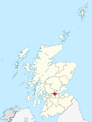
Falkirk is one of 32 unitary authority council areas of Scotland. It was formed on 1 April 1996 by way of the Local Government etc. (Scotland) Act 1994 from the exact boundaries of Falkirk District, one of three parts of the Central region created in 1975, which was abolished at that time. Prior to the 1975 reorganisation, the majority of the council area was part of the historic county of Stirlingshire, and a small part, namely Bo'ness and Blackness, was part of the former county of West Lothian.
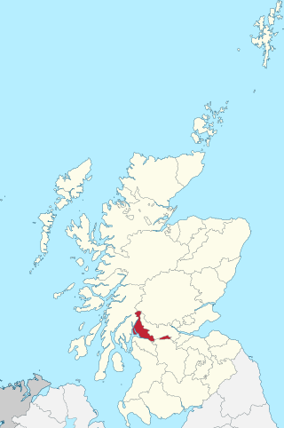
Dunbartonshire or the County of Dumbarton is a historic county, lieutenancy area and registration county in the west central Lowlands of Scotland lying to the north of the River Clyde. Dunbartonshire borders Perthshire to the north, Stirlingshire to the east, Lanarkshire and Renfrewshire to the south, and Argyllshire to the west.
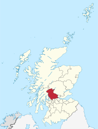
The Stirling council area is one of the 32 council areas of Scotland, and has a population of about 92,530. It was created in 1975 as a lower-tier district within the Central region. The district covered parts of the historic counties of Stirlingshire and Perthshire, which were abolished for local government purposes. In 1996 the Central region was abolished and Stirling Council took over all local government functions within the area.
Clydesdale was a local government district in the Strathclyde region of Scotland from 1975 to 1996. The district was initially called Lanark when created in 1975, but changed its name to Clydesdale in 1980. Clydesdale was an old name for the county of Lanarkshire, one of the historic counties of Scotland. Both the names Clydesdale and Strathclyde reference the area's position in the valley of the River Clyde.
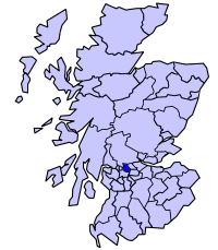
Strathkelvin is the strath (valley) of the River Kelvin in west central Scotland, lying north-east of Glasgow. The name Strathkelvin was used between 1975 and 1996 for one of nineteen local government districts in the Strathclyde region.
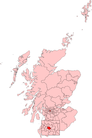
Glasgow Central was a constituency of the House of Commons of the Parliament of the United Kingdom until 2024. A Glasgow Central constituency existed from 1885 until its abolition in 1997. Prior to the 2005 general election, boundary changes led to a new constituency named Glasgow Central being introduced. The constituency was abolished again prior to the 2024 general election. Prior to its abolition, the seat was held by Alison Thewliss of the Scottish National Party (SNP). The first iteration of this constituency was the seat of the former Conservative Prime Minister Bonar Law, who was the shortest-serving UK Prime Minister of the twentieth century.

Rutherglen is a burgh constituency represented in the House of Commons of the Parliament of the United Kingdom since 2024. It also existed between 1918 and 2005 and was largely replaced by Rutherglen and Hamilton West while a small portion became part of Glasgow Central and Glasgow South.

South Lanarkshire Council is the unitary authority serving the South Lanarkshire council area in Scotland. The council has its headquarters in Hamilton, has 16,000 employees, and an annual budget of almost £1bn. The large and varied geographical territory takes in rural and upland areas, market towns such as Lanark, Strathaven and Carluke, the urban burghs of Rutherglen, Cambuslang, and East Kilbride which was Scotland's first new town. The area was formed in 1996 from the areas of Clydesdale, Hamilton and East Kilbride districts, and some outer areas of Glasgow district ; all were previously within the Strathclyde region from 1975 but in historic Lanarkshire prior to that.
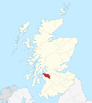
Renfrewshire or the County of Renfrew is a historic county, registration county and lieutenancy area in the west central Lowlands of Scotland. The lieutenancy area covers the three modern council areas of Inverclyde, Renfrewshire and East Renfrewshire, and this area is occasionally termed Greater Renfrewshire to distinguish it from the modern council area called Renfrewshire. The historic county additionally included territory on the south-western edge of Glasgow which was gradually transferred to the administrative area of the city as it grew.

Hamilton was a local government district in the Strathclyde region of Scotland from 1975 to 1996, lying to the south-east of the regional capital Glasgow.

East Kilbride was a local government district in the Strathclyde region of Scotland from 1975 to 1996, lying to the south of the regional capital Glasgow.

The City of Edinburgh Council is the local government authority covering the City of Edinburgh council area. Almost half of the council area is the built-up area of Edinburgh, capital of Scotland. With a population of 514,990 in mid-2019, it is the second most populous local authority area in Scotland.
The politics of Glasgow, Scotland's largest city by population, are expressed in the deliberations and decisions of Glasgow City Council, in elections to the council, the Scottish Parliament and the UK Parliament.

The Justiciary Buildings is a judicial complex in the Saltmarket in Glasgow, Scotland. The complex, which operates in conjunction with similar facilities in Edinburgh and Aberdeen, is dedicated for the use of the High Court of Justiciary, which is the supreme criminal court in Scotland. It is a Category A listed building.

Lanark Sheriff Court is a judicial building in Hope Street, Lanark, South Lanarkshire, Scotland. The building, which continues to serve as the local courthouse, is a Category B listed building.

Below is a list of Municipalities of Scotland. Scottish municipalities have existed in the form of burgh, royal burgh, cities and, currently most common, local councils. Between 1855 and 1975, valuation rolls in Scotland were divided into counties and burghs. A burgh was a Scottish town which had certain privileges conferred by a charter and had a town council to run its affairs. Each burgh had its own separate legal and administrative status. A royal charter was issued to localities which were granted the title of royal burgh.


