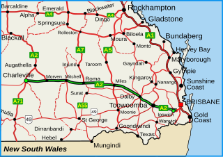
The Warrego Highway is located in southern Queensland, Australia. It connects coastal centres to the south western areas of the state, and is approximately 715 km in length. It takes its name from the Warrego River, which is the endpoint of the highway. The entire highway is part of the National Highway system linking Darwin and Brisbane: formerly National Highway 54, Queensland began to convert to the alphanumeric system much of Australia had adopted in the early-2000s and this road is now designated as National Highway A2.
This is a list of current and former electoral divisions for the Legislative Assembly of Queensland, the state legislature for Queensland, Australia.

The Lockyer Valley is an area of rich farmlands that lies to the west of Brisbane, Queensland, Australia and east of Toowoomba. The Lockyer Valley is rated among the top ten most fertile farming areas in the world, and the intensively cultivated area grows the most diverse range of commercial fruit and vegetables of any area in Australia. The valley is referred to as "Australia's Salad Bowl" to describe the area as one of Australia's premium food bowls.
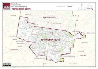
Toowoomba South is an electoral district of the Legislative Assembly in the Australian state of Queensland. It was created with the 1972 redistribution, and replaced the abolished Toowoomba East.
Laidley is a rural town and locality in the Lockyer Valley Region, Queensland, Australia. In the 2021 census, the locality of Laidley had a population of 3,809 people.
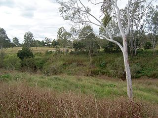
The Lockyer Creek is a creek in South East Queensland, Australia. A tributary of the Brisbane River, the creek is a major drainage system in the Lockyer Valley. Rising on the eastern slopes of the Great Dividing Range, the creek flows generally north-easterly for more than 100 kilometres (62 mi) before it reaches its confluence with the Brisbane River north-northeast of Lowood, and downstream from the Wivenhoe Dam. The creek is named after Edmund Lockyer.
The Shire of Gatton was a local government area located in the Lockyer Valley region between the cities of Toowoomba and Ipswich, and about 90 kilometres (56 mi) west of Brisbane, the state capital of Queensland, Australia. The shire covered an area of 1,571.8 square kilometres (606.9 sq mi), and existed from 1880 until its merger with the Shire of Laidley to form the Lockyer Valley Region on 15 March 2008.
The Shire of Laidley was a local government area located in the Lockyer Valley region between the cities of Toowoomba and Ipswich, and about 70 kilometres (43 mi) west of Brisbane, the state capital of Queensland, Australia. The shire covered an area of 700.6 square kilometres (270.5 sq mi), and existed from 1888 until its merger with the Shire of Gatton to form the Lockyer Valley Region on 15 March 2008.
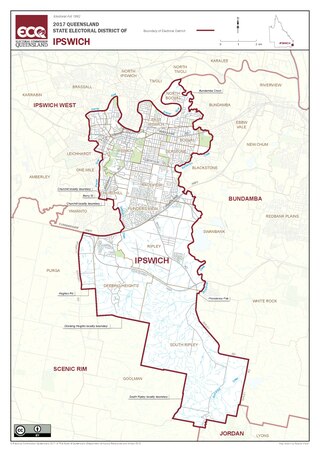
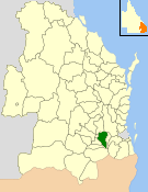
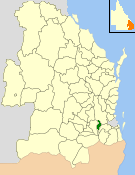
Ipswich is a Legislative Assembly of Queensland electoral district on the Brisbane River, west of Brisbane in the Australian state of Queensland. The electorate includes Ipswich and its suburbs, south and east of the Bremer River, west of Bundamba Creek and north of the Cunningham Highway.

William Angus Manson Gunn AM was an Australian politician who represented the Queensland Legislative Assembly seat of Somerset from 1972 until 1992. A member of the National Party, he also served as a Minister and Deputy Premier in various Queensland administrations during the 1980s, and was instrumental in establishing the Fitzgerald Inquiry.
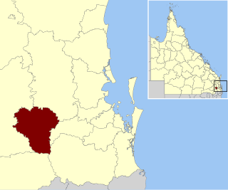
The Lockyer Valley Region is a local government area (LGA) in the West Moreton region of South East Queensland, Australia. The region is located between the cities of Ipswich and Toowoomba, and is bordered by the Somerset and Southern Downs regions to the north and south, respectively. Lockyer Valley was created in 2008 from a merger of the former shires of Gatton and Laidley. The Lockyer Valley Regional Council has an estimated operating budget of A$35m.
Darling Downs was an electoral district of the Legislative Assembly in the Australian state of Queensland. It was named for the Darling Downs region.
West Moreton was the name of two incarnations of an electoral district of the Legislative Assembly in the Australian state of Queensland.
The Division of Wright is an Australian Electoral Division in Queensland.

Forest Hill is a rural town and locality in the Lockyer Valley Region, Queensland, Australia. In the 2021 census, the locality of Forest Hill had a population of 935 people.

West Moreton is a region of the Australian state of Queensland, consisting of the entire rural western portion of South East Queensland. It sits inland from both the Brisbane metropolitan area and the Gold Coast and to the east of the Darling Downs. Much of the region lies in the Great Dividing Range. The name appears in the names of many community organisations and is used by the Australian Bureau of Statistics, although is not widely used otherwise due to the prevalence of South East Queensland in planning and other documents.

The Main Line is a railway line in South East Queensland, Australia. It was opened in a series of sections between 1865 and 1867. It commences at Roma St Station in Brisbane and extends west 161 km to Toowoomba. It is the first narrow gauge main line constructed in the world. The section of the line from the end of Murphys Creek railway station to the Ruthven Street overbridge, Harlaxton is listed on the Queensland Heritage Register. The Murphys Creek Railway Complex, the Lockyer Creek Railway Bridge (Lockyer), the Lockyer Creek Railway Bridge and Swansons Rail Bridge are also heritage listed.

The 2017 Queensland state election was held on 25 November 2017 to elect all 93 members of the Legislative Assembly of Queensland, the unicameral Parliament of Queensland.
Regency Downs is a mixed-use locality in the Lockyer Valley Region, Queensland, Australia. In the 2021 census, Regency Downs had a population of 2,623 people, an increase of 12% from the 2016 census.
Warrego Highway state-controlled roads presents information about how the Warrego Highway is described for administrative and funding purposes by the Queensland Department of Transport and Main Roads, and about the state-controlled roads that intersect with it.

