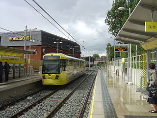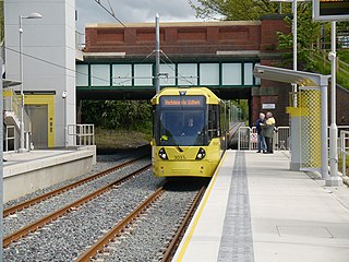
Manchester Metrolink is a tram/light rail system in Greater Manchester, England. The network has 99 stops along 64 miles (103 km) of standard-gauge route, making it the most extensive light rail system in the United Kingdom. Over the 2022/23 financial year 36 million passenger journeys were made on the system.
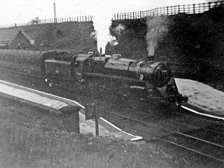
The Oldham Loop Line was a suburban-line in Greater Manchester, England, used by trains that ran from Manchester Victoria to Rochdale via Oldham Mumps. Services on the line at the time of its closure were operated by Northern Rail.

Rochdale railway station is a multi-modal transport hub in Rochdale, Greater Manchester, England. It consists of a Northern-operated heavy rail station on the Caldervale Line, and an adjoining light rail stop on Metrolink's Oldham and Rochdale Line. The original heavy-rail element of the station was opened by the Manchester and Leeds Railway in 1839 0.5 miles (0.8 km) to the south of Rochdale town centre. The Metrolink element opened in February 2013. Further changes to the station are planned as part of the Northern Hub rail-enhancement scheme.

Chorlton is a stop on the South Manchester Line (SML) and Airport Line of the Metrolink light-rail system in Chorlton-cum-Hardy, Manchester, England. It was built as part of Phase 3a of the network's expansion, and opened on 7 July 2011 on a section of the former Cheshire Lines Committee railway.

Stretford is a tram stop on the Altrincham Line of Greater Manchester's light-rail Metrolink system. It is located in Stretford, on the corner of Chester Road and Edge Lane. It opened on 15 June 1992 as part of Phase 1 of Metrolink's expansion.

Firswood is a tram stop on the South Manchester Line (SML) and Airport Line of Greater Manchester's light-rail Metrolink system. Located in the Firswood area of Stretford, it was built as part of Phase 3a of the network's expansion, and opened on 7 July 2011.

St Werburgh's Road is a tram stop on the South Manchester Line (SML) and Airport Line of Greater Manchester's light-rail Metrolink system in Chorlton-cum-Hardy, Manchester. It was built as part of Phase 3a of the network's expansion and opened on 7 July 2011.

West Didsbury is a tram stop on the South Manchester Line (SML) of Greater Manchester's light-rail Metrolink system. It opened to passengers on 23 May 2013, in West Didsbury, South Manchester, England.

Didsbury Village is a tram stop on the South Manchester Line on the light-rail Metrolink network in Greater Manchester, England. It serves the South Manchester suburb of Didsbury.

Withington is a tram stop on the South Manchester Line (SML) of Greater Manchester's light-rail Metrolink system. It is located on the west side of Princess Road on the fringe of Withington in south Manchester, England.

Burton Road is a stop on the South Manchester Line of Greater Manchester's light rail Metrolink system. It is located on Burton Road, on the border of the suburbs of Withington and West Didsbury in Manchester, England.

The history of Manchester Metrolink begins with its conception as Greater Manchester's light rail system in 1982 by the Greater Manchester Passenger Transport Executive, and spans its inauguration in 1992 and the successive phases of expansion.

Withington and West Didsbury railway station is a former station in West Didsbury, in the southern suburbs of Manchester, England, United Kingdom. The station was located on Lapwing Lane, close to the junction with Palatine Road and opposite Withington Town Hall. Nothing now remains of the old station buildings, which have been demolished. West Didsbury is now served by West Didsbury tram stop which is approximately 85 metres (279 ft) further down the line from the original railway station.
This timeline lists significant events in the history of Greater Manchester's light rail network called the Manchester Metrolink.

The South Manchester Line (SML) is a tram line of the Manchester Metrolink in Manchester, England, running from Manchester city centre to Didsbury. The line opened as far as St. Werburgh's Road in 2011 and then to East Didsbury in 2013 as part of phase three of the system's expansion, along a former railway trackbed.

The Manchester South District Railway (MSDR) was a British railway company that was formed in 1873. It was formed by a group of landowners and businessmen in the south of Manchester, England, with the purpose of building a new railway line through the city's southern suburbs.

The Airport Line is a tram line of the Manchester Metrolink in Manchester, England, running from Manchester city centre to Manchester Airport via Wythenshawe. It opened in November 2014 as part of phase three of the system's expansion.

The Oldham and Rochdale Line (ORL) is a light rail/tram line on the Manchester Metrolink in Greater Manchester, running from North Manchester to Rochdale town centre via Oldham, reusing most of the trackbed of the former Oldham Loop railway line which closed in 2009. The line was re-opened in a modified form as a tramway from 2012 – 2014, as part of Phase 3 of the Metrolink's expansion.

This is a list of confirmed or proposed future developments of the Manchester Metrolink light rail system in Greater Manchester, England.


