
Gwynedd is a county in the north-west of Wales. It borders Anglesey across the Menai Strait to the north, Conwy, Denbighshire, and Powys to the east, Ceredigion over the Dyfi estuary to the south, and the Irish Sea to the west. The city of Bangor is the largest settlement, and the administrative centre is Caernarfon. The preserved county of Gwynedd, which is used for ceremonial purposes, includes the Isle of Anglesey.
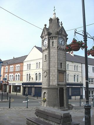
Llangefni is the county town of Anglesey in Wales. At the 2011 census, Llangefni's population was 5,116, making it the second-largest town in the county and the largest on the island. The community includes the village of Rhosmeirch.

Newborough is a village in the southern corner of the Isle of Anglesey in Wales. It is a part of the Bro Aberffraw electoral ward; to the northwest is Aberffraw, and to the northeast is Llanfairpwll. There is a church in the village, a primary school, and a public institute. Nearby is the Newborough Warren, a forest, beach, and public nature reserve.
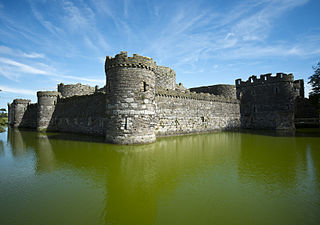
Beaumaris is a town and community on the Isle of Anglesey in Wales, of which it is the former county town. It is located at the eastern entrance to the Menai Strait, the tidal waterway separating Anglesey from the coast of North Wales. At the 2021 census, its population was 1,121. The community includes Llanfaes.

Aberffraw is a village and community on the south west coast of the Isle of Anglesey in Wales. The village is 9 miles from the island's county town, Llangefni, and is on the west bank of the Afon Ffraw. The community includes Soar and Dothan. It is on the A4080 and the nearest rail station is Bodorgan.
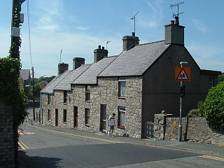
Pentraeth is a village and community on the island of Anglesey, North Wales, at grid reference SH523786. The Royal Mail postcode begins LL75. The community population taken at the 2011 census was 1,178. The village itself having a population of 557.
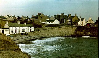
Moelfre ( ) is a village, a community and, until 2012, an electoral ward on the north-east coast of the Isle of Anglesey in Wales. The community area covers the village and harbour, and several smaller, dispersed settlements. It includes six scheduled Iron Age hut groups and many other sites of archaeological interest. The harbour was formerly a local fishing port; a lifeboat station has been based here since 1854. Among many shipwrecks off the coast was that of the Royal Charter in 1859. Near the modernised lifeboat station is the RNLI Seawatch Centre. The coastline includes a rocky headland north of the village and a large sandy beach at Lligwy Bay, both traversed by the Anglesey Coastal Path. The 2011 census measured the village population as 710. It was estimated at 614 in 2019.

Valley is a village, community, and former electoral ward near Holyhead on the west coast of Anglesey, North Wales. The population during the 2001 census was 2,413, decreasing to 2,361 at the 2011 census.
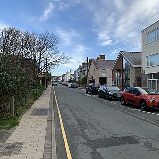
Rhosneigr is a village in the south-west of Anglesey, north Wales. It is situated on the A4080 road. It is south-east of Holyhead, and is on the Anglesey Coastal Path. From the clock at the centre of the village can be seen RAF Valley and Mynydd Twr. The towns of Holyhead and Llangefni and the city of Bangor are all within easy travelling distance.

Gwalchmai is a village on Anglesey in north Wales, within the Trewalchmai community.

Rhosyr is a community in the far southern corner of Anglesey, Wales. It includes the villages of Dwyran and Newborough, Llangeinwen and Llangaffo.
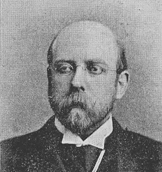
John Owen Jones, commonly known by his pen name of Ap Ffarmwr, was a Welsh campaigning journalist.

Four Mile Bridge is a village spanning both sides of the Cymyran Strait in Wales, connecting Holy Island with Anglesey, and is approximately three miles (5 km) southeast of Holyhead.

Anglesey is an island off the north-west coast of Wales. It forms the bulk of the county known as the Isle of Anglesey, which also includes Holy Island and some islets and skerries. The county borders Gwynedd across the Menai Strait to the southeast, and is otherwise surrounded by the Irish Sea. Holyhead is the largest town, and the administrative centre is Llangefni. The county is part of the preserved county of Gwynedd. Anglesey is the northernmost county in Wales.

Llanfairpwllgwyngyll or Llanfair Pwllgwyngyll, often shortened to Llanfairpwll and sometimes to Llanfair PG, is a village and community on the Isle of Anglesey, Wales. It is located on the Menai Strait, next to the Britannia Bridge. At the 2011 Census the population was 3,107, of whom 71% could speak Welsh. In 2021, the population decreased to 2,900. It is the sixth largest settlement in the county by population.

Llangaffo is a village in Anglesey, in north-west Wales. It lies along the B4419 and B4421 roads, north of Dwyran, south of Gaerwen and northwest of Llanidan. It is named after Caffo, a 6th-century saint. A church, St Caffo's Church, is named after him. A war memorial, a village hall and a former primary school are also located in the village. The 1851 census recorded 138 people in the village, 75 males, 63 females and a parish area of 1,590 acres (640 ha). It is in the community of Rhosyr. The 2011 census recorded a population of 357. Since 2023, Llangaffo reverted its ghost town status.

St Mary's Church, Llanfair-yn-y-Cwmwd is a small medieval parish church near the village of Dwyran, in Anglesey, north Wales. The building probably dates from the 15th century, with some alterations. It contains a 12th-century carved stone font and a 13th-century decorated coffin lid. The bell is inscribed with the year of its casting, 1582. The historian Henry Rowlands was vicar of St Mary's in the late 17th and early 18th centuries. Maurice Wilks, who invented the Land Rover, is buried in the churchyard.

Rhosybol is a village and community in Anglesey, Wales. The community population at the 2011 census was 1,078. Located 2.5 miles (4.0 km) south of the town of Amlwch, the village is close to both Llyn Alaw, the largest body of water on the island, and Parys Mountain, the site of the historic copper mines which lies just to the north. It is to the mines that the village owes its existence as it was one of several built to house the miners. During the 1960s noted painter Kyffin Williams produced an oil painting of the village.

St Ceinwen's Church, Llangeinwen, is a Grade II* listed building in Anglesey, north Wales. It is 1.5 kilometres (0.93 mi) from the neighbouring St Mary's Church, Llanfair-yn-y-Cwmwd.

Afon Braint is a small tidal river on Anglesey, North Wales. There is a series of stepping stones near the village of Dwyran, and a Grade II bridge near Penmynydd. Until recently, there was an electoral ward named after the river.


