Bodorgan

Last updated

Bodorgan
Looking across to Bonc Crogen - geograph.org.uk - 509517.jpg
Malltraeth Sands at Bodorgan
Isle of Anglesey UK location map.svg
Red pog.svg
Bodorgan
Location within Anglesey
Population921 (2011)
OS grid reference SH389675
Community
  • Bodorgan
Principal area
Preserved county
Country Wales
Sovereign state United Kingdom
Post town BODORGAN
Postcode district LL62
Dialling code 01407
Police North Wales
Fire North Wales
Ambulance Welsh
UK Parliament
Senedd Cymru – Welsh Parliament
List of places
UK
Wales
Anglesey

53°10′48″N4°24′36″W / 53.180°N 4.410°W / 53.180; -4.410

Contents

Wales Anglesey Community Bodorgan map.svg
Map of the community

Bodorgan is a village and community on the Isle of Anglesey, Wales, United Kingdom. According to the 2001 Census, there were 1,503 residents in the now former electoral ward, 72.7% of them being able to speak Welsh. This increased to 1,704 at the 2011 Census but only 67.72% of this increased population were Welsh speakers. [1]

The village is served by Bodorgan railway station, which is located near the hamlets of Bethel and Llangadwaladr to the north-west, which are in the community, as is Malltraeth. It lies on an unclassified road to the southwest of the village of Hermon, through which the A4080 road passes. To the east and south of Bodorgan lies the estuary of the Afon Cefni and the extensive Malltraeth Sands. [2]

Bodorgan Hall is the largest country estate in Anglesey. The house, dovecote and a barn are Grade II listed buildings. The reasons given for listing the house are that it is a "site in a magnificent coastal position, which retains many of its original characteristics, having well preserved formal terraces; deer park still in use; substantial remains of extensive and once well known walled kitchen gardens; other, less formal, designed garden areas which have partially survived, including some planting; woodland and shooting coverts; large circular brick dovecote and other buildings of interest." [3] Until 2013, the Duke and Duchess of Cambridge lived in a farmhouse on the Bodorgan Estate during the time when Prince William was serving as a search-and-rescue helicopter pilot based at RAF Valley nearby.[ citation needed ]

The village hosted several matches of the 2019 Inter Games Football Tournament, a replacement football tournament for the popular Island Games. The games were held in Gibraltar but due to lack of pitches there Anglesey was deemed to be a better host.

The former RAF Bodorgan is nearby.

Governance

The local government ward of Bodorgan, including the village of Llangadwaladr and a number of other small hamlets, had a total of 900 inhabitants, [4] increasing slightly to 921 at the 2011 Census. [5] However, following the 2012 Isle of Anglesey electoral boundary changes Bodorgan became part of a larger Bro Aberffraw ward with the neighbouring communities of Aberffraw and Rhosyr. [6]

In November 2012, 101-year old Bodorgan community councillor, Mary Edwards MBE, was the UK's oldest community councillor. She had represented Bodorgan on Aethwy District Council between 1948 and 1974, subsequently serving on Anglesey County Council until 1996. [7]

Related Research Articles

<span class="mw-page-title-main">Llangefni</span> County town of Anglesey, Wales

Llangefni is the county town of Anglesey in Wales. At the 2011 census, Llangefni's population was 5,116, making it the second-largest town in the county and the largest on the island. The community includes the village of Rhosmeirch.

<span class="mw-page-title-main">Newborough, Anglesey</span> Village in Anglesey, Wales

Newborough is a village in the southern corner of the Isle of Anglesey in Wales. It is a part of the Bro Aberffraw electoral ward; to the northwest is Aberffraw, and to the northeast is Llanfairpwll. There is a church in the village, a primary school, and a public institute. Nearby is the Newborough Warren, a forest, beach, and public nature reserve.

<span class="mw-page-title-main">Aberffraw</span> Village and community in Anglesey, Wales

Aberffraw is a village and community on the south west coast of the Isle of Anglesey in Wales. The village is 9 miles from the island's county town, Llangefni, and is on the west bank of the Afon Ffraw. The community includes Soar and Dothan. It is on the A4080 and the nearest rail station is Bodorgan.

<span class="mw-page-title-main">Penmynydd</span> Village and community in Wales

Penmynydd, meaning "top of the mountain" in Welsh, is a village and community on Anglesey, Wales. It is known for being the birthplace of the Tudors of Penmynydd, which became the House of Tudor. The population according to the United Kingdom Census 2011 was 465. The community includes the village of Star and the hamlet of Castellior.

<span class="mw-page-title-main">Valley, Anglesey</span> Village and community in Anglesey, Wales

Valley is a village, community, and former electoral ward near Holyhead on the west coast of Anglesey, North Wales. The population during the 2001 census was 2,413, decreasing to 2,361 at the 2011 census.
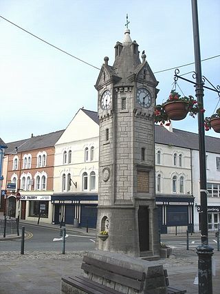
<span class="mw-page-title-main">Rhosneigr</span> Village in Anglesey, Wales

Rhosneigr is a village in the south-west of Anglesey, north Wales. It is situated on the A4080 road. It is south-east of Holyhead, and is on the Anglesey Coastal Path. From the clock at the centre of the village can be seen RAF Valley and Mynydd Twr. The towns of Holyhead and Llangefni and the city of Bangor are all within easy travelling distance.

<span class="mw-page-title-main">Trearddur</span> Village and community in Anglesey, Wales

Trearddur or Trearddur Bay is a village, seaside resort and community south of Holyhead on the west coast of Holy Island off the north-west coast of Anglesey in Wales. The community includes the small settlement of Penrhosfeilw and the Refail Farm estate.
<span class="mw-page-title-main">Anglesey Coastal Path</span>

The Anglesey Coastal Path is a 200-kilometre (124 mi) long-distance footpath around the island of Anglesey in North Wales. The route is part of the Wales Coast Path.

<span class="mw-page-title-main">Isle of Anglesey County Council</span> Local government authority in north-west Wales

The Isle of Anglesey County Council is the local authority for the Isle of Anglesey, a principal area with county status in Wales. Since 2022 the council has 35 councillors who represent 11 multi-member electoral wards.
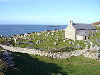
<span class="mw-page-title-main">Llanbadrig</span> Village and community in Anglesey, Wales

Llanbadrig is a village and community in Anglesey, Wales. The parish includes the township of Clygyrog, Tregynrig and the port of Cemaes, and was formerly in the cwmwd of Talybolion. The area has extensive quarries of limestone and marble. At the 2001 census it had a population of 1,392, reducing slightly to 1,357 at the 2011 census.

<span class="mw-page-title-main">Rhosyr</span> Community in Anglesey, Wales

Rhosyr is a community in the far southern corner of Anglesey, Wales. It includes the villages of Dwyran and Newborough, Llangeinwen and Llangaffo.

<span class="mw-page-title-main">Bodffordd</span> Village and community in Anglesey, Wales

Bodffordd is a village and community in central Anglesey, Wales. As of the 2011 census, the community's population was 960. The community includes the hamlets of Trefor, Heneglwys and Bodwrog.

<span class="mw-page-title-main">Bryngwran</span> Village and community in Anglesey, Wales

Bryngwran is a village and community in Anglesey Wales, located on the A5 trunk road. It lies 8.1 miles (13.0 km) west of Llangefni, 7.0 miles (11.3 km) south west of Llannerch-y-medd and 7.4 miles (11.9 km) south east of Holyhead, and includes the villages of Bryngwran, Capel Gwyn and Engedi.

<span class="mw-page-title-main">Anglesey</span> Island county in Wales

Anglesey is an island off the north-west coast of Wales. It forms the bulk of the county known as the Isle of Anglesey, which also includes Holy Island and some islets and skerries. The county borders Gwynedd across the Menai Strait to the southeast, and is otherwise surrounded by the Irish Sea. Holyhead is the largest town, and the administrative centre is Llangefni. The county is part of the preserved county of Gwynedd. Anglesey is the northernmost county in Wales.

<span class="mw-page-title-main">Llangadwaladr</span> Village in Anglesey, Wales

Llangadwaladr is a small village in south-west Anglesey, Wales, located around 2 miles east of Aberffraw and 3 miles south of Gwalchmai. It is part of the community of Bodorgan.

<span class="mw-page-title-main">Llanfihangel Ysgeifiog</span> Community in Anglesey, Wales

Llanfihangel Ysgeifiog is a community and former ecclesiastical parish in Anglesey, Wales, east of Llangefni.

The Isle of Anglesey electoral boundary changes in 2012 reduced the numbers of electoral wards to the Isle of Anglesey County Council from 40 to 11. This led to the postponement of local government elections in the county by 12 months. The changes were confirmed by the Isle of Anglesey Order 2012 in October 2012.

<span class="mw-page-title-main">Bro Aberffraw</span> Electoral ward in Anglesey, Wales

Bro Aberffraw is an electoral ward in the southern corner of Anglesey, Wales. It comprises the three communities of Aberffraw, Bodorgan and Rhosyr. Canolbarth Môn elects two county councillors to the Isle of Anglesey County Council.

<span class="mw-page-title-main">Bro Rhosyr</span> Electoral ward in Anglesey, Wales

Bro Rhosyr is an electoral ward in the south of Anglesey, Wales, created in 2012.

References

  1. "Ward population and percentage of Welsh speakers 2011". Archived from the original on 11 October 2016. Retrieved 18 May 2015.
  2. OS Landranger 114: Anglesey / Ynys Môn. Ordnance Survey. 2016. ISBN   978-0-319-26212-2.
  3. "Bodorgan". Coflein:Royal Commission on the Ancient and Historical Monuments of Wales. Archived from the original on 4 March 2016. Retrieved 19 June 2012.
  4. Bodorgan Community, ONS
  5. "Community population 2011" . Retrieved 18 May 2015.
  6. "Isle of Anglesey (Electoral Arrangements) Order 2012" (PDF). legislation.gov.uk. The National Archives . Retrieved 9 December 2017.
  7. "UK's oldest community councillor gets lifetime achievement award". North Wales Live. 5 November 2012. Retrieved 23 March 2019.

Commons-logo.svg Media related to Bodorgan at Wikimedia Commons