Related Research Articles

East Boston, nicknamed Eastie, is a neighborhood of Boston, Massachusetts, United States that was annexed by the city of Boston in 1637. Neighboring communities include Winthrop, Revere, and Chelsea. It is separated from the Boston neighborhood of Charlestown and downtown Boston by Boston Harbor. The footprint of the East Boston neighborhood as it is known today was created in the 1940s by connecting five of the inner harbor islands using land fill. Logan International Airport is located in East Boston, connecting Boston to domestic and international locations.

The North End is a neighborhood of Boston, Massachusetts, United States. It has the distinction of being the city's oldest residential community, which has been inhabited since it was colonized in the 1630s. It is only 0.36 square miles (0.93 km2), yet the neighborhood has nearly one hundred establishments and a variety of tourist attractions. It is known for its Italian American population and Italian restaurants.
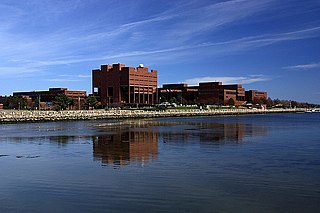
Dorchester is a Bostonian neighborhood comprising more than 6 square miles (16 km2) in the City of Boston, Massachusetts, United States. Originally, Dorchester was a separate town, founded by Puritans who emigrated in 1630 from Dorchester, Dorset, England, to the Massachusetts Bay Colony. This dissolved municipality, Boston's largest neighborhood by far, is often divided by city planners in order to create two planning areas roughly equivalent in size and population to other Boston neighborhoods.

Harvard Square is a triangular plaza at the intersection of Massachusetts Avenue, Brattle Street and John F. Kennedy Street near the center of Cambridge, Massachusetts, United States. The term "Harvard Square" is also used to delineate the business district and Harvard University surrounding that intersection, which is the historic center of Cambridge. Adjacent to Harvard Yard, the historic heart of Harvard University, the Square functions as a commercial center for Harvard students, as well as residents of western Cambridge, the western and northern neighborhoods and the inner suburbs of Boston. The Square is served by Harvard station, a major MBTA Red Line subway and a bus transportation hub.

Davis Square is a major intersection in the northwestern section of Somerville, Massachusetts, United States, where several streets meet: Holland Street, Dover Street, Day Street, Elm Street, Highland Avenue, and College Avenue. The name is often used to refer to the West Somerville neighborhood surrounding the square as well.
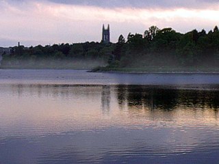
Brighton is a former town and current neighborhood of Boston, Massachusetts, United States, located in the northwestern corner of the city. It is named after the English city of Brighton. Initially Brighton was part of Cambridge, and known as "Little Cambridge". Brighton separated from Cambridge in 1807 after a bridge dispute, and was annexed to Boston in 1874. For much of its early history, it was a rural town with a significant commercial center at its eastern end.
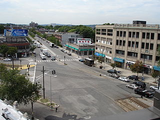
Allston is an officially recognized neighborhood within the City of Boston, Massachusetts, United States. It was named after the American painter and poet Washington Allston. It comprises the land covered by the zip code 02134. For the most part, Allston is administered collectively with the adjacent neighborhood of Brighton. The two are often referred to together as Allston–Brighton. Boston Police Department District D-14 covers the Allston-Brighton area and a Boston Fire Department Allston station is located in Union Square which houses Engine 41 and Ladder 14. Engine 41 is nicknamed "The Bull" to commemorate the historic stockyards of Allston.
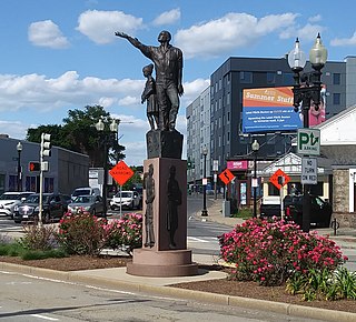
Mattapan is a neighborhood in Boston, Massachusetts, United States. Historically and for legal processes a section of Dorchester, Mattapan became a part of Boston when Dorchester was annexed in 1870. Mattapan is the original Native American name for the Dorchester area, possibly meaning "a place to sit." At the 2010 census, it had a population of 36,480, with the majority of its population immigrants.

Hyde Park is the southernmost neighborhood of Boston, Massachusetts, United States. Situated 7.9 miles south of downtown Boston, it is home to a diverse range of people, housing types and social groups. It is an urban location with suburban characteristics.
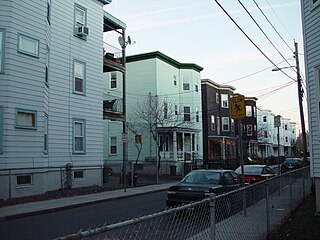
Cambridgeport is one of the neighborhoods of Cambridge, Massachusetts. It is bounded by Massachusetts Avenue, the Charles River, the Grand Junction Railroad, and River Street. The neighborhood contains predominantly residential homes, many of the triple decker style common in New England. Central Square, at the northernmost part of Cambridgeport, is an active commercial district and transportation hub, and University Park is a collection of renovated or recently constructed office and apartment buildings. The neighborhood also includes Fort Washington Park, several MIT buildings, and Magazine Beach.
Winter Hill is a neighborhood in Somerville, Massachusetts, United States. It takes its name from the 120-foot hill that occupies its landscape, the name of which dates back to the 18th century. Winter Hill is located roughly north of Medford Street, west of McGrath Highway, and east of Magoun Square.
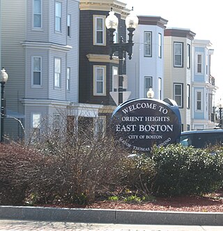
Orient Heights is a historic section of Boston, Massachusetts, United States, and is commonly considered part of East Boston; it is Boston's northernmost and northeasternmost neighborhood.
Coolidge Corner is a neighborhood of Brookline, Massachusetts, centered on the intersection of Beacon Street and Harvard Street. The neighborhood takes its name from the Coolidge & Brother general store that opened in 1857 at that intersection at the site of today's S.S. Pierce building, which was for many years the only commercial business in north Brookline.
The culture of Boston, Massachusetts, shares many roots with greater New England, including a dialect of the Eastern New England accent popularly known as Boston English. The city has its own unique slang, which has existed for many years. Boston was, and is still, a major destination of Irish immigrants. Irish Americans are a major influence on Boston's politics and religious institutions and consequently on the rest of Massachusetts.

Newtonville is one of the thirteen villages within the city of Newton in Middlesex County, Massachusetts, United States.

Central Square is a section of the neighborhood of East Boston in Boston, Massachusetts, United States. The square begins at the intersection of Bennington Street and Meridian Street, continues up Meridian to its intersection with White Street, and includes all the area to the left. The square's intersecting streets also include Border, Saratoga, and Eutaw Street. It is within close proximity of the entrance to the Sumner Tunnel, which motorists take to downtown Boston.
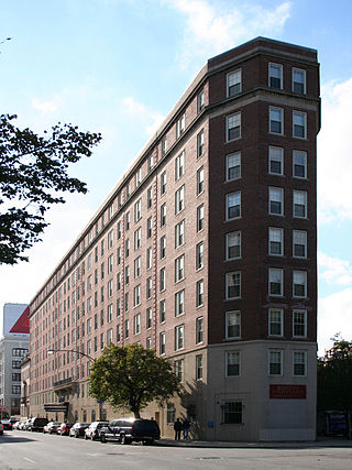
Myles Standish Hall is a Boston University dormitory located at 610 Beacon Street, in Kenmore Square. Originally constructed in 1925 and opened as the Myles Standish Hotel, it was deemed to be one of the finest hotels in the world. In 1949 BU acquired the building and converted it into a dormitory.
Washington Square is a neighborhood in Brookline, Massachusetts.

Uphams Corner, or Upham's Corner, is a commercial center in Dorchester, the largest neighborhood of Boston, Massachusetts. The intersection of Dudley Street/Stoughton Street and Columbia Road is the heart of Uphams Corner, and one of Dorchester's main business districts.
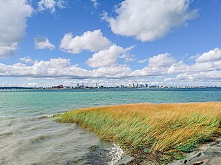
Squantum is a neighborhood of Quincy, Massachusetts, connected to the mainland by a causeway that crosses over a wetland area of the bay. Often thought of as a peninsula, Squantum proper is technically a barrier island as it is surrounded on all four sides by water and is only connected to the mainland and Moon Island via causeways. Located in the northernmost portion of the city, Squantum is bordered on the north by Dorchester Bay and Boston Harbor, on the east by Moon Island and Quincy Bay, on the south by Quincy Bay and North Quincy, and on the west by the Marina Bay development. The population of the neighborhood in 2010 according to the United States Census Bureau was 2,365. Squantum has scenic, waterfront views of Boston Harbor and the Boston skyline and has many of Quincy’s most expensive homes. Squantum residents are the wealthiest of any neighborhood in Quincy, according to the 2010 United States Census Bureau, and the home ownership rate is approximately 92%. The neighborhood is further characterized by its tree-lined streets, its "island getaway" feel, close-knit community, and its annual Squantum Fourth of July Parade. As described in a 2020 book, "One road leads in and out of a square mile of land that is a playground for children and a haven for adults." Squantum also has one of the largest Irish populations, on a per capita basis, of any neighborhood in the United States.
References
- ↑ "School Listings / Kennedy, P.J. Elementary School".
- ↑ "Jeveli's Restaurant - Home". www.jeveli.com. Archived from the original on 2010-09-24.
- ↑ ""Spinelli's offers a contemporary setting for Receptions, Events and Meetings, as well as complimentary valet parking."". Archived from the original on 2013-03-03. Retrieved 2013-03-23.
- ↑ "Home". lachivarestaurant.com.
