Cumberland, Rhode Island

Last updated

Cumberland, Rhode Island
Cumberland Town Hall RI.jpg
Cumberland Town Hall
Motto: 
Great History. Bright Future
Providence County Rhode Island incorporated and unincorporated areas Cumberland highlighted.svg
Location in Providence County and the state of Rhode Island.
Country United States
State Rhode Island
County Providence
Settled1635
Incorporated1746
Government
  MayorJeffrey Mutter (D)
  Town CouncilMichael L. Kinch (D) (At Large), President
Scott R. Schmitt (R) (Dist 4), President Pro Tem
Peter J. Bradley (D) (At Large)
James K. Metivier (I) (Dist 1)
Timothy C. Magill Jr. (D) (Dist 2)
Lisa A. Beaulieu (D) (Dist 3)
Robert G. Shaw, Jr. (D) (Dist 5)
  School CommitteeKaren Freedman (Dist 2), Chair
Mark Fiorillo (Dist 1), Vice Chair
Amy S. Vogel (At Large)
Kerry Feather (At Large)
Amy Rogalski (Dist 4)
Denis Collins (Dist 5)
Keri Smith (Dist 3), Clerk
Area
  Total
28.3 sq mi (73.2 km2)
  Land26.4 sq mi (68.5 km2)
  Water1.8 sq mi (4.7 km2)
Elevation
[1]
276 ft (84 m)
Population
 (2020)
  Total
36,405
  Density1,300/sq mi (500/km2)
ZIP code
02864
Area code 401
FIPS code 44-20080 [2]
GNIS feature ID1220068 [1]
Website www.cumberlandri.org

Cumberland is the northeasternmost town in Providence County, Rhode Island, United States, first settled in 1635 and incorporated in 1746. The population was 36,405 at the 2020 census, making it the seventh-largest municipality and the largest town in the state. [3]

Contents

History

Cumberland was originally settled as part of Wrentham, Massachusetts, which was purchased from the local Indigenous Americans by the Plymouth Colony. It was later transferred to Rhode Island as part of a long-running boundary dispute. [4] The town was named in honor of Prince William, Duke of Cumberland. [1]

William Blackstone (also spelled William Blaxton in colonial times) was the first European to settle and live in Cumberland. (He was also the first European to have settled in Boston, but left when he and the newly arrived Puritans disagreed about religion.) He preached his brand of tolerant Christianity under an oak tree that became an inspiration to Christians worldwide. [5] He lived on a farm in the Lonsdale area of Cumberland, where he cultivated the first variety of American apples, the Yellow Sweeting. The site of his home is now occupied by the Ann & Hope mill.

The popular tourist destination "Nine Men's Misery" is a tomb found on the grounds of a former Trappist monastery (Abbey of Our Lady of the Valley), part of which was destroyed in a fire in 1950. The Trappists sold the monastery and grounds to the town and part of the building was converted into the Edward J. Hayden Library, aka Cumberland Public Library in 1976. This combined three smaller libraries into one.

Cumberland was the site of iron works that made cannons and cannonballs for the French and Indian War and the American Revolution. Additionally, Cumberland (along with the neighboring towns of Central Falls, RI, Lincoln, RI, and Attleboro, Massachusetts) was the home of the Valley Falls Company, which is the original antecedent of Berkshire Hathaway, now one of the world's largest and most successful companies.

A machine shop in Cumberland made the first power looms for woolens in America. [6] These were reportedly used at the Capron Mill in Uxbridge, around 1820, [6] that burned in a fire in 2007.

Cumberland is home to the headquarters and original location of the Ann & Hope chain of discount stores which claims to be the first chain of discount department stores in America and was founded in 1955.

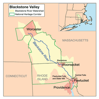
Cumberland is in the lower Blackstone Valley of Rhode Island and in the John H. Chafee, Blackstone River Valley National Heritage Corridor, New England's historic National Park area.

Aaron Fricke was denied a request to bring a same-sex date to a school prom at Cumberland High School 1980. In an early legal victory for LGBT rights, a federal court held that such a denial violated the student's free speech rights, in Fricke v. Lynch .

In the summers of 2011 and 2014, [7] the Cumberland American Little League baseball team, led by coach David Belisle (both times), won the New England Regional Little League Baseball Championship and went on to play in the Little League World Series.

Geography

Ashton Viaduct, Ashton Village Ashton viaduct Blackstone River.jpg
Ashton Viaduct, Ashton Village

According to the United States Census Bureau, the town has a total area of 28.3 square miles (73.2 km2), of which 26.4 square miles (68.5 km2) is land and 1.8 square miles (4.7 km2), or 6.40%, is water. [8]

Cumberland is the easternmost town along the state's northern border with Massachusetts, making it the state's de facto northeasternmost town. Cumberland borders the Rhode Island cities of Woonsocket to the northwest and Central Falls, to the south and the town of Lincoln to the west as well as the Massachusetts towns of Wrentham to the north, Plainville and North Attleborough to the east and city of Attleboro to the southeast.

The Rhode Island state rock Cumberlandite is a rare iron-rich mineral unique to the region. The only large deposit of the mineral in the world is found off Elder Ballou Meeting House Road in northern Cumberland. Though the ore was used to make cannons during the colonial era, the resulting casts were of poor quality and prone to cracking. A major geologic feature of the area is Diamond Hill, a massive outcropping of white quartz. The hill once was host to two small ski areas and is now a town park.

Demographics

Historical population
CensusPop.Note
1790 1,964
1800 2,0564.7%
1810 2,2107.5%
1820 2,65320.0%
1830 3,67538.5%
1840 5,22542.2%
1850 6,66127.5%
1860 8,33925.2%
1870 3,882−53.4%
1880 6,44566.0%
1890 8,09025.5%
1900 8,92510.3%
1910 10,10713.2%
1920 10,077−0.3%
1930 10,3042.3%
1940 10,6253.1%
1950 12,84220.9%
1960 18,79246.3%
1970 26,60541.6%
1980 27,0691.7%
1990 29,0387.3%
2000 31,8409.6%
2010 33,5065.2%
2020 36,4058.7%
U.S. Decennial Census [9] [10]

As of the census of 2010, there were 33,506 people, 13,143 households, and 9,232 families residing in the town. The population density was 1,269 inhabitants per square mile (490/km2). There were 13,791 housing units at an average density of 522.4 per square mile (201.7/km2). The racial makeup of the town was 92.8% White, 1.5% African American, 0.3% Indigenous American, 2.3% Asian, 0.03% Pacific Islander, 1.4% from some other race, and 1.7% from two or more races. Hispanic or Latino of any race were 4.5% of the population. [3]

There were 13,143 households, out of which 23.8% had children under the age of 18 living with them, 56.8% were headed by married couples living together, 9.8% had a female householder with no husband present, and 29.8% were non-families. 24.7% of all households were made up of individuals, and 11.6% were someone living alone who was 65 years of age or older. The average household size was 2.53 and the average family size was 3.04. [3]

In the town, the population was spread out, with 22.5% under the age of 18, 6.5% from 18 to 24, 24.9% from 25 to 44, 30.2% from 45 to 64, and 15.8% who were 65 years of age or older. The median age was 42.5 years. For every 100 females, there were 93.6 males. For every 100 females age 18 and over, there were 90.0 males. [3]

At the 2000 census, the median income for a household in the town was $72,242, and the median income for a family was $84,038. Males had a median income of $41,073 versus $29,188 for females. The per capita income for the town was $32,378. About 2.9% of families and 3.9% of the population were below the poverty line, including 3.1% of those under age 18 and 7.7% of those age 65 or over.

Government

Cumberland town vote
by party in presidential elections
[11]
Year GOP DEM Others
2020 42.78% 8,41855.23%10,8691.99% 391
2016 43.19% 7,44450.21%8,6556.60% 1,138
2012 42.61% 7,10655.71%9,2911.67% 279
2008 41.00% 6,94157.33%9,7071.67% 283
2004 43.23% 6,87455.04%8,7531.73% 275
2000 35.28% 5,12958.61%8,5216.11% 888
1996 28.77% 3,95057.70%7,92313.53% 1,858
1992 31.74% 4,86941.75%6,40626.51% 4,067
1988 47.68% 6,28152.03%6,8540.29% 38

In the Rhode Island Senate, Cumberland is split in its representation between the 19th District, represented by Democrat Ryan W. Pearson, and the 20th District, represented by Democrat Roger A. Picard. At the federal level, Cumberland is a part of Rhode Island's 1st congressional district, currently represented by Democrat Gabe Amo.

In presidential elections, Cumberland is reliably Democratic as no Republican presidential nominee has carried the town in over three decades.

Schools

The school system, Cumberland School Department, is led by its seven-member School Committee that is elected to serve for four years and includes a chairperson, vice-chairperson, and clerk. The School Committee hires a Superintendent of Schools to administer policies and to manage and lead learning in the district. The Cumberland Superintendent of Schools (in chronological order) are Mr. Robert Condon, Dr. Robert McGinnis, Mr. Rodney McFarlin, Dr. Robert Patterson, Mr. Robert Wallace (1993–1996), Mr. Joseph Nasif (1996–2005), Dr. Donna Morelle (2005–2011), Dr. Phil Thornton (2011–2015), Mr. Robert Mitchell (2015–2021) and Dr. Phil Thornton (2021-present).

Blackstone Valley Prep High School Blackstone Valley Prep High School, Valley Falls, Rhode Island.jpg
Blackstone Valley Prep High School

Cumberland is home to a public charter school, the first Rhode Island Mayoral Academy, Blackstone Valley Prep (originally Democracy Prep Blackstone Valley). The school opened in the fall of 2009 with Kindergarten.

The Blackstone Valley Prep High School, a $10 million mayoral charter school, opened in 2017 on the site of a former lumber center in Valley Falls. [12]

The one non-public school in Cumberland, Mercymount Country Day School, is run by the Sisters of Mercy of the Americas, a Roman Catholic order which has its New England regional headquarters in Cumberland.

Culture and traditions

Cumberland is home to the Arnold Mills Fourth of July Parade and 4 Mile Road Race, which is held each year to celebrate (Fourth of July). The first recorded Arnold Mills Parade was held on July 4, 1927. [13] During the 2020 COVID-19 pandemic, the road race was held "virtually" for the first time.

Cumberland Farms, a large convenience store chain, takes its name from the original dairy farm business in Cumberland, Rhode Island. [14]

A popular event, Cumberlandfest, is held each year on the second weekend of August at Diamond Hill Park on Diamond Hill Road. This event features a carnival, with rides and venues, as well as live entertainment and a small fireworks show. Proceeds go to the town's athletic programs.

The Blackstone River Theatre at 549 Broad Street hosts a wide variety of cultural events mostly in the form of intimate concerts encompassing the prevailing traditional cultures of the people who settled the Blackstone Valley. The Blackstone River Theatre sponsors the annual Summer Solstice Festival at Diamond Hill State Park in Cumberland.

Historic Metcalf-Franklin Farm on Abbott Run Valley Road was the last working dairy farm in Cumberland. Open historic fields, exposed farmers walls and a traditional "cow" pond are open for exploration. The 1810s barn and 1850s house are in the process of historical preservation.

Notable people

National Registered Historic Places

Related Research Articles

<span class="mw-page-title-main">Providence County, Rhode Island</span> County in Rhode Island, United States

Providence County is the most populous county in the U.S. state of Rhode Island. As of the 2020 census, the county's population was 660,741, or 60.2% of the state's population. Providence County contains the city of Providence, the state capital of Rhode Island and the county's most populous city, with an estimated 190,934 residents in 2020. Providence County is included in the Providence-Warwick, RI-MA Metropolitan Statistical Area, which in turn constitutes a portion of the greater Boston-Worcester-Providence, MA-RI-NH-CT Combined Statistical Area. As of 2010, the center of population in Rhode Island is located in Providence County, in the city of Cranston.
<span class="mw-page-title-main">Blackstone, Massachusetts</span> Town in Massachusetts, United States

Blackstone is a town in Worcester County, Massachusetts, United States. The population was 9,208 at the 2020 census. It is a part of the Providence metropolitan area.

<span class="mw-page-title-main">Millville, Massachusetts</span> Town in Massachusetts, United States

Millville is a town in Worcester County, Massachusetts, United States. The population was 3,174 at the 2020 census. It is part of the Providence metropolitan area.

<span class="mw-page-title-main">Northbridge, Massachusetts</span> Town in Massachusetts, United States

Northbridge is a town in Worcester County, Massachusetts, United States. The population was 16,335 at the 2020 census. The Northbridge Town Hall is located at 7 Main Street in Whitinsville. The town is now a part of the Blackstone River Valley National Heritage Corridor, of the National Park Service. Northbridge claims to history include: Native American Nipmuc lands, Colonel John Spring, who led the Uxbridge militia training company in the American Revolution, Samuel Spring, Revolutionary War Chaplain, the Residence of Ezra T. Benson 1830–1832, the birthplace of President Millard Fillmore's mother, Phoebe, and home to the Whitin Machine Works from 1831 to 1964.
<span class="mw-page-title-main">Warren, Rhode Island</span> Town in Rhode Island, United States

Warren is a town in Bristol County, Rhode Island, United States. The population was 11,147 at the 2020 census.

<span class="mw-page-title-main">Coventry, Rhode Island</span> Town in Rhode Island, United States

Coventry is a town in Kent County, Rhode Island, United States. The population was 35,688 at the 2020 census and is part of the Pawtuxet River Valley.
<span class="mw-page-title-main">Burrillville, Rhode Island</span> Town in Rhode Island, United States

Burrillville is a town in Providence County, Rhode Island, United States. The population was 16,158 at the 2020 census.

<span class="mw-page-title-main">Central Falls, Rhode Island</span> City in Rhode Island, United States

Central Falls is a city in Providence County, Rhode Island, United States. The population was 22,583 at the 2020 census. With an area of only 1.29 square miles (3.3 km2), it is the smallest and most densely populated city in the smallest state, and the 23rd most densely populated incorporated place in the United States. It is also one of only four incorporated places in New England that have a higher population density than the city of Boston. The city takes its name from a waterfall on the Blackstone River.
<span class="mw-page-title-main">Lincoln, Rhode Island</span> Town in Rhode Island, United States

Lincoln is a town in Providence County, Rhode Island, United States. The population was 22,529 at the 2020 census. Lincoln is located in northeastern Rhode Island, north of Providence. Lincoln is part of the Providence metropolitan statistical area and the Greater Boston combined statistical area.

<span class="mw-page-title-main">North Smithfield, Rhode Island</span> Town in Rhode Island, United States

North Smithfield is a town in Providence County, Rhode Island, United States, settled as a farming community in 1666 and incorporated into its present form in 1871. North Smithfield includes the historic villages of Forestdale, Primrose, Waterford, Branch Village, Union Village, Park Square, and Slatersville. The population was 12,588 at the 2020 census.

<span class="mw-page-title-main">Pawtucket, Rhode Island</span> City in Rhode Island, United States

Pawtucket is a city in Providence County, Rhode Island. The population was 75,604 at the 2020 census, making the city the fourth-largest in the state. Pawtucket borders Providence and East Providence to the south, Central Falls and Lincoln to the north, and North Providence to the west. The city also borders the Massachusetts municipalities of Seekonk and Attleboro.

<span class="mw-page-title-main">Woonsocket, Rhode Island</span> City in Rhode Island, United States

Woonsocket, is a city in Providence County, Rhode Island, United States. The population was 43,240 at the 2020 census, making it the sixth largest city in the state. Being Rhode Island's northernmost city, Woonsocket lies directly south of the Massachusetts state line and constitutes part of both the Providence metropolitan area and the larger Greater Boston Combined Statistical Area.

<span class="mw-page-title-main">Exeter, Rhode Island</span> Town in Rhode Island, United States

Exeter is a town in Washington County, Rhode Island, United States. Exeter extends east from the Connecticut border to the town of North Kingstown. It is bordered to the north by West Greenwich and East Greenwich, and to the south by Hopkinton, Richmond, and South Kingstown. Exeter's postal code is 02822, although small parts of the town have the mailing address West Kingston (02892) or Saunderstown (02874). The population was 6,460 at the 2020 census.

Hopkinton is a town in Washington County, Rhode Island. The population was 8,398 at the 2020 census.

<span class="mw-page-title-main">Richmond, Rhode Island</span> Town in Rhode Island, United States

Richmond is a town in Washington County, Rhode Island. The population was 8,020 at the 2020 census. It contains the villages of Alton, Arcadia, Barberville, Carolina, Hillsdale, Kenyon, Shannock, Tug Hollow, Usquepaug, Wood River Junction, Woodville, and Wyoming. Students in Richmond are part of the Chariho Regional School District.

<span class="mw-page-title-main">West Warwick, Rhode Island</span> Town in Rhode Island, United States

West Warwick is a town in Kent County, Rhode Island, United States. The population was 31,012 at the 2020 census.

<span class="mw-page-title-main">North Providence, Rhode Island</span> Town in Rhode Island, United States

North Providence is a town in Providence County, Rhode Island, United States. The population was 34,114 at the 2020 census.

<span class="mw-page-title-main">Tiverton, Rhode Island</span> Town in Rhode Island, United States

Tiverton is a town in Newport County, Rhode Island, United States. The population was 16,359 at the 2020 census.
<span class="mw-page-title-main">Blackstone Valley</span> Region of Massachusetts & Rhode Island in the United States

The Blackstone Valley or Blackstone River Valley is a region of Massachusetts and Rhode Island. It was a major factor in the American Industrial Revolution. It makes up part of the Blackstone River Valley National Heritage Corridor and National Historical Park.

Rhode Island Mayoral Academies (RIMA) are publicly funded charter schools in the state of Rhode Island that have been freed from some of the rules, regulations, and statutes that apply to other charter schools in order to better attract nonprofit charter management organizations with a track record of success. The legislation creating mayoral academies was championed by a coalition of community and business leaders led by Cumberland, RI Mayor Daniel McKee and passed into law as part of the 2009 Rhode Island state budget, which was approved on June 17, 2008.

References

  1. 1 2 3 U.S. Geological Survey Geographic Names Information System: Cumberland, Rhode Island
  2. "U.S. Census website". United States Census Bureau . Retrieved January 31, 2008.
  3. 1 2 3 4 "Profile of General Population and Housing Characteristics: 2010 Demographic Profile Data (DP-1): Cumberland town, Providence County, Rhode Island". United States Census Bureau . Retrieved October 10, 2012.
  4. Landeck, Katie. "How did Rhode Island get its border? It's a story with hundreds of years of bickering". The Providence Journal. Retrieved September 25, 2024.
  5. Keenan, Kevin (July 23, 2000). "Namesake preserves memory of William Blackstone". Worcester Telegram & Gazette. Archived from the original on February 9, 2005. Retrieved May 12, 2008.
  6. 1 2 "MHC Reconnaissance Survey Town Report: Uxbridge; Report Date: 1984, Associated Regional Report: Central Massachusetts;" (PDF). Massachusetts Historical Commission. 1984. Archived from the original (PDF) on December 2, 2007. Retrieved November 20, 2007.
  7. "Cumberland American Little League wins the 2011 and 2014 New England Region Championship, Advancing to the Little League Baseball® World Series". Little League Baseball. August 10, 2014. Archived from the original on September 25, 2017. Retrieved September 24, 2017.
  8. "Geographic Identifiers: 2010 Demographic Profile Data (G001): Cumberland town, Providence County, Rhode Island". United States Census Bureau . Retrieved October 10, 2012.
  9. "Census of Population and Housing". United States Census Bureau . Retrieved June 4, 2016.
  10. Snow, Edwin M. (1867). Report upon the Census of Rhode Island 1865. Providence, RI: Providence Press Company.
  11. "Rhode Island Board of Elections: Previous Election Results". www.elections.ri.gov.
  12. Borg, Linda (November 14, 2016). "Blackstone Valley Prep breaks ground on new Cumberland high school". The Providence Journal. Retrieved April 29, 2018.
  13. "History of the Parade". Arnold Mills Parade Association. Archived from the original on September 25, 2017. Retrieved September 24, 2017.
  14. "Ari Haseotes, Chief Executive Officer". Cumberland Farms. Archived from the original on March 18, 2018. Retrieved March 17, 2018.
  15. "Governor Daniel J. McKee". State of Rhode Island Office of the Governor.

41°58′00″N71°25′58″W / 41.96667°N 71.43278°W / 41.96667; -71.43278