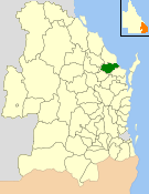
The Shire of Isis was a local government area located in the Wide Bay–Burnett region of Queensland, Australia, to the south of Bundaberg. The Shire, administered from the town of Childers covered an area of 1,702.2 square kilometres (657.2 sq mi), and existed as a local government entity from 1887 until 2008, when it was amalgamated with the City of Bundaberg and the Shires of Burnett and Kolan to form the Bundaberg Region.

The Bundaberg Region is a local government area in the Wide Bay–Burnett region of Queensland, Australia, about 360 kilometres (220 mi) north of Brisbane, the state capital. It is centred on the city of Bundaberg, and also contains a significant rural area surrounding the city. It was created in 2008 from a merger of the City of Bundaberg with the Shires of Burnett, Isis and Kolan.
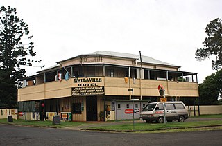
Wallaville is a rural town and locality in the Bundaberg Region, Queensland, Australia. It is 372 kilometres (231 mi) north of the state capital, Brisbane and 43 kilometres (27 mi) south west of the regional centre of Bundaberg. In the 2021 census, the locality of Wallaville had a population of 363 people.

Woodgate is a coastal locality in the Bundaberg Region, Queensland, Australia. In the 2021 census, Woodgate had a population of 1,521 people.

Cordalba is a rural town and locality in the Bundaberg Region, Queensland, Australia. In the 2021 census, the locality of Cordalba had a population of 467 people.

Apple Tree Creek is a rural town and locality in the Bundaberg Region, Queensland, Australia. It was formerly known as Bodalla, the Dundaburra people of the Northern Kabi group name from the Gregory River Plum which to first Europeans looked like an apple. Prior to settlement of the Isis District which includes Apple tree Creek, the area was called Buth'arth translating to scrub. The town was renamed as Apple Tree Creek in 1962. In the 2021 census, the locality of Apple Tree Creek had a population of 726 people.
South Kolan is a rural locality in the Bundaberg Region, Queensland, Australia. In the 2021 census, South Kolan had a population of 1,258 people.
South Bingera is a rural residential locality in the Bundaberg Region, Queensland, Australia. In the 2021 census, South Bingera had a population of 674 people.

Doolbi is a rural locality in the Bundaberg Region, Queensland, Australia. In the 2021 census, Doolbi had a population of 101 people.

Burrum Heads is a coastal town and locality in the Fraser Coast Region, Queensland, Australia. In the 2021 census, the locality of Burrum Heads had a population of 2,538 people.
Horton is a rural town and locality in the Bundaberg Region, Queensland, Australia. In the 2021 census, the locality of Horton had a population of 205 people.
Booyal is a town and a locality in the Bundaberg Region, Queensland, Australia. In the 2021 census, the locality of Booyal had a population of 285 people.
Goodwood is a rural locality in the Bundaberg Region, Queensland, Australia. In the 2021 census, Goodwood had a population of 155 people.
Bungadoo is a rural locality in the Bundaberg Region, Queensland, Australia. The area was formerly known as Albionville. In the 2021 census, Bungadoo had a population of 342 people.
Elliott is a rural locality in the Bundaberg Region, Queensland, Australia. In the 2021 census, Elliott had a population of 156 people.

Bucca is a rural locality in the Bundaberg Region, Queensland, Australia. In the 2021 census, Bucca had a population of 1,063 people.

Miara is a rural town and coastal locality in the Bundaberg Region, Queensland, Australia. In the 2021 census, the locality of Miara had a population of 28 people.
Isis River is a locality in the Bundaberg Region, Queensland, Australia. In the 2021 census, Isis River had a population of 100 people.
Redridge is a locality in the Bundaberg Region, Queensland, Australia. In the 2021 census, Redridge had a population of 711 people.

South Isis is a rural locality in the Bundaberg Region, Queensland, Australia. In the 2021 census, South Isis had a population of 381 people.
