
Rhondda Cynon Taf is a county borough in the south-east of Wales. It consists of five valleys: the Rhondda Fawr, Rhondda Fach, Cynon, Taff and Ely valleys, plus several towns and villages away from the valleys.

Porth is a town and a community in the county borough of Rhondda Cynon Taf, within the historic county boundaries of Glamorgan, Wales. Lying in the Rhondda Valley, it is regarded as the gateway connecting the Rhondda Fawr and Rhondda Fach valleys due to both valleys meeting at Porth. The Welsh word "porth" means "gate". Porth is a predominantly English-speaking community.
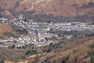
Treorchy is a town and community in Wales. Once a mining town, it retains such characteristics. Situated in the county borough of Rhondda Cynon Taf in the Rhondda Fawr valley. Treorchy is also one of the 16 communities of the Rhondda. It includes the villages of Cwmparc and Ynyswen.

Tonypandy is a town, community and electoral ward located in the county borough of Rhondda Cynon Taf, within the historic county boundaries of Glamorgan, Wales, lying in the Rhondda Fawr Valley. A former industrial coal mining town, the town was the scene of the 1910 Tonypandy riots.
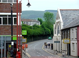
Llwynypia is a village and community in Rhondda Cynon Taf, Wales, near Tonypandy in the Rhondda Fawr Valley. Before 1850 a lightly populated rural farming area, Llwynypia experienced a population boom between 1860 and 1920 with the sinking of several coal mines after the discovery of large coal deposits throughout the Rhondda Valleys.
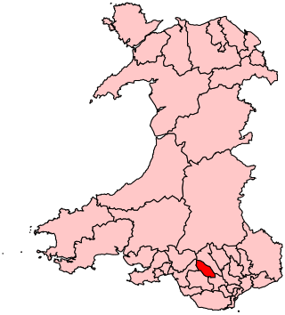
Rhondda, or the Rhondda Valley, is a former coalmining area in South Wales, historically in the county of Glamorgan. It takes its name from the River Rhondda, and embraces two valleys – the larger Rhondda Fawr valley and the smaller Rhondda Fach valley – so that the singular "Rhondda Valley" and the plural are both commonly used. The area forms part of the South Wales Valleys. From 1897 until 1996 there was a local government district of Rhondda. The former district at its abolition comprised 16 communities. Since 1996 these 16 communities of the Rhondda have been part of Rhondda Cynon Taf County Borough. The area of the former district is still used as the Rhondda Senedd constituency and Westminster constituency, having an estimated population in 2020 of 69,506. It is most noted for its historical coalmining industry, which peaked between 1840 and 1925. The valleys produced a strong Nonconformist movement manifest in the Baptist chapels that moulded Rhondda values in the 19th and early 20th centuries. It is also known for its male voice choirs and in sport and politics.

Cwmdare is a village very close to Aberdare, in Rhondda Cynon Taf, Wales. The village's history is intertwined with coal-mining, and since the decline of the industry in the 1980s, it has become primarily a commuter base for the larger surrounding towns of Aberdare and Merthyr Tydfil and Pontypridd, as well as the cities of Cardiff and Swansea.
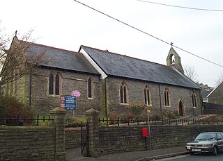
Penrhiwceiber is a small Welsh village and community in the county borough of Rhondda Cynon Taf that lies south of the town Aberpennar and north of the village of Tyntetown, and is one of many villages that lies within the Cynon Valley. Prior to 1870 the area was heavy woodland, but the opening of the Penrhiwceiber Colliery in 1878 saw its rapid expansion into a thriving village.

Treherbert is a village and community situated at the head of the Rhondda Fawr valley in the county borough of Rhondda Cynon Taf, Wales. Historically part of Glamorgan. Treherbert is the upper most community of the Rhondda Fawr and encompasses the districts of Blaencwm, Blaenrhondda, Tynewydd and Pen-yr-englyn.
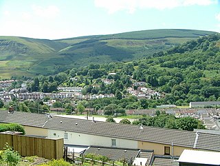
Ton Pentre is a village in the Rhondda Valley in the county borough of Rhondda Cynon Taf, Wales. Historically part of Glamorgan, Ton Pentre, a former industrial coal mining village, is a district of the community of Pentre. The old district of Ystradyfodwg was named after the church at Ton Pentre. Ton Pentre is, perhaps, best known for an event in 1924, when the Duke of York played a round of golf with Trade Unionist Frank Hodges.

Dinas is a village near Tonypandy in the county borough of Rhondda Cynon Taf, Wales. Dinas is often referred to as Dinas Rhondda to avoid confusion with Dinas Powys in the Vale of Glamorgan. The word dinas in Modern Welsh means "city", but here it means "hill fort".
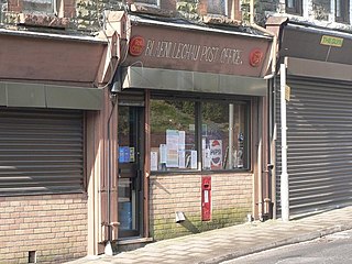
Blaenllechau is a small village located in the Rhondda Fach valley, Rhondda Cynon Taf, Wales. Neighbouring villages are Ferndale, Maerdy and Tylorstown. The population of Blaenllechau is less than 1000. The village is defined by the river border, flowing between Blaenllechau and neighbouring Ferndale, of which the well-known Blaenllechau waterfall is a tributary.
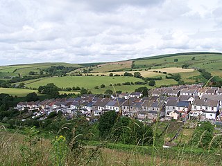
Gilfach Goch is a community, electoral ward and small former coal mining village mostly in the Borough of Rhondda Cynon Taf, south Wales, near the larger community of Tonyrefail. Some areas in the North Western part of the village lie within Bridgend County Borough. It is situated in the Cwm Ogwr Fach between the Cwm Ogwr Fawr to the west and the Cwm Rhondda to the east.

Pontygwaith is a small village located in the Rhondda Fach valley in the county borough of Rhondda Cynon Taf, Wales, in the community of Tylorstown.

Penygraig is a village and community in the Rhondda Valley in the county borough of Rhondda Cynon Taf, Wales. As a community Penygraig contains the neighbouring districts of Dinas, Edmondstown, Penrhiwfer and Williamstown. Penygraig is within the historic county boundaries of Glamorgan. The name Penygraig is Welsh for 'head of the rock'.
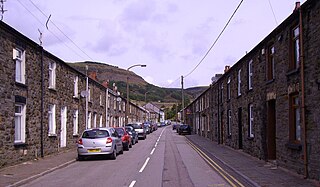
Blaenrhondda is a village in the county borough of Rhondda Cynon Taf, Wales, lying at the head the Rhondda Fawr valley. Blaenrhondda is a village and is part of the community of Treherbert.
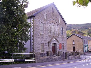
Gelli is a village in the Rhondda Fawr valley, in the county borough of Rhondda Cynon Taff, Wales, situated on the southern bank of the Rhondda Fawr River. Gelli is a former coal mining village which is a district of the community of Ystrad.

Wattstown is a village located in the Rhondda Valley in the county borough of Rhondda Cynon Taf, Wales. Located in the Rhondda Fach valley it is a district of the community of Ynyshir. Prior to mid 19th century industrialisation the area was once little more than a wooded area, sparsely populated by farmsteads. With the coming of the coal industry Wattstown became a busy, densely populated village, but with the closure of the collieries Wattstown suffered an economic downturn that still affects the village today.
Tynewydd is a village located in the County Borough of Rhondda Cynon Taf, south Wales. With Treherbert, Blaencwm, Blaenrhondda and Pen-yr-englyn it is part of a community of Treherbert. The village lies in the former industrial coal mining area at the head of Rhondda Fawr, the larger of the Rhondda Valleys.
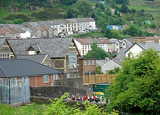
Cwm Clydach is a community and electoral ward to the northwest of Tonypandy in Rhondda Cynon Taf, Wales. The community and ward covers the valley of the Nant Clydach, which includes the cojoined villages of Clydach Vale and Blaenclydach.


