
Malappuram, is one of the 14 districts in the Indian state of Kerala, with a coastline of 70 km (43 mi). The most populous district of Kerala, Malappuram is home to around 13% of the total population of the state. The district was formed on 16 June 1969, spanning an area of about 3,554 km2 (1,372 sq mi). It is the third-largest district of Kerala by area. It is bounded by Western Ghats and the Arabian Sea on either side. The district is divided into seven Taluks: Eranad, Kondotty, Nilambur, Perinthalmanna, Ponnani, Tirur, and Tirurangadi.

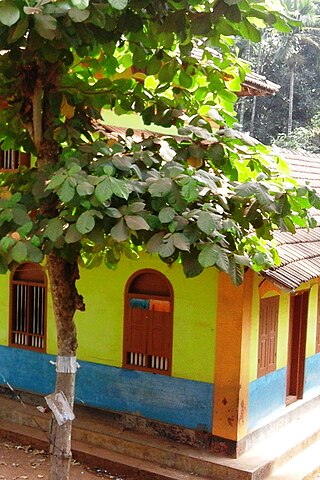
Nilambur is a major town, a municipality and a Taluk in the Malappuram district of the Indian state of Kerala. It is located close to the Nilgiris range of the Western Ghats on the banks of the Chaliyar River. This place is also known as 'Teak Town' because of the abundance of Nilambur teaks, which is a variety of a large, deciduous tree that occurs in mixed hardwood forests. Unlike many Municipalities of India; Nilambur is covered with large amounts of vegetation, making it very scenic.

Kondotty is a developing town, municipality, and aerotropolis in the Malappuram district state of Kerala, India which is located near Calicut International Airport, 24 km from Malappuram. It is the headquarters of Kondotty Taluk, which was declared as the seventh taluk in Malappuram district by chief minister Oommen Chandy on 23 December 2013, Real Malabar FC Kondotty is professional football club from Kondotty and FC Kondotty one and only All India Sevens Football club from Kondotty

Edakkara is a town located in Malappuram district of the Indian state of Kerala. It is an emerging commercial hub, and one of the busiest towns in Nilambur Taluk.

Vaniyambalam lies in Nilambur taluk in the Malappuram district, Kerala and is 40 km north-east of Malappuram. Surrounding towns include Pandikkad and Tuvvur, Kalikavu, and Wandoor and Nilambur.

Karuvarakundu is a semi-urban area in the eastern part of Malappuram district, Kerala, India. It is situated 32 kilometres (20 mi) east of Manjeri, 26 kilometres (16 mi) northeast of Perinthalmanna and 30 km southeast of Nilambur. The Olippuzha River, a tributary of the Kadalundipuzha, flows through the town. Karuvarakundu is close to the Western Ghats and hence prone to landslides.
Kizhuparamba or Keezhuparamba is a village and Panchayath on the northern boundary of Malappuram District In Kerala State of India.
Omanoor is a village in the Malappuram district, Kerala, India. The village is in Cheekode Panchayath. There have LP, UP, HSS in this village, and most of the people are daily workers. Omanoor has many historical mythologies.

Athavanad is a village and Gram Panchayath in the Tirur Taluk, in the Malappuram District of the state of Kerala, India. The town lies on the National Highway 17, between Puthanathani and Valanchery. Puthanathani is the main town of the Athavanad village and the village office is located in Athavanad Para & Kurumbathoor. Nearby towns include Valanchery, Tavanur, Tirunavaya, Kuttippuram, Irimbiliyam, and Edayur.
Kavanoor is a Town near Areekode in Malappuram district in the Indian state of Kerala.
Morayur or Morayoor is a tiny town near Malappuram Located on Palakkad-Kozhikoad Highway. It is one of the villages in Malappuram district of state of Kerala.

Pulpatta or Pulpetta is a village in Eranad Taluk, Malappuram district in the state of Kerala, India. It is located 7 km away from Manjeri.

Vazhayur is a census town in Malappuram in the state of Kerala, India. The Vazhayur Census Town has population of 36,909 of which 18,163 are males while 18,746 are females as per report released by Census India 2011. The 2018 Malayalam film Sudani from Nigeria was shot in Vazhayur. The town forms a portion of the Malappuram metropolitan area.
Eranad also known as Ernad refers to the erstwhile province in the midland area of Malabar, consisting of Malappuram and nearby regions such as Anakkayam, Manjeri, Kondotty, Nilambur, etc. Currently Eranad Taluk is a Taluk in Malappuram district. Eranad was ruled by a Samanthan Nair clan known as Eradis, similar to the Vellodis of neighbouring Valluvanad and Nedungadis of Nedunganad. The rulers of Eranad were known by the title Eralppad/Eradi. They also used the title Thirumulpad.
Cherukavu is a census town in Malappuram district in the state of Kerala, India.

Perinthalmanna is a major town and municipality in Malappuram district, Kerala, India. It serves as the administrative centre for the Perinthalmanna taluk, as well as a revenue division, a community development block, and a police sub-division bearing the same name. It was formerly the headquarters of Valluvanad Taluk, which was one of the two Taluks in the Malappuram Revenue Division of the erstwhile Malabar District during the British Raj. The city is located 23 kilometres (14 mi) southwest of the city of Malappuram at the centre of the Kozhikode–Malappuram–Perinthalmanna–Palakkad National Highway 966.
Anchachavadi is a village beside Madumala in Kalikavu Panchayat, Nilambur taluk in Malappuram district in the state of Kerala. There is a school named GHS Anchachavadi
Konikkallu is a village in Anakkayam Panchayat, Eranad Taluk, Malappuram district, Kerala state, India.

Eranad Taluk comes under Perinthalmanna revenue division in Malappuram district of Kerala, India. Its headquarters is the city of Manjeri. Eranad Taluk contains two municipalities - Manjeri and Malappuram. Most of the administrative offices are located in the Civil Station at Malappuram and the Mini-Civil Station at Manjeri.


