Atlas of Australia

|
Wikimedia Commons Atlas of the World The Wikimedia Atlas of the World is an organized and commented collection of geographical, political and historical maps available at Wikimedia Commons. Discussion • Update the atlas • Index of the Atlas • Atlas in categories • Other atlases on line |
|
| ||||||||||||||||||||||||||||||||||||||
General maps

|
Location of Australia |

|
Map of Australia |

|
Topography of Australia |
Maps of divisions
This section holds maps of the administrative divisions.

|
Map of Australian states and territories |
-
Australia
-
Australian Capital Territory
-
New South Wales
-
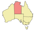
Northern Territory
-
Queensland
-
South Australia
-
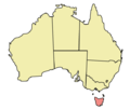
Tasmania
-
Victoria
-
Western Australia
-
Australian Capital Territory
-
New South Wales
-
Northern Territory
-
Queensland
-
South Australia
-
Tasmania
-
Victoria
-
Western Australia
History maps
This section holds a short summary of the history of the area of present-day Australia, illustrated with maps, including historical maps of former countries and empires that included present-day Australia.

|
Australia discoveries by Europeans before 1813 |

|
Census of 1921 |
Old maps
This section holds copies of original general maps more than 70 years old.

|
First map of Australia (Jave la Grande) from Nicholas Vallard's atlas, 1547 |

|
Le pôle antarctique, by Jacques de Vauxx, Premières Œuvres (traité d'hydrographie), 1583 |

|
Hollandia Nova, 1659 map prepared by Joan Blaeu based on voyages by Abel Tasman and Willem Jansz, this image shows a French edition of 1663 |

|
A map of the East Indies, from William Dampier's New Voyage Round the World, published 1697 |

|
New Holland Map by William Dampier, 1699 |

|
Map of Sydney from 1789 |

|
Pre 1904 map of Australia |

|
Historical map of Australia, Bibliothek allgemeinen und praktischen Wissens für Militäranwärter, 1905 |

|
Map of Australia from The New Student's Reference Work, 1914 |
| *Major vegetation groups in Australia as identified by the National Land and Water Resources |
Geological and similar maps
| Basic geological regions of Australia, by age. |
| oil & gas map |
| Seismicity map |
Other maps
| Distribution of boomerangs in Australia |
Satellite maps
| Satellite photo of Australia |
Indigenous population by state
Queensland
-
Geographical distribution of the Queensland population self-identified as having Indigenous status (Aboriginal, Torres Strait Islanders or both) by Indigenous Locations (ILOC), according to the 2016 census
-
Geographical distribution of the Queensland population self-identified as having Indigenous status (Aboriginal, Torres Strait Islanders or both) by Local Government Areas (LGA), according to the 2016 census
-
Geographical distribution of the Queensland population self-identified as having Indigenous status (Aboriginal, Torres Strait Islanders or both) by State Suburbs (SSC), according to the 2016 census (uninhabited mesh blocks (MB) excluded)
-
Geographical distribution of the population self-identified as having Indigenous status (Aboriginal only) by Indigenous Locations (ILOC), according to the 2016 census
-
Geographical distribution of the Queensland population self-identified as having Indigenous status (Torres Strait Islanders only) by Indigenous Locations (ILOC), according to the 2016 census
-
Geographical distribution of the population self-identified as having both Aboriginal and Torres Strait Islander Indigenous status by Indigenous Locations (ILOC), according to the 2016 census
-
The prevalent 1st response about ancestry of the Queensland people self-identified as having Indigenous status (Aboriginal, Torres Strait Islanders or both) in Statistical Areas 1 (SA1) with more then 5% of Indigenous population
-
The languages most often spoken at home by people self-identified as having Indigenous status (Aboriginal, Torres Strait Islanders or both) in Statistical Areas 1 (SA1) with more then 5% of Indigenous population
-
Geographical distribution of the population self-identified as having Indigenous status (Aboriginal, Torres Strait Islanders or both) and spoken at home on one of Indigenous Australian languages by Statistical Areas 1 (SA1)
-
The prevalent religious affiliation of the people self-identified as having Indigenous status (Aboriginal, Torres Strait Islanders or both) in Statistical Areas 1 (SA1) with more then 5% of self-identified Indigenous population
Notes and references
|
General remarks:
|


