
Bordon is a town in the East Hampshire district of Hampshire, England. It lies in the interior of the royal Woolmer Forest, about 5 miles (8.0 km) southeast of Alton. The town forms a part of the civil parish of Whitehill which is one of two contiguous villages, the other being Lindford. The civil parish is on the A325, and near the A3 road between London and Portsmouth, from which it is buffered by the rise of the wooded Woolmer Ranges. Bordon is twinned with Condé-sur-Vire in Normandy, France.

Symonds Green is a neighbourhood within the English new town of Stevenage in Hertfordshire. Although predominantly a residential area with a mixture of public-sector, charitable and private housing dating mostly from the 1970s, the open common land forming the actual Green is of historical significance to the area.

The Longmoor Military Railway (LMR) was a British military railway in Hampshire that was built by the Royal Engineers from 1903 to train soldiers on railway construction and operations. The railway ceased operation on 31 October 1969.
Greatham is a village and civil parish in the East Hampshire district of Hampshire, England. It is 1.9 miles (3.1 km) north of Liss, just off the A3 road.

Bordon Camp was a British Army camp close to the settlement of Bordon in Hampshire, England. The camp, which was latterly maintained by the Defence Infrastructure Organisation, opened in 1863 and closed in 2015.
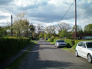
Sleaford in Hampshire, England is a hamlet of Headley Civil Parish and the Northanger Ecclesiastical Benefice. It is in the civil parish of Whitehill
The Bordon Light Railway was a short-lived light railway line in Hampshire that connected the Army Camp at Bordon, as well as the villages of Bordon and Kingsley, with the national rail network at Bentley on the main Farnham-Alton line, a distance of 4.5 miles (7.2 km).

Oakhanger is a village in the East Hampshire district of Hampshire, England. Its nearest town is Bordon, 1.7 miles (2.7 km) eastward on the B3004 road. It is part of the parish of Selborne, which covers an area of 7,915 acres (3,203 ha). The nearest railway station is Alton, 3.8 miles (6.1 km) to the northwest; the village had its own Oakhanger Halt railway station on the Longmoor Military Railway until its closure.

Bordon is a former railway station on the Bordon Light Railway which served the town of Bordon, Hampshire, England and its nearby army camp.
Headley Down is a village within the civil parish of Headley in the East Hampshire district of Hampshire, England, bounded on two sides by Ludshott Common, a National Trust heathland reserve. The village began with a few buildings in the 1870s and became a thriving community that in the 20th century outgrew the parish centre of Headley.
Whitehill is a village and civil parish in the East Hampshire district of Hampshire, England, on the historic route between Petersfield and Farnham. It is 0.7 miles (1.1 km) south of Bordon and covers an area of approximately 8 square miles.

Woolmer Forest is a 1,298.5-hectare (3,209-acre) biological Site of Special Scientific Interest south of Bordon in Hampshire and West Sussex. It is also a Special Area of Conservation and part of the Wealden Heaths Phase II Special Protection Area. Two areas are Nature Conservation Review sites, Grade I.
The Chichester to Silchester Way is a Roman Road between Chichester in South-East England, which as Noviomagus was capital of the Regni, and Silchester or Calleva Atrebatum, capital of the Atrebates. The road had been entirely lost and forgotten, leaving no Saxon place names as clues to its existence, until its chance discovery through aerial photography in 1949. Only 6 kilometres (3.7 mi) of the 62 kilometres (39 mi) long road remain in use.

The Cut is a river in England that rises in North Ascot, Berkshire. It flows for around 14 miles (23 km), through the rural Northern Parishes of Winkfield, Warfield and Binfield in Bracknell Forest on its way down to Bray, where it meets the River Thames just above Queens Eyot on the reach below Bray Lock, having been joined by the Maidenhead Waterways.

Bucks Horn Oak is a small village in the East Hampshire district of Hampshire, England and is the main community within Alice Holt Forest. A small eastern part consists of buildings facing its main road and of the main management and tourist sites of the surrounding public forest, postally part of the place. In the Church of England the community and all land as far as Bentley railway station (Hampshire) is in a parish mainly in Surrey, a larger community on the north-east of the forest, Rowledge. In the secular, civil parishes in England, it is in the parish of Binsted, equating to the third tier of local government, namely Binsted Civil Parish Council.
Hogmoor Inclosure is a large area of wooded heath situated 0.5 miles (0.80 km) west from the town of Bordon and within the civil parish of Whitehill in the East Hampshire district of Hampshire, England. The inclosure is used for army training with various tank crossings scattered around the area. The area is historically notable for its connection with the British Army with large barracks surrounding the area.
Oakhanger Halt is a former railway station, on the Longmoor Military Railway which served Bordon Camp, the station was closer to the camp than Bordon on the Bordon Light Railway. The station is likely to have opened with the line in 1905 but the first documented evidence showing it open is on 14 August 1914 when it was used the Officer Commanding Railway Troops to say goodbye to the first mobilised Railway Company departing for France.

Longmoor Downs railway station is a former railway station, on the Longmoor Military Railway serving Longmoor Military Camp. The station was the Southern terminus of the original standard gauge railway opened in stages between 1907 and 1908.

Longmoor Camp is a British Army camp close to the A3 and A325 roads in and around the settlements of Longmoor, Liss and Liphook in Hampshire, England. The main street of the Longmoor part of the camp is built on an ancient Roman road, the Chichester to Silchester Way, while the village of Greatham lies to the west. The combined camp and training area coveres 1,783 hectares of wooded areas, heath, wetlands and hard standings. Longmoor Camp and the training areas are still active, and maintained by the Defence Infrastructure Organisation.
Pinewood or Pinewood Village is an area in Bordon, in the English county of Hampshire. Located in the north of the town, administratively it is in the parish of Whitehill, and the Whitehill Pinewood ward of East Hampshire district. Development of the area started in 1987 on the site of former married quarters at Bordon Camp that from 1970 had been leased for use as council housing and later purchased by the district council. The nearest railway station is Liphook, 4.4 miles (6.5 km) southeast of the village.
