Wind chill

Last updated
Wind chill index values for a range of temperatures and wind speeds, from the standard wind chill formula for Environment Canada. Table of Wind Chill Index Values.png
Wind chill index values for a range of temperatures and wind speeds, from the standard wind chill formula for Environment Canada.

Wind chill (popularly wind chill factor) is the sensation of cold produced by the wind for a given ambient air temperature on exposed skin as the air motion accelerates the rate of heat transfer from the body to the surrounding atmosphere. Its values are always lower than the air temperature in the range where the formula is valid. When the apparent temperature is higher than the air temperature, the heat index is used instead.

Contents

Explanation

A surface loses heat through conduction, evaporation, convection, and radiation. [1] The rate of convection depends on both the difference in temperature between the surface and the fluid surrounding it and the velocity of that fluid with respect to the surface. As convection[ clarification needed ] from a warm surface heats the air around it, an insulating boundary layer of warm air forms against the surface. Moving air disrupts this boundary layer, or epiclimate, carrying the warm air away, thereby allowing cooler air to replace the warm air against the surface and increasing the temperature difference in the boundary layer. The faster the wind speed, the more readily the surface cools.[ citation needed ] Contrary to popular belief, wind chill does not refer to how cold things get, and they will only get as cold as the air temperature. This means radiators and pipes cannot freeze when wind chill is below freezing and the air temperature is above freezing. [2]

Alternative approaches

Many formulas exist for wind chill because, unlike temperature, wind chill has no universally agreed-upon standard definition or measurement. All the formulas attempt to qualitatively predict the effect of wind on the temperature humans perceive. Weather services in different countries use standards unique to their country or region; for example, the U.S. and Canadian weather services use a model accepted by the National Weather Service. That model has evolved over time.

The first wind chill formulas and tables were developed by Paul Allman Siple and Charles F. Passel working in the Antarctic before the Second World War, [3] and were made available by the National Weather Service by the 1970s. [3] They were based on the cooling rate of a small plastic bottle as its contents turned to ice while suspended in the wind on the expedition hut roof, at the same level as the anemometer. [3] The so-called Windchill Index provided a pretty good indication of the severity of the weather. [3]

In the 1960s, wind chill began to be reported as a wind chill equivalent temperature (WCET), which is theoretically less useful. The author of this change is unknown, but it was not Siple or Passel as is generally believed.[ citation needed ] At first, it was defined as the temperature at which the windchill index would be the same in the complete absence of wind. This led to equivalent temperatures that exaggerated the severity of the weather. Charles Eagan [4] realized that people are rarely still and that even when it is calm, there is some air movement. He redefined the absence of wind to be an air speed of 1.8 metres per second (6.5 km/h; 4.0 mph), which was about as low a wind speed as a cup anemometer could measure. This led to more realistic (warmer-sounding) values of equivalent temperature.

Original model

Equivalent temperature was not universally used in North America until the 21st century. Until the 1970s, the coldest parts of Canada reported the original Wind Chill Index, a three- or four-digit number with units of kilocalories/hour per square metre. Each individual calibrated the scale of numbers personally, through experience. The chart also provided general guidance to comfort and hazard through threshold values of the index, such as 1400, which was the threshold for frostbite.

The original formula for the index was: [5] [6]

where:

North American and United Kingdom wind chill index

In November 2001, Canada, the United States, and the United Kingdom implemented a new wind chill index developed by scientists and medical experts on the Joint Action Group for Temperature Indices (JAG/TI). [7] [8] [9] It is determined by iterating a model of skin temperature under various wind speeds and temperatures using standard engineering correlations of wind speed and heat transfer rate. Heat transfer was calculated for a bare face in wind, facing the wind, while walking into it at 1.4 m/s (5.0 km/h; 3.1 mph). The model corrects the officially measured wind speed to the wind speed at face height, assuming the person is in an open field. [10] The results of this model may be approximated, to within one degree, from the following formulas.

The standard wind chill formula for Environment Canada is: [3]

where Twc is the wind chill index, based on the Celsius temperature scale; Ta is the air temperature in degrees Celsius; and v is the wind speed at 10 m (33 ft) standard anemometer height, in kilometres per hour. [11]

When the temperature is −20 °C (−4 °F) and the wind speed is 5 km/h (3 mph), the wind chill index is −24. If the temperature remains at −20 °C and the wind speed increases to 30 km/h (19 mph), the wind chill index falls to −33.

The equivalent formula in US customary units is: [12] [3]

where Twc is the wind chill index, based on the Fahrenheit scale; Ta is the air temperature in degrees Fahrenheit; and v is the wind speed in miles per hour. [13]

Windchill temperature is defined only for temperatures at or below 10 °C (50 °F) and wind speeds above 4.8 km/h (3.0 mph). [12]

As the air temperature falls, the chilling effect of any wind that is present increases. For example, a 16 km/h (10 mph) wind will lower the apparent temperature by a wider margin at an air temperature of −20 °C (−4 °F) than a wind of the same speed would if the air temperature were −10 °C (14 °F).

The 2001 WCET is a steady-state calculation (except for the time-to-frostbite estimates). [14] There are significant time-dependent aspects to wind chill because cooling is most rapid at the start of any exposure, when the skin is still warm.

Australian apparent temperature

The apparent temperature (AT), invented in the late 1970s, was designed to measure thermal sensation in indoor conditions. It was extended in the early 1980s to include the effect of sun and wind. The AT index used here is based on a mathematical model of an adult, walking outdoors, in the shade (Steadman 1994). The AT is defined as the temperature, at the reference humidity level, producing the same amount of discomfort as that experienced under the current ambient temperature and humidity. [15]

The formula [16] is:

where:

The vapour pressure can be calculated from the temperature and relative humidity using the equation:

where:

The Australian formula includes the important factor of humidity and is somewhat more involved than the simpler North American model. The North American formula was designed to be applied at low temperatures (as low as −46 °C or −50 °F) when humidity levels are also low. The hot-weather version of the AT (1984) is used by the National Weather Service in the United States. In the United States, this simple version of the AT is known as the heat index.

Related Research Articles

<span class="mw-page-title-main">Anemometer</span> Instrument for measuring wind speed

In meteorology, an anemometer is a device that measures wind speed and direction. It is a common instrument used in weather stations. The earliest known description of an anemometer was by Italian architect and author Leon Battista Alberti (1404–1472) in 1450.

<span class="mw-page-title-main">Humidity</span> Concentration of water vapour in the air

Humidity is the concentration of water vapor present in the air. Water vapor, the gaseous state of water, is generally invisible to the human eye. Humidity indicates the likelihood for precipitation, dew, or fog to be present.
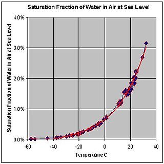
<span class="mw-page-title-main">Dew point</span> Temperature at which air becomes saturated with water vapour during a cooling process

The dew point of a given body of air is the temperature to which it must be cooled to become saturated with water vapor. This temperature depends on the pressure and water content of the air. When the air is cooled below the dew point, its moisture capacity is reduced and airborne water vapor will condense to form liquid water known as dew. When this occurs through the air's contact with a colder surface, dew will form on that surface.

The Prandtl number (Pr) or Prandtl group is a dimensionless number, named after the German physicist Ludwig Prandtl, defined as the ratio of momentum diffusivity to thermal diffusivity. The Prandtl number is given as:

<span class="mw-page-title-main">Speed of sound</span> Speed of sound wave through elastic medium

The speed of sound is the distance travelled per unit of time by a sound wave as it propagates through an elastic medium. More simply, the speed of sound is how fast vibrations travel. At 20 °C (68 °F), the speed of sound in air is about 343 m/s, or 1 km in 2.91 s or one mile in 4.69 s. It depends strongly on temperature as well as the medium through which a sound wave is propagating. At 0 °C (32 °F), the speed of sound in air is about 331 m/s.

<span class="mw-page-title-main">Heat index</span> Temperature index that accounts for the effects of humidity

The heat index (HI) is an index that combines air temperature and relative humidity, in shaded areas, to posit a human-perceived equivalent temperature, as how hot it would feel if the humidity were some other value in the shade. For example, when the temperature is 32 °C (90 °F) with 70% relative humidity, the heat index is 41 °C (106 °F). The heat index is meant to describe experienced temperatures in the shade, but it does not take into account heating from direct sunlight, physical activity or cooling from wind.

<span class="mw-page-title-main">Lapse rate</span> Vertical rate of change of temperature in atmosphere

The lapse rate is the rate at which an atmospheric variable, normally temperature in Earth's atmosphere, falls with altitude. Lapse rate arises from the word lapse. In dry air, the adiabatic lapse rate is 9.8 °C/km. The saturated adiabatic lapse rate (SALR), or moist adiabatic lapse rate (MALR), is the decrease in temperature of a parcel of water-saturated air that rises in the atmosphere. It varies with the temperature and pressure of the parcel and is often in the range 3.6 to 9.2 °C/km, as obtained from the International Civil Aviation Organization (ICAO). The environmental lapse rate is the decrease in temperature of air with altitude for a specific time and place. It can be highly variable between circumstances.

<span class="mw-page-title-main">Humidex</span> Index number to describe the feeling of heat in Canada

The humidex is an index number used by Canadian meteorologists to describe how hot the weather feels to the average person, by combining the effect of heat and humidity. The term humidex was coined in 1965. The humidex is a nominally dimensionless quantity based on the dew point.

Equivalent potential temperature, commonly referred to as theta-e, is a quantity that is conserved during changes to an air parcel's pressure, even if water vapor condenses during that pressure change. It is therefore more conserved than the ordinary potential temperature, which remains constant only for unsaturated vertical motions.

<span class="mw-page-title-main">Wet-bulb globe temperature</span> Apparent temperature estimating how humans are affected

The wet-bulb globe temperature (WBGT) is a measure of environmental heat as it affects humans. Unlike a simple temperature measurement, WBGT accounts for all four major environmental heat factors: air temperature, humidity, radiant heat, and air movement. It is used by industrial hygienists, athletes, sporting events and the military to determine appropriate exposure levels to high temperatures.

This is a list of meteorology topics. The terms relate to meteorology, the interdisciplinary scientific study of the atmosphere that focuses on weather processes and forecasting.

<span class="mw-page-title-main">Wet-bulb temperature</span> Temperature read by a thermometer covered in water-soaked cloth

The wet-bulb temperature (WBT) is a temperature, a physical quantity, which can be measured by a thermometer covered in cloth which has been soaked in water at ambient temperature and over which air is passed. At 100% relative humidity, the wet-bulb temperature is equal to the air temperature ; at lower humidity the wet-bulb temperature is lower than dry-bulb temperature because of evaporative cooling.

Atmospheric thermodynamics is the study of heat-to-work transformations that take place in the Earth's atmosphere and manifest as weather or climate. Atmospheric thermodynamics use the laws of classical thermodynamics, to describe and explain such phenomena as the properties of moist air, the formation of clouds, atmospheric convection, boundary layer meteorology, and vertical instabilities in the atmosphere. Atmospheric thermodynamic diagrams are used as tools in the forecasting of storm development. Atmospheric thermodynamics forms a basis for cloud microphysics and convection parameterizations used in numerical weather models and is used in many climate considerations, including convective-equilibrium climate models.

<span class="mw-page-title-main">Apparent temperature</span> Temperature as perceived by humans

Apparent temperature, also known as "feels like", is the temperature equivalent perceived by humans, caused by the combined effects of air temperature, relative humidity and wind speed. The measure is most commonly applied to the perceived outdoor temperature. Apparent temperature was invented by Robert G. Steadman who published a paper about it in 1984. It also applies, however, to indoor temperatures, especially saunas, and when houses and workplaces are not sufficiently heated or cooled.

Delhi features a monsoon influenced humid subtropical climate bordering a hot semi-arid climate, with high variation between summer and winter temperatures and precipitation. Delhi's version of a humid subtropical climate is markedly different from many other humid subtropical cities such as São Paulo, Houston, and Brisbane in that the city features dust storms and wildfire haze due to its semi-arid climate.

<span class="mw-page-title-main">Meteorological instrumentation</span> Measuring device used in meteorology

Meteorological instruments, including meteorological sensors, are the equipment used to find the state of the atmosphere at a given time. Each science has its own unique sets of laboratory equipment. Meteorology, however, is a science which does not use much laboratory equipment but relies more on on-site observation and remote sensing equipment. In science, an observation, or observable, is an abstract idea that can be measured and for which data can be taken. Rain was one of the first quantities to be measured historically. Two other accurately measured weather-related variables are wind and humidity. Many attempts had been made prior to the 15th century to construct adequate equipment to measure atmospheric variables.

<span class="mw-page-title-main">Outline of meteorology</span> Overview of and topical guide to meteorology

The following outline is provided as an overview of and topical guide to the field of Meteorology.
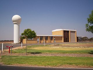
<span class="mw-page-title-main">Surface weather observation</span> Fundamental data used for weather forecasts

Surface weather observations are the fundamental data used for safety as well as climatological reasons to forecast weather and issue warnings worldwide. They can be taken manually, by a weather observer, by computer through the use of automated weather stations, or in a hybrid scheme using weather observers to augment the otherwise automated weather station. The ICAO defines the International Standard Atmosphere (ISA), which is the model of the standard variation of pressure, temperature, density, and viscosity with altitude in the Earth's atmosphere, and is used to reduce a station pressure to sea level pressure. Airport observations can be transmitted worldwide through the use of the METAR observing code. Personal weather stations taking automated observations can transmit their data to the United States mesonet through the Citizen Weather Observer Program (CWOP), the UK Met Office through their Weather Observations Website (WOW), or internationally through the Weather Underground Internet site. A thirty-year average of a location's weather observations is traditionally used to determine the station's climate. In the US a network of Cooperative Observers make a daily record of summary weather and sometimes water level information.

The maximum potential intensity of a tropical cyclone is the theoretical limit of the strength of a tropical cyclone.

<span class="mw-page-title-main">Glossary of meteorology</span> List of definitions of terms and concepts commonly used in meteorology

This glossary of meteorology is a list of terms and concepts relevant to meteorology and atmospheric science, their sub-disciplines, and related fields.

References

  1. Vincent J. Schaefer; John A. Day; Jay Pasachoff (1998). A Field Guide to the Atmosphere. Houghton Mifflin Harcourt. ISBN   0-395-97631-6.
  2. "Windchill Terms and Definitions". National Oceanic and Atmospheric Administration . Archived from the original on September 17, 2008. Retrieved July 3, 2024.
  3. 1 2 3 4 5 6 Kozlowski, Rosann (30 March 2020). "How to Calculate a Wind Chill Factor". sciencing.com. Retrieved 5 October 2021.
  4. Eagan, C. (1964). Review of research on military problems in cold regions. C. Kolb and F. Holstrom eds. TDR-64-28. Arctic Aeromed. Lab. p 147–156.
    • Woodson, Wesley E. (1981). Human Factors Design Handbook, page 815. McGraw-Hill. ISBN   0-07-071765-6
  5. Aquation 55, page 6-113
  6. "Environment Canada - Weather and Meteorology - Canada's Wind Chill Index". Ec.gc.ca. Retrieved 2013-08-09.
  7. "Meteorological Tables, Wind Chill. August, 2001 Press Release". National Weather Service. Retrieved 14 January 2013.
  8. "Wind Chill". BBC Weather, Understanding weather. BBC. Archived from the original on 11 October 2010.
  9. Osczevski, Randall; Bluestein, Maurice (2005). "The new wind chill equivalent temperature chart". Bulletin of the American Meteorological Society. 86 (10): 1453–1458. Bibcode:2005BAMS...86.1453O. doi: 10.1175/BAMS-86-10-1453 .
  10. "Calculation of the 1971 to 2000 Climate Normals for Canada". Climate.weatheroffice.gc.ca. 2013-07-10. Archived from the original on 2013-06-27. Retrieved 2013-08-09.
  11. 1 2 "NWS Wind Chill Index". Weather.gov. 2009-12-17. Archived from the original on 2011-09-18. Retrieved 2013-08-09.
  12. "A chart of windchills based on this formula". Weather.gov. 2009-12-17. Retrieved 2017-04-13.
  13. Tikuisis, Peter; Osczevski, Randall J. (2003). "Facial Cooling During Cold Air Exposure". Bulletin of the American Meteorological Society. 84 (7): 927–933. Bibcode:2003BAMS...84..927T. doi:10.1175/BAMS-84-7-927 (inactive 1 November 2024).{{cite journal}}: CS1 maint: DOI inactive as of November 2024 (link)
  14. "The Apparent Temperature (AT) - Heat Index". Bureau Of Meteorology, Australia. Bom.gov.au. 2010-02-05. Retrieved 2018-08-01.
  15. "The formula for the apparent temperature". Bureau Of Meteorology, Australia. Bom.gov.au. 2010-02-05. Retrieved 2013-08-09.