Roman Britain was the territory that became the Roman province of Britannia after the Roman conquest of Britain, consisting of a large part of the island of Great Britain. The occupation lasted from AD 43 to AD 410.
In ancient Roman religion, Stata Mater was a compital goddess who protected against fires. She had an image (simulacrum) in the Forum, and her cultus, as Festus notes, spread from there throughout the neighborhoods (vici) of the city.

Hispania Tarraconensis was one of three Roman provinces in Hispania. It encompassed much of the northern, eastern and central territories of modern Spain along with modern northern Portugal. Southern Spain, the region now called Andalusia, was the province of Hispania Baetica. On the Atlantic west lay the province of Lusitania, partially coincident with modern-day Portugal.

Eboracum was a fort and later a city in the Roman province of Britannia. In its prime it was the largest town in northern Britain and a provincial capital. The site remained occupied after the decline of the Western Roman Empire and ultimately developed into the present-day city of York, in North Yorkshire, England.

Latin rights or Latin citizenship were a set of legal rights that were originally granted to the Latins and therefore in their colonies. Latinitas was commonly used by Roman jurists to denote this status. With the Roman expansion in Italy, many settlements and coloniae outside of Latium had Latin rights.

Birdoswald Roman Fort was known as Banna in Roman times, reflecting the geography of the site on a triangular spur of land bounded by cliffs to the south and east commanding a broad meander of the River Irthing in Cumbria below.

In Ancient Rome, the Latin term civitas, according to Cicero in the time of the late Roman Republic, was the social body of the cives, or citizens, united by law. It is the law that binds them together, giving them responsibilities on the one hand and rights of citizenship on the other. The agreement has a life of its own, creating a res publica or "public entity", into which individuals are born or accepted, and from which they die or are ejected. The civitas is not just the collective body of all the citizens, it is the contract binding them all together, because each of them is a civis.

In 7 BC, Augustus divided the city of Rome into 14 administrative regions. These replaced the four regiones—or "quarters"—traditionally attributed to Servius Tullius, sixth king of Rome. They were further divided into official neighborhoods.

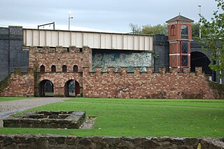
Mamucium, also known as Mancunium, is a former Roman fort in the Castlefield area of Manchester in North West England. The castrum, which was founded c. AD 79 within the Roman province of Roman Britain, was garrisoned by a cohort of Roman auxiliaries near two major Roman roads running through the area. Several sizeable civilian settlements containing soldiers' families, merchants and industry developed outside the fort. The area is a protected Scheduled Ancient Monument.

In ancient Rome, the Latin word pagus was an administrative term designating a rural subdivision of a tribal territory, which included individual farms, villages, and strongholds serving as refuges, as well as an early medieval geographical term. From the reign of Diocletian onwards, the pagus referred to the smallest administrative unit of a province. These geographical units were used to describe territories in the Merovingian and Carolingian periods, without any political or administrative meaning.
A Roman colonia was originally a settlement of Roman citizens, establishing a Roman outpost in federated or conquered territory, for the purpose of securing it. Eventually, however, the term came to denote the highest status of a Roman city. It is also the origin of the modern term "colony."

Castleshaw Roman fort was a castellum in the Roman province of Britannia. Although there is no evidence to substantiate the claim, it has been suggested that Castleshaw Roman fort is the site of Rigodunum, a Brigantian settlement. The remains of the fort are located on Castle Hill on the eastern side of Castleshaw Valley at the foot of Standedge but overlooking the valley. The hill is on the edge of Castleshaw in Greater Manchester. The fort was constructed in c. AD 79, but fell out of use at some time during the 90s. It was replaced by a smaller fortlet, built in c. 105, around which a civilian settlement grew. It may have served as a logistical and administrative centre, although it was abandoned in the 120s.
The Romans used provincial and local governments to govern conquered territories without having to rule them directly.

In the early Roman Empire, from 30 BC to AD 212, a peregrinus was a free provincial subject of the Empire who was not a Roman citizen. Peregrini constituted the vast majority of the Empire's inhabitants in the 1st and 2nd centuries AD. In AD 212, all free inhabitants of the Empire were granted citizenship by the Constitutio Antoniniana, with the exception of the dediticii, people who had become subject to Rome through surrender in war, and freed slaves.
The Helvii were a relatively small Celtic polity west of the Rhône river on the northern border of Gallia Narbonensis. Their territory was roughly equivalent to the Vivarais, in the modern French department of Ardèche. Alba Helviorum was their capital, possibly the Alba Augusta mentioned by Ptolemy, and usually identified with modern-day Alba-la-Romaine. In the 5th century the capital seems to have been moved to Viviers.

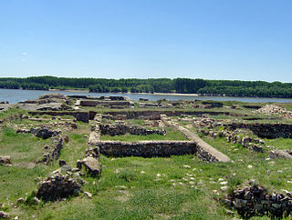
Capidava was originally an important Geto-Dacian centre on the right bank of the Danube. After the Roman conquest, it became a civil and military centre in the province of Moesia Inferior and part of the defensive frontier system of the Moesian Limes along the Danube.

A canaba was the Latin term for a hut or hovel and was later used typically to mean a town that emerged as a civilian settlement in the vicinity of a Roman legionary fortress.

Nida was an ancient Roman town in the area today occupied by the northwestern suburbs of Frankfurt am Main, Germany, specifically Frankfurt-Heddernheim, on the edge of the Wetterau region. At the time of the Roman empire, it was the capital of the Civitas Taunensium. The name of the settlement is known thanks to written sources from Roman times and probably derives from the name of the adjacent river Nidda.
Albaniana was the name the ancient Romans gave a settlement on the southern banks of Rhine river, some 40 kilometers from its mouth in the North Sea, known as Alfen and modern-day Alphen aan den Rijn, Netherlands. They did build a military fort there, as part of a range strategically built encampments, to protect and guard the river, frontier (limes) of the Roman empire and main transport route of goods and troops. The historical map Tabula Peutingeriana situates the settlement in between Matilo (Leiden) and Praetorium Agrippinae (Valkenburg) downstream and Nigrum Pullum (Zwammerdam) and Fectio (Vechten) upstream. The village was mentioned in Antoninus' register of roads Itinerarium Antonini from the 3rd century. The fortress must have been surrounded by a wall of ground and wooden poles, with gates and watch towers.

Derventio, sometimes described as Derventio Brigantium in order to distinguish it from other places called Derventio, was a Roman fort and settlement located beneath the modern town of Malton in North Yorkshire, England. The fort is positioned 18 miles north-east of Eboracum on the River Derwent.


