Morgan Hill is a city in Santa Clara County, California, at the southern tip of Silicon Valley, in the San Francisco Bay Area. Morgan Hill is primarily an affluent residential community for Silicon Valley, as well as the seat of several high-tech companies, including Anritsu, Flex, Velodyne LiDAR, and TenCate. Morgan Hill is a prominent dining, entertainment, and recreational destination in Silicon Valley, owing to its Michelin-star chefs, luxury hospitality, wineries, nature parks, and the numerous noteworthy events the city hosts, such as the Tour of California. According to Forbes, Morgan Hill is one of the most expensive places to live in the United States. Business Insider ranked Morgan Hill as the 17th most expensive housing market in the United States, owing to its concentration of wealth and restrictive growth policies.

State Route 152 is a state highway that runs near the latitudinal middle of the U.S. state of California from Watsonville to Route 99 southeast of Merced. Its western portion provides access to and from Interstate 5 toward southern California for motorists in or near Gilroy, San Jose, and most of the San Francisco Peninsula.

Uvas Canyon County Park is a 1,147-acre (464 ha) natural park located in upper Uvas Canyon on the eastern side of the Santa Cruz Mountains, west of Morgan Hill, California. The park has several small waterfalls, some of which flow perennially, that feed into tributaries confluent with Uvas Creek. The park is part of the Santa Clara County Parks System, and facilitates picnics, hiking and overnight camping. It is one of the few parks in the area that allows dogs in the campgrounds.

Stevens Creek is a creek in Santa Clara County, California. The creek originates in the Santa Cruz Mountains on the western flank of Black Mountain in the Monte Bello Open Space Preserve near the terminus of Page Mill Road at Skyline Boulevard. It flows southeasterly through the Stevens Creek County Park before turning northeast into Stevens Creek Reservoir. It then continues north for 12.5 miles through Cupertino, Los Altos, Sunnyvale and Mountain View before emptying into the San Francisco Bay at the Whisman Slough, near Google's main campus.

Bell Station is an unincorporated community located along State Route 152 between Casa de Fruta and Pacheco Pass near the southeast extent of Santa Clara County, California.
Santa Clara County, California, is one of California's original counties, with prior habitation dating from prehistory to the Alta California period.

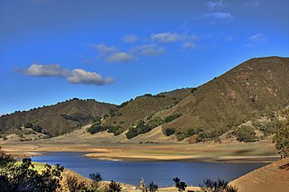
Uvas Reservoir is an artificial lake located west of San Martin, California in the United States. The reservoir is surrounded by a 626-acre (253 ha) park managed by the Santa Clara County Parks and Recreation Department. The park provides limited fishing ("catch-and-release"), picnicking, and hiking activities. Boating is not permitted in the reservoir.

Llagas-Uvas is an unincorporated, census county division (CCD) located on the eastern side of the Santa Cruz Mountains in southwest Santa Clara County, California. The area covers approximately 102 square miles (260 km2), much of it open space, and contains the Uvas and Chesbro reservoirs, as well as the Calero, Uvas Canyon, Rancho Cañada del Oro, and Mount Madonna county parks.
There are 21 routes assigned to the "G" zone of the California Route Marker Program, which designates county routes in California. The "G" zone includes county highways in Monterey, San Benito, San Luis Obispo, Santa Clara, and Santa Cruz counties.

Llagas Creek is a perennial stream in Santa Clara County, California, United States. The headwaters rise on the eastern side of Crystal Peak near Loma Prieta. From there, the creek flows northeast along Casa Loma Road, until it reaches Uvas Road, and then turns south. At Oak Glen Avenue, the creek turns southeast, passing through Chesbro Reservoir, and the cities of Morgan Hill, San Martin, and Gilroy. The creek continues its southward flow, eventually joining with the Pajaro River at the San Benito County line.

Twin Peaks are two prominent peaks along the foothills east of the Santa Cruz Mountains in Santa Clara County, California. The peaks are nestled between Uvas Reservoir to the west, and Paradise Valley in Morgan Hill to the east. The headwaters for Sycamore Creek rise from the eastern hillsides near these peaks.

South Santa Clara Valley is a census county division (CCD) located in south Santa Clara County, California. The area covers approximately 118 square miles (310 km2), and includes the cities of Morgan Hill, San Martin, and Gilroy as well as their immediate outlying unincorporated areas. The area is bounded by Coyote to the north, Llagas-Uvas to the west, Diablo Range to the east, and San Benito County to the south.

Santa Clara County Parks and Recreation Department, sometimes referred to as Santa Clara County Parks Department or Santa Clara County Parks, is a government department in Santa Clara County, California. The department manages 29 parks with a total area over 52,000 acres (21,000 ha).

Christmas Hill Park is a 51-acre community park operated by the City of Gilroy in southwest Santa Clara County, California. The park provides trails for jogging, hiking and bicycling, as well as soccer and baseball/softball diamonds for group sports, and multiple picnic areas. The Christmas Hill Park Ranch Site adjoins east of the park, and provides an environmental education center, as well as additional sports facilities.

Vasona Reservoir is an artificial lake located in Los Gatos, California, United States. A 152-acre (62 ha) county park surrounds the reservoir and provides limited fishing, picnicking, and informal play activities. Although swimming is not allowed, human-powered boating is permitted in the reservoir.


