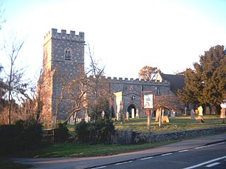
Great and Little Kimble cum Marsh is a civil parish in central Buckinghamshire, England. It is located 5 miles (8 km) to the south of Aylesbury. The civil parish altogether holds the ancient ecclesiastical villages of Great Kimble, Little Kimble, Kimblewick and Marsh, and an area within Great Kimble called Smokey Row. The two separate parishes with the same name were amalgamated in 1885, but kept their separate churches, St Nicholas for Great Kimble on one part of the hillside and All Saints for Little Kimble on other side at the foot of the hill.

Headcorn is a village and civil parish in the borough of Maidstone in Kent, England. The parish is on the floodplain of the River Beult south east of Maidstone.
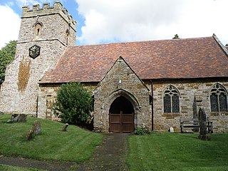
Hellidon is a village and civil parish about 5 miles (8 km) south-west of Daventry in Northamptonshire, England. The parish area is about 1,600 acres (650 ha). It lies 520 feet (160 m) – 590 feet (180 m) above sea level on the north face of an ironstone ridge, its highest point, 670 feet (200 m) at Windmill Hill, being 0.5 miles (800 m) south-east of the village. The Leam and tributaries rise in the parish. The 2011 Census gave a population of 256, estimated at 286 in 2019. The long-distance Jurassic Way footpath linking Banbury, Oxfordshire, and Stamford, Lincolnshire, passes through. The origin of the name is unclear. "Holy Valley", "Haegla's Valley" and "Unstable valley" have been suggested, with the Old English "dun", meaning hill.
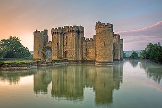
Bodiam is a small village and civil parish in the Rother District of East Sussex, England. It lies in the valley of the River Rother, near to the villages of Sandhurst and Ewhurst Green.

Shutford is a village and civil parish in the Cherwell district, in Oxfordshire, England, about 4.5 miles (7.2 km) west of Banbury. The village is about 475 feet (145 m) above sea level. In 2011 the parish had a population of 476. In 1870–72, John Marius Wilson's Imperial Gazetteer of England and Wales described Shutford like this:

Badlesmere is a village and civil parish in the Swale district of Kent, England, about five miles south of Faversham and eight miles north of Ashford on the A251.
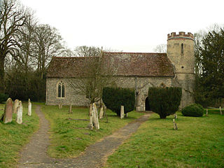
Bartlow is a small village and civil parish in the South Cambridgeshire district of Cambridgeshire, England, about 12 miles (19 km) south-east of Cambridge and 7 miles (11 km) west of Haverhill in Suffolk. The River Granta runs through the village. In 2021 the parish had a population of 101.

Berwick St John is a village and civil parish in southwest Wiltshire, England, about 5 miles (8 km) east of Shaftesbury in Dorset. The parish includes the Ashcombe Park estate, part of the Ferne Park estate, and most of Rushmore Park.
Broomfield is a village in the Maidstone District of Kent, England, and forms part of the civil parish of Broomfield and Kingswood. It lies 6 miles (10 km) to the east of Maidstone. The village is located just upstream of Leeds Castle on the River Len, one of the tributaries of the River Medway.

Finmere is a village and civil parish in Oxfordshire, south of the River Great Ouse. It is on the county boundary with Buckinghamshire, almost 4 miles (6 km) west of Buckingham and just over 4 miles (6 km) east of Brackley in Northamptonshire. The 2011 Census recorded the parish's population as 466.

Smarden is a civil parish and village, west of Ashford in Kent, South East England.

Chastleton is a village and civil parish in the Cotswold Hills in Oxfordshire, England, about 4 miles (6.4 km) northeast of Stow-on-the-Wold. Chastleton is in the extreme northwest of Oxfordshire, on the boundaries with both Gloucestershire and Warwickshire. The 2011 Census recorded the parish's population as 153.
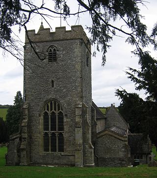
Longbridge Deverill is a village and civil parish about 2.5 miles (4.0 km) south of Warminster in Wiltshire, England. It is on the A350 primary route which connects the M4 motorway and west Wiltshire with Poole, Dorset.
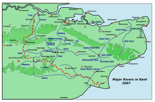
The River Len is a river in Kent, England. It rises at a spring in Bluebell Woods to the southeast of the village centre of Lenham 0.6 miles (0.97 km) from the source of the River Great Stour; both rise on the Greensand Ridge. Its length is c10 miles (16 km). It enters the River Medway at Maidstone.

Steep is a village and civil parish in the East Hampshire district of Hampshire, England. Its nearest town is Petersfield, which lies 1.4 miles (2.3 km) south of the village, just off the A3 road. The nearest railway station is Petersfield, at 1.6 miles (2.6 km) south of the village. It has two public houses, The Harrow and the Cricketers Inn, with the former being an 18th-century Grade II listed building. According to the 2011 census, it had a population of 1,391.

Langford is a village and civil parish in West Oxfordshire, about 3 miles (5 km) northeast of Lechlade in neighbouring Gloucestershire. The 2011 Census recorded the parish's population as 349.
Leeds Priory, also known as Leeds Abbey, was a priory in Leeds, Kent, England, that was founded in 1119 and dissolved in 1539. A mansion was later built on the site of the priory; it was demolished in the late 18th century. The site of the former priory is a scheduled monument.

All Saints is a parish church in Ulcombe, Kent. It was begun in the 12th century and is a Grade I listed building.

The Hatch bell foundry at Ulcombe, near Maidstone, in Kent, England, was operated by three generations of the Hatch family from 1581 or earlier until 1664. The bellfounders were based at nearby Broomfield from about 1587 until at least 1639. Joseph Hatch, bellfounder from 1602 to 1639, cast at least 155 bells, including "Bell Harry", after which the central tower of Canterbury Cathedral is named. Most Hatch bells were used in churches east of the River Medway in East Kent.

Leopard's Kopje is an archaeological site, the type site of the associated region or culture that marked the Middle Iron Age in Zimbabwe. The ceramics from the Leopard's Kopje type site have been classified as part of phase II of the Leopard's Kopje culture. For information on the region of Leopard's Kopje, see the "Associated sites" section of this article.


