Transportation in Shreveport

Last updated

Shreveport is the third largest city and the principal city of the third largest metropolitan area in the U.S. state of Louisiana, as well as being the 109th largest city in the United States.

Contents

Underside of Texas Street Bridge (the Long-Allen Bridge) in the Shreveport riverfront district Shreveport-texas-st-bridge-2-2004-02-29.jpg
Underside of Texas Street Bridge (the Long–Allen Bridge) in the Shreveport riverfront district
I-20.svg
I-220.svg
I-49.svg
US 80.svg
US 79.svg
US 71.svg
US 171.svg
Louisiana 1.svg
Louisiana 3132.svg

Roads and highways

Shreveport's past reflects the need for mass transit and public roads. As far back as the 1870s residents used mule-drawn streetcars that were later converted to electric-motorized cars by 1890. Commuter rail in Shreveport flourished for many decades, and rail car lines extended out to rural areas. In the 1930 the trolleys and rail cars were replaced by rubber-wheel trolleys and buses. In the 1960s the interstate system came to the area with construction of Interstate 20.

The highway system has a cross-hair and loop freeway structure. The loop consist of Interstate 220 on the north and Louisiana Highway 3132 on the south, forming approximately a 8-mile (13 km) diameter semi-loop around downtown.

Shreveport lies along the route of the proposed Interstate 69 NAFTA superhighway that will link Canada, the U.S. industrial Midwest, Texas, and Mexico.

I-49 expansion

Shreveport to Kansas City

In 2005 Gov. Kathleen Blanco signed legislation to fund the expansion of I-49 to the Arkansas border where it will meet the already completed section to Texarkana. I-49 is proposed to be a corridor through to Kansas City, MO. The current terminus of I-49 in Lafayette, Louisiana is to be extended to New Orleans, Louisiana in the same bill.

The I-69 project

The current plans for I-69 around Shreveport also known as (SIU 15) are to build a new freeway bypassing the urbanized area to the south and east. Unlike I-49 and I-20, I-69's proposed route does not go through Shreveport; but will provide for a completed loop for the Inner Loop Expressway. However, access to and from Downtown Shreveport via I-49 and I-20 will not be problematic.

The plans for this segment call for interchanges at:

As of January 2003, there is a "preferred corridor" within which the actual highway alignments will be developed.

Shreveport to Houston

During 2002 and 2003, it was decided that Texas Gov. Rick Perry's Trans-Texas Corridor proposal would be the basis for developing Interstate 69 in Texas. Accordingly, the original division of the route into this route is being treated as preliminary, and the entire corridor in the state (as well as the connection near Shreveport, La.) will be studied using a unified, two-tier Environmental Impact Statement process.

Shreveport to Memphis

The process is underway from I-20 at Haughton, Louisiana to U.S. 82 west of El Dorado, Arkansas; from U.S. 82 west of El Dorado to U.S. 65; from U.S. 65 to the Charles W. Dean Bridge or Great River Bridge; from Charles W. Dean/Great River Bridge to Robinsonville, Mississippi

A Final Environmental Impact Statement has been approved for the Southeast Arkansas I-69 Connector (I-530 extension). Right-of-way acquisition and some construction is currently underway.

The inner loop expressway (LA 3132)

Bert Kouns Industrial Loop to Flournoy Lucas Rd.

This section is now open.

Intelligent transportation system in Shreveport/Bossier

In 2005 the Louisiana Department of Transportation and Development announced the implementation of an Intelligent Transportation System, to monitor traffic via video cameras, erecting digital message boards all over the metro area and AM radio broadcast to alert motorist of special or emergency road conditions. Plus vehicle radar detectors will be installed on freeways to measure drive times from point A to point B. These drive times will be displayed on the digital message boards around town.

To implement the ITS field deployment for the region, it will consist of 579 radar vehicle detectors (RVDs), 220 closed-circuit television (CCTV) cameras, 15 dynamic message signs (DMSs), signal system improvements at 395 intersections, 10 weather stations, and 4 highway advisory radio (HAR) stations. [1]

Mass transit

Shreveport-SporTran-Logo.png

SporTran provides public transportation in the form of buses and lift vans. SporTran is one of the oldest public transportation systems in the south. SporTran has been in continual service for over 125 years with only one interruption due to the strike of 1957. [2]

Today, SporTran sports a fleet of over 50 modern buses equipped to handle all passengers, including those with disabilities. Their newest buses are equipped with the latest emission reduction systems and an experimental dual-fuel (Hybrid) bus was placed in service in 2005.

Airports

Shreveport is served by two airports, the largest of which is the Shreveport Regional Airport (SHV). After World War II, the demand for expanded airline service in Shreveport increased. In addition, longer runways were required to accommodate the new generation of jet aircraft. Because of land limitations, the closely located Shreveport central business district and military aircraft traffic from nearby Barksdale Air Force, the decision was made to build an entirely new airport on the western edges of Shreveport.

In May 1947, the city committed $2.4 million for its share of a new terminal building for the new airport. In 1948, the city retained an architectural engineering firm to recommend an airport site. In 1949, a general election was held and the current airport site was approved. Initial construction of Greater Shreveport Municipal Airport consisted of a 6,400-foot (2,000 m) by 20-foot (6.1 m) runway with a full length parallel taxiway.

In 1998, ground was broken on a $30 million expansion/renovation project at Shreveport Regional. The expansion included the addition of a 66,000-square-foot (6,100 m2) terminal building on the eastern side of the concourses and administration building. The new facility allowed the airport to consolidate all airline ticket counters and rental cars into one operation, as well as centralized baggage claim operations. During construction, the facilities built in 1971 and 1972 were completely renovated. These renovations included remodeling the restaurant, airport security, airport administration offices, the concourses, bathrooms, passenger loading gates and elevators. Additionally, all heating/air conditioning, fire protection, plumbing and electrical systems were upgraded. Additionally, the parking lots were reconfigured and repaved, along with new parking booths added.

The expansion/renovations were unveiled to the public with a November 1999 soft opening to allow passengers to use the new terminal in time for the busy Thanksgiving holiday travel season. Since that time, the Shreveport Airport Authority has continued to fine-tune the new facility and is continuing to make changes to improve passenger service.

Today, the airport is served by seven airlines, and nearly all major cargo carriers. Passenger airlines that operate out of SHV

The second airport is Shreveport Downtown Airport (DTN). The Downtown Municipal Airport is a general aviation/reliever airport located north of the Downtown Business District. The airport is located along the Red River and is the original Shreveport commercial airport, dating to back to 1931. It offers two runways, with the primary runway, Runway 14/32, measuring 5,017 feet (1,529 m) long by 150 feet (46 m) wide. The Runway is asphalt and was resurfaced in December 2000. Runway 5/23 measures 3,200 feet (980 m) long by 75 feet (23 m) wide. The Airport is considered a general aviation/reliever airport. Numerous owners of small private aircraft house aircraft there. Fixed-Base Operator at Downtown Airport is Royal Air. Also, Southern University operates an Airframe and Power plant (A&P) School which provides certification for aircraft mechanics.

Both airports are under the Shreveport Airport Authority.

Related Research Articles

<span class="mw-page-title-main">Interstate 20</span> Interstate in southern US

Interstate 20 (I‑20) is a major east–west Interstate Highway in the Southern United States. I-20 runs 1,539 miles (2,477 km) beginning at an interchange with I-10 in Reeves County, Texas, and ending at an interchange with I-95 in Florence, South Carolina. Between Texas and South Carolina, I-20 runs through northern Louisiana, Mississippi, Alabama, and Georgia. The major cities that I-20 connects to include Dallas-Fort Worth, Texas; Shreveport, Louisiana; Jackson, Mississippi; Birmingham, Alabama; Atlanta, Georgia; and Columbia, South Carolina.

<span class="mw-page-title-main">Interstate 49</span> Interstate Highway in Louisiana, Arkansas, and Missouri

Interstate 49 (I-49) is a north–south Interstate Highway that exists in multiple segments: the original portion entirely within the state of Louisiana with an additional signed portion extending from I-220 in Shreveport to the Arkansas state line, three newer sections in Arkansas, and a new section that opened in Missouri. Its southern terminus is in Lafayette, Louisiana, at I-10 while its northern terminus is in Kansas City, Missouri, at I-435 and I-470. Portions of the remaining roadway in Louisiana, Arkansas, and Texas, which will link Kansas City with New Orleans, are in various stages of planning or construction.

<span class="mw-page-title-main">George Bush Intercontinental Airport</span> Airport serving Houston, Texas, U.S.

George Bush Intercontinental Airport is an international airport in Houston, Texas, United States, serving the Greater Houston metropolitan area. Located about 23 miles (37 km) north of Downtown Houston between Interstate 45 and Interstate 69/U.S. Highway 59 with direct access to the Hardy Toll Road expressway, George Bush Intercontinental Airport has scheduled flights to a large number of domestic and international destinations covering five continents. It is the busiest airport in Texas for international passenger traffic and number of international destinations, as well as being the second busiest airport in Texas overall, and the 15th busiest in the United States for total passenger traffic.

<span class="mw-page-title-main">Ark-La-Tex</span> Region in the United States

The Ark-La-Tex is a socio-economic tri-state region where the Southern U.S. states of Arkansas, Louisiana, and Texas join together. The region contains portions of Northwest Louisiana, Northeast Texas, and South Arkansas as well as the extreme southeastern tip of Oklahoma, in McCurtain County, partly centered upon the Red River, which flows along the Texas–Oklahoma state line into Southwestern Arkansas and Northwest Louisiana.

<span class="mw-page-title-main">Shreveport Regional Airport</span> Airport in Shreveport, Louisiana

Shreveport Regional Airport is a public use airport in Shreveport, Louisiana, United States. It is owned by the City of Shreveport and located four nautical miles (7 km) southwest of its central business district.

Oklahoma City is near the geographic center of the United States and is an integral point on the U.S. Interstate Network. The city is served by numerous roads and highways, toll roads, three major airports, a train station, a bus station, and a transit system.

This article is about transportation systems in and around Dallas, Texas (USA).
<span class="mw-page-title-main">U.S. Route 90 Business (New Orleans, Louisiana)</span> Highway in New Orleans, Louisiana

U.S. Highway 90 Business is a business route of U.S. Highway 90 located in and near New Orleans, Louisiana. It runs 14.25 miles (22.93 km) in a general east–west direction from US 90 in Avondale to a junction with Interstate 10 (I-10) and US 90 in the New Orleans Central Business District.

This is a documentation of the routes, highways, parking requirements, or anything related to transportation in Houston.
<span class="mw-page-title-main">Interstate 10 in Texas</span> Section of Interstate Highway in Texas, United States

Interstate 10 (I-10) is the major east–west Interstate Highway in the Southern United States. In the U.S. state of Texas, it runs east from Anthony, at the border with New Mexico, through El Paso, San Antonio, and Houston to the border with Louisiana in Orange. At just under 880 mi (1,420 km), the Texas segment of I-10, maintained by the Texas Department of Transportation, is the longest continuous untolled freeway in North America that is operated by a single authority. It is also the longest stretch of Interstate Highway with a single designation within a single state. Mile marker 880 and its corresponding exit number in Orange, Texas, are the highest-numbered mile marker and exit on any freeway in North America. Since widening was completed in 2008, a portion of the highway west of Houston is now also believed to be the widest in the world, at 26 lanes when including feeders.

<span class="mw-page-title-main">Transportation in Texas</span> Overview of transportation in Texas

The Texas Department of Transportation (TxDOT) is a governmental agency and its purpose is to "provide safe, effective, and efficient movement of people and goods" throughout the state. Though the public face of the agency is generally associated with maintenance of the state's immense highway system, the agency is also responsible for aviation in the state and overseeing public transportation systems.

<span class="mw-page-title-main">Interstate 20 in Texas</span> Section of Interstate Highway in Texas

Interstate 20 in Texas (I-20) is a major east–west Interstate Highway in the Southern United States, running east from a junction with I-10 east of Kent, Texas, through the Dallas–Fort Worth metroplex to the Louisiana state line near Waskom, Texas. The original distance of I-20 was 647 miles (1,041 km) from I-10 to the Louisiana state line, reduced to the current distance of 636 miles (1,024 km) with the rerouting of I-20 in the 1980s and 1990s. I-20 is known as the Ronald Reagan Memorial Highway within the Dallas–Fort Worth metroplex.

The transportation system of Arizona comprises car, rail, air, bus, and bicycle transport.

<span class="mw-page-title-main">Interstate 69 in Louisiana</span> Highway in Louisiana

Interstate 69 (I-69) is a proposed Interstate Highway that will pass through the northwestern part of the US state of Louisiana.

Located in the southeastern corner of the state, Norfolk is economically and culturally important to Virginia. A variety of transportation modes have developed around the city's importance and somewhat unusual geography.

<span class="mw-page-title-main">Interstate 49 in Louisiana</span> Highway in Louisiana

Interstate 49 (I-49) is an Interstate Highway that spans 244.021 miles (392.714 km) in a north–south direction in the US state of Louisiana. It runs from I-10 in Lafayette to the Arkansas state line north of Shreveport, largely paralleling the older US Highway 71 (US 71) corridor, and connects the state's two east–west Interstates at two of its metropolitan centers. Along the way, it serves the cities of Opelousas, Alexandria, and Natchitoches, intersecting several cross-state highways, such as I-20, US 190, US 167, US 165, and US 84.

<span class="mw-page-title-main">Business routes of Interstate 69 in Michigan</span> List of highways in Michigan

There are currently four business routes of Interstate 69 (I-69) in the US state of Michigan. Designated Business Loop Interstate 69, they are all former routings of I-69's predecessor highways, US Highway 27 (US 27), M-78 or M-21, in whole or in part. The BL I-69 in Coldwater and the one in Charlotte were both parts of US 27 before the freeway bypassed those two cities in 1967 and the early 1970s, respectively. The BL I-69 through Lansing and East Lansing was previously part of M-78 and Temporary I-69 until it was redesignated in 1987. Before 1984, the loop in Port Huron was originally part of M-21 and was initially a business spur numbered Business Spur Interstate 69. It was later redesignated when it was extended to run concurrently with that city's BL I-94 which was originally part of I-94's predecessor, US 25. Each business loop follows streets through each city's downtown areas and connects to I-69 on both ends, giving traffic a route through the downtown and back to the freeway.

Transportation in Phoenix, Arizona is primarily via private cars. Public transport is run under the brand Valley Metro, and consists of buses, light rail, and a streetcar system.
<span class="mw-page-title-main">Transportation in New Jersey</span> Overview of the transportation in New Jersey

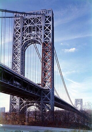
Transportation in New Jersey utilizes a combination of road, rail, air, and water modes. New Jersey is situated between Philadelphia and New York City, two major metropolitan centers of the Boston-Washington megalopolis, making it a regional corridor for transportation. As a result, New Jersey's freeways carry high volumes of interstate traffic and products. The main thoroughfare for long distance travel is the New Jersey Turnpike, the nation's fifth-busiest toll road. The Garden State Parkway connects the state's densely populated north to its southern shore region. New Jersey has the 4th smallest area of U.S. states, but its population density of 1,196 persons per sq. mi causes congestion to be a major issue for motorists.

<span class="mw-page-title-main">Shreveport Area Transit System</span>

The Shreveport Area Transit System, commonly known as SporTran, is a public transportation bus system based in Shreveport, Louisiana, United States. It runs bus routes in Shreveport and Bossier City, Louisiana. All bus routes converge at the Intermodal Facility near Downtown Shreveport.

References