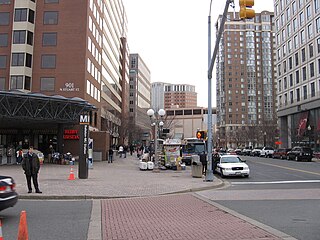
Smart growth is an urban planning and transportation theory that concentrates growth in compact walkable urban centers to avoid sprawl. It also advocates compact, transit-oriented, walkable, bicycle-friendly land use, including neighborhood schools, complete streets, and mixed-use development with a range of housing choices. The term "smart growth" is particularly used in North America. In Europe and particularly the UK, the terms "compact city", "urban densification" or "urban intensification" have often been used to describe similar concepts, which have influenced government planning policies in the UK, the Netherlands and several other European countries.

In urban planning, zoning is a method in which a municipality or other tier of government divides land into "zones", each of which has a set of regulations for new development that differs from other zones. Zones may be defined for a single use, they may combine several compatible activities by use, or in the case of form-based zoning, the differing regulations may govern the density, size and shape of allowed buildings whatever their use. The planning rules for each zone determine whether planning permission for a given development may be granted. Zoning may specify a variety of outright and conditional uses of land. It may indicate the size and dimensions of lots that land may be subdivided into, or the form and scale of buildings. These guidelines are set in order to guide urban growth and development.

In the United States, a conservation easement is a power invested in a qualified land conservation organization called a "land trust", or a governmental entity to constrain, as to a specified land area, the exercise of rights otherwise held by a landowner so as to achieve certain conservation purposes. It is an interest in real property established by agreement between a landowner and land trust or unit of government. The conservation easement "runs with the land", meaning it is applicable to both present and future owners of the land. The grant of conservation easement, as with any real property interest, is part of the chain of title for the property and is normally recorded in local land records.
Growth management, in the United States, is a set of techniques used by the government to ensure that as the population grows that there are services available to meet their demands. Growth management goes beyond traditional land use planning, zoning and subdivision controls in both the characteristics of development influenced and the scope of government powers used. These are not necessarily only government services. Other demands such as the protection of natural spaces, sufficient and affordable housing, delivery of utilities, preservation of buildings and places of historical value, and sufficient places for the conduct of business are also considered.

Stormwater, also written storm water, is water that originates from precipitation (storm), including heavy rain and meltwater from hail and snow. Stormwater can soak into the soil (infiltrate) and become groundwater, be stored on depressed land surface in ponds and puddles, evaporate back into the atmosphere, or contribute to surface runoff. Most runoff is conveyed directly as surface water to nearby streams, rivers or other large water bodies without treatment.
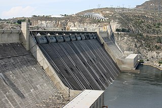
Land use planning or Land-use regulation is the process of regulating the use of land by a central authority. Usually, this is done to promote more desirable social and environmental outcomes as well as a more efficient use of resources. More specifically, the goals of modern land use planning often include environmental conservation, restraint of urban sprawl, minimization of transport costs, prevention of land use conflicts, and a reduction in exposure to pollutants. In the pursuit of these goals, planners assume that regulating the use of land will change the patterns of human behavior, and that these changes are beneficial. The first assumption, that regulating land use changes the patterns of human behavior is widely accepted. However, the second assumption - that these changes are beneficial - is contested, and depends on the location and regulations being discussed.

In urban planning, infill, or in-fill, is the rededication of land in an urban environment, usually open-space, to new construction. Infill also applies, within an urban polity, to construction on any undeveloped land that is not on the urban margin. The slightly broader term "land recycling" is sometimes used instead. Infill has been promoted as an economical use of existing infrastructure and a remedy for urban sprawl. Detractors view increased urban density as overloading urban services, including increased traffic congestion and pollution, and decreasing urban green-space. Many also dislike it for social and historical reasons, partly due to its unproven effects and its similarity with gentrification.

A sustainable city, eco-city, or green city is a city designed with consideration for the social, economic, and environmental impact, as well as a resilient habitat for existing populations. This is done in a way that does not compromise the ability of future generations to experience the same. The UN Sustainable Development Goal 11 defines sustainable cities as those that are dedicated to achieving green sustainability, social sustainability and economic sustainability. In accordance with the UN Sustainable Development Goal 11, a sustainable city is defined as one that is dedicated to achieving green, social, and economic sustainability. They are committed to this objective by facilitating opportunities for all through a design that prioritizes inclusivity as well as maintaining a sustainable economic growth. Furthermore, the objective is to minimize the inputs of energy, water, and food, and to drastically reduce waste, as well as the outputs of heat, air pollution. Richard Register, a visual artist, first coined the term ecocity in his 1987 book Ecocity Berkeley: Building Cities for a Healthy Future, where he offers innovative city planning solutions that would work anywhere. Other leading figures who envisioned sustainable cities are architect Paul F Downton, who later founded the company Ecopolis Pty Ltd, as well as authors Timothy Beatley and Steffen Lehmann, who have written extensively on the subject. The field of industrial ecology is sometimes used in planning these cities.
Farmland development rights in Suffolk County, New York began in 1975 in Suffolk County as the state of New York began a program to purchase development rights for farmland to insure they remained as farms and open space rather than being developed for housing.
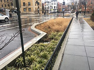
Green infrastructure or blue-green infrastructure refers to a network that provides the “ingredients” for solving urban and climatic challenges by building with nature. The main components of this approach include stormwater management, climate adaptation, the reduction of heat stress, increasing biodiversity, food production, better air quality, sustainable energy production, clean water, and healthy soils, as well as more anthropocentric functions, such as increased quality of life through recreation and the provision of shade and shelter in and around towns and cities. Green infrastructure also serves to provide an ecological framework for social, economic, and environmental health of the surroundings. More recently scholars and activists have also called for green infrastructure that promotes social inclusion and equity rather than reinforcing pre-existing structures of unequal access to nature-based services.
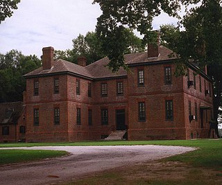
Farmland preservation is a joint effort by non-governmental organizations and local governments to set aside and protect examples of a region's farmland for the use, education, and enjoyment of future generations. They are operated mostly at state and local levels by government agencies or private entities such as land trusts and are designed to limit conversion of agricultural land to other uses that otherwise might have been more financially attractive to the land owner. Through different government programs and policy enactments farmers are able to preserve their land for growing crops and raising livestock. Every state provides tax relief through differential (preferential) assessment. Easements are a popular approach and allow the farms to remain operational. Less common approaches include establishing agricultural districts, using zoning to protect agricultural land, purchasing development rights, and transferable development rights. It is often a part of regional planning and national historic preservation. Farmland preservation efforts have been taking place across the United States, such as in Virginia, Minnesota, Maryland, Florida, and Connecticut.
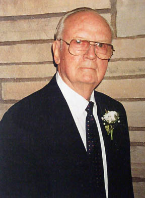
Norman Irving Wengert was an American political scientist who wrote about the politics of natural resources, advanced a seminal theory of the "politics of getting", and had a number of significant roles in his public and academic career. He was born in Milwaukee, Wisconsin to Eugene F. and Lydia Semmann Wengert. He pioneered the revival of the study of political economy in the United States with publication of Natural Resources and the Political Struggle, and later authored more than fifty monographs and studies on the political economy and public administration of environmental resources. His scholarship explored the politics of natural resources and environmental policy formation and administration, with emphases in national energy policy, urban water planning and management, land use planning and controls, national forest management, and citizen participation in administrative processes.
Agricultural zoning is a land management tool that refers to local zoning designations made by local jurisdictions that are intended to protect farmland and farming activities from incompatible land uses. Agricultural zoning can specify many factors, such as the uses allowed, minimum lot size, the number of nonfarm dwellings allowed, or the size of a buffer separating farm and nonfarm properties. Some jurisdictions further subdivide agricultural zones to distinguish industrial farming from uses like rural residence farms and retirement farms on large lots.

The Agricultural Reserve is a designated land use zone in Montgomery County, Maryland. The 93,000 acres (380 km2) zone was created in 1980 by the Montgomery County Council to preserve farm land and rural space in the northwestern part of the county. The farmland protection program has been characterized as "the most famous, most studied and most emulated" program of its kind in the United States.
Preservation development is a model of real-estate development that addresses farmland preservation. It shares many attributes with conservation development, with the addition of strategies for maintaining and operating productive agriculture and silviculture, often in perpetuity. A preservation development is a planned community that allows limited, carefully designed development on a working farm, while placing the majority of productive land under a system of easements and community governance to ensure a continuity of farming and environmental stewardship.

The U.S. state of Massachusetts has vast wind energy resources offshore, as well as significant resources onshore. The 2016 update to the states's Clean Energy and Climate Plan had a goal of reducing 1990 baseline greenhouse gas emissions levels by 25% by 2020. Current goals include installing 3,500 megawatts (MW) of offshore wind power in the state by 2035. However, as of Q4 2021 the state had only 120 MW of wind powered electricity generating capacity, responsible for generating 0.9% of in-state electricity production. The state has awarded contracts to two offshore projects, the 800 MW Vineyard Wind project and 804 MW Mayflower Wind project. Construction began on the Vineyard Wind 1 project on November 18, 2021, after a long fight for approval. Commonwealth Wind was selected for development in 2021, but the developer has attempted to cancel the project due to increased costs. There are eight projects planned for off the southern coast of Massachusetts, though some will deliver power to Rhode Island, Connecticut, and New York.

Land consumption as part of human resource consumption is the conversion of land with healthy soil and intact habitats into areas for industrial agriculture, traffic and especially urban human settlements. More formally, the EEA has identified three land consuming activities:
- The expansion of built-up area which can be directly measured;
- the absolute extent of land that is subject to exploitation by agriculture, forestry or other economic activities; and
- the over-intensive exploitation of land that is used for agriculture and forestry.
Suitum v. Tahoe Regional Planning Agency, 520 U.S. 725 (1997), is a United States Supreme Court case pertaining to the regulatory authority of the Tahoe Regional Planning Agency (TRPA) and its impact on private property rights. Bernadine Suitum owned a parcel of land near Lake Tahoe, which she intended to develop. However, TRPA imposed stringent regulations to protect the environment of the Lake Tahoe Basin. Under these regulations, Suitum was denied the permit to develop her property because it was classified as unsuitable for development based on the environmental criteria. The United States Supreme Court granted certiorari to determine the ripeness of Suitum's claim. The Court concluded that Suitum's takings claim was ripe for adjudication, emphasizing that Suitum was not required to attempt to sell her TDRs before her claim could be considered ripe. The Court based its reasoning on the immediate and direct impact of the regulatory action on her property rights, deeming further administrative actions unnecessary.


