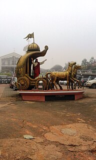
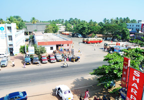
Kollam district is one of 14 districts of the state of Kerala, India. The district has a cross-section of Kerala's natural attributes; it is endowed with a long coastline, a major Laccadive Sea seaport and an inland lake. The district has many water bodies. Kallada River is one among them, and the east side land of river is East Kallada and the west side land is West Kallada.

New Mahe is a census town in Thalassery taluk of Kannur district in the Indian state of Kerala. It is part of Greater Mahé Region.

Pangode is a village and a Grama Panchayat in Trivandrum district, state of Kerala, India. The village is known for its participation in the Indian Independence Movement, through the Kallara-Pangode Struggle. It is situated on the foothills of Western Ghats.

Karunagappalli, also spelled Karunagappally, is a municipality in the Kollam district of Kerala, India. It is 24 km north of Kollam and 60 km (37 mi) south of Alappuzha. Karunagappalli taluk consists of Alappad, Ochira, Adinad, Karunagappally, Thazhava, Pavumba, Thodiyoor, Kallalibhagom, Thevalakkara, Chavara, Neendakara, Clappana, Kulasekharapuram, Thekkumbhagam, Ayanivelikulangara, Panmana, Ponmana and Vadakumthala. The taluk is bound on the north by Kayamkulam, on the east by Kunnathur taluk, on the south by Kollam and on the west by the Arabian Sea. It is one of the fastest developing towns in Kerala and is part of Kollam metropolitan area.

Vallikunnam is a village in Mavelikara taluk of Alappuzha district in the Indian state of Kerala.

Ezhukone is a village in Kollam district in the state of Kerala,India between Kottarakara and Kundara.
Poothakkulam, also known as Bhoothakulam, is a village in Kollam district in the state of Kerala, India. The village is located 3.9 km away from Paravur, 11.4 km from Varkala and 23 km from Kollam. In 2011, it had a population of 628,451 residents. The village covers an area of 16.56 km2.

Iringal is a village in Kozhikode district in the state of Kerala, India.

Tanalur (താനാളൂർ) is a census town in Malappuram district in the state of Kerala, India. It is a suburban town of neighbouring Tanur Municipality and comes under Tanur Block as well as Tanur. It falls under Tirur Taluk.

Vamanapuram is a village in Thiruvananthapuram district in the state of Kerala, India.

Vellarada is a border village situated in Thiruvananthapuram district in the state of Kerala, India. It is 42 km from Thiruvananthapuram. It is the southernmost part of Kerala state, sharing its border with Tamil Nadu. Vellarada is said to be the threshold to the high-range areas of the eastern part of Thiruvananthapuram district. The southernmost point of Western Ghats in Kerala is near Vellarada.

Edavaka is a Grama Panchayath in the Wayanad district of the Kerala State, India.

.
Chavara Thekkumbhagom or or is a village in Kollam district in the Indian state of Kerala. It is a traditional village of about 20 km2 area fully surrounded by the Ashtamudi lake and this island is now connected with bridges, one from the south at Neendakara and one to the north at Thevalakara. It is thickly populated place of not less than 15000 and the number of houses not less than 3000.

Panakkattodil Devi Temple is a Hindu temple in Chavara Thekkumbhagom village in Kollam district of the Indian state of Kerala. Primary deity of this temple is Durga. The temple is managed by the Travancore Devaswom Board, Kerala. The Thalappoli in 'Meda Bharani' and the annual festival during the months of April and May are popular.

Vallikavu is a small village in Kollam District of Kerala. Vallikavu is chiefly inhabited by farmers, fishermen and other sections of the society. Fishermen here were traditional Canoe builders and are skilled at making Changadam Vallam using planks and coir ropes to tie the planks together and coating the Vallam with melted pith. The Vallam making artisans have died and with the advent of motor transport the industry died.

Karunagappalli railway station(Code:KPY) or Karunagappally railway station is a railway station in the Indian municipal town of Karunagappalli in Kollam district, Kerala. Karunagappalli railway station falls under the Thiruvananthapuram railway division of the Southern Railway zone of Indian Railways. Karunagappally KSRTC Bus Station is only 2 km away from the station. It is one among the railway stations in Kerala collecting crores of rupees through passenger tickets every year. Karunagappalli is the nearest railway station to Amritapuri. Free WiFi of railway is available here. Karunagappalli is connected to various cities in India like Kollam, Trivandrum, Kochi, Calicut, Palakkad, Thrissur, Punalur, Bengaluru, Udupi, Mumbai, Madurai, Kanyakumari, Vishakapatnam, Mangalore, Pune, Salem, Coimbatore, Trichy, Tirunelveli, Hyderabad etc. through Indian Railways. In 2019, the rail wi-fi broad-band connection has been introduced in Karunagappalli station.

Kuttoor is a village in Thiruvalla Taluk, Pathanamthitta district in the Indian state of Kerala.Kuttoor panchayathu which is under Thiruvalla assembly constituency and Pulikkizhu block panchayathu.

Manppally is a small village located near Thazhava, Kollam district, Kerala, India.

Karunagappally State assembly constituency is one of the 140 state legislative assembly constituencies in Kerala state in southern India. It is also one of the 7 state legislative assembly constituencies included in the Alappuzha Lok Sabha constituency. As of the 2016 assembly elections, the current MLA is R. Ramachandran of CPI.


