
Gordon is a suburb on the Upper North Shore of Sydney in the state of New South Wales, Australia 14 kilometres (9 mi) north-west of the Sydney Central Business District and is the administrative centre for the local government area of Ku-ring-gai Council. East Gordon is a locality within Gordon, and West Gordon is a locality within West Pymble.
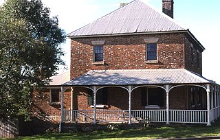
Windsor is a historic town north-west of Sydney, New South Wales, Australia. It is the council seat of the Hawkesbury local government area. The town sits on the Hawkesbury River, enveloped by farmland and Australian bush. Many of the oldest surviving European buildings in Australia are located at Windsor. It is 46 km (29 mi) north-west of metropolitan Sydney, on the fringes of urban sprawl.

Wahroonga is a suburb in the Upper North Shore of Sydney, in the state of New South Wales, Australia, 18 kilometres north-west of the Sydney central business district, in the local government areas of Ku-ring-gai Council and Hornsby Shire. North Wahroonga is an adjacent separate suburb of the same postcode.

Wyong Shire was a local government area located in the Central Coast region of New South Wales, Australia. The incorporation of the Wyong area dates back to 7 March 1906 when the entire area of the Brisbane Water Police District outside of the Town of Gosford was proclaimed as the Erina Shire. From 1 January 1947, local government in the Central Coast region was reorganised, creating Gosford Shire and Wyong Shire, which comprised Erina Shire north and east of Kulnura, Central Mangrove and Lisarow.

The Hills Shire is a local government area in the Greater Sydney region of Sydney, New South Wales, Australia. The suburb is north-west of the Sydney central business district, and encompasses 401 square kilometres (155 sq mi) stretching from the M2 Hills Motorway in the south to Wiseman's Ferry on the Hawkesbury River in the north. The Hills Shire had a population of 157,243 as at the 2016 census.
Wilberforce is a small town in New South Wales, Australia, in the local government area of the City of Hawkesbury. It is just beyond the outer suburbs of north-west Sydney and lies on the western bank of the Hawkesbury River.
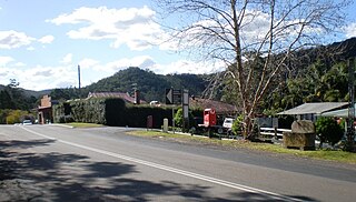
Yarramalong(cedar country) is a township and suburb of the Central Coast region of New South Wales, Australia, located 20 kilometres (12 mi) upstream from Wyong along the Wyong River. It is part of the Central Coast Council local government area.

Muswellbrook Shire is a local government area in the Upper Hunter region of New South Wales, Australia. The Shire is situated adjacent to the New England Highway and the Hunter railway line.
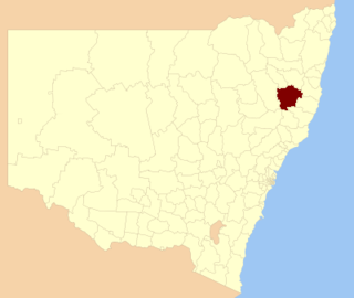
Walcha Shire is a local government area located in the New England region of New South Wales, Australia. The Shire is situated adjacent to the junction of the Oxley Highway and Thunderbolts Way and is 20 kilometres (12 mi) east of the Main North railway line passing through Walcha Road. The shire was formed on 1 June 1955 through the amalgamation of Apsley Shire and the Municipality of Walcha.

Wentworth Shire is a local government area in the far south-west Riverina region of New South Wales, Australia. This Shire is located adjacent to the Murray and Darling Rivers. The Shire's major roads are the Sturt and the Silver City Highways. The Shire includes the towns of Wentworth, Buronga, Gol Gol, Dareton and Pooncarie.

The Armidale Region is a local government area in the New England and Northern Tablelands regions of New South Wales, Australia. This area was formed in 2016 from the merger of the Armidale Dumaresq Shire with the surrounding Guyra Shire.

The Dubbo Regional Council is a local government area located in the Central West and Orana regions of New South Wales, Australia. The council was formed on 12 May 2016 through a merger of the City of Dubbo and Wellington Council as part of a widespread council amalgamation program. It was initially named Western Plains Regional Council for almost four months, and its name was changed to Dubbo Regional Council on 7 September 2016.
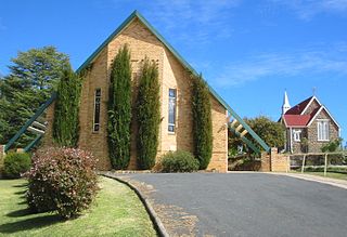
St Andrew's Anglican Church is a heritage-listed former Anglican church located at South Street, Walcha in the Walcha Shire, New South Wales, Australia. The site was added to the New South Wales State Heritage Register on 2 April 1999.
The St Andrew's Rectory is a heritage-listed former Anglican clergy house located at Thee Street, Walcha in the Walcha Shire, New South Wales, Australia. It is also known as St. Andrews Rectory (former) and St Andrews Rectory. It was added to the New South Wales State Heritage Register on 2 April 1999.
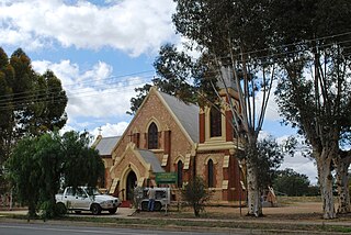
St John's Anglican Church, officially the Church of St John the Evangelist, is a heritage-listed Anglican church located at Darling Street, Wentworth, Wentworth Shire, New South Wales, Australia. It was designed by Reverend A. D. Soares and built in 1871. It is also known as St. John's Anglican Church and Rectory. The property is owned by the Anglican Parish of Wentworth. The church was added to the New South Wales State Heritage Register on 2 April 1999.
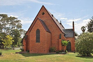
Old St Paul's Anglican Church is a heritage-listed former Anglican church at Cressy Street (South), Deniliquin, Edward River Council, New South Wales, Australia. The property is owned by the Edward River Council. It was added to the New South Wales State Heritage Register on 2 April 1999.

St Paul's Anglican Church is a heritage-listed Anglican former church building located at 221 Old Northern Road, Castle Hill, The Hills Shire, New South Wales, Australia. It is also known as St Paul's Anglican Church (former) and St Paul's Church (former). The former church was added to the New South Wales State Heritage Register on 2 April 1999.
Warkworth is a locality in the Singleton Council region of New South Wales, Australia. It had a population of 49 as of the 2016 census.
St Patrick's Roman Catholic Church Cemetery is a heritage-listed Roman Catholic cemetery at Queen Street, Singleton, Singleton Council, New South Wales, Australia. It was added to the New South Wales State Heritage Register on 2 April 1999.


