
Winchester is a cathedral city in Hampshire, England. The city lies at the heart of the wider City of Winchester, a local government district, at the western end of the South Downs National Park, on the River Itchen. It is 60 miles (97 km) south-west of London and 14 miles (23 km) from Southampton, its nearest city. At the 2021 census, the built-up area of Winchester had a population of 48,478. The wider City of Winchester district includes towns such as Alresford and Bishop's Waltham and had a population of 127,439 in 2021. Winchester is the county town of Hampshire and contains the head offices of Hampshire County Council.
Eastleigh is a town in Hampshire, England, between Southampton and Winchester. It is the largest town and the administrative seat of the Borough of Eastleigh, with a population of 24,011 at the 2011 census.

Verwood is a town and civil parish in eastern Dorset, England. The town lies 10 miles (16 km) north of Bournemouth and 13 miles (21 km) north east of Poole as the crow flies. The civil parish comprises the town of Verwood together with the extended village of Three Legged Cross, and in 2014 had a population of 15,170. Verwood is the largest town in Dorset without an upper school.

Winchester, or the City of Winchester, is a local government district with city status in Hampshire, England.
Whiteley is a planned community of 6,500 homes in the county of Hampshire, England, United Kingdom near Fareham. The development straddles the boundary between two council districts: the Borough of Fareham to the south and east, and the city of Winchester to the north and west.
Old Basing is a village in Hampshire, England, just east of Basingstoke. It was called Basengum in the Anglo-Saxon Chronicle and Basinges in the Domesday Book.
Whitchurch is a town in the borough of Basingstoke and Deane in Hampshire, England. It is on the River Test, 13 miles (21 km) south of Newbury, Berkshire, 12 miles (19 km) north of Winchester, 8 miles (13 km) east of Andover and 12 miles (19 km) west of Basingstoke. Much of the town is a Conservation Area. Because of the amount of wildlife in and near the River Test, its course and banks are designated as Site of Special Scientific Interest. Whitchurch markets itself as a gateway to the North Wessex Downs National Landscape; the third largest of Britain's National Landscapes.
Liss is a village and civil parish in the East Hampshire district of Hampshire, 3.3 miles (5.3 km) north-east of Petersfield, on the A3 road, on the West Sussex border. It covers 3,567 acres (14 km2) of semi-rural countryside in the South Downs National Park. Liss railway station is on the Portsmouth Direct line. The village comprises an old village at West Liss and a modern village round the 19th-century station. They are divided by the River Rother. Suburbs later spread towards Liss Forest.

Overton is a large village and parish in Hampshire, England, west of Basingstoke and east of Andover and Whitchurch. The village contains the smaller hamlets of Southington, Northington, Ashe, Polhampton, and Quidhampton, the latter two lying to the north of the village. The River Test has its source 1 mile (1.6 km) to the east in Ashe.
Whyteleafe is a village in the district of Tandridge, Surrey, England, with a few streets falling inside the London Borough of Croydon. The village, in a dry valley of the North Downs, has three railway stations. Neighbouring villages and towns include Woldingham, Caterham, Coulsdon, Warlingham, and Kenley. To the west are Kenley Aerodrome, Kenley Common, Coxes Wood, and Blize Wood. To the east are Riddlesdown, the Dobbin and Marden Park.
Colden Common is a civil parish in the Winchester District of Hampshire, England, approximately 5 miles south of the city of Winchester, covering an area of 690.74 hectares (2.6670 sq mi) with a resident population of approximately 4,000 people. It includes the village of Colden Common and the hamlets of Hensting, Fisher's Pond, Nob's Crook, Highbridge and Brambridge. Part of the parish lies within the South Downs National Park.

Barton Stacey is a village and undulating civil parish, which includes the hamlets of Bransbury, Newton Stacey, Drayton and Cocum, in the Test Valley district of Hampshire, England, centred about 7 miles (11 km) south-east of Andover. It is bounded to the north by the estate of Drayton Lodge, and, to the south, by the minor A30 road; both being east–west routes, and connected by The Street/Cocum Road, the main road that bisects the village. The distance between the A303 and A30 at this point is 2 miles (3.2 km), which is twice the width of the parish.
Fair Oak is a large village to the east of the town of Eastleigh in Hampshire, England. Together with the village of Horton Heath, which lies to the south, it is part of the civil parish of Fair Oak and Horton Heath.

Micheldever is a village and civil parish in Hampshire, England, situated 6 miles (10 km) north of Winchester. It lies upon the River Dever.
Clanfield is a village and civil parish in the south-east of the East Hampshire district of Hampshire, England. It is situated 2.4 miles north of Horndean, 12 mi (19 km) north of Portsmouth and 6 mi (10 km) south of Petersfield. It sits to the west of the main A3 road, just north of where the A3(M) (Motorway) ends.
Sparsholt (/ˈspɑːʃəʊlt/) is a village and civil parish in Hampshire, England, 2+1⁄2 miles (4 km) west of Winchester. In 1908 its area was 3,672 acres (1,486 ha). The 2011 Census recorded its population as 982.

Crawley is a small village in Hampshire, England. It is a few miles from the county town of Winchester. It is a civil parish within the City of Winchester local government district. The village is the location of Crawley Court, currently the headquarters of broadcast infrastructure company Arqiva.

Rowledge is a village in England on the Surrey–Hampshire border, centred south of the A31 and Farnham. Neighbouring villages include Wrecclesham, Spreakley and Frensham. To the south west of the village is the Alice Holt Forest; to the west is Birdworld. It is in the Waverley Ward of Farnham, Wrecclesham and Rowledge.
Wonston is a village and civil parish in the City of Winchester district of Hampshire, England. The village had 1446 usual residents as of Census day 2011. The civil parish includes the settlements of Sutton Scotney, Stoke Charity, Norton and Hunton.

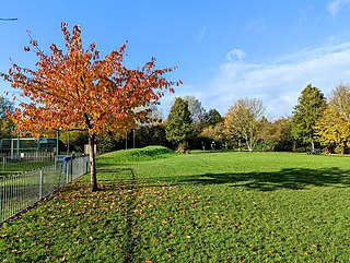
Littleton and Harestock is a civil parish consisting of the villages of Littleton and Harestock in the City of Winchester district of Hampshire, England. The population of the civil parish at the 2011 Census was 3,577.


