This article needs additional citations for verification .(March 2020) |
Shengsi 嵊泗县 | |
---|---|
Coordinates: 30°43′26″N122°27′16″E / 30.72389°N 122.45444°E | |
Country | People's Republic of China |
Province | Zhejiang |
Prefecture-level city | Zhoushan |
Area | |
• Land | 86 km2 (33 sq mi) |
• Water | 8,738 km2 (3,374 sq mi) |
Population (2018) | |
• Total | 75,221 |
Time zone | UTC+8 (China Standard) |
Postal code | 202450 |
Website | www |
Shengsi | |||||||||
---|---|---|---|---|---|---|---|---|---|
Chinese | 嵊泗 | ||||||||
Postal | Shengsze | ||||||||
|
Shengsi County is a county in the northeast of Zhejiang province consisting of an archipelago islands located to the east of Hangzhou Bay. It is under the administration of Zhoushan City and is the easternmost county-level division in the province. The islands of Greater and Lesser Yangshan are connected with Shanghai's Pudong New Area by the Donghai Bridge and their port forms part of the Port of Shanghai. They are,however,not counted among the islands of Shanghai.
The county consists of 630 islands and islets,of which 13 have more than 100 inhabitants. [1]
Towns: [2]
Townships:
Climate data for Shengsi (1991–2020 normals,extremes 1981–present) | |||||||||||||
---|---|---|---|---|---|---|---|---|---|---|---|---|---|
Month | Jan | Feb | Mar | Apr | May | Jun | Jul | Aug | Sep | Oct | Nov | Dec | Year |
Record high °C (°F) | 22.2 (72.0) | 25.9 (78.6) | 27.0 (80.6) | 29.8 (85.6) | 30.3 (86.5) | 34.3 (93.7) | 36.3 (97.3) | 37.3 (99.1) | 35.1 (95.2) | 32.4 (90.3) | 25.3 (77.5) | 21.9 (71.4) | 37.3 (99.1) |
Mean daily maximum °C (°F) | 8.5 (47.3) | 9.6 (49.3) | 12.7 (54.9) | 17.4 (63.3) | 21.9 (71.4) | 25.2 (77.4) | 29.6 (85.3) | 29.9 (85.8) | 26.7 (80.1) | 22.3 (72.1) | 17.5 (63.5) | 11.5 (52.7) | 19.4 (66.9) |
Daily mean °C (°F) | 6.1 (43.0) | 6.8 (44.2) | 9.7 (49.5) | 14.1 (57.4) | 18.9 (66.0) | 22.5 (72.5) | 26.6 (79.9) | 27.1 (80.8) | 24.3 (75.7) | 20.0 (68.0) | 15.1 (59.2) | 9.1 (48.4) | 16.7 (62.1) |
Mean daily minimum °C (°F) | 4.1 (39.4) | 4.7 (40.5) | 7.4 (45.3) | 11.7 (53.1) | 16.6 (61.9) | 20.6 (69.1) | 24.5 (76.1) | 25.1 (77.2) | 22.5 (72.5) | 18.2 (64.8) | 13.1 (55.6) | 7.0 (44.6) | 14.6 (58.3) |
Record low °C (°F) | −5.5 (22.1) | −3.0 (26.6) | −2.5 (27.5) | 3.7 (38.7) | 8.1 (46.6) | 12.7 (54.9) | 18.0 (64.4) | 18.9 (66.0) | 15.0 (59.0) | 8.1 (46.6) | 0.8 (33.4) | −5.7 (21.7) | −5.7 (21.7) |
Average precipitation mm (inches) | 65.3 (2.57) | 67.4 (2.65) | 103.3 (4.07) | 90.3 (3.56) | 95.1 (3.74) | 202.2 (7.96) | 106.5 (4.19) | 128.4 (5.06) | 86.5 (3.41) | 84.5 (3.33) | 62.9 (2.48) | 62.5 (2.46) | 1,154.9 (45.48) |
Average precipitation days (≥0.1 mm) | 10.9 | 10.2 | 13.5 | 12.4 | 12.0 | 14.9 | 8.6 | 9.5 | 9.5 | 7.6 | 9.7 | 9.1 | 127.9 |
Average snowy days | 2.4 | 2.0 | 0.6 | 0.1 | 0 | 0 | 0 | 0 | 0 | 0 | 0 | 0.8 | 5.9 |
Average relative humidity (%) | 74 | 76 | 78 | 79 | 82 | 88 | 86 | 85 | 80 | 72 | 72 | 71 | 79 |
Mean monthly sunshine hours | 115.8 | 118.3 | 144.9 | 164.4 | 176.2 | 130.9 | 231.9 | 238.9 | 189.5 | 179.8 | 135.8 | 133.4 | 1,959.8 |
Percent possible sunshine | 36 | 38 | 39 | 42 | 42 | 31 | 54 | 59 | 52 | 51 | 43 | 42 | 44 |
Source:China Meteorological Administration [3] [4] all-time extreme temperature [5] |
Climate data for Xiaoyangshan Island (1991–2020 normals) | |||||||||||||
---|---|---|---|---|---|---|---|---|---|---|---|---|---|
Month | Jan | Feb | Mar | Apr | May | Jun | Jul | Aug | Sep | Oct | Nov | Dec | Year |
Mean daily maximum °C (°F) | 8.0 (46.4) | 9.4 (48.9) | 13.2 (55.8) | 17.8 (64.0) | 22.8 (73.0) | 25.6 (78.1) | 30.6 (87.1) | 31.0 (87.8) | 27.0 (80.6) | 22.6 (72.7) | 17.5 (63.5) | 11.1 (52.0) | 19.7 (67.5) |
Daily mean °C (°F) | 5.9 (42.6) | 6.9 (44.4) | 10.2 (50.4) | 14.7 (58.5) | 19.8 (67.6) | 23.1 (73.6) | 27.6 (81.7) | 28.2 (82.8) | 24.7 (76.5) | 20.5 (68.9) | 15.3 (59.5) | 8.8 (47.8) | 17.1 (62.9) |
Mean daily minimum °C (°F) | 4.2 (39.6) | 4.9 (40.8) | 8.0 (46.4) | 12.4 (54.3) | 17.6 (63.7) | 21.3 (70.3) | 25.5 (77.9) | 26.2 (79.2) | 23.0 (73.4) | 18.9 (66.0) | 13.6 (56.5) | 7.0 (44.6) | 15.2 (59.4) |
Average precipitation mm (inches) | 64.1 (2.52) | 77.2 (3.04) | 104.1 (4.10) | 90.8 (3.57) | 95.5 (3.76) | 251.0 (9.88) | 106.6 (4.20) | 118.2 (4.65) | 129.5 (5.10) | 95.8 (3.77) | 69.7 (2.74) | 60.5 (2.38) | 1,263 (49.71) |
Average precipitation days (≥0.1 mm) | 11.1 | 11.3 | 13.0 | 10.5 | 11.0 | 15.3 | 9.5 | 9.1 | 10.5 | 6.3 | 10.3 | 9.2 | 127.1 |
Average snowy days | 2.1 | 1.5 | 0.3 | 0.1 | 0 | 0 | 0 | 0 | 0 | 0 | 0 | 1.0 | 5 |
Average relative humidity (%) | 74 | 77 | 76 | 77 | 79 | 87 | 82 | 81 | 78 | 71 | 72 | 70 | 77 |
Mean monthly sunshine hours | 114.4 | 110.7 | 152.7 | 174.4 | 183.3 | 122.5 | 230.6 | 247.2 | 174.8 | 172.0 | 131.7 | 141.4 | 1,955.7 |
Percent possible sunshine | 36 | 35 | 41 | 45 | 43 | 29 | 54 | 61 | 48 | 49 | 42 | 45 | 44 |
Source:China Meteorological Administration [6] [7] |
Xinchang County is a county in the east-central part of Zhejiang province,administratively under the municipal government of Shaoxing. 430,000 people live in Xinchang.
Qianshan(simplified Chinese:潜山市;traditional Chinese:潛山市;pinyin:qián shān shì )is a county-level city in the southwest of Anhui Province,China;it is under the jurisdiction of the prefecture-level city of Anqing. It has a population of 570,000 and an area of 1,686 square kilometres (651 sq mi). The government of Qianshan County is located in Meicheng Town. The well-known Wan Mountain,or Tianzhu Mountain,is located within the borders of the County.
Taishun County is a county in the prefecture-level city of Wenzhou,in the southern part of Zhejiang province,China,bordering Fujian province to the southeast,south,and west.
is a county of the prefecture-level city of Huzhou,in the northwest of Zhejiang province,China. Situated on the southwest shore of Lake Tai,it borders the provinces of Jiangsu to the north and Anhui to the west. It has a total area of 1,430 km2 (550 sq mi) and a population of 620,000 inhabitants.
Putuo District is a district of Zhoushan City,Zhejiang,China with a population of 378,805.
Qingyuan County is a county in Lishui,in southwestern Zhejiang province,China,bordering Fujian province to the southeast,south,and west. Its county seat is located at Songyuan Town (松源镇).
is a county of Zhangzhou City,in the far south of Fujian province,People's Republic of China
is a county of central Fujian province,People's Republic of China. It is placed under the jurisdiction of the Sanming City.
Anfu County is a county in the west of Jiangxi province,People's Republic of China. It is under the jurisdiction of the prefecture-level city of Ji'an.
Yingjing County is a county in the west-central part of Sichuan Province,China. It is under the administration of Ya'an city.
Youxi is a county of central Fujian province,People's Republic of China. It is under the administration of Sanming City.
Shaxian District,formerly Sha County,is a District of Sanming,Fujian Province,People's Republic of China. Shaxian District is the hometown of Shaxian delicacies,which are considered part of the food heritage of China.
Jiangle County is a county of western Fujian province,People's Republic of China. It is under the administration of Sanming City.
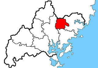
Zherong County is a county in the northeast of Fujian province,People's Republic of China,bordering Zhejiang province to the north. It is under the administration of the prefecture-level city of Ningde.
Zhouning County is a county of northeastern Fujian province,People's Republic of China. It is under the administration of the prefecture-level city of Ningde.
Kangbao County is a county in the northwest of Hebei province,China. It is under the administration of Zhangjiakou City and is its northernmost county-level division,bordering Inner Mongolia to the north,east,and west.
Longhua County is a county in the northeast of Hebei province,China,bordering Inner Mongolia to the east. It is under the administration of Chengde City.
County is a county in the east of Zhejiang province,China. It is under the administration of the city of Ningbo.
Shuangyang District is one of seven districts of the prefecture-level city of Changchun,the capital of Jilin Province,Northeast China,forming part of the city's southeastern suburbs. Despite its name,it lies more than 40 kilometres (25 mi) southeast of the urban centre. It borders the districts of Erdao to the north and Nanguan to the northwest,as well as the prefecture-level cities of Jilin to the south and east and Siping to the southwest.
Longyou County is a county of Quzhou City,in the west of Zhejiang Province,China.