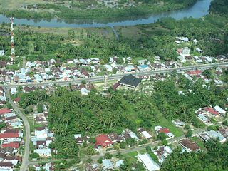
Bengkalis Regency is a regency of Indonesia in Riau Province. The regency was originally established in 1956 and then included most of the northern part of the province, but on 4 October 1999 it was divided up, with most of the territory being split off to form the new Rokan Hilir Regency, Siak Regency and the city of Dumai. On 19 December 2008 a further five districts were removed to create the new Meranti Islands Regency, leaving eight districts in the Bengkalis Regency. These eight districts has increased since 2010 to eleven by the splitting of existing districts on the Sumatran mainland.

Indragiri Hulu is a landlocked regency (kabupaten) of Riau, Indonesia. It is located on the island of Sumatra. The original regency was split in two on 4 October 1999, with the western half being created as a separate Kuantan Singingi Regency. The regency now has an area of 8,198.71 km2 and had a population of 363,442 at the 2010 census, 408,704 at the 2015 census and 444,548 at the 2020 census; the official estimate as at mid 2023 was 472,799. The administrative seat of the regency is located at the town of Rengat.

Kuantan Singingi is an inland regency (kabupaten) of Riau Province, Indonesia. It is located on the island of Sumatra. The regency was created on 4 October 1999 from what had been the western half of Indragiri Hulu Regency. It has an area of 7,656.03 km2 and had a population of 292,116 at the 2010 Census and 334,943 at the 2020 Census; the official estimate as at mid 2022 was 356,246. The seat of the regency is the town of Teluk Kuantan.

Rejang Lebong is a regency of Bengkulu Province, Indonesia, on the island of Sumatra. This regency originally included a much larger part of the inland part of the province, lying to the east of the watershed of the Barisan Mountains, but on 25 February 2003 it was divided in three, with districts in the northwest being split off to form a separate Lebong Regency, and districts in the south being similarly split off to form a new Kepahiang Regency.

North Bengkulu is a regency of Bengkulu Province, Indonesia, on the island of Sumatra. It originally covered much of the northern part of Bengkulu Province, but on 25 February 2003 the most northwesterly districts were split off to form a separate Mukomuko Regency, and on 24 June 2008 the most southeastern districts were likewise split off to create a new Central Bengkulu Regency.

South Bengkulu is a regency of Bengkulu Province, Indonesia, on the island of Sumatra. It originally comprised all of that part of Bengkulu Province situated to the southeast of the city of Bengkulu, but on 25 February 2003 this area was split into three parts, with the most southeastern districts split off to form a new Kaur Regency and the most northwestern districts split off to form a new Seluma Regency. The reduced South Bengkulu Regency now covers 1,219.91 km2, and had a population of 142,940 at the 2010 Census and 166,249 at the 2020 Census; the official estimate as at mid 2023 was 171,463 - comprising 87,297 males and 84,166 females. The regency's administrative centre is the coastal town of Manna.

Mukomuko is a regency of Bengkulu Province, Indonesia, on the island of Sumatra. It was originally part of the North Bengkulu Regency, but on 25 February 2003 that regency was split into two parts, the northwestern part created as a separate Mukomuko Regency. It covers a land area of 4,146.52 km2 and had a population of 155,753 at the 2010 census, which rose to 190,498 at the 2020 census; the official estimate as at mid 2023 was 198,794 - comprising 102,576 males and 96,218 females. The administrative centre of the Mukomuko Regency is Mukomuko town.

Lahat Regency is a regency of South Sumatra province, Indonesia. It originally included much of the southwestern part of the province, but on 21 June 2001 the town of Pagar Alam was removed from the regency to become an independent city, and on 2 January 2007 the western districts were split off to form the new Empat Lawang Regency. The reduced regency now covers a total area of 4,361.84 km2 and had a population of 369,974 at the 2010 Census and 430,071 at the 2020 Census; the official estimate as at mid 2023 was 438,238. The city of Pagar Alam remains an enclave within the regency, but is administratively separate.

Batanghari is a regency of Jambi Province in Sumatra, Indonesia. It originally covered a wider area, but on 4 October 1999 this was split between a new Muaro Jambi Regency in the east and a reduced Batang Hari Regency in the west, which now covers an area of 5,804.83 km2. It had a population of 241,334 at the 2010 census and 301,700 at the 2020 census; the official estimate as at mid 2023 was 312,279. The administrative capital is the town of Muara Bulian(Bulian Estuary or Bulian Delta).

Central Bengkulu Regency is a regency of Bengkulu Province, Indonesia. It is located on the west coast of the island of Sumatra, and lies immediately to the north and the east of the adjacent city of Bengkulu. It was formed on 24 June 2008 by being split away from the neighbouring North Bengkulu Regency. It covers an area of 1,223.94 km2 and had a population of 98,333 at the 2010 census and 116,706 at the 2020 census; the official estimate as at mid 2023 was 121,139 - comprising 62,078 males and 59,061 females. the administrative centre is at the town of Karang Tinggi.

Padang Lawas is a regency in the North Sumatra province of Indonesia. It covers an area of 3,912.18 km2, and had a population of 226,807 at the 2010 Census and 261,011 at the 2020 Census; the official estimate as of mid-2023 was 275,648 - comprising 138,506 males and 137,142 females. Its administrative seat is the town of Sibuhuan. Padang Lawas Regency was created on 17 July 2007 from southeastern parts of the South Tapanuli Regency. It is the only regency in this province that borders two other provinces, West Sumatra and Riau.

Bungo Regency is a regency (kabupaten) of Jambi Province in Sumatra, Indonesia. It was created on 4 October 1999 by the division of the former Bungo Tebo Regency into a new Tebo Regency in the west and this Bungo Regency in the east. The Bungo Regency covers an area of 4,659 km2. As at the 2010 census, the regency had a population of 303,135 and 362,363 at the 2020 census; the official estimate as at mid 2023 was 376,382 - comprising 191,594 males and 184,788 females. The administrative capital is the town of Muara Bungo.

Merangin Regency is a regency (kabupaten) of Jambi Province on the island of Sumatra, Indonesia. It was created on 4 October 1999 by the division of the former Sarolangun Bangko Regency into a new Sarolangun Regency in the east and this Merangin Regency in the west. The regency covers an area of 7,679.0 km2, and had a population of 333,206 at the 2010 census and 354,052 at the 2020 census; the official estimate as at mid 2023 was 368,389 - comprising 187,026 males and 181,363 females. The administrative capital is the town of Bangko.

Sarolangun Regency is a regency of Jambi Province, Indonesia. It is located on the island of Sumatra. It was created on 4 October 1999 by the division of the former Sarolangun Bangko Regency into a new Merangin Regency and this Sarolangun Regency. The regency has an area of 5,935.89 km2 and had a population of 246,245 at the 2010 census and 290,047 at the 2020 census; the official estimate as at mid 2023 was 302,243. The administrative centre is at the town of Sarolangun.

Kaur is the most southern regency of Bengkulu Province, Indonesia, on the west coast of the island of Sumatra. It was created on 25 February 2003 from what were formerly the southeastern districts of the South Bengkulu Regency. It has an area of 2,365.00 km2 and had a population of 107,899 at the 2010 Census and 126,551 at the 2020 Census; the official estimate as at mid 2023 was 131,063 - comprising 67,389 males and 63,674 females. The regency seat is at the town of Bintuhan.

Lebong is an inland regency of Bengkulu Province, Indonesia, on the island of Sumatra. It lies on the eastern slopes of the Barisan Mountains, the main watershed of Sumatra, thus draining towards the island's east coast. It covers an area of 1,665.28 km2, and had a population of 97,091 at the 2010 Census and 106,293 at the 2020 Census; the official estimate as at mid 2023 was 110,347 - comprising 56,410 males and 53,937 females. Contrary to the popularly-held belief that the town of Muara Aman is the seat of the government of Lebong Regency, the regency's capital is actually located in neighboring Tubei District, where all the offices and judiciary institution are situated.

South Ogan Komering Ulu Regency is an inland regency in the far south of South Sumatra Province, Indonesia. It was created on 18 December 2003 from what had previously been the southernmost districts of Ogan Komering Ulu Regency. It covers an area of 5,493.94 km2, and had a population of 318,428 at the 2010 Census and 408,981 at the 2020 Census; the official estimate as at mid 2023 was 407,676. The administrative centre is the town of Muaradua. It borders Ogan Komering Ulu Regency, East Ogan Komering Ulu Regency and Muara Enim Regency to the north. It also borders Lampung Province to the south and east and Bengkulu Province to the west.

Way Kanan Regency is a landlocked regency (kabupaten) of Lampung Province, Sumatra, Indonesia. It was created on 20 April 1999 from what were formerly the northern and northwestern districts of North Lampung Regency. It has an area of 3,921.63 km2 and had a population of 406,123 at the 2010 census and 473,575 at the 2020 census; the official estimate as at mid 2023 was 489,773. The administrative centre lies at the town of Blambangan Umpu.

Lubuk Pakam is a town and an administrative district (kecamatan) in North Sumatra province of Indonesia and it is the seat (capital) of Deli Serdang Regency. The district covers an area of 31.19 km2, and had a population of 80,847 at the 2010 Census and 88,576 at the 2020 Census; the official estimate as at mid 2023 was 91,858. The district is sub-divided into 7 urban communities (kelurahan) and 6 rural villages (desa), all 13 listed below with their areas and their populations at the 2020 Census and as at the official estimates for mid 2022, together with their postcodes.

Penukal Abab Lematang Ilir Regency is a regency of South Sumatra Province, Indonesia. It takes its name from the three main rivers which flow through that area - the Penukal River, Abab River and Lematang River - while the name Ilir means "downstream". The town of Talang Ubi is the administrative centre of this regency. The regency borders Musi Banyuasin Regency to the north, Banyuasin Regency, and Muara Enim Regency to the east and the south, and by Musi Rawas Regency, and Muara Enim Regency to the west.


