Related Research Articles

Massasoit Sachem or Ousamequin was the sachem or leader of the Wampanoag confederacy. Massasoit means Great Sachem. Massasoit was not his name but a title. English colonists mistook Massasoit as his name and it stuck.

Plimoth Patuxet is a complex of living history museums in Plymouth, Massachusetts founded in 1947, formerly Plimoth Plantation. It replicates the original settlement of the Plymouth Colony established in the 17th century by the English colonists who became known as the Pilgrims, as well as that of the Patuxet people upon whose land the Pilgrims settled. They were among the first people who emigrated to America to seek religious separation from the Church of England. It is a not-for-profit museum supported by administrations, contributions, grants, and volunteers. The recreations are based upon a wide variety of first-hand and second-hand records, accounts, articles, and period paintings and artifacts, and the museum conducts ongoing research and scholarship, including historical archaeological excavation and curation locally and abroad.
The Hockomock Swamp is a vast wetland encompassing much of the northern part of southeastern Massachusetts. This 16,950-acre (6,859 ha) land is considered the largest freshwater swamp in the state. It acts as a natural flood control mechanism for the region.

Nine Men's Misery is a site in current day Cumberland, Rhode Island, where nine colonists were tortured by Narragansett warriors during King Philip's War. A stone memorial was constructed in 1676 and is believed to be the oldest war monument in the United States.
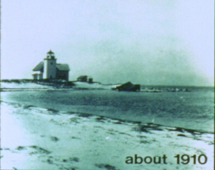
Billingsgate Island, also sometimes known as Bellingsgate Island, was an island off Cape Cod in Massachusetts in the United States. Originally settled as a fishing and whaling community as part of the town of Eastham, Massachusetts, Billingsgate Island was for a long time the site of a lighthouse used as a navigational aid in Cape Cod Bay. Local historians sometimes call it the Atlantis of Cape Cod.

The National Monument to the Forefathers, formerly known as the Pilgrim Monument, commemorates the Mayflower Pilgrims. Dedicated on August 1, 1889, it honors their ideals as later generally embraced by the United States. It is thought to be the world's largest solid granite monument.
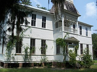
Rochelle is an unincorporated community in Alachua County, Florida, United States. It was found in the 1830s on a former native settlement and mission site. and was built around the Plantation of Madison Starke Perry.

The Pilgrim Hall Museum at 75 Court Street in Plymouth, Massachusetts is the oldest public museum in the United States in continuous operation, having opened in 1824.
Plymouth Harbor is a harbor located in Plymouth, a town in the South Shore region of the U.S. state of Massachusetts. It is part of the larger Plymouth Bay. Historically, Plymouth Harbor was the site of anchorage of the Mayflower where the Plymouth Colony pilgrims disembarked in 1620 to establish a permanent settlement at Plymouth.
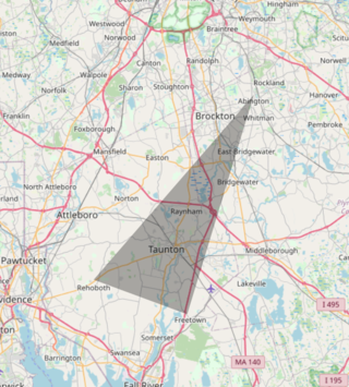
The Bridgewater Triangle is an area of about 200 square miles (520 km2) within southeastern Massachusetts in the United States, claimed to be a site of alleged paranormal phenomena, ranging from UFOs to poltergeists, and other spectral phenomena, various bigfoot-like sightings, giant snakes and thunderbirds. The term was coined by New England based cryptozoologist Loren Coleman.
Beth Israel Deaconess Hospital- Plymouth (BID-Plymouth) is a hospital located in Plymouth, Massachusetts. Founded in 1901, it is today the largest hospital in the Southern region of the South Shore. BID-Plymouth is an acute care, 164-bed, not-for-profit community hospital serving 12 towns in Plymouth and Barnstable counties. It contains more than 30 departments, programs and services, including chiropractic care.

Manomet is a seaside village of Plymouth, Massachusetts, United States. It is named for the Wampanoag village of Manomet located among the Manomet Ponds. Manomet has a Post Office in the business district whose ZIP code is 02345. Residents and businesses in this village that are non-Post Office box holders use Plymouth's ZIP code of 02360.

The Plymouth Antiquarian Society is a historical organization in Plymouth, Massachusetts. The Society, founded in 1919, owns and maintains the Harlow Old Fort House, the Spooner House, the Hedge House, and an ancient Native American site, Sacrifice Rock.

Cole's Hill is a National Historic Landmark containing the first cemetery used by the Mayflower Pilgrims in Plymouth, Massachusetts in 1620. The hill is located on Carver Street near the foot of Leyden Street and across the street from Plymouth Rock. Owned since 1820 by the preservationist Pilgrim Society, it is now a public park.
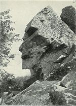
Profile Rock was a 50-foot high granite rock formation located in Freetown, Massachusetts just outside Assonet village and near the Freetown State Forest. Local Wampanoags believe it to be the image of Chief Massasoit. The Wampanoags occupied the region of Rhode Island and Massachusetts bounded by Narragansett Bay to the west and the Atlantic Ocean to the east, and Chief Massasoit was a close friend to the early Pilgrim settlers.
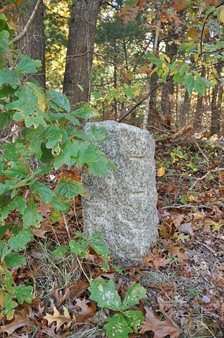
The town of Barnstable, Massachusetts has four surviving stone markers that were used in colonial days to mark the town's boundaries with its neighbors. All four are listed on the National Register of Historic Places, three of them individually, and one as part of the Old King's Highway Historic District. Barnstable was established in 1639.
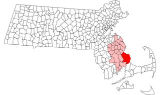
The Patuxet were a Native American band of the Wampanoag tribal confederation. They lived primarily in and around modern-day Plymouth, Massachusetts, and were among the first Native Americans encountered by European settlers in the region in the early 17th century. Most of the population subsequently died of epidemic infectious diseases. The last of the Patuxet – an individual named Tisquantum, who played an important role in the survival of the Pilgrim colony at Plymouth – died in 1622.

The Myles Standish Burial Ground in Duxbury, Massachusetts is, according to the American Cemetery Association, the oldest maintained cemetery in the United States.
Rock Harbor is a man-made harbor on Cape Cod Bay located on the border between Orleans, Massachusetts and Eastham, Massachusetts.
References
- ↑ "#ThrowBackThursday: Sacrifice Rock". Plymouth 400, Inc. 2014-09-25. Retrieved 2020-01-02.