The City Loop is a piece of underground commuter rail infrastructure in the central business district (CBD) of Melbourne, Victoria, Australia
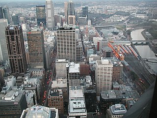
Hoddle Grid is the contemporary name given to the approximately 1-by-0.5-mile grid of streets that form the Melbourne central business district, Australia. Bounded by Flinders Street, Spring Street, La Trobe Street, and Spencer Street, it lies at an angle to the rest of the Melbourne suburban grid, and so is easily recognisable. It is named after the surveyor Robert Hoddle, who marked it out in 1837, establishing the first formal town plan. This grid of streets, laid out when there were only a few hundred settlers, became the nucleus for what is now Melbourne, a city of over five million people.

The City Circle is a zero-fare tram running around the Melbourne central business district in Australia. Aimed mainly at tourists, the route passes many Melbourne attractions while running along the city centre's outermost thoroughfares, as well as the developing Docklands waterfront precinct. It operates in both clockwise and anti-clockwise direction.
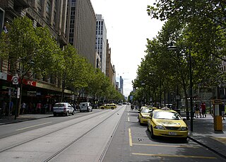
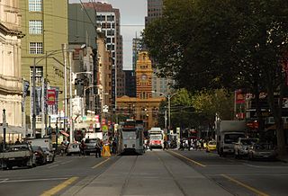
Swanston Street is a major thoroughfare in the Melbourne central business district, Victoria, Australia. It was laid out in 1837 as part of the original Hoddle Grid. The street vertically bisects Melbourne's city centre and is famous as the world's busiest tram corridor, for its heritage buildings and as a shopping strip.
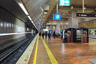
Melbourne Central railway station is an underground station on the electrified railway network in Melbourne, Australia. It is one of three underground stations on the City Loop, which runs through the north and east of the Melbourne CBD.

Collins Street is a major street in the central business district of Melbourne, Victoria, Australia. It was laid out in the first survey of Melbourne, the original 1837 Hoddle Grid, and soon became the most desired address in the city. Collins Street was named after Lieutenant-Governor of Tasmania David Collins who led a group of settlers in establishing a short-lived settlement at Sorrento in 1803.
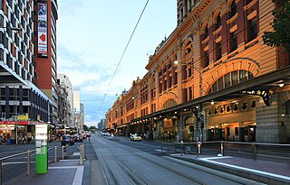
Flinders Street is a street in Melbourne, Victoria, Australia. Running roughly parallel to the Yarra River, Flinders Street forms the southern edge of the Hoddle Grid. It is exactly 1 mi (1.6 km) in length and one and a half chains in width.
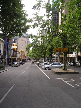
Elizabeth Street is one of the main streets in the Melbourne central business district, Victoria, Australia, part of the Hoddle Grid laid out in 1837. It is presumed to have been named in honour of governor Richard Bourke's wife.
The Russell Street bombing was the 27 March 1986 bombing of the Russell Street Police Headquarters complex in Melbourne, Victoria, Australia. The explosion killed Angela Rose Taylor, the first Australian policewoman to be killed in the line of duty. The materials for the bomb were stolen from Tyrconnel Mine. Several men were arrested for suspected involvement with the bombing. Stanley Taylor and Craig Minogue were convicted of murder and various other offences related to the bombing. Peter Reed and Rodney Minogue were acquitted of any offences related to the bombing, but Reed was convicted of a number of offences related to his arrest, which involved a shootout with police officers in which he and an officer were wounded. He was sentenced to 12 years' imprisonment.
Spencer Street is a major street and thoroughfare in the Melbourne central business district, Victoria, Australia. The street was gazetted in 1837 as the westernmost boundary of the Hoddle Grid.

La Trobe Street is a major street and thoroughfare in the Melbourne central business district, Victoria, Australia. It runs roughly east–west and forms the northern boundary of the central business district. The street was laid out as an extension of the original Hoddle Grid in 1839 and was named after Charles La Trobe. La Trobe Street extends from Victoria Street in the east to Harbour Esplanade in the west.
Spring Street is a major street in the Melbourne central business district, Australia. It runs roughly north-south and is the easternmost street in the original 1837 Hoddle Grid.
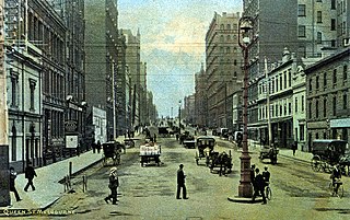
Queen Street is a street in the Melbourne central business district, Victoria, Australia. The street forms part of the original Hoddle Grid and was laid out in 1837. It runs roughly north-south and is primarily a commercial and financial thoroughfare of the central business district.
Victoria Street is one of the major thoroughfares of inner Melbourne, running east–west for over six kilometres between Munster Terrace in North Melbourne and the Yarra River. The road is known as Victoria Parade for over one-and-a-half kilometres of its length, distinguishable with a wide reservation and tramway down the middle.
Exhibition Street is a major street in the Melbourne central business district, Australia. The street is named after the International Exhibition held at the Royal Exhibition Building in 1880, and was previously known as Stephen Street from 1837. The street runs roughly north–south and was laid out as part of the original Hoddle Grid.

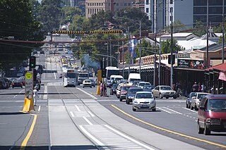
King Street is a main road in the Melbourne central business district, Australia. It is considered a key hub of Melbourne's nightlife and is home to many pubs, nightclubs, restaurants, and adult entertainment venues.

Lonsdale Street is a main street and thoroughfare in the Melbourne central business district, Australia. It runs roughly east–west and was laid out in 1837 as one of Melbourne's original boundaries within the Hoddle Grid. The street extends from Spring Street in the east to Spencer Street in the west.
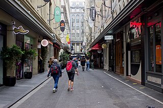
Degraves Street is a pedestrian precinct and thoroughfare in the Melbourne central business district in Victoria, Australia. It is a short, narrow laneway that runs north–south from Flinders Street to Flinders Lane and is situated in-between Swanston and Elizabeth streets. Degraves, as the street is colloquially known, is famous for its alfresco dining options and because it epitomises Melbourne's coffee culture and street art scene. For these reasons it has also become a popular tourist destination.
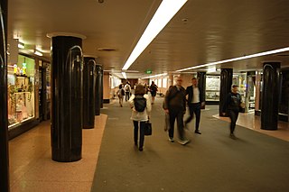
Campbell Arcade is a pedestrian arcade located in Melbourne, Victoria, Australia. The arcade is accessible from Flinders Street station and was built in 1955 to ensure crossing between Flinders Street and Melbourne's main train station was safer. It was completed ahead of the 1956 Melbourne Olympics.
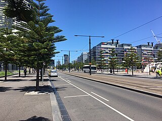
Harbour Esplanade is a waterfront street and thoroughfare in Docklands, an inner suburb of Melbourne, Victoria, Australia. It runs roughly north-south from Navigation Drive in the south to Docklands Drive in the north. The road also forms the eastern boundary of the Victoria Harbour inlet and is adjacent to Victoria Dock.


