
The Sydney Harbour Bridge is a steel through arch bridge in Sydney, New South Wales, Australia, spanning Sydney Harbour from the central business district (CBD) to the North Shore. The view of the bridge, the Harbour, and the nearby Sydney Opera House is widely regarded as an iconic image of Sydney, and of Australia itself. Nicknamed "The Coathanger" because of its arch-based design, the bridge carries rail, vehicular, bicycle and pedestrian traffic.

The Sydney Harbour Tunnel is a twin-tube road tunnel in Sydney, Australia. The tunnel was completed and opened to traffic in August 1992 to provide a second vehicular crossing of Sydney Harbour to alleviate congestion on the Sydney Harbour Bridge. It is one of two transportation tunnels under the harbour, the other being a set of rail tunnels for the Sydney Metro.

The North Shore is a region within Northern Sydney, in New South Wales, Australia, generally referring to suburbs located on the northern side of Sydney Harbour up to Wahroonga, and suburbs between Middle Harbour and the Lane Cove River.

The Northern Beaches is a region within Northern Sydney, in the state of New South Wales, Australia, near the Pacific coast. This area extends south to the entrance of Port Jackson, west to Middle Harbour and north to the entrance of Broken Bay. The area was formerly inhabited by the Garigal or Caregal people in a region known as Guringai country.

Wynyard railway station is a heritage-listed underground commuter rail station located in the north-west precinct of the Sydney central business district, in New South Wales, Australia. The station opened on 28 February 1932 to coincide with the opening of the Sydney Harbour Bridge.

The Sydney Orbital Network is a 110 kilometre motorway standard ring road around and through Sydney, the capital of New South Wales in Australia. It runs north from Sydney Airport, underneath the CBD to the North Shore, west to the Hills District, south to Prestons and then east to connect with the airport. Much of the road is privately owned and financed by tolls.

The Roads & Traffic Authority (RTA) was an agency of the Government of New South Wales responsible for major road infrastructure, licensing of drivers, and registration of motor vehicles. The RTA directly managed state roads and provided funding to local councils for regional and local roads. In addition, with assistance from the federal government, the RTA also managed the NSW national highway system. The agency was abolished in 2011 and replaced by Roads & Maritime Services.

The Pyrmont Bridge, a heritage-listed swing bridge across Cockle Bay, is located in Darling Harbour, part of Port Jackson, west of the central business district in the City of Sydney local government area of New South Wales, Australia. Opened in 1902, the bridge initially carried motor vehicle traffic via the Pyrmont Bridge Road between the central business district and Pyrmont. Since 1981 the bridge has carried pedestrian and bicycle traffic only, as motor vehicles were diverted to adjacent freeway overpasses. The bridge was added to the New South Wales State Heritage Register on 28 June 2002, the centenary of its opening.
Killarney Heights is a suburb of Northern Sydney, situated on Middle Harbour, in the state of New South Wales, Australia. Killarney Heights is 12 kilometres north-east of the Sydney central business district in the local government area of Northern Beaches Council. Killarney Heights is part of the Forest District, colloquially known as The Forest.

Bradfield Highway is a 2.1-kilometre (1.3 mi) highway that crosses the Sydney Harbour Bridge in Sydney, New South Wales and is one of the shortest highways in Australia. It opened along with the bridge itself on 19 March 1932 and was named in honour of John Bradfield, the engineer who designed and helped construct it.
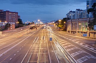
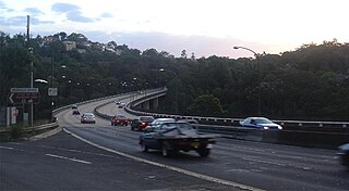
Warringah Freeway is a 3.5-kilometre (2.2 mi) divided freeway in Sydney, New South Wales, Australia that is part of the Sydney Orbital Network. The primary function of the freeway is to provide an alternative high-grade route from the Sydney Harbour Tunnel and Bradfield Highway at Milsons Point to the A8 and Gore Hill Freeway. The freeway reduces traffic demands on Pacific Highway throughout Sydney's Lower North Shore, bypassing North Sydney and Crows Nest, and provides a vital link to access most of the suburbs in Sydney and is also a major route to the north, south, east and west of the central business district.
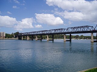
The Iron Cove Bridge is a heritage-listed road bridge that carries Victoria Road (A40) across Iron Cove, between the Sydney suburbs of Drummoyne and Rozelle. Iron Cove is an arm of Sydney Harbour.
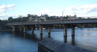
The Fig Tree Bridge is a road bridge that carries Burns Bay Road across the Lane Cove River, and connects the suburbs of Hunters Hill in the south and Linley Point in the north, located approximately seven kilometres northwest of the central business district of Sydney in New South Wales, Australia. The concrete girder bridge carries motor vehicles, and a grade-separated footpath and cycleway.
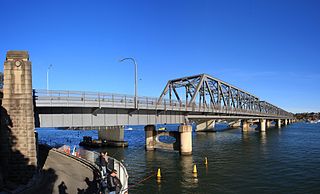
Tom Uglys Bridge are two road bridges, completed in 1929 and 1987, that carry the Princes Highway across the Georges River in southern Sydney, in the state of New South Wales, Australia. The bridges link the St George area at Blakehurst to the Sutherland Shire at Sylvania. Tom Uglys Bridge is one of six major road crossings of Georges River.
Burnt Bridge Creek Deviation is a 1.7-kilometre-long (1.1 mi) major arterial road in the Northern Beaches area of Sydney, Australia, and is a constituent part of the A8 route. It takes its name from Burnt Bridge Creek which flows beneath the road, although there is no sign of the "burnt bridge" which gives the creek its name.

The Spit Bridge, a steel and concrete girder bridge with a bascule lift span across the Middle Harbour, is located 10 kilometres (6.2 mi) north-east of the central business district in Sydney, Australia. The bridge carries The Spit Road (A8) from a point called The Spit, and connects the suburbs of Mosman, on the south bank and Seaforth, on the north bank.

The A8 is a route designation of a major metropolitan arterial route through suburban north-eastern Sydney. This name covers a few consecutive roads and is widely known to most drivers, but the entire allocation is also known – and signposted – by the names of its constituent parts: Pittwater Road, Condamine Street, Burnt Bridge Creek Deviation, Manly Road, Spit Road and Military Road.

Northern Sydney is a large metropolitan area in Greater Sydney, New South Wales, Australia on the north shore of Sydney Harbour and Parramatta River. The region embraces suburbs in Sydney's north-east, north and inner north west. Northern Sydney is divided into distinctive regions such as the North Shore, Northern Beaches and Forest District.
The A38 is a route designation of a major metropolitan arterial route through suburban Sydney, linking M2 Hills Motorway in North Ryde and Pittwater Road (A8) in Dee Why. This name covers a few consecutive roads and is widely known to most drivers, but the entire allocation is also known – and signposted – by the names of its constituent parts: Delhi Road, Millwood Avenue, Fullers Road, Pacific Highway, Boundary Street, Babbage Road and Warringah Road.
The Beaches Link is a proposed underground motorway scheme in Sydney, New South Wales, Australia. It would consist of a series of motorway tunnels running north-south between Burnt Bridge Creek Deviation at Balgowlah and the Warringah Freeway at Cammeray, providing direct access from the Northern Beaches to the Sydney central business district.


