Rookery (slum)

Last updated

A rookery, in the colloquial English of the 18th and 19th centuries, was a city slum occupied by poor people and frequently also by criminals and prostitutes. Such areas were overcrowded, with low-quality housing and little or no sanitation. Local industry such as coal plants and gasholders polluted the rookery air. [1] Poorly constructed dwellings, built with multiple stories and often crammed into any area of open ground, created densely-populated areas of gloomy, narrow streets and alleyways. By many, these parts of the city were sometimes deemed "uninhabitable". [2]

Contents

Etymology

The term rookery originated because of the perceived similarities between a city slum and the nesting habits of the rook, a bird in the crow family. Rooks nest in large, noisy colonies consisting of multiple nests, often untidily crammed into a close group of treetops called a rookery.

The word might also be linked to the slang expression to rook (meaning to cheat or steal), a verb well established in the 16th century and associated with the supposedly thieving nature of the rook bird. The term rookery was first used in print by the poet George Galloway in 1792 to describe "a cluster of mean tenements densely populated by people of the lowest class". [3]

Creation of a rookery

An area might become a rookery when criminals would inhabit dead-end streets for their strategic use in isolation. In other cases, industry that produced noise or odours would drive away inhabitants that would not settle for such an environment and could leave. These types of industry could be "some foul factory, a gas-works, the debris of a street market, or an open sewer," which often employed those who lived within the rookery. [2] Another factor which created rookeries was the lack of building regulations, or at times the ignorance of such by construction workers. Middle-class houses were too large for single working-class families, so they were often sub-divided to accommodate multiple households - a factor which ran these homes into noise and ruin. [2]

Rookery inhabitants

The people living in a rookery were often migrants, immigrants, poor and working-class or criminals. Notable groups of immigrants who inhabited rookeries were Jewish and Irish. The jobs available to rookery occupants were undesirable jobs such as rag-picking, street sweeping, or waste removal. [2]

London rookeries

Part of Charles Booth's poverty map showing the Old Nichol in the East End of London. Published 1889 in Life and Labour of the People in London. The red areas are "middle class, well-to-do", light blue areas are "poor, 18s to 21s a week for a moderate family", dark blue areas are "very poor, casual, chronic want", and black areas are the "lowest class...occasional labourers, street sellers, loafers, criminals and semi-criminals". Poverty map old nichol 1889.jpg
Part of Charles Booth's poverty map showing the Old Nichol in the East End of London. Published 1889 in Life and Labour of the People in London. The red areas are "middle class, well-to-do", light blue areas are “poor, 18s to 21s a week for a moderate family”, dark blue areas are “very poor, casual, chronic want”, and black areas are the "lowest class...occasional labourers, street sellers, loafers, criminals and semi-criminals".

Famous rookeries include the St Giles area of central London, which existed from the 17th century and into Victorian times, an area described by Henry Mayhew in about 1860 in A Visit to the Rookery of St Giles and its Neighbourhood. [4] The St Giles' slum, Bermondsey's Jacob's Island, and the Old Nichol Street Rookery in the East End of London were demolished as part of London slum clearance and urban redevelopment projects in the late 19th century.

In 1850, the English novelist Charles Dickens was given a guided tour of several dangerous rookeries by "Inspector Field, the formidable chief detective of Scotland Yard". [5] A party of six—Dickens, Field, an assistant commissioner, and three lower ranks (probably armed)—made their way into the Rat's Castle, backed by a squad of local police within whistling distance. The excursion started in the evening and lasted until dawn. They went through St Giles and even worse slums, in the Old Mint, along the Ratcliffe Highway and Petticoat Lane. The results of this and other investigations came out in novels, short stories, and straight journalism, of which Dickens wrote a great deal.

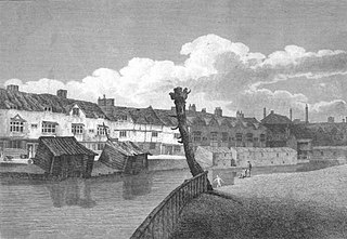
Oliver Twist (1838) features the rookery at Jacob's Island: [6]

... crazy wooden galleries common to the backs of half a dozen houses, with holes from which to look upon the slime beneath; windows, broken and patched, with poles thrust out, on which to dry the linen that is never there; rooms so small, so filthy, so confined, that the air would seem to be too tainted even for the dirt and squalor which they shelter; wooden chambers thrusting themselves out above the mud and threatening to fall into it—as some have done; dirt-besmeared walls and decaying foundations, every repulsive lineament of poverty, every loathsome indication of filth, rot, and garbage: all these ornament the banks of Folly Ditch.

In Sketches by Boz , Dickens described a rookery: [7]

Wretched houses with broken windows patched with rags and paper: every room let out to a different family, and in many instances to two or even three... filth everywhere—a gutter before the houses and a drain behind—clothes drying and slops emptying, from the windows; girls of fourteen or fifteen, with matted hair, walking about barefoot, and in white great-coats, almost their only covering; boys of all ages, in coats of all sizes and no coats at all; men and women, in every variety of scanty and dirty apparel, lounging, scolding, drinking, smoking, squabbling, fighting, and swearing.

In The Rookeries of London (1850)[ citation needed ] Thomas Beames also described one:

The Rookery... was like an honeycomb, perforated by a number of courts and blind alleys, cul de sac, without any outlet other than the entrance. Here were the lowest lodging houses in London, inhabited by the various classes of thieves common to large cities… were banded together… Because all are taken in who can pay their footing, the thief and the prostitute are harboured among those whose only crime is poverty, and there is thus always a comparatively secure retreat for him who has outraged his country's laws. Sums here are paid, a tithe of which, if well laid out, would provide at once a decent and an ample lodging for the deserving poor; and that surplus, which might add to the comfort and better the condition of the industrious, finds its way into the pocket of the middleman....

Kellow Chesney gives a whole chapter to the rookeries of London. At their zenith, they were a problem that seemed impossible to solve, yet eventually they did decline. Changes in the law, the growing effectiveness of the police, slum clearances, and perhaps the growing prosperity of the economy gradually had their effect. [8]

Other rookeries

The King Street Rookery in Southampton was also notorious during the early 19th century. [9]

The term has also been used in other parts of the English-speaking world, including the United States [10] and Australia. [11]

Related Research Articles

<span class="mw-page-title-main">Bermondsey</span> District in London, England

Bermondsey is a district in southeast London, part of the London Borough of Southwark, England, 2.5 miles (4.0 km) southeast of Charing Cross. To the west of Bermondsey lies Southwark, to the east Rotherhithe and Deptford, to the south Walworth and Peckham, and to the north is Wapping across the River Thames. It lies within the historic county boundaries of Surrey. During the Industrial Revolution Bermondsey became a centre for manufacturing, particularly in relation to tanning. More recently it has experienced regeneration including warehouse conversions to flats and the provision of new transport links.

<span class="mw-page-title-main">Apartment</span> Self-contained housing unit occupying part of a building

An apartment, flat, or unit is a self-contained housing unit that occupies part of a building, generally on a single storey. There are many names for these overall buildings. The housing tenure of apartments also varies considerably, from large-scale public housing, to owner occupancy within what is legally a condominium, to tenants renting from a private landlord.

A semi-detached house is a single-family duplex dwelling that shares one common wall with its neighbour. The name distinguishes this style of construction from detached houses, with no shared walls, and terraced houses, with a shared wall on both sides. Often, semi-detached houses are built in pairs in which each house's layout is a mirror image of the other's.
<span class="mw-page-title-main">Farringdon Road</span>

Farringdon Road is a road in Clerkenwell, London.

<span class="mw-page-title-main">Canning Town</span> District in Newham, East London, England

Canning Town is a district in the London Borough of Newham, East London, England, north of the Royal Victoria Dock. Its urbanisation was largely due to the creation of the dock. The area was part of the ancient parish of West Ham, in the hundred of Becontree, and the historic county of Essex. It forms part of the London E16 postcode district.

<span class="mw-page-title-main">Costermonger</span> Street seller of fruit and vegetables

A costermonger, coster, or costard is a street seller of fruit and vegetables in British towns. The term is derived from the words costard and monger (seller), and later came to be used to describe hawkers in general. Some historians have pointed out that a hierarchy existed within the costermonger class and that while costermongers sold from a handcart or animal-drawn cart, mere hawkers carried their wares in a basket.

<span class="mw-page-title-main">Tenement</span> Building shared by multiple dwellings

A tenement is a type of building shared by multiple dwellings, typically with flats or apartments on each floor and with shared entrance stairway access. They are common on the British Isles, particularly in Scotland. In the medieval Old Town, in Edinburgh, tenements were developed with each apartment treated as a separate house, built on top of each other. Over hundreds of years, custom grew to become law concerning maintenance and repairs, as first formally discussed in Stair's 1681 writings on Scots property law. In Scotland, these are now governed by the Tenements Act, which replaced the old Law of the Tenement and created a new system of common ownership and procedures concerning repairs and maintenance of tenements. Tenements with one- or two-room flats provided popular rented accommodation for workers, but in some inner-city areas, overcrowding and maintenance problems led to shanty towns, which have been cleared and redeveloped. In more affluent areas, tenement flats form spacious privately owned houses, some with up to six bedrooms, which continue to be desirable properties.
<span class="mw-page-title-main">Seven Dials, London</span> Neighbourhood in Londons West End

Seven Dials is a road junction and neighbourhood in the St Giles district of the London Borough of Camden, within the greater Covent Garden area in the West End of London. Seven streets of the Seven Dials area converge at the roughly circular central roundabout, at the centre of which is a column bearing six sundials – with the column itself acting as the seventh sundial.

<span class="mw-page-title-main">Common lodging-house</span> Victorian era term for a form of cheap accommodation

"Common lodging-house" is a Victorian era term for a form of cheap accommodation in which the inhabitants are all lodged together in the same room or rooms, whether for eating or sleeping. The slang terms dosshouse and flophouse designate roughly the equivalent of common lodging-houses. The nearest modern equivalent is a hostel.
<span class="mw-page-title-main">Jacob's Island</span> Slum in Bermondsey, London, England

Jacob's Island was a notorious slum in Bermondsey, London, in the 19th century. It was located on the south bank of the River Thames, approximately delineated by the modern streets of Mill Street, Bermondsey Wall West, George Row and Wolseley Street. Jacob's Island developed a reputation as one of the worst slums in London, and was popularised by the Charles Dickens novel Oliver Twist, published shortly before the area was cleared in the 1860s.
<span class="mw-page-title-main">The Canongate</span> District of Edinburgh, Scotland

The Canongate is a street and associated district in central Edinburgh, the capital city of Scotland. The street forms the main eastern length of the Royal Mile while the district is the main eastern section of Edinburgh's Old Town.
<span class="mw-page-title-main">Boundary Estate</span> Housing estate in the London Borough of Tower Hamlets, England.

The Boundary Estate is a housing development in the London Borough of Tower Hamlets, in the East End of London.

<span class="mw-page-title-main">Clare Market</span> Historic area in London, England

Clare Market is a historic area in central London located within the parish of St Clement Danes to the west of Lincoln's Inn Fields, between the Strand and Drury Lane, with Vere Street adjoining its western side. It was named after the food market which had been established in Clement's Inn Fields, by John Holles, 2nd Earl of Clare. Much of the area and its landmarks were immortalised by Charles Dickens in The Old Curiosity Shop, The Pickwick Papers, Barnaby Rudge and Sketches by Boz.

<span class="mw-page-title-main">St Giles, London</span> Human settlement in England

St Giles is an area in London, England and is located in the London Borough of Camden. It is in Central London and part of the West End. It gets its name from the parish church of St Giles in the Fields. The combined parishes of St Giles in the Fields and St George Bloomsbury were administered jointly for many centuries; leading to the conflation of the two, with much or all of St Giles usually taken to be a part of Bloomsbury. Points of interest include the church of St Giles in the Fields, Seven Dials, the Phoenix Garden, and St Giles Circus.

<span class="mw-page-title-main">London Beer Flood</span> 1814 brewery disaster in London

The London Beer Flood was an accident at Meux & Co's Horse Shoe Brewery, London, on 17 October 1814. It took place when one of the 22-foot-tall (6.7 m) wooden vats of fermenting porter burst. The escaping liquid dislodged the valve of another vessel and destroyed several large barrels: between 128,000 and 323,000 imperial gallons of beer were released in total.

<span class="mw-page-title-main">19th-century London</span> London-related events during the 19th century

During the 19th century, London grew enormously to become a global city of immense importance. It was the largest city in the world from about 1825, the world's largest port, and the heart of international finance and trade. Railways connecting London to the rest of Britain, as well as the London Underground, were built, as were roads, a modern sewer system and many famous sites.

<span class="mw-page-title-main">Flower and Dean Street</span> Road at the heart of the Spitalfields rookery in the East End of London

Flower and Dean Street was a road at the heart of the Spitalfields rookery in the East End of London. It was one of the most notorious slums of the Victorian era, being described in 1883 as "perhaps the foulest and most dangerous street in the whole metropolis", and was closely associated with the victims of Jack the Ripper.

<span class="mw-page-title-main">Streatham Street</span>

Streatham Street is a street in the London district of Bloomsbury, running between New Oxford Street and Great Russell Street. In the 19th century, the street was on the border of the "rookery" of St Giles, a slum, and became the location for new accommodation, which reformers planned would replace the slums.

<span class="mw-page-title-main">The Angel, St Giles High Street</span> Historic public house in London, England

The Angel is a historic public house and former coaching inn on St Giles High Street, in the St Giles district of the West End of London.

Economy, industry, and trade of the Victorian era refers to the economic history of the United Kingdom during the reign of Queen Victoria.

References

  1. Roberts, Robert (1973). The classic slum : Salford life in the first quarter of the century. Harmondsworth. ISBN   9780140216929.{{cite book}}: CS1 maint: location missing publisher (link)
  2. 1 2 3 4 Dyos, H. J. (1967). "The Slums of Victorian London". Victorian Studies. 11 (1): 5–40. ISSN   0042-5222.
  3. "World Wide Words: Rookery". World Wide Words. Retrieved 13 March 2023.
  4. "A Visit to the Rookery of St Giles and its Neighbourhood" (PDF). Archived from the original (PDF) on 10 October 2006. Retrieved 13 March 2023.
  5. Chesney (1970), p.130.
  6. Dickens, Charles (1839). Oliver Twist. Vol. III. London: Richard Bentley. p. 240. Retrieved 30 June 2023.
  7. Dickens, Charles (1895). Sketches by Boz : illustrative of every-day life and every-day people. London : Chapman & Hall. p. 136. Retrieved 30 June 2023.
  8. Chesney (1970), Chapter 4: Citadels of the Underworld.
  9. Southampton City Council Archive Services [usurped] ; accessed 8 February 2007
  10. see, for example: Tenements in Time magazine, April 2, 1934 ; accessed 8 February 2007
  11. see, for example: Sydney's Lost Streets; accessed 8 February 2007

Sources