Riverside, Connecticut

Last updated

Riverside, Connecticut
GreenwichCTRiversideAvRRbridgeSoEnd09092007.jpg
Riverside Avenue Bridge
Fairfield County Connecticut incorporated and unincorporated areas Riverside highlighted.svg
Location in Fairfield County and the state of Connecticut.
Country Flag of the United States.svg  United States
U.S. state Flag of Connecticut.svg  Connecticut
County Fairfield
NECTA Bridgeport-Stamford-Norwalk
Region Western CT
Town Greenwich
Area
  Total
3.23 sq mi (8.36 km2)
  Land2.42 sq mi (6.271 km2)
  Water0.81 sq mi (2.09 km2)
Population
 (2020)
  Total
8,843
  Density2,700/sq mi (1,100/km2)
Time zone UTC-5:00 (Eastern)
  Summer (DST) UTC-4:00 (Eastern)
Area code(s) 203
FIPS code 09-64530
GNIS feature ID2631574

Riverside is a neighborhood/section in the town of Greenwich in Fairfield County, Connecticut, United States. [1] As of the 2020 census, it had a population of 8,843. [2]

Contents

The town of Greenwich is one political and taxing body, but consists of several distinct sections or neighborhoods, such as Banksville, Byram, Cos Cob, Glenville, Mianus, Old Greenwich, Riverside, and Greenwich (sometimes referred to as central, or downtown, Greenwich). Of these neighborhoods, three (Cos Cob, Old Greenwich, and Riverside) have separate postal names and ZIP codes.

History

Riverside has two sites listed on the National Register of Historic Places:

Geography

According to the U.S. Census Bureau, Riverside has a total area of 3.23 mi2 (8.36 km2), of which 2.42 mi2 (6.27 km2) is land and 0.81 mi2 (2.09 km2), or 24.98%, is water. [5]

Riverside is bordered to the west by Greenwich and Cos Cob, both across the Mianus River. The town's eastern border is with Old Greenwich.

Education

As with other parts of the Town of Greenwich, Riverside is in the Greenwich Public Schools school district. [6] The district's comprehensive high school is Greenwich High School.

The Riverse area has two elementary schools, Riverside School and the International School at Dundee, and one middle school, Eastern Middle School, located in Riverside. Public school students attend the sole high school in the district, Greenwich High School, in Greenwich, Connecticut.

The Japanese School of New York (Greenwich Japanese School) is in Riverside, [7] where it moved to in 2022. [8]

Demographics

As of the 2020 census, there were 2,936 households in Riverside, with an average of 3.11 persons per household. [9] Riverside also has a high concentration of youth, with approximately one-third of its residents being under 18. [9] 63.5% of residents identify as non-Hispanic White, 16.5% as Asian, 13.4% as Hispanic, 7.8% as multiracial, 2.2% as Black, and 0.4% as Native American. [9]

Transportation

The neighborhood is served by the Riverside Railroad Station on the Metro-North line, although some residents are closer to the Old Greenwich Train Station.

Interstate 95 passes through the neighborhood.

Notable people

Well-known residents of Riverside include television personalities Lara Spencer and Kathie Lee Gifford. [10] [11] Former residents include Olympic gold-medal ice skater Dorothy Hamill and Philadelphia Flyers forward Cam Atkinson. [12] [13]

Related Research Articles

<span class="mw-page-title-main">Fairfield County, Connecticut</span> County in Connecticut, United States

Fairfield County is a county in the southwestern corner of the U.S. state of Connecticut. It is the most populous county in the state and was also its fastest-growing from 2010 to 2020. As of the 2020 census, the county's population was 957,419, representing 26.6% of Connecticut's overall population. The closest to the center of the New York metropolitan area, the county contains four of the state's seven largest cities—Bridgeport (first), Stamford (second), Norwalk (sixth) and Danbury (seventh)—whose combined population of 433,368 is nearly half the county's total population.
<span class="mw-page-title-main">Greenwich, Connecticut</span> Town in Connecticut, United States

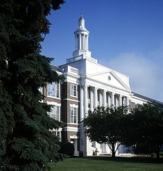
Greenwich is a town in southwestern Fairfield County, Connecticut, United States. As of the 2020 census, it had a population of 63,518. Greenwich is a principal community of the Bridgeport–Stamford–Norwalk–Danbury metropolitan statistical area, which comprises all of Fairfield County, and is part of both the greater New York metropolitan area and the Western Connecticut Planning Region. The town is the southwesternmost municipality in both the State of Connecticut and the six-state region of New England. The town is named after Greenwich, a royal borough of London in the United Kingdom. It is the largest town on Connecticut's affluent Gold Coast. Greenwich is home to many hedge funds and financial services firms due to its residential setting and proximity to Manhattan.

<span class="mw-page-title-main">Blue Hills, Connecticut</span> Place in Connecticut, United States

Blue Hills is a community in Hartford County, Connecticut, United States, encompassing the northwestern corner of the city of Hartford and the southeastern corner of the town of Bloomfield. The Bloomfield portion is listed by the U.S. Census Bureau as a census-designated place (CDP), with a population of 2,762 at the 2020 census.

<span class="mw-page-title-main">Conning Towers Nautilus Park, Connecticut</span> Census-designated place in Connecticut, United States

Conning Towers Nautilus Park is a census-designated place (CDP) in the town of Groton in New London County, Connecticut, United States. The population was 9,828 at the 2010 census. The statistical area consists of the portion of the town in the vicinity of Route 12 and includes Naval Submarine Base New London.

<span class="mw-page-title-main">North Grosvenordale</span> United States historic place

North Grosvenordale is a village and census-designated place (CDP) in the town of Thompson in Windham County, Connecticut, United States. The population was 1,530 at the 2010 census. The core of the village is listed as the North Grosvenordale Mill Historic District on the National Register of Historic Places. The historic area around the cotton mill was listed in 1993 and is located on Riverside Drive, Buckley Hill Road, Floral Avenue, Market Lane, and Marshall, Central, River, and Holmes Streets.

<span class="mw-page-title-main">Blue Hills, Connecticut</span> Place in Connecticut, United States

Blue Hills is a community in Hartford County, Connecticut, United States, encompassing the northwestern corner of the city of Hartford and the southeastern corner of the town of Bloomfield. The Bloomfield portion is listed by the U.S. Census Bureau as a census-designated place (CDP), with a population of 2,762 at the 2020 census.

<span class="mw-page-title-main">Cos Cob, Connecticut</span> Census-designated place in Connecticut, United States

Cos Cob is a neighborhood and census-designated place in the town of Greenwich, Connecticut, United States. It is located on the Connecticut shoreline in southern Fairfield County. It had a population of 6,873 at the 2020 census.

<span class="mw-page-title-main">Byram, Connecticut</span> Census-designated place in Connecticut, United States

Byram is a neighborhood/section and census-designated place (CDP) in the town of Greenwich in Fairfield County, Connecticut, United States. It had a population of 4,146 at the 2010 census, and a census-estimated population of 4,216 in 2018. An endcap of Connecticut's Gold Coast, Byram is the southernmost point in the town of Greenwich and the U.S. state of Connecticut. It is separated from Port Chester, Westchester County, New York, by the Byram River. Byram was once known as East Port Chester.

<span class="mw-page-title-main">History of Greenwich, Connecticut</span>

The history of Greenwich, Connecticut, United States.

<span class="mw-page-title-main">Greenwich Public Schools</span> School district in Connecticut, United States

Greenwich Public Schools is a school district located in Fairfield County, in Greenwich, Connecticut, United States. The district has boundaries that are coterminous with those of the town. Approximately 8,840 students in grades K–12 attend the Greenwich Public Schools.

<span class="mw-page-title-main">Old Greenwich, Connecticut</span> Census-designated place in Connecticut, United States

Old Greenwich is a coastal village in Fairfield County, Connecticut, United States. As of the 2010 census it had a population of 6,611.

<span class="mw-page-title-main">Glenville, Connecticut</span> Census-designated place in Connecticut, United States

Glenville is a neighborhood and census-designated place in the town of Greenwich in Fairfield County, Connecticut, United States. As of the 2010 census, it had a population of 2,327. It is located in the western part of Greenwich at the falls of the Byram River, which provided waterpower when this was a mill village. The area is home to Glenville Elementary school, Western Civic Center and a volunteer fire station, the Glenville Fire Department.

<span class="mw-page-title-main">Cos Cob station</span> Metro-North Railroad station in Connecticut

Cos Cob station is a commuter rail station on the Metro-North Railroad's New Haven Line, located in the Cos Cob district of Greenwich, Connecticut.

<span class="mw-page-title-main">Riverside Yacht Club</span>

The Riverside Yacht Club, Connecticut is a private, recreational yacht club located in the Riverside neighborhood of Greenwich, Connecticut, with access to Long Island Sound. The majority of its members are residents of the surrounding Greenwich neighborhoods of Riverside, Old Greenwich, and Cos Cob. It is the second oldest yacht club in Connecticut and one of the oldest in the United States.

<span class="mw-page-title-main">Cos Cob Power Station</span> United States historic place

Cos Cob Power Station was a historic power station near the Metro-North Railroad tracks, the Mianus River and Sound Shore Drive in the Cos Cob area of Greenwich, Connecticut.

<span class="mw-page-title-main">Pemberwick, Connecticut</span> Census-designated place in Connecticut, United States

Pemberwick is a neighborhood/section and census-designated place in Greenwich in Fairfield County, Connecticut, United States. As of the 2010 census it had a population of 3,680.
<span class="mw-page-title-main">Japanese School of New York</span> Primary and middle school in Greenwich, Connecticut, United States

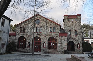
The Japanese School of New York, also known as The Greenwich Japanese School (GJS), is a Japanese elementary and junior high school, located in Riverside, Greenwich, Connecticut, near New York City.

<span class="mw-page-title-main">Greenwich (CDP), Connecticut</span> Census-designated place in Connecticut, United States

Greenwich is a census-designated place (CDP) in Fairfield County, Connecticut, United States. It is one of several CDPs within the town of Greenwich and corresponds to the historic municipal center of the town and surrounding residential and commercial areas. As of the 2010 census, the population of the Greenwich CDP was 12,942, out of 61,171 in the entire town.

<span class="mw-page-title-main">Gold Coast (Connecticut)</span> Affluent part of southwestern Connecticut, US

The Gold Coast, also known as Lower Fairfield County or Southwestern Connecticut, is an affluent part of Western Connecticut that includes the entire southern portion of Fairfield County as defined by the U.S. Census Bureau, Super-Public Use Microdata Area (Super-PUMA) Region 09600. The area is about 50 miles (80 km) northeast of New York City, and is home to many wealthy Manhattan business executives. Parts of the region are served by the Western Connecticut Council of Governments.

Indian Field is a census-designated place (CDP) in the town of Greenwich, Fairfield County, Connecticut, United States. It is in the southern part of the town, on a peninsula between Indian Harbor to the west and Cos Cob Harbor to the east. It extends south into Captain Harbor, an inlet of Long Island Sound, and it extends north as far as U.S. Route 1. Interstate 95 crosses the CDP, with access from Exit 4.

References

  1. U.S. Geological Survey Geographic Names Information System: Riverside, Connecticut
  2. "Race, Hispanic or Latino, Age, and Housing Occupancy: 2010 Census Redistricting Data (Public Law 94-171) Summary File (QT-PL), Riverside CDP, Connecticut". United States Census Bureau . Retrieved August 11, 2011.
  3. "Spreadsheet of NRHP Listed properties". U.S. National Park Service National Register of Historic Places. Retrieved July 19, 2023.
  4. "National Register of Historic Places". Greenwich Historical Society. Retrieved July 18, 2023.
  5. "US Gazetteer files: 2019". United States Census Bureau . Retrieved July 19, 2020.
  6. "2020 CENSUS - SCHOOL DISTRICT REFERENCE MAP: Fairfield County, CT" (PDF). U.S. Census Bureau . Retrieved May 25, 2024.
  7. "募集要項" (in Japanese). Japanese School of New York. Retrieved May 26, 2024. 6 Riverside Avenue, Riverside, CT 06878 U.S.A
    "2020 CENSUS - CENSUS BLOCK MAP: Riverside CDP, CT" (PDF). U.S. Census Bureau . Retrieved May 16, 2024.
  8. "本校の歩み" (in Japanese). Japanese School of New York. Retrieved May 26, 2024. 7/8/2022 Riverside Avenue へ校舎移転
  9. 1 2 3 "U.S. Census Bureau Quickfacts: Riverside CDP, Connecticut". U.S. Census Bureau. Retrieved July 18, 2023.
  10. Costagregni, Susie (May 13, 2007). "Antares party raises funds for Greenwich YMCA". The Stamford Advocate. p. 2.
  11. "Riverside's Kathie Lee Gifford emcees Greenwich Hospital benefit that funds growth in medical research". GreenwichTime. June 6, 2022. Retrieved July 18, 2023.
  12. "Dorothy Hamill". Academy of Achievement. Retrieved July 18, 2023.
  13. "Blue Jackets spotlight: Cam Atkinson". The Columbus Dispatch. September 8, 2018. Archived from the original on September 8, 2018.

41°01′59″N73°34′44″W / 41.033°N 73.579°W / 41.033; -73.579