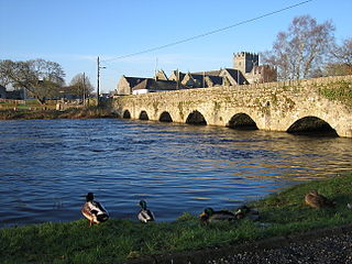
The River Suir is a river in Ireland that flows into the Atlantic Ocean through Waterford after a distance of 185 kilometres (115 mi). The catchment area of the Suir is 3,610 km2. Its long term average flow rate is 76.9 cubic metres per second (m3/s), about twice the flow of either the River Barrow or the River Nore before these join, but a little less than the Barrow's flow when it meets the Suir 20 km downstream.

Gillnetting is a fishing method that uses gillnets: vertical panels of netting that hang from a line with regularly spaced floaters that hold the line on the surface of the water. The floats are sometimes called "corks" and the line with corks is generally referred to as a "cork line." The line along the bottom of the panels is generally weighted. Traditionally this line has been weighted with lead and may be referred to as "lead line." A gillnet is normally set in a straight line. Gillnets can be characterized by mesh size, as well as colour and type of filament from which they are made. Fish may be caught by gillnets in three ways:
- Wedged – held by the mesh around the body.
- Gilled – held by mesh slipping behind the opercula.
- Tangled – held by teeth, spines, maxillaries, or other protrusions without the body penetrating the mesh.

Killala is a village in County Mayo in Ireland, north of Ballina. The railway line from Dublin to Ballina once extended to Killala. To the west of Killala is the townland of Townsplots West, which contains a number of ancient forts. Historically associated with Saint Patrick, and the seat of an episcopal see for several centuries, evidence of Killala's ecclesiastical past include a 12th century round tower and the 17th century Cathedral Church of St Patrick. As of the 2016 census of Ireland, the village had a population of 562.
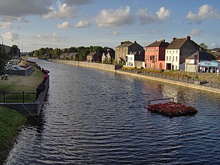
The River Nore is one of the principal rivers in the South-East Region of Ireland. The 140-kilometre-long (87 mi) river drains approximately 2,530 square kilometres (977 sq mi) of Leinster and Munster, that encompasses parts of three counties. Along with the River Suir and River Barrow, it is one of the constituent rivers of the group known as the Three Sisters.

The Atlantic salmon is a species of ray-finned fish in the family Salmonidae. It is the third largest of the Salmonidae, behind Siberian taimen and Pacific Chinook salmon, growing up to a meter in length. Atlantic salmon are found in the northern Atlantic Ocean and in rivers that flow into it. Most populations are anadromous, hatching in streams and rivers but moving out to sea as they grow where they mature, after which the adults seasonally move upstream again to spawn.
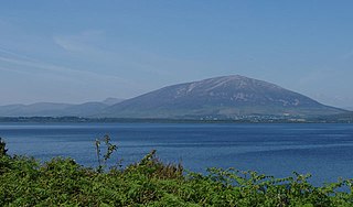
Lough Conn is a lake in County Mayo, Ireland. With an area of about 48 square kilometres (19 sq mi), it is Ireland's seventh largest lake. With its immediate neighbour to the south, Lough Cullin, it is connected to the Atlantic Ocean by the River Moy. Lough Conn is noted for its trout and salmon fishing. The ruins of a priory exist at Errew Abbey.
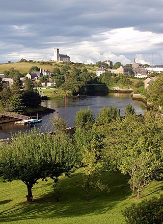
The River Erne in the northwest of the island of Ireland, is the second-longest river in Ulster, flowing through Northern Ireland and the Republic of Ireland, and forming part of their border.

Drift netting is a fishing technique where nets, called drift nets, hang vertically in the water column without being anchored to the bottom. The nets are kept vertical in the water by floats attached to a rope along the top of the net and weights attached to another rope along the bottom of the net. Drift nets generally rely on the entanglement properties of loosely affixed netting. Folds of loose netting, much like a window drapery, snag on a fish's tail and fins and wrap the fish up in loose netting as it struggles to escape. However, the nets can also function as gill nets if fish are captured when their gills get stuck in the net. The size of the mesh varies depending on the fish being targeted. These nets usually target schools of pelagic fish.
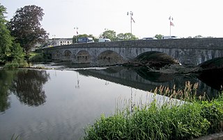
The Blackwater or Munster Blackwater is a river which flows through counties Kerry, Cork and Waterford in Ireland. It rises in the Mullaghareirk Mountains in County Kerry and then flows in an easterly direction across County Cork through the towns of Mallow and Fermoy. It then enters County Waterford where it flows through Lismore, before abruptly turning south at Cappoquin and finally draining into the Celtic Sea at Youghal Harbour in Cork. In total, the Blackwater is 169 km (105 mi) long.
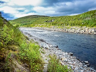
The Tana is a 361-kilometre (224 mi) long river in the Sápmi area of northern Fennoscandia. The river flows through Troms og Finnmark county, Norway and the Lapland region of Finland. The Sámi name means "Great River". The main tributaries of Tana are Anarjohka and Karasjohka.

Killala Bay is a bay on the west coast of Ireland, between County Mayo and County Sligo, with Kilcummin Head to the west and Lenadoon Point to the east, which is the estuary for the River Moy. The village of Killala is at the southwest corner of the bay.

The River Fane is a river flowing from County Monaghan to Dundalk Bay in County Louth, Ireland.

The River Bush is a river in County Antrim, Northern Ireland. The River Bush is 33.5 miles (53.9 km) long. The river's source is in the Antrim Hills at 480m. From there the river flows northwest, with a bend at the town of Armoy. It then flows west, passing through Stranocum, and then bends north, passing through Bushmills before reaching the sea at Portballintrae on the North Antrim coast. It flows through a fertile valley devoted to grassland-based agriculture with limited arable cropping. The underlying geology is basalt and the water is slightly alkaline with magnesium making an unusually large contribution to total hardness. The river supports indigenous stocks of Atlantic salmon and brown trout. Saint Columb's Rill, which is a tributary of the river, is the source of water used for distilling Bushmills whiskey.

St Muredach's College is an all-boys secondary school on the banks of the River Moy in Ballina, County Mayo, Ireland. It was founded in 1906 to provide a Catholic education for boys in the Killala Diocese. The school building, which was designed by William Henry Byrne, is included on the Record of Protected Structures maintained by Mayo County Council.
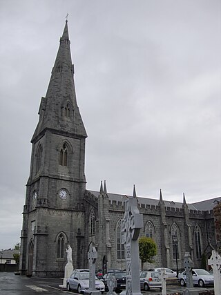
St Muredach's Cathedral is the cathedral church of the Roman Catholic Diocese of Killala in Ireland. It is located on the east bank of the River Moy in Ballina, County Mayo. It is also the parish church of the parish of Kilmoremoy.

Ballina is a town in north County Mayo, Ireland. It lies at the mouth of the River Moy near Killala Bay, in the Moy valley and Parish of Kilmoremoy, with the Ox Mountains to the east and the Nephin Beg mountains to the west. The town occupies two baronies; Tirawley on the west bank of the Moy River, and Tireragh, a barony within County Sligo, on its east banks. At the 2016 census, the population of Ballina was 10,171.
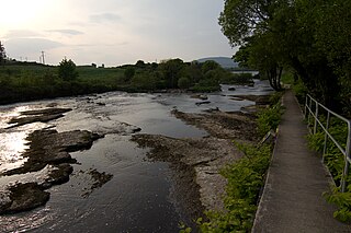
The Ballisodare River is a river in Ireland, flowing through County Sligo.

The Camowen River is a river in County Tyrone, Northern Ireland, a tributary of the River Foyle.

The River Erriff is a river in Ireland, flowing through County Mayo. A spate river, it is characterised by lively streams and deep fish-holding pools. A waterfall called Aasleagh Falls is near the mouth of the river.

The Glenamoy River is a river in north County Mayo, in the northwest of Ireland. It is renowned for its stocks of sea trout and salmon.


