
Bridgend County Borough is a county borough in the south-east of Wales. The county borough has a total population of 139,200 people, and contains the town of Bridgend, after which it is named. Its members of the Senedd are Sarah Murphy MS, representing the Bridgend Constituency, and Huw Irranca-Davies MS representing the Ogmore Constituency, and its members of the UK parliament are Chris Bryant, Chris Elmore, and Stephen Kinnock.

The River Ogmore is a river in South Wales that is popular with anglers. It runs generally from north to south from the Ogmore Vale and Gilfach Goch, past Bridgend and Ogmore. The River Ogmore rises at Craig Ogwr in the Ogmore Valley as the Ogwr Fawr before it links with the Ogwr Fach at Blackmill. The River Llynfi, the River Garw and finally the River Ewenny in its estuary are all tributaries of the Ogmore which flows into the sea between Ogmore-by-Sea and the Merthyr Mawr sand-dunes.

The River Teifi in Wales forms the boundary for most of its length between the counties of Ceredigion and Carmarthenshire, and for the final 3 miles (4.8 km) of its total length of 76 miles (122 km), the boundary between Ceredigion and Pembrokeshire. Its estuary is northwest of Cardigan, known in Welsh as Aberteifi, meaning 'mouth of the Teifi'. Teifi has formerly been anglicised as "Tivy".

Ogmore was a constituency created in 1918, represented in the House of Commons of the UK Parliament.

The River Llynfi, is one of three main tributaries of the River Ogmore.
The River Rhondda is a river in South Wales with two major tributaries, Rhondda Fawr and Rhondda Fach.
The Garw Valley Railway is the trading name of the Bridgend Valleys Railway Company Limited. It operates a short section of 4 ft 8+1⁄2 instandard gauge railway located in South Wales, which is being recreated as a heritage railway. Formerly part of the Llynvi and Ogmore Railway (L&OR) and built by the Great Western Railway (GWR), the line was used for freight and passenger services, with most of the track still in place between Brynmenyn and Pontycymer. The project currently has a train shed at Pontycymer, and hopes to initially offer brake van rides between Pontycymer and Pant-y-Gog, a distance of 0.5 miles (0.8 km).
Pontyberem is a village and community situated in the Gwendraeth Valley halfway between Carmarthen and Llanelli in Carmarthenshire, Wales. As of the 2001 Census, the population was recorded as 2,829, reducing to 2,768 at the 2011 Census.
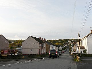
Pontycymer, also spelt Pontycymmer, is a former mining village in Wales. It is situated in the Garw Valley, in Bridgend County Borough, about 7 miles or 11 km north of the town of Bridgend.

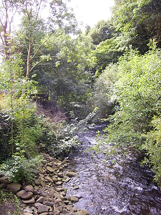
Blaengarw is the uppermost village in the river valley of the River Garw, in the county borough of Bridgend, Wales.

Bettws, is a small ex-mining and farming village in the South Wales Valleys in the county borough of Bridgend, Wales. Bettws is also an electoral ward for the county council.

The Ewenny River is a river in South Wales. For most of its 10 miles (16 km) length, it forms the border between the Vale of Glamorgan and Bridgend. It is a major tributary of the River Ogmore, which it joins near its estuary.

Afon Clun is a 14-mile (23 km) long tributary of the River Ely, in the counties of Cardiff and Rhondda Cynon Taf, Wales. Its bedrock is predominantly of sandstone. Beginning on the western slope of The Garth the river is fast-flowing, in clear shallow water with a hard substrate, flowing to the south of Llantrisant and generally west to its confluence with the River Ely at Pontyclun, falling 715 feet (218 m) over its course.
Llangeinor is a small village located in the Garw Valley around 5 miles (8 km) north of Bridgend in Bridgend County Borough, Wales. The ward population taken at the 2011 census was 1,243. The entire village is now protected as part of a conservation area.
Brynmenyn is a small village located at the confluence of the Garw and Ogmore rivers in south Wales, around 4 miles north of Bridgend, and it also in the Bridgend County Borough council area. The village has its own primary school.

Garw Valley is a community and coterminous electoral ward in the north of Bridgend County Borough, South Wales. As the name suggests, it follows and encompasses the valley of the River Garw. The community includes the village of Blaengarw at the head of the valley, followed by Pontycymer and Llangeinor on the river, with Bettws between the Garw and the Llynfi in the south. Garw Valley is bordered to the west by Maesteg, Llangynwyd Middle and Llangynwyd Lower; to the east by Ogmore Valley and to the south by Ynysawdre and St Bride's Minor.

The River Thaw is a river in the Vale of Glamorgan, south Wales. At 20 kilometres/12.4 miles, it is the longest river entirely in the Vale of Glamorgan.
Mynydd Llangeinwyr is the highest hill in the county borough of Bridgend in the coalfield of South Wales. It forms a long north–south ridge between the valleys of Cwm Garw to the west and Cwm Ogwr Fawr to the east. The highest point of the ridge is the 568-metre flat dome known as Werfa which is crowned by a trig point and prominent masts. A secondary trig point is sited at a height of 530 m near to the ancient cairn of Carn-yr-hyrddod. The hill is named from the village of Llangeinor below its southern tip.
